- Paxton, Nebraska
Infobox Settlement
official_name = Paxton, Nebraska
settlement_type = Village
nickname =
motto =
imagesize =
image_caption =
image_
imagesize =
image_caption =
image_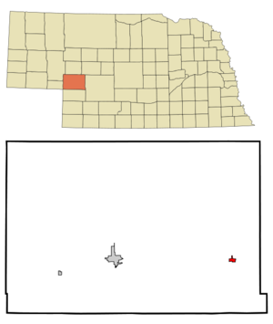
mapsize = 250px
map_caption = Location of Paxton, Nebraska
mapsize1 =
map_caption1 =subdivision_type = Country
subdivision_name =United States
subdivision_type1 = State
subdivision_name1 =Nebraska
subdivision_type2 = County
subdivision_name2 = Keith
government_footnotes =
government_type =
leader_title =
leader_name =
leader_title1 =
leader_name1 =
established_title =
established_date =unit_pref = Imperial
area_footnotes =area_magnitude =
area_total_km2 = 1.4
area_land_km2 = 1.4
area_water_km2 = 0.0
area_total_sq_mi = 0.5
area_land_sq_mi = 0.5
area_water_sq_mi = 0.0population_as_of = 2000
population_footnotes =
population_total = 614
population_density_km2 = 431.8
population_density_sq_mi = 1118.4timezone = Mountain (MST)
utc_offset = -7
timezone_DST = MDT
utc_offset_DST = -6
elevation_footnotes =
elevation_m = 934
elevation_ft = 3064
latd = 41 |latm = 7 |lats = 29 |latNS = N
longd = 101 |longm = 21 |longs = 21 |longEW = Wpostal_code_type =
ZIP code
postal_code = 69155
area_code = 308
blank_name = FIPS code
blank_info = 31-38610GR|2
blank1_name = GNIS feature ID
blank1_info = 0832009GR|3
website =
footnotes =Paxton is a village in Keith County,
Nebraska ,United States . The population was 614 at the 2000 census.Geography
Paxton is located at coor dms|41|7|29|N|101|21|21|W|city (41.124699, -101.355843).GR|1
According to the
United States Census Bureau , the village has a total area of 0.6square mile s (1.4km² ), all of it land.Demographics
As of the
census GR|2 of 2000, there were 614 people, 237 households, and 169 families residing in the village. Thepopulation density was 1,118.4 people per square mile (431.0/km²). There were 248 housing units at an average density of 451.7/sq mi (174.1/km²). The racial makeup of the village was 97.72% White, 0.49% African American, 0.49% Native American, 0.16% Asian, 0.33% from other races, and 0.81% from two or more races. Hispanic or Latino of any race were 1.63% of the population.There were 237 households out of which 38.8% had children under the age of 18 living with them, 62.0% were married couples living together, 6.8% had a female householder with no husband present, and 28.3% were non-families. 24.9% of all households were made up of individuals and 13.1% had someone living alone who was 65 years of age or older. The average household size was 2.59 and the average family size was 3.11.
In the village the population was spread out with 29.5% under the age of 18, 5.0% from 18 to 24, 27.9% from 25 to 44, 22.3% from 45 to 64, and 15.3% who were 65 years of age or older. The median age was 38 years. For every 100 females there were 97.4 males. For every 100 females age 18 and over, there were 92.4 males.
The median income for a household in the village was $28,523, and the median income for a family was $34,063. Males had a median income of $25,833 versus $17,500 for females. The
per capita income for the village was $12,988. About 9.2% of families and 9.5% of the population were below thepoverty line , including 10.6% of those under age 18 and 9.3% of those age 65 or over.History
The town of Paxton was founded by Pax Loche, an immigrant Scotsman who arrived in the area to farm a homestead.
The Paxton area was settled in the later part of the 19th century by homesteaders of predominantly northern European extraction. Each homestead would consist of 1/4 section of land on which would be a home, barn and other needed buildings. Water was either taken from the
North Platte River or the aquifer, which allowed the production of corn, winter wheat and other assorted vegetable crops in addition to raising livestock for consumption and sale. Each homestead would consist of a married couple and their children, giving a population density of about 40 to 60 people per square mile.With the beginning of mechanized farming the large farm families left for the cities as one person could farm several sections by themselves or with minimal help. Most of the original farm homes were demolished to make room for more arable land and to lower tax rates once the land was "unimproved". With the drying out of the
Ogallala Aquifer much of the land is being returned toprairie and dry cattle ranching, further reducing the population in the surrounding area. Fact|date=July 2007References
External links
Wikimedia Foundation. 2010.