- Niobrara, Nebraska
-
Niobrara, Nebraska — Village — Location of Niobrara, Nebraska
Coordinates: 42°45′0″N 98°1′55″W / 42.75°N 98.03194°WCoordinates: 42°45′0″N 98°1′55″W / 42.75°N 98.03194°W Country United States State Nebraska County Knox Area – Total 0.7 sq mi (1.9 km2) – Land 0.7 sq mi (1.9 km2) – Water 0.0 sq mi (0.0 km2) Elevation 1,230 ft (375 m) Population (2010) – Total 370 – Density 525.2/sq mi (202.8/km2) Time zone Central (CST) (UTC-6) – Summer (DST) CDT (UTC-5) ZIP code 68760 Area code(s) 402 FIPS code 31-34370[1] GNIS feature ID 0831636[2] Niobrara (
 /ˌnaɪ.əˈbrærə/; Omaha: Ní Ubthátha Tʰáⁿwaⁿgthaⁿ [nĩꜜ ubɫᶞaꜜɫᶞa tʰãꜜwãŋɡɫᶞã], meaning "water spread-out village")[3] is a village in Knox County, Nebraska, United States. The population was 370 at the 2010 census.[4]
Contents
Geography
Niobrara is located at 42°45′0″N 98°1′55″W / 42.75°N 98.03194°W (42.750000, -98.031989)[5].
According to the United States Census Bureau, the village has a total area of 0.7 square miles (1.8 km2), all of it land.
History
Niobrara's beginning can be traced back to the year of 1856, when a group of men headed by a Dr. Benneville Yeakel Shelly marked their claim to an area on the banks of the Missouri. They built a log garrison of cottonwood, which later became known as "Old Cabin". The company, founded by Shelly and others, was called L'eau Qui Court Company.
The L'eau Qui Court Company failed and the Niobrara Township Company was organized. The new town was eventually called "Niobrara", an Indian word for "running water".
On June 29, 1857, a steam sawmill was brought to Niobrara from St. Louis by the steamer "Omaha" and was immediately put into operation sawing lumber for the building of the new town. In spite of early hardships, the new town continued to grow and the 1881 population was said to be about 500.
Through most of Niobrara's history, ferry boats have provided an important transportation link with South Dakota. The first ferry boat began operation in about 1860 and was operated by horses walking on a treadmill.
When Knox County was formed in 1877, Niobrara was named county seat.
Just as the Missouri River was responsible for the original settlement of Niobrara, it was also responsible for the first move. In March 1881 the spring thaw produced one of the largest Missouri River floods on record. On March 28, 1881, an ice gorge broke and Niobrara residents were greeted by a surge of muddy water. The water continued to overflow until most of the town was covered, forcing people and animals alike to seek the safety of higher ground. Fortunately, no lives were lost but this disastrous flood influenced the citizens of Niobrara to pick up and move to a new town site west and south of the old site. The town grew and flourished at the new location providing most of the goods and services required by a rural Nebraska community of that era.
The first school house was constructed in 1886. Modern utilities came to the town of Niobrara in 1899. That year, the first waterworks system, which was supplied by an artesian well, and an electric light plant were both constructed. The railroad came to Niobrara in 1902. 1902 also marked the moving of the county seat from Niobrara to a new central location in the newly formed town of Center.
In 1910, The Niobrara State Park, originally The Niobrara Island Park was opened. The land on which the park was built was given to the village for a park in 1881 by the U.S. Department of the Interior. Later, many improvements to the park were made by the Civilian Conservation Corps (CCC). The facility was operated by the village through the 1930s at which time it was given to the State of Nebraska and added to the Nebraska Park System. It also suffered the same fate as the town and was relocated by the park commission and rededicated in 1987. The all-new park which overlooks the two rivers, offers scenic beauty, modern cabins, camping facilities, picnic and rest areas, horseback riding and an interpretive shelter telling of the area's history. The park is located a short two miles west of the town.
In April 1952,while the Fort Randall dam in South Dakota was being built to prevent flooding, the mighty Missouri again invaded Niobrara. Much of the town and the surrounding area was flooded. With the completion of the Fort Randall dam, citizens rejoiced, assured that floods were finally "a thing of the past."
The town celebrated its centennial from June 16–17, 1956. There were many events leading up to the two day celebration which was attended by an estimated 20,000 people.
Later, in the 1960s, it became apparent that the mighty Missouri would, again, influence Niobrara history. Silt from the Niobrara River, which began to accumulate in the river bed, raised the ground water level in Niobrara and the surrounding area. Many basements became flooded requiring constant pumping and it was apparent that the problem would continue to intensify. By 1969, community officials began to look for solutions. Engineers became involved and eventually suggested three solutions. These included abandonment of the town, an elaborate dike and pumping system, or relocation to a new site.
Niobrara citizens accepted the challenge of, once again, moving Niobrara and the site selection process followed. Funds were appropriated by Congress to pay a sizable portion of the cost of the move. Site preparation began in September 1973 and was completed in April 1974. Next came the water, sewer, storm sewer, paving, water wells and water storage tank. The sale of residential lots followed in the summer of 1974 and residential construction moved forward at a fast pace. Federal funds helped pay a portion of the cost of the move as well as provide for water, sewer, and paving. By the end of 1977, the move was nearly completed. The 1980 census showed 420 and 213 homes in Niobrara.
In the years since the move, Niobrara's citizens have continued to strive for a solid, progressive community.Through volunteer efforts, a nine-hole grass greens golf course was completed on the old town site. The Niobrara State Park was relocated, suffering the same fate as the old town.
Niobrara's history can best be summarized as being charted by the changes in the "Mighty Mo," on whose banks it was founded, and from whose reach it has continuously tried to escape.
1981 marked the 112th anniversary of the original settlement and was celebrated with a historical pageant, parade and other activities
The town gained unfortunate notoriety in 1969, when three members of the Sage family — brothers Gary, 22, Gregory, 21, and Kelly, 19 — died in a Vietnam War naval accident. The brothers died when USS Frank E. Evans, the destroyer they were serving aboard, collided with and was sunk by the Australian aircraft carrier HMAS Melbourne in the South China Sea. The brothers, who had asked to serve together, were among 74 American crewmen to die in the incident. A memorial in Niobrara commemorates the brothers' sacrifice.[6]
Demographics
As of the census[1] of 2000, there were 379 people, 184 households, and 107 families residing in the village. The population density was 525.2 people per square mile (203.2/km²). There were 230 housing units at an average density of 318.7 per square mile (123.3/km²). The racial makeup of the village was 86.54% White, 10.29% Native American, 0.53% Pacific Islander, 0.53% from other races, and 2.11% from two or more races. Hispanic or Latino of any race were 2.37% of the population.
There were 184 households of which 22.8% had children under the age of 18 living with them, 46.7% were married couples living together, 8.2% had a female householder with no husband present, and 41.8% were non-families. 39.7% of all households were made up of individuals and 22.8% had someone living alone who was 65 years of age or older. The average household size was 2.06 and the average family size was 2.72.
In the village the population was spread out with 22.7% under the age of 18, 3.4% from 18 to 24, 17.9% from 25 to 44, 32.2% from 45 to 64, and 23.7% who were 65 years of age or older. The median age was 49 years. For every 100 females there were 103.8 males. For every 100 females age 18 and over, there were 98.0 males.
The median income for a household in the village was $26,000, and the median income for a family was $36,250. Males had a median income of $26,042 versus $21,250 for females. The per capita income for the village was $15,299. About 9.3% of families and 13.8% of the population were below the poverty line, including 28.4% of those under age 18 and 7.4% of those age 65 or over.
Notable people
- James Tufts, acting governor of Montana Territory
- Anton Krupicka, ultrarunner
The Niobrara River
The Niobrara River, which is right next to the town, actually courses through the Mormon Canal rather than its original riverbed.
Cultural references
- The village is mentioned in the last chapter of Willa Cather's 1918 novel My Antonia, when Leo and Rudolph are to go hunting there 'next summer'.
References
- ^ a b "American FactFinder". United States Census Bureau. http://factfinder.census.gov. Retrieved 2008-01-31.
- ^ "US Board on Geographic Names". United States Geological Survey. 2007-10-25. http://geonames.usgs.gov. Retrieved 2008-01-31.
- ^ Dorsey, James Owen (1890)The Cegiha Language: Contributions to North American Ethnology 4. Washington: US Department of the Interior: Government Printing Office, p. 214, line 10.
- ^ http://www.yankton.net/articles/2011/03/03/community/doc4d6f181b374f9967268554.txt
- ^ "US Gazetteer files: 2010, 2000, and 1990". United States Census Bureau. 2011-02-12. http://www.census.gov/geo/www/gazetteer/gazette.html. Retrieved 2011-04-23.
- ^ Nebraska State Historical Society, "The Sage Brothers," 4 June 2004, http://www.nebraskahistory.org/publish/markers/texts/sage_brothers.htm, retrieved 19 February 2008
External links
Municipalities and communities of Knox County, Nebraska Cities 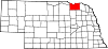
Villages Townships Addison | Bohemia | Central | Cleveland | Columbia | Creighton | Dolphin | Dowling | Eastern | Frankfort | Harrison | Herrick | Hill | Jefferson | Lincoln | Logan | Miller | Morton | Niobrara | North Frankfort | Peoria | Raymond | Spade | Sparta | Union | Valley | Verdigre | Walnut Grove | Washington | Western
Unincorporated
communityLindy
Indian reservations Ponca Reservation | Santee Sioux Reservation
Categories:- Populated places in Knox County, Nebraska
- Villages in Nebraska
- Seats of government of American Indian reservations
- Populated places established in 1856
- Nebraska populated places on the Missouri River

Wikimedia Foundation. 2010.