- Bruning, Nebraska
Infobox Settlement
official_name = Bruning, Nebraska
settlement_type = Village
nickname =
motto =
imagesize =
image_caption =
image_
imagesize =
image_caption =
image_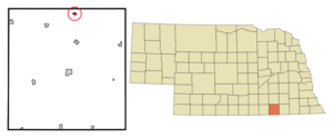
mapsize = 250px
map_caption = Location of Bruning, Nebraska
mapsize1 =
map_caption1 =subdivision_type = Country
subdivision_name =United States
subdivision_type1 = State
subdivision_name1 =Nebraska
subdivision_type2 = County
subdivision_name2 = Thayer
government_footnotes =
government_type =
leader_title =
leader_name =
leader_title1 =
leader_name1 =
established_title =
established_date =unit_pref = Imperial
area_footnotes =area_magnitude =
area_total_km2 = 0.7
area_land_km2 = 0.7
area_water_km2 = 0.0
area_total_sq_mi = 0.3
area_land_sq_mi = 0.3
area_water_sq_mi = 0.0population_as_of = 2000
population_footnotes =
population_total = 300
population_density_km2 = 413.4
population_density_sq_mi = 1070.6timezone = Central (CST)
utc_offset = -6
timezone_DST = CDT
utc_offset_DST = -5
elevation_footnotes =
elevation_m = 483
elevation_ft = 1585
latd = 40 |latm = 20 |lats = 8 |latNS = N
longd = 97 |longm = 33 |longs = 54 |longEW = Wpostal_code_type =
ZIP code
postal_code = 68322
area_code = 402
blank_name = FIPS code
blank_info = 31-06820GR|2
blank1_name = GNIS feature ID
blank1_info = 0827706GR|3
website =
footnotes =Bruning is a village in Thayer County,
Nebraska ,United States . The population was 300 at the 2000 census. DuringWorld War II theU.S. Army Air Forces operatedBruning Army Airfield nearby. In October 1960, inventor and aviatorEd Yost used Bruning as the starting point for the first free flight of a modern,propane -fueledhot air balloon .Geography
Bruning is located at coor dms|40|20|8|N|97|33|54|W|city (40.335675, -97.564883)GR|1.
According to the
United States Census Bureau , the village has a total area of 0.3square mile s (0.7km² ), all of it land.Demographics
As of the
census GR|2 of 2000, there were 300 people, 150 households, and 85 families residing in the village. Thepopulation density was 1,070.6 people per square mile (413.7/km²). There were 162 housing units at an average density of 578.1/sq mi (223.4/km²). The racial makeup of the village was 100.00% White. Hispanic or Latino of any race were 1.67% of the population.There were 150 households out of which 19.3% had children under the age of 18 living with them, 49.3% were married couples living together, 4.7% had a female householder with no husband present, and 43.3% were non-families. 40.0% of all households were made up of individuals and 26.7% had someone living alone who was 65 years of age or older. The average household size was 2.00 and the average family size was 2.71.
In the village the population was spread out with 19.0% under the age of 18, 5.7% from 18 to 24, 19.3% from 25 to 44, 19.3% from 45 to 64, and 36.7% who were 65 years of age or older. The median age was 51 years. For every 100 females there were 78.6 males. For every 100 females age 18 and over, there were 74.8 males.
The median income for a household in the village was $30,972, and the median income for a family was $43,036. Males had a median income of $32,273 versus $19,135 for females. The
per capita income for the village was $17,148. About 5.5% of families and 7.5% of the population were below thepoverty line , including 12.7% of those under the age of eighteen and 9.2% of those sixty five or over.References
External links
Wikimedia Foundation. 2010.