- Monroe, Nebraska
-
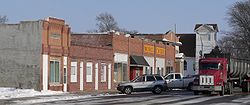
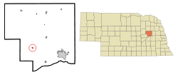
Monroe, Nebraska — Village — Downtown Monroe Location of Monroe, Nebraska Coordinates: 41°28′29″N 97°36′2″W / 41.47472°N 97.60056°WCoordinates: 41°28′29″N 97°36′2″W / 41.47472°N 97.60056°W Country United States State Nebraska County Platte Area – Total 0.2 sq mi (0.5 km2) – Land 0.2 sq mi (0.5 km2) – Water 0.0 sq mi (0.0 km2) Elevation 1,522 ft (464 m) Population (2000) – Total 307 – Density 1,753.8/sq mi (677.1/km2) Time zone Central (CST) (UTC-6) – Summer (DST) CDT (UTC-5) ZIP code 68647 Area code(s) 402 FIPS code 31-32585[1] GNIS feature ID 0831380[2] Monroe is a village in Platte County, Nebraska, United States. The population was 307 at the 2000 census.
Contents
Geography
Monroe is located at 41°28′29″N 97°36′2″W / 41.47472°N 97.60056°W (41.474662, -97.600431)[3].
According to the United States Census Bureau, the village has a total area of 0.2 square miles (0.52 km2), all of it land.
Economy
The economy is primarily based on agricultural support. Most residents either work directly with agricultural interests, or commute to Columbus, Nebraska (approximately 14 miles to the east) to work. Transportation access is Nebraska Highway 22, and a main rail line owned by the Nebraska Central Railroad (formerly owned by Union Pacific). There is no public transportation available to or within the village.
Active businesses in Monroe are one large grain elevator, currently owned by the Tri-Valley Co-op. A convenience store/grocery/gas station/truck stop called M-Mart now occupies the former ice cream shop location. Another gas station is across the highway from it. There is a gift shop located on the highway in the former irrigation dealership, which also has a large warehouse behind where some former owners have had a nice antique store. On Main Street there is currently a bank and a tavern–restaurant. Monroe formerly hosted a small IGA Grocery, Chevrolet dealership, a hardware store, an ice cream shop called Dairy sweet, irrigation dealership, and an agricultural supply dealership. There were also formerly two other gas stations, one of which included a repair shop.
Education
In 2001, Monroe, Silver Creek, and Genoa merged into a single Twin River School District.[4] After the consolidation, only a K-6 school remained in Monroe.[5] This was closed in the fall of 2007.[6] The school district retains possession of the Monroe gym, which it uses for junior high athletic events.[7]
Demographics
As of the census[1] of 2000, there were 307 people, 119 households, and 89 families residing in the village. The population density was 1,753.8 people per square mile (658.5/km²). There were 125 housing units at an average density of 714.1 per square mile (268.1/km²). The racial makeup of the village was 98.37% White, 0.33% Pacific Islander, 1.30% from other races. Hispanic or Latino of any race were 1.63% of the population.
There were 119 households out of which 37.8% had children under the age of 18 living with them, 64.7% were married couples living together, 9.2% had a female householder with no husband present, and 25.2% were non-families. 21.8% of all households were made up of individuals and 11.8% had someone living alone who was 65 years of age or older. The average household size was 2.58 and the average family size was 3.01.
In the village the population was spread out with 27.4% under the age of 18, 7.2% from 18 to 24, 30.6% from 25 to 44, 20.8% from 45 to 64, and 14.0% who were 65 years of age or older. The median age was 36 years. For every 100 females there were 91.9 males. For every 100 females age 18 and over, there were 92.2 males.
The median income for a household in the village was $37,292, and the median income for a family was $43,977. Males had a median income of $27,917 versus $21,607 for females. The per capita income for the village was $16,311. About 4.7% of families and 6.1% of the population were below the poverty line, including 7.4% of those under the age of eighteen and 17.8% of those sixty five or over.
References
- ^ a b "American FactFinder". United States Census Bureau. http://factfinder.census.gov. Retrieved 2008-01-31.
- ^ "US Board on Geographic Names". United States Geological Survey. 2007-10-25. http://geonames.usgs.gov. Retrieved 2008-01-31.
- ^ "US Gazetteer files: 2010, 2000, and 1990". United States Census Bureau. 2011-02-12. http://www.census.gov/geo/www/gazetteer/gazette.html. Retrieved 2011-04-23.
- ^ Hovey, Art. "Consolidation hits faster beat". Columbus Telegram. 2001-03-25. Retrieved 2009-12-25.
- ^ Blum, Julie. "School plans moving forward". Columbus Telegram. 2003-05-25. Retrieved 2009-12-25.
- ^ Freeman, Eric. "Monroe grade school to close". Columbus Telegram. 2007-06-28. Retrieved 2009-12-25.
- ^ "Twin River Public Schools". Retrieved 2009-12-25.
Municipalities and communities of Platte County, Nebraska Cities Columbus | Humphrey | Newman Grove‡
Villages Townships Bismark | Burrows | Butler | Columbus | Creston | Grand Prairie | Granville | Humphrey | Joliet | Lost Creek | Loup | Monroe | Oconee | St. Bernard | Shell Creek | Sherman | Walker | Woodville
Footnotes ‡This populated place also has portions in an adjacent county or counties
Categories:- Populated places in Platte County, Nebraska
- Villages in Nebraska
Wikimedia Foundation. 2010.


