- National Register of Historic Places listings in Antelope County, Nebraska
-
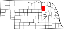 Location of Antelope County in Nebraska
This is a list of the National Register of Historic Places listings in Antelope County, Nebraska. It is intended to be a complete list of the properties on the National Register of Historic Places in Antelope County, Nebraska, United States. The locations of National Register properties for which the latitude and longitude coordinates are included below, may be seen in a Google map.[1]
There are 9 properties listed on the National Register in the county.
-
- This National Park Service list is complete through NPS recent listings posted November 10, 2011.[2]
Current listings
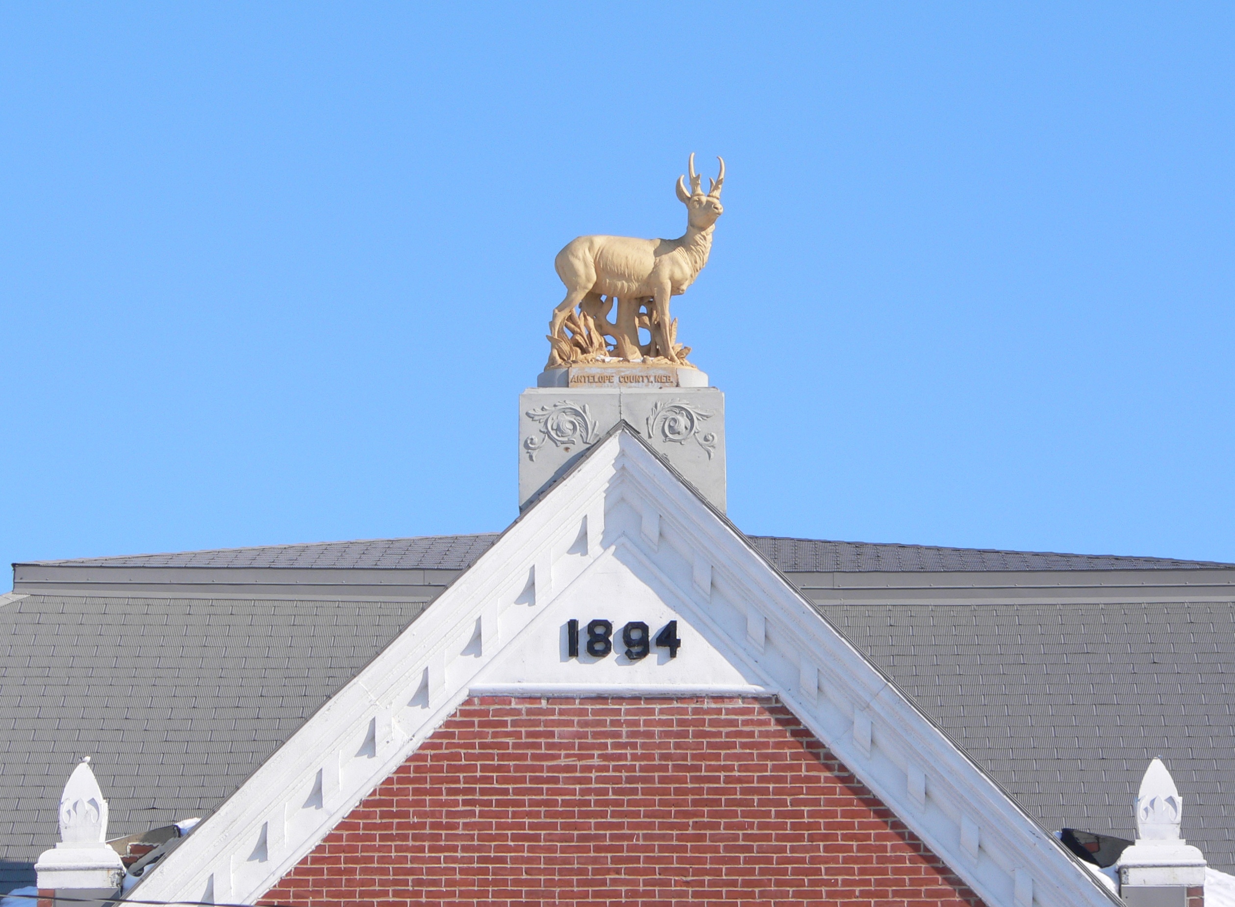
[3] Landmark name [4] Image Date listed Location City or town Summary 1 Antelope County Courthouse 
December 3, 1980 501-511 Main St.
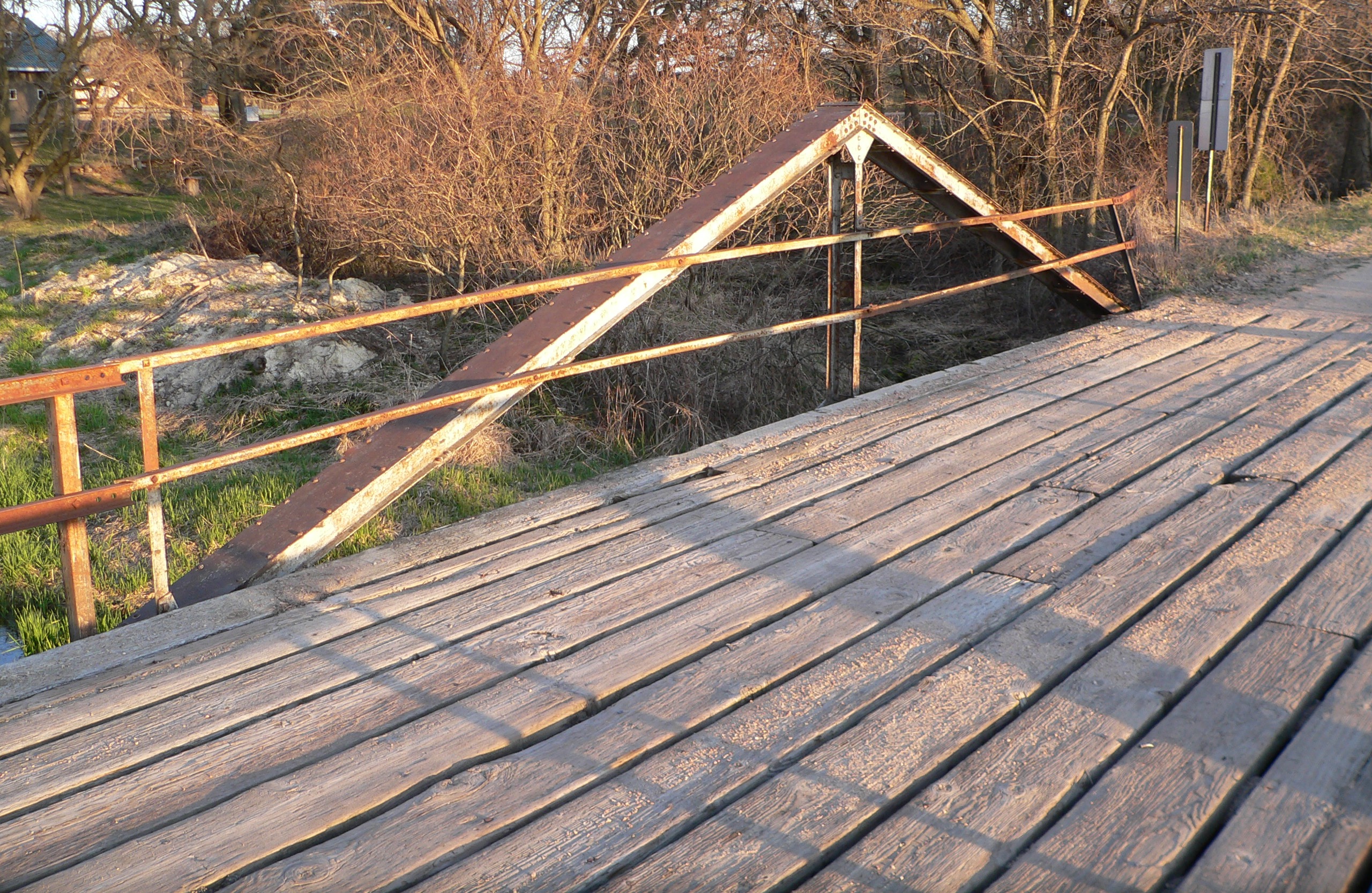
42°07′48″N 98°01′44″W / 42.13°N 98.028889°WNeligh 2 Bridge 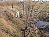
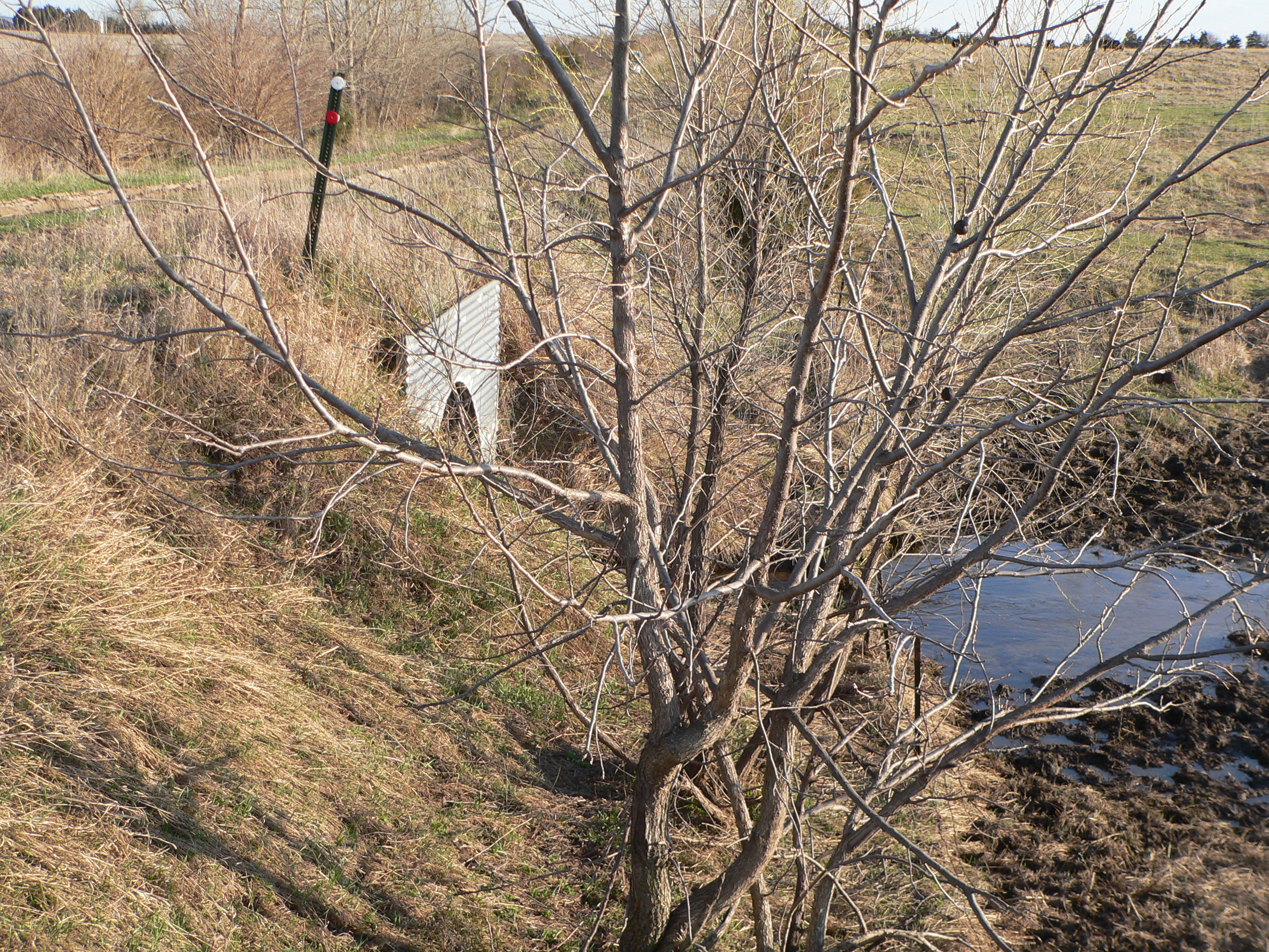
June 29, 1992 Township road over an unnamed stream, 6.8 miles northeast of Royal
42°24′50″N 98°04′02″W / 42.413889°N 98.067222°WRoyal Bridge apparently gone: see photo. Site not listed on Nebraska State Historical Society's website.[5] 3 Elkhorn River Bridge 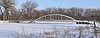
June 29, 1992 Township road over the Elkhorn River, 3 miles east of Clearwater
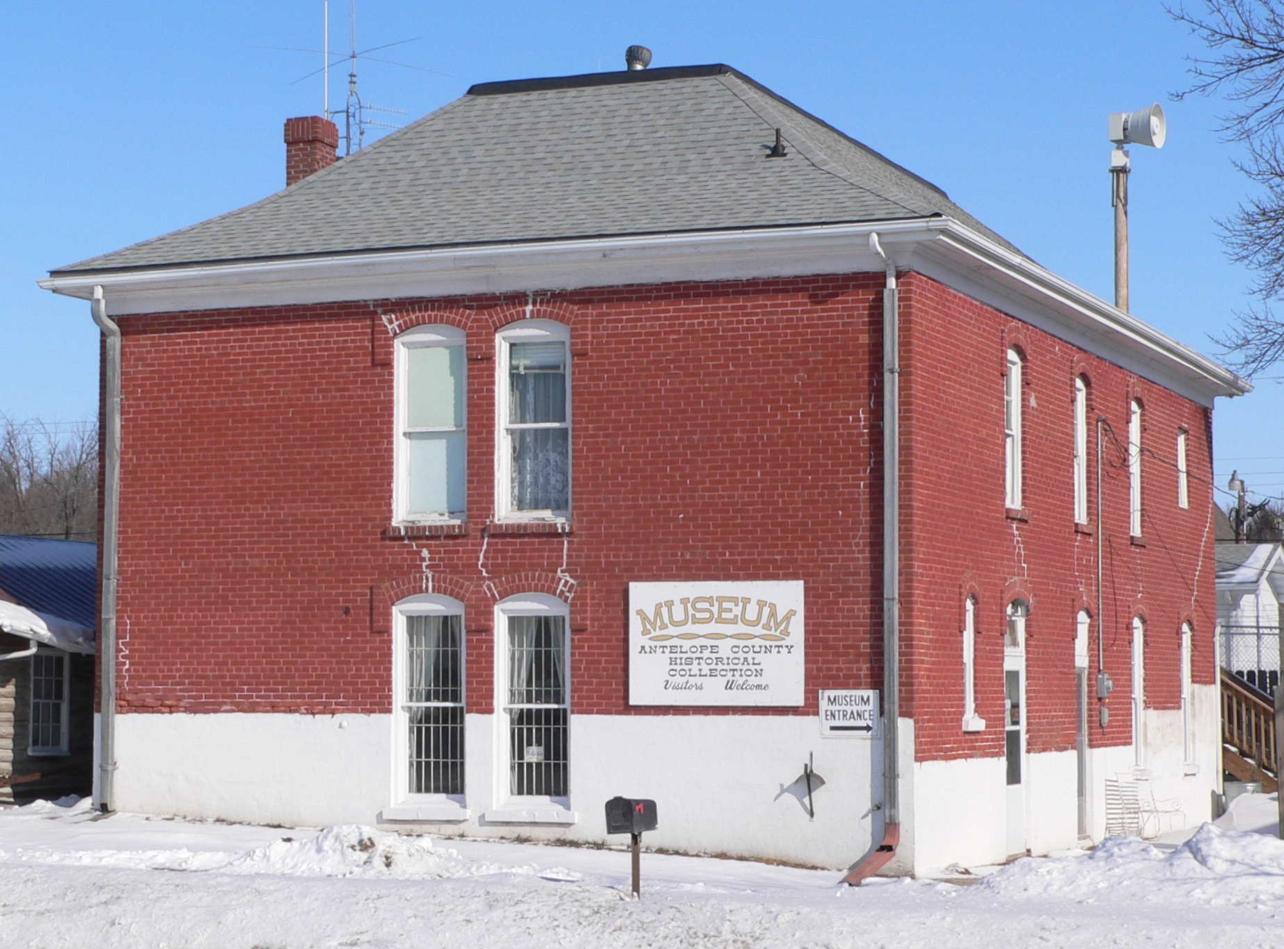
42°09′36″N 98°07′33″W / 42.16°N 98.125833°WClearwater 4 Gates College Gymnasium 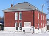
April 20, 1981 509 L St.
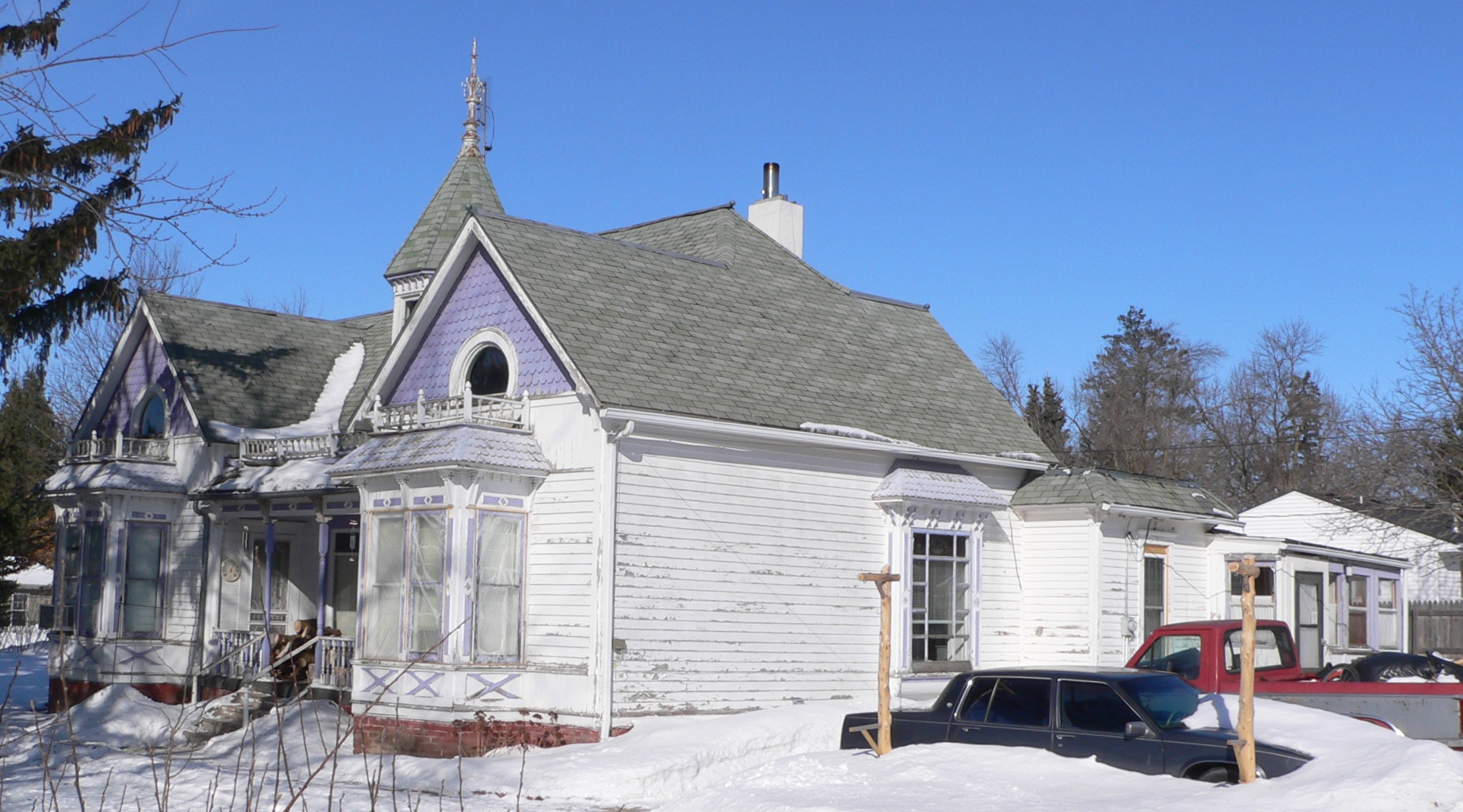
42°07′49″N 98°01′40″W / 42.130278°N 98.027778°WNeligh 5 Maybury-McPherson House 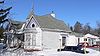
March 14, 1996 502 E. 4th St.
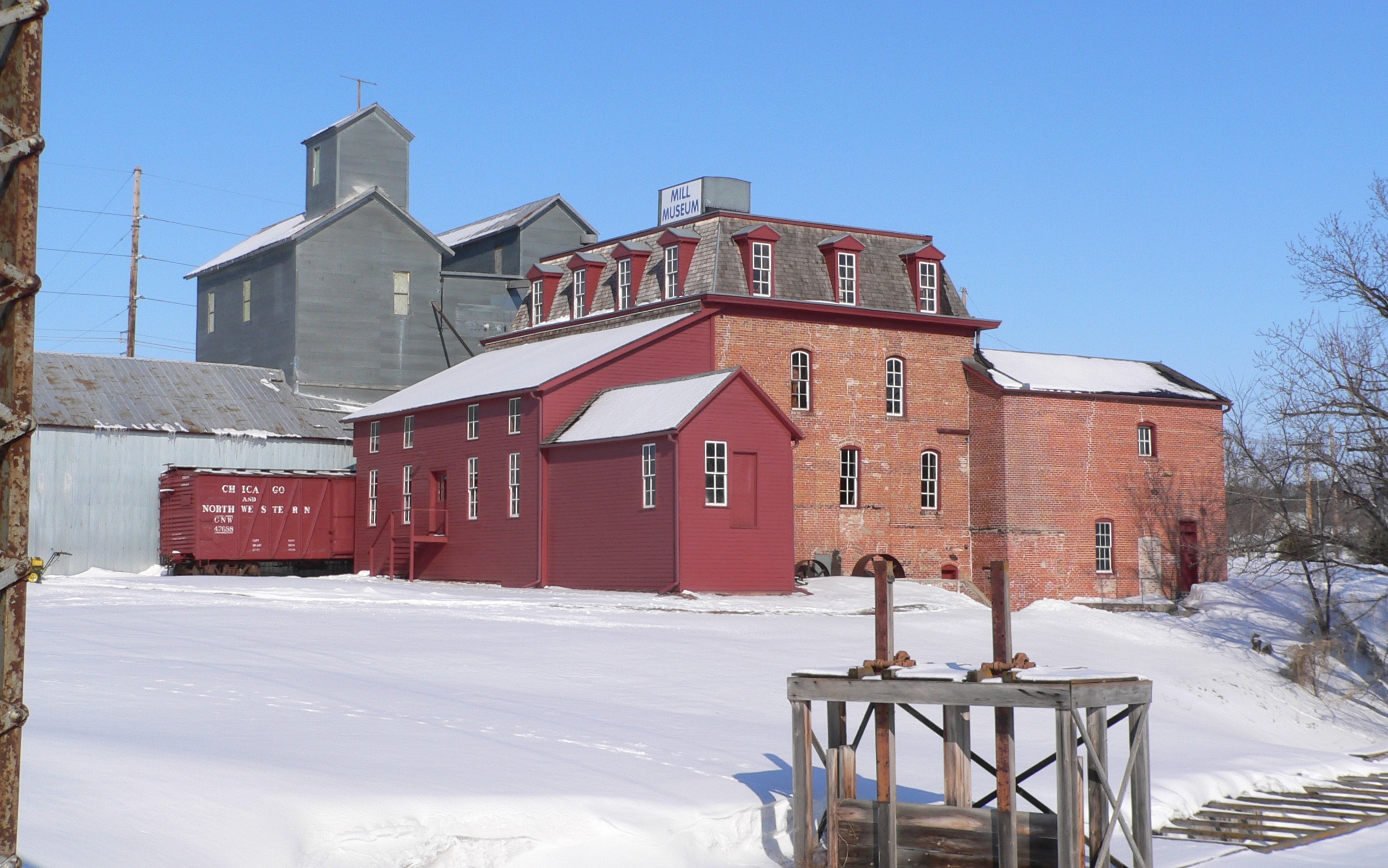
42°07′44″N 98°01′26″W / 42.128889°N 98.023889°WNeligh 6 Neligh Mill 
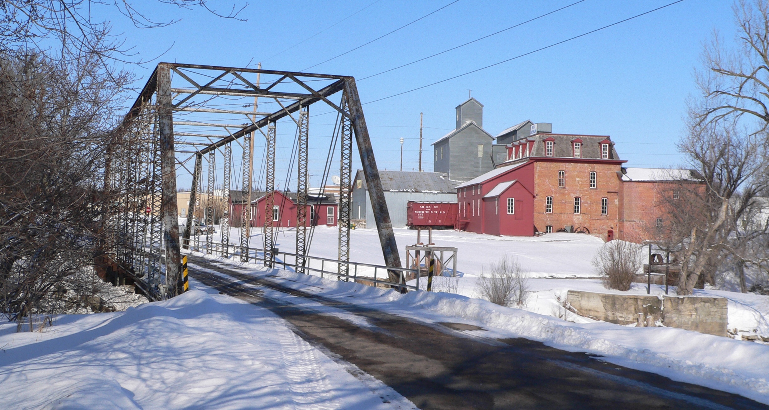
October 15, 1969 111 W. 2nd St.; also includes the mill elevators
42°07′35″N 98°01′50″W / 42.126389°N 98.030556°WNeligh Mill elevators represent a boundary increase; Boundary increase II (listed 4/2/2010): Irregular Tracks in Block 22, Original Town, Neligh and the N1/2 of the SE1/4 of Section 20, T25N, R6W 7 Neligh Mill Bridge 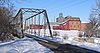
June 29, 1992 Elm St. over the Elkhorn River
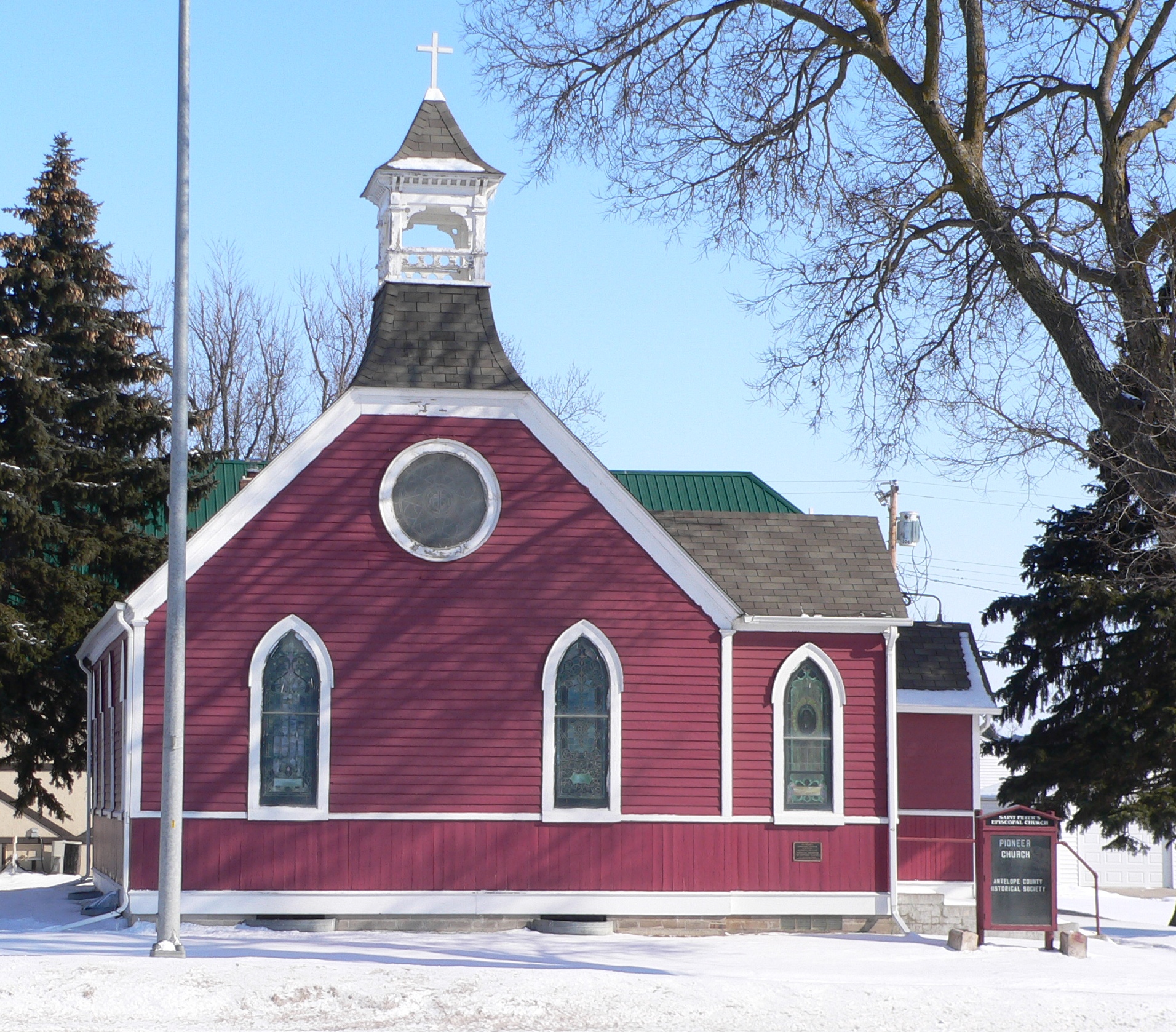
42°07′32″N 98°01′51″W / 42.125556°N 98.030833°WNeligh Bridge damaged by flooding in June 2010; Antelope County Board of Supervisors voted in April 2011 to remove it,[6] but rescinded this decision in June 2011.[7] 8 St. Peter's Episcopal Church 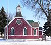
December 3, 1980 411 L St.
42°07′46″N 98°01′40″W / 42.129444°N 98.027778°WNeligh 9 Verdigris Creek Bridge 
June 29, 1992 Township road over Verdigris Creek, 1.9 miles northeast of Royal
42°21′31″N 98°06′23″W / 42.358611°N 98.106389°WRoyal See also
- List of National Historic Landmarks in Nebraska
- National Register of Historic Places listings in Nebraska
References
- ^ The latitude and longitude information provided in this table was derived originally from the National Register Information System, which has been found to be fairly accurate for about 99% of listings. For about 1% of NRIS original coordinates, experience has shown that one or both coordinates are typos or otherwise extremely far off; some corrections may have been made. A more subtle problem causes many locations to be off by up to 150 yards, depending on location in the country: most NRIS coordinates were derived from tracing out latitude and longitudes off of USGS topographical quadrant maps created under the North American Datum of 1927, which differs from the current, highly accurate WGS84 GPS system used by Google maps. Chicago is about right, but NRIS longitudes in Washington are higher by about 4.5 seconds, and are lower by about 2.0 seconds in Maine. Latitudes differ by about 1.0 second in Florida. Some locations in this table may have been corrected to current GPS standards.
- ^ "National Register of Historic Places: Weekly List Actions". National Park Service, United States Department of the Interior. Retrieved on November 10, 2011.
- ^ Numbers represent an ordering by significant words. Various colorings, defined here, differentiate National Historic Landmark sites and National Register of Historic Places Districts from other NRHP buildings, structures, sites or objects.
- ^ "National Register Information System". National Register of Historic Places. National Park Service. . http://nrhp.focus.nps.gov/natreg/docs/All_Data.html.
- ^ "Nebraska National Register Sites in Antelope County". Nebraska State Historical Society. Retrieved 2010-04-09.
- ^ "Neligh's Mill Bridge is History". Neligh News and Leader. 2011-05-04.
- ^ Anchan, Asha. "Bridge's future still undecided". Norfolk Daily News. 2011-06-08. Retrieved 2011-08-31.
U.S. National Register of Historic Places Topics Lists by states Alabama • Alaska • Arizona • Arkansas • California • Colorado • Connecticut • Delaware • Florida • Georgia • Hawaii • Idaho • Illinois • Indiana • Iowa • Kansas • Kentucky • Louisiana • Maine • Maryland • Massachusetts • Michigan • Minnesota • Mississippi • Missouri • Montana • Nebraska • Nevada • New Hampshire • New Jersey • New Mexico • New York • North Carolina • North Dakota • Ohio • Oklahoma • Oregon • Pennsylvania • Rhode Island • South Carolina • South Dakota • Tennessee • Texas • Utah • Vermont • Virginia • Washington • West Virginia • Wisconsin • WyomingLists by territories Lists by associated states Other Municipalities and communities of Antelope County, Nebraska Cities 
Villages Brunswick | Clearwater | Oakdale | Orchard | Royal
Townships Footnotes ‡This populated place also has portions in an adjacent county or counties
Categories:- National Register of Historic Places in Nebraska by county
- Antelope County, Nebraska
- Buildings and structures in Antelope County, Nebraska
-

Wikimedia Foundation. 2010.