- National Register of Historic Places listings in Apache County, Arizona
-
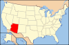
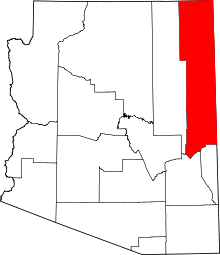 Location of Apache County in Arizona
This is a list of the National Register of Historic Places listings in Apache County, Arizona. It is intended to be a complete list of the properties and districts on the National Register of Historic Places in Apache County, Arizona, United States. The locations of National Register properties and districts for which the latitude and longitude coordinates are included below, may be seen in a Google map.[1]
There are 32 properties and districts listed on the National Register in the county, including 5 that are also National Historic Landmarks.
-
- This National Park Service list is complete through NPS recent listings posted November 10, 2011.[2]
Listings county-wide
[3] Landmark name Image Date listed Location City or town Summary 1 Allentown Bridge September 30, 1988 Indian Route 9402 over the Puerco River at milepost 9.1
35°16′51″N 109°09′16″W / 35.280833°N 109.154444°WHouck 2 Alpine Elementary School April 25, 1997 11 and 12 County Road 2052, near its junction with U.S. Route 180
33°50′51″N 109°08′27″W / 33.8475°N 109.140833°WAlpine 3 Butterfly Lodge June 17, 1992 Forest Rd. 245 east of State Route 373 in the Apache National Forest
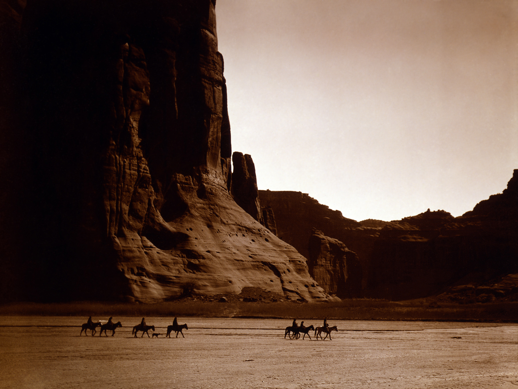
34°01′08″N 109°26′57″W / 34.018889°N 109.449167°WGreer 4 Canyon de Chelly National Monument 
August 25, 1970 Eastern side of Chinle
36°8′21″N 109°20′5″W / 36.13917°N 109.33472°WChinle 5 Casa Malpais Site 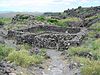
October 15, 1966 Address restricted
34°09′33″N 109°17′24″W / 34.159167°N 109.29°WSpringerville 6 Chinle Franciscan Mission Historic District June 5, 2007 Indian Service Route 7 across road and southwest of the Chinle Judicial complex and Police Station Chinle 7 Colter Ranch Historic District July 9, 1993 Junction of 4th St. and School Bus Rd.
34°06′24″N 109°19′11″W / 34.106667°N 109.319722°WEagar 8 Eagar School July 22, 1993 174 S. Main St.
34°06′29″N 109°17′30″W / 34.108056°N 109.291667°WEagar 9 Eagar Townsite Historic District July 23, 1993 Roughly bounded by Central Ave., Main St., 1st Ave. and Eagar St. 2nd Ave, and Harless St., 3rd Ave., and Eagar St.
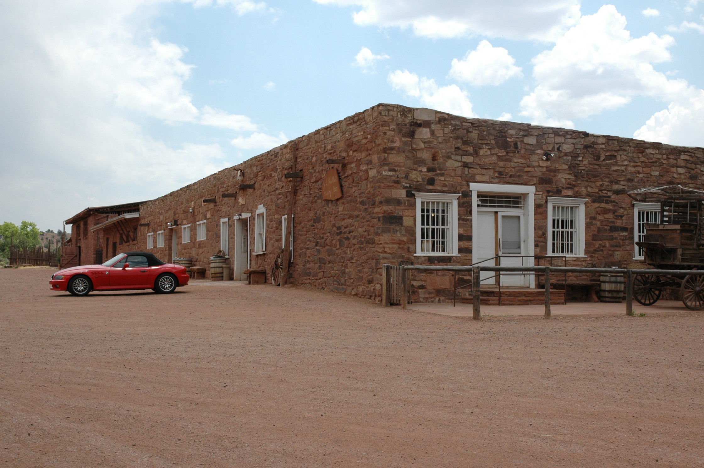
34°06′45″N 109°17′25″W / 34.1125°N 109.290278°WEagar 10 Flattop Site July 12, 1976 Address restricted Adamana 11 Hubbell Trading Post National Historic Site 
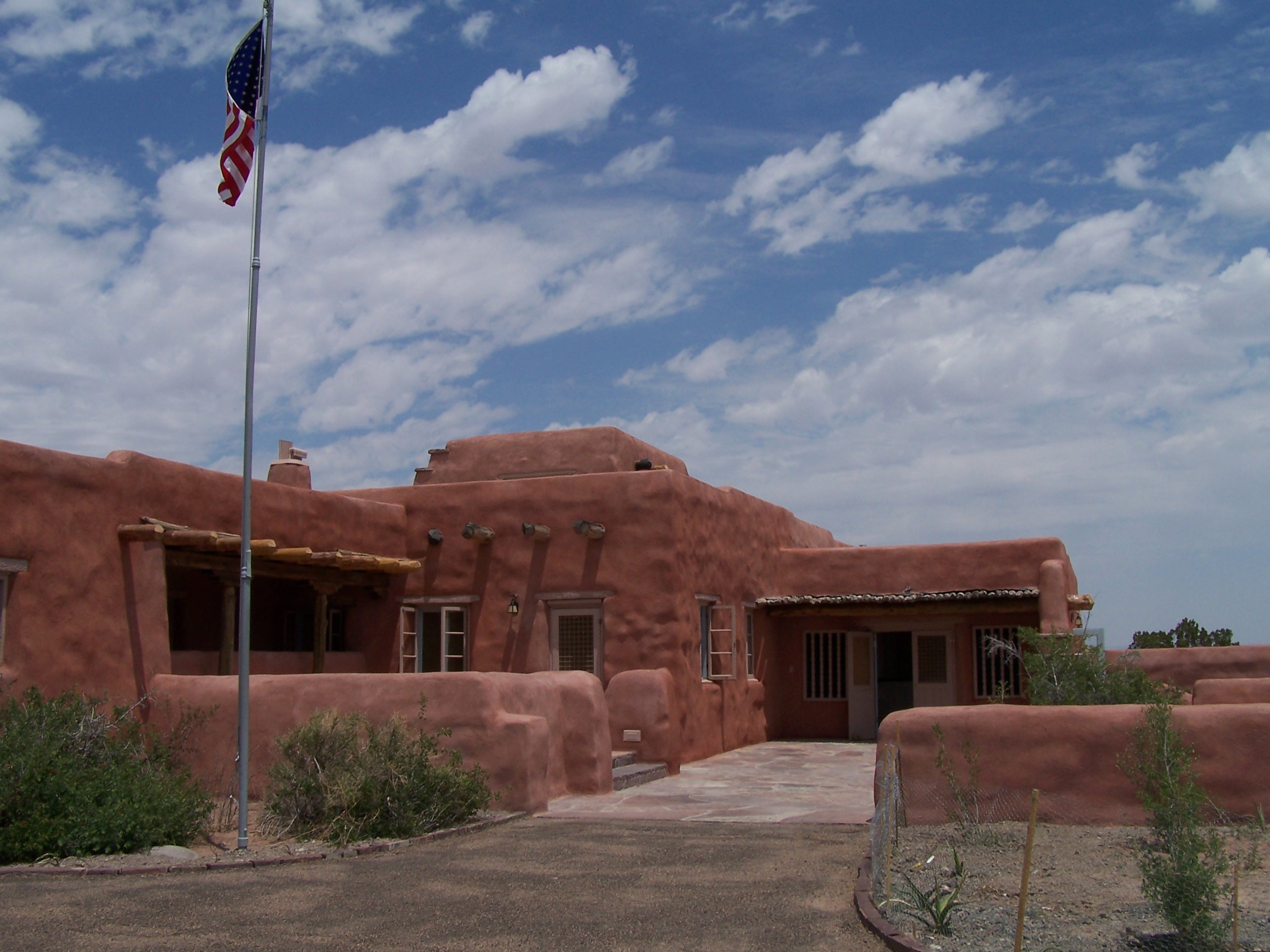
October 15, 1966 Western side of Ganado Ganado 12 Isaacson Building September 12, 1983 37 Commercial St.
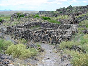
34°30′22″N 109°21′47″W / 34.506111°N 109.363056°WSt. Johns 13 Kin Tiel May 22, 1978 Address restricted Chambers 14 Lake Mountain Lookout Complex January 28, 1988 Off Vernon McNary Rd.
34°09′28″N 109°46′07″W / 34.157778°N 109.768611°WMcNary 15 Los Burros Ranger Station October 23, 1986 Forest Rd. 20
34°08′27″N 109°45′55″W / 34.140833°N 109.765278°WMcNary 16 Lower Zuni River Archeological District April 29, 1994 Address restricted St. Johns 17 Lyman Lake Rock Art Site August 19, 2003 Address restricted St. Johns 18 Navajo Nation Council Chamber 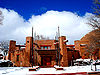
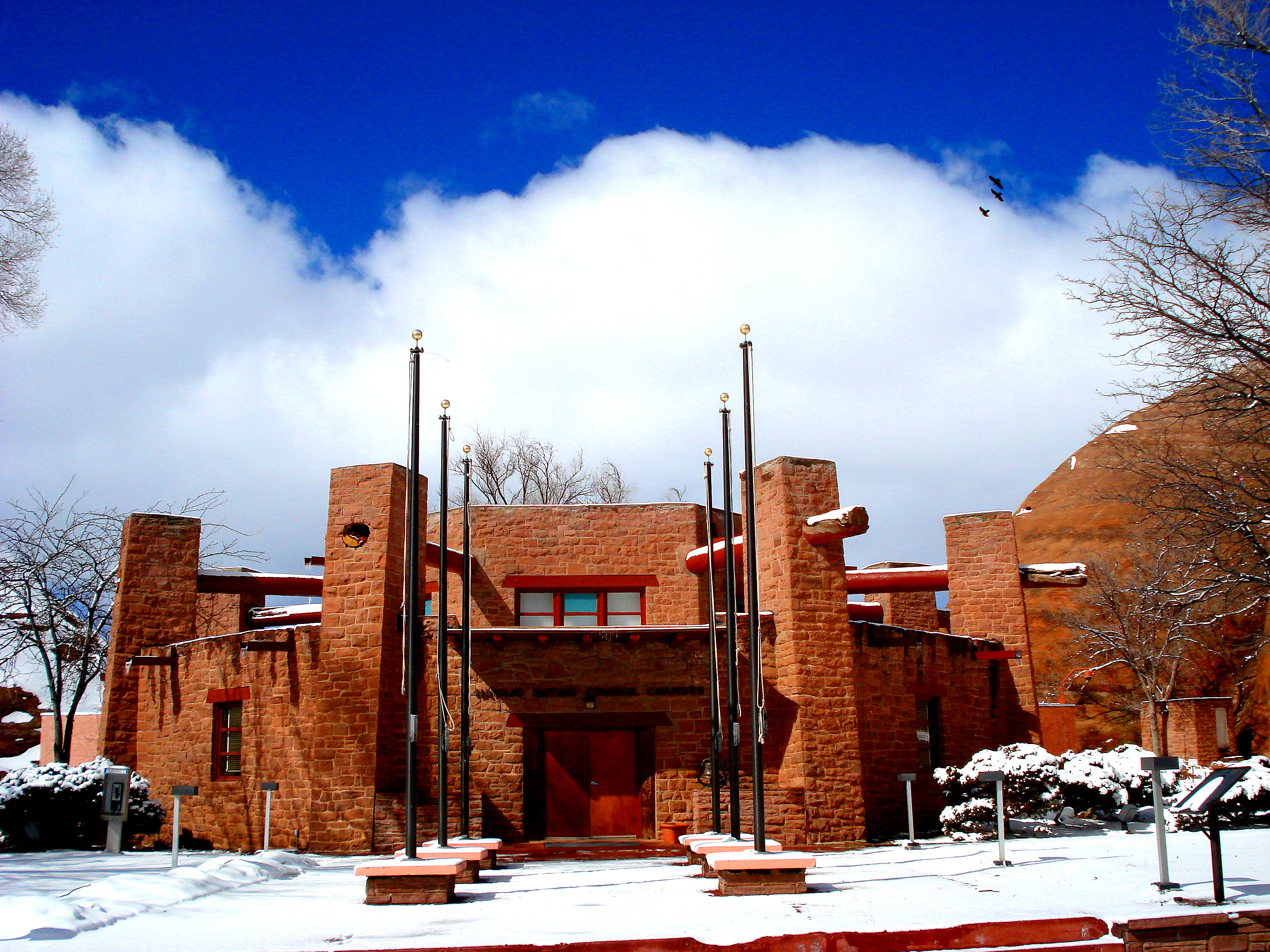
August 18, 2004 W008-013 Circle Boulevard
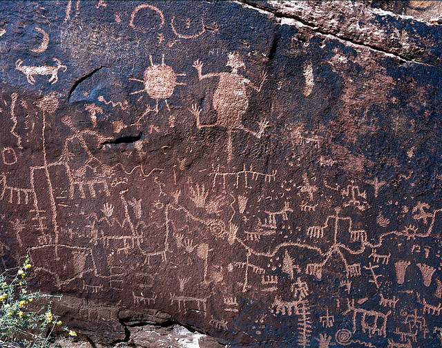
35°40′58″N 109°02′54″W / 35.682778°N 109.048333°WWindow Rock 19 Newspaper Rock Petroglyphs Archeological District 
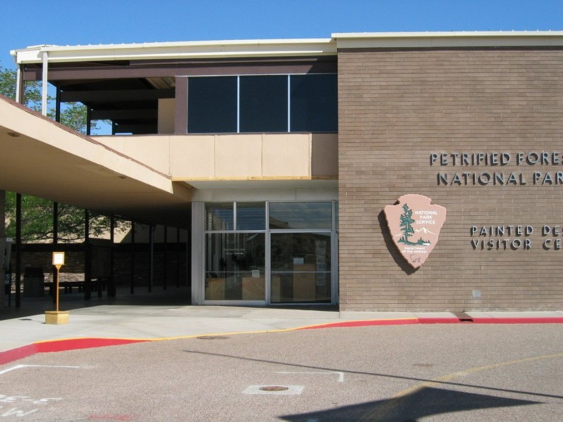
July 12, 1976 Address restricted Adamana 20 Painted Desert Community Complex Historic District 
April 15, 2005 One Park Rd.
35°04′06″N 109°46′50″W / 35.068333°N 109.780556°WPetrified Forest National Park 21 Painted Desert Inn 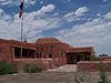
October 10, 1975 West of Navajo in Petrified Forest National Park, off Interstate 40
35°05′03″N 109°47′06″W / 35.084167°N 109.785°WNavajo Designated a National Historic Landmark on May 28, 1987 22 PS Knoll Lookout Complex January 28, 1988 Apache-Sitgreaves National Forest
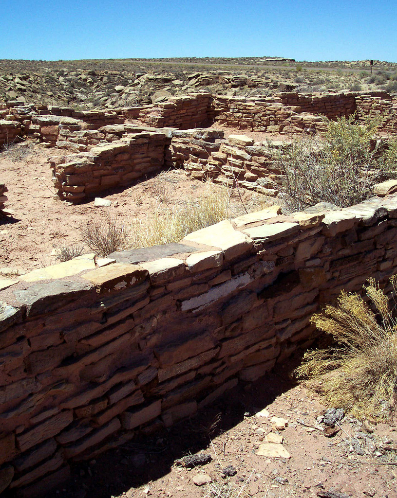
33°45′16″N 109°23′52″W / 33.754444°N 109.397778°WMaverick 23 Puerco Ruin and Petroglyphs 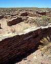
July 12, 1976 Address restricted Adamana 24 Querino Canyon Bridge September 30, 1988 Old U.S. Route 66 over Querino Canyon
35°16′49″N 109°15′28″W / 35.280278°N 109.257778°WHouck 25 Rattlesnake Point Pueblo August 2, 2001 Lyman Lake State Park St. Johns 26 Sage Memorial Hospital School of Nursing January 16, 2009 Ganado Mission Ganado 27 St. Michael's Mission May 29, 1975 North of Window Rock off State Route 264
35°38′44″N 109°05′53″W / 35.645556°N 109.098056°WWindow Rock 28 Sanders Bridge September 30, 1988 Indian Route 9402 over the Puerco River
35°12′46″N 109°19′47″W / 35.212778°N 109.329722°WSanders 29 Sherwood Ranch Pueblo August 17, 2005 Address restricted Springerville 30 Thirty-Fifth Parallel Route December 6, 1977 25 miles east of Holbrook off Interstate 40
35°04′09″N 109°46′14″W / 35.069167°N 109.770556°WHolbrook 31 Twin Buttes Archeological District July 12, 1976 Address restricted Adamana 32 Water Canyon Administrative Site June 10, 1993 Forest Rd. 285 south of Springerville, Apache-Sitgreaves National Forest
34°03′56″N 109°17′34″W / 34.065556°N 109.292778°WSpringerville See also
- List of National Historic Landmarks in Arizona
- National Register of Historic Places listings in Arizona
References
- ^ The latitude and longitude information provided in this table was derived originally from the National Register Information System, which has been found to be fairly accurate for about 99% of listings. For about 1% of NRIS original coordinates, experience has shown that one or both coordinates are typos or otherwise extremely far off; some corrections may have been made. A more subtle problem causes many locations to be off by up to 150 yards, depending on location in the country: most NRIS coordinates were derived from tracing out latitude and longitudes off of USGS topographical quadrant maps created under the North American Datum of 1927, which differs from the current, highly accurate WGS84 GPS system used by Google maps. Chicago is about right, but NRIS longitudes in Washington are higher by about 4.5 seconds, and are lower by about 2.0 seconds in Maine. Latitudes differ by about 1.0 second in Florida. Some locations in this table may have been corrected to current GPS standards.
- ^ "National Register of Historic Places: Weekly List Actions". National Park Service, United States Department of the Interior. Retrieved on November 10, 2011.
- ^ Numbers represent an ordering by significant words. Various colorings, defined here, differentiate National Historic Landmark sites and National Register of Historic Places Districts from other NRHP buildings, structures, sites or objects.
U.S. National Register of Historic Places Topics Lists by states Alabama • Alaska • Arizona • Arkansas • California • Colorado • Connecticut • Delaware • Florida • Georgia • Hawaii • Idaho • Illinois • Indiana • Iowa • Kansas • Kentucky • Louisiana • Maine • Maryland • Massachusetts • Michigan • Minnesota • Mississippi • Missouri • Montana • Nebraska • Nevada • New Hampshire • New Jersey • New Mexico • New York • North Carolina • North Dakota • Ohio • Oklahoma • Oregon • Pennsylvania • Rhode Island • South Carolina • South Dakota • Tennessee • Texas • Utah • Vermont • Virginia • Washington • West Virginia • Wisconsin • WyomingLists by territories Lists by associated states Other Properties on the National Register of Historic Places in Arizona 
Municipalities and communities of Apache County, Arizona City 
Towns CDPs Burnside | Chinle | Dennehotso | Fort Defiance | Ganado | Houck | Lukachukai | Many Farms | McNary‡ | Nazlini | Red Mesa | Rock Point | Rough Rock | Round Rock | St. Michaels | Sawmill | Steamboat | Teec Nos Pos | Tsaile | Window Rock
Unincorporated
communitiesIndian reservations Footnotes ‡This populated place also has portions in an adjacent county or counties
Categories:- National Register of Historic Places in Arizona by county
- History of Apache County, Arizona
-


Wikimedia Foundation. 2010.