- National Register of Historic Places listings in Orange County, California
-
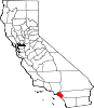
This list includes 112 properties and districts listed on the National Register of Historic Places in Orange County, California. These historic sites reflect the region's Native American, Spanish and Mexican ethnic heritage. They include historic mansions from the eras of wealth created by citrus farming and oil discovery and reflect political leadership and scientific achievements, as well as other themes.
Click the "Map of all coordinates" link to the right to view a Google map of all properties and districts with latitude and longitude coordinates in the table below.[1]
-
- This National Park Service list is complete through NPS recent listings posted November 10, 2011.[2]
[3] Landmark name [4] Image Date listed Location City or town Summary 1 Lewis Ainsworth House 
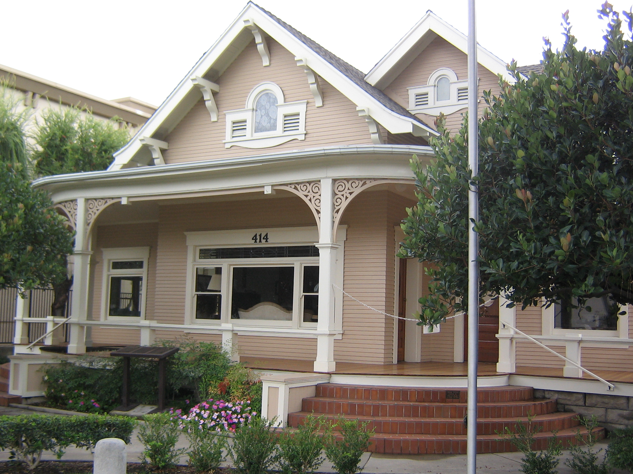
March 13, 1981 414 E. Chapman Ave.
33°47′17″N 117°50′56″W / 33.788056°N 117.848889°WOrange 2 Artz Building 
April 18, 1994 150-158 W. Main St.
33°44′29″N 117°49′43″W / 33.741389°N 117.828611°WTustin 3 Ferdinand Backs House October 14, 1980 225 N. Claudina St.
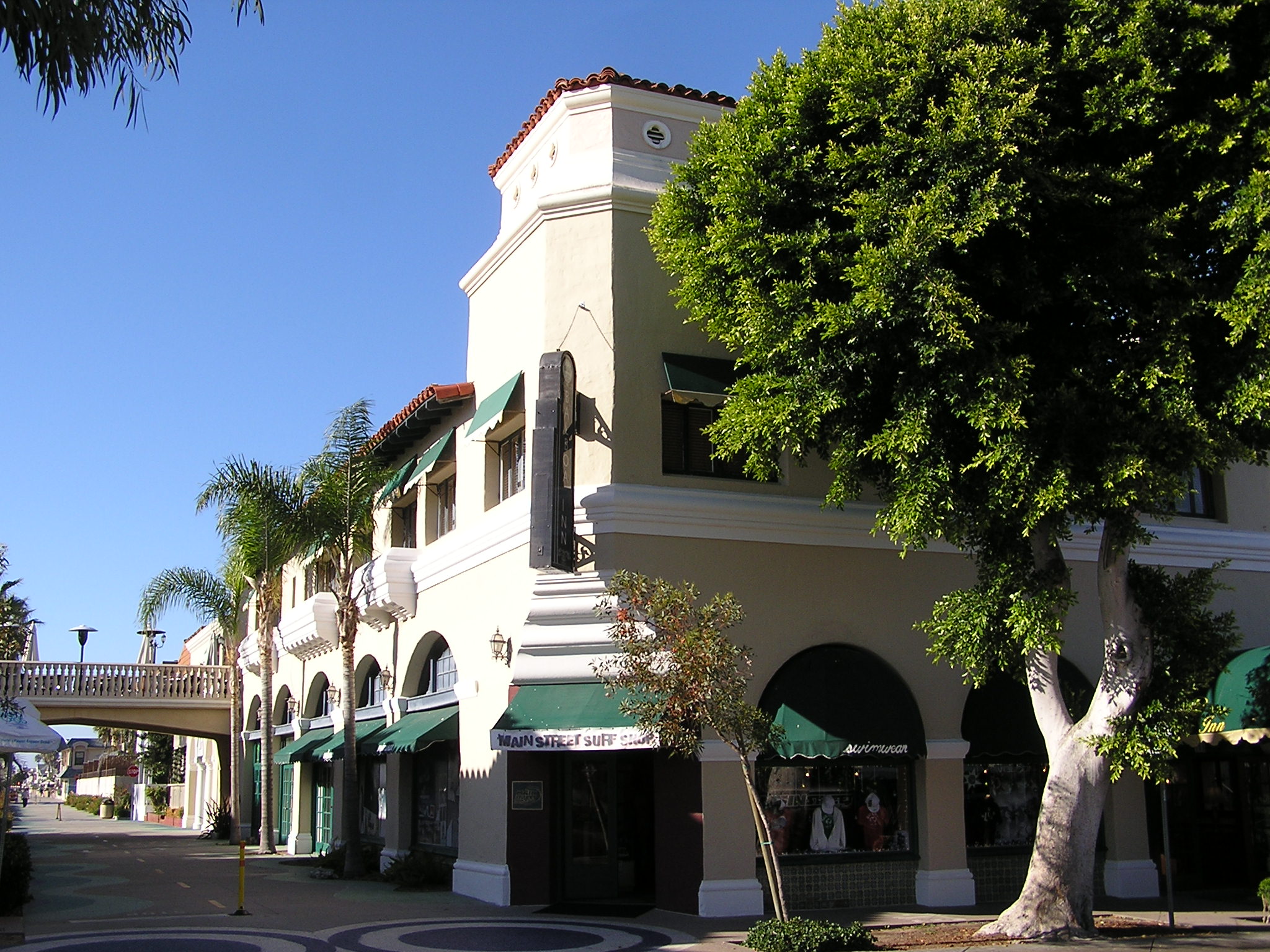
33°50′15″N 117°54′46″W / 33.8375°N 117.912778°WAnaheim 4 Balboa Inn 
April 11, 1986 105 Main St.
33°36′05″N 117°53′56″W / 33.601389°N 117.898889°WNewport Beach 5 Balboa Pavilion 
May 17, 1984 400 Main St.
33°36′10″N 117°53′52″W / 33.602778°N 117.897778°WBalboa 6 Bank of Balboa-Bank of America July 24, 1986 611 E. Balboa Blvd.
33°36′07″N 117°53′59″W / 33.601944°N 117.899722°WNewport Beach 7 Bixby-Bryant Ranch House January 16, 1997 5700 Susanna Bryant Dr.
33°52′30″N 117°42′28″W / 33.875°N 117.707778°WYorba Linda 8 A. S. Bradford House October 3, 1978 136 Palm Circle
33°53′18″N 117°51′49″W / 33.888333°N 117.863611°WPlacentia 9 Brea City Hall and Park May 24, 1984 401 S. Brea Blvd.
33°54′51″N 117°54′05″W / 33.914167°N 117.901389°WBrea 10 Builders Exchange Building April 29, 1982 202-208 N. Main St.
33°44′47″N 117°52′01″W / 33.746389°N 117.866944°WSanta Ana 11 Carnegie Library October 22, 1979 241 S. Anaheim Blvd.
33°50′00″N 117°54′45″W / 33.833333°N 117.9125°WAnaheim 12 Casa de Esperanza October 1, 1990 31806 El Camino Real
33°30′04″N 117°39′38″W / 33.501111°N 117.660556°WSan Juan Capistrano 13 Casa Romantica December 27, 1991 415 Avenida Granada
33°25′16″N 117°37′13″W / 33.421111°N 117.620278°WSan Clemente 14 Chapman Building September 22, 1983 110 E. Wilshire Ave.
33°52′20″N 117°55′23″W / 33.872222°N 117.923056°WFullerton 15 Christ College Site April 16, 1993 Northeastern corner of the Concordia University campus, off University Dr.
33°39′24″N 117°48′27″W / 33.65667°N 117.8075°W[5]Irvine 16 Dr. George C. Clark House December 12, 1976 California State University campus
33°53′14″N 117°52′59″W / 33.887222°N 117.883056°WFullerton 17 Joel R. Congdon House July 22, 2002 32701 Alipaz St.
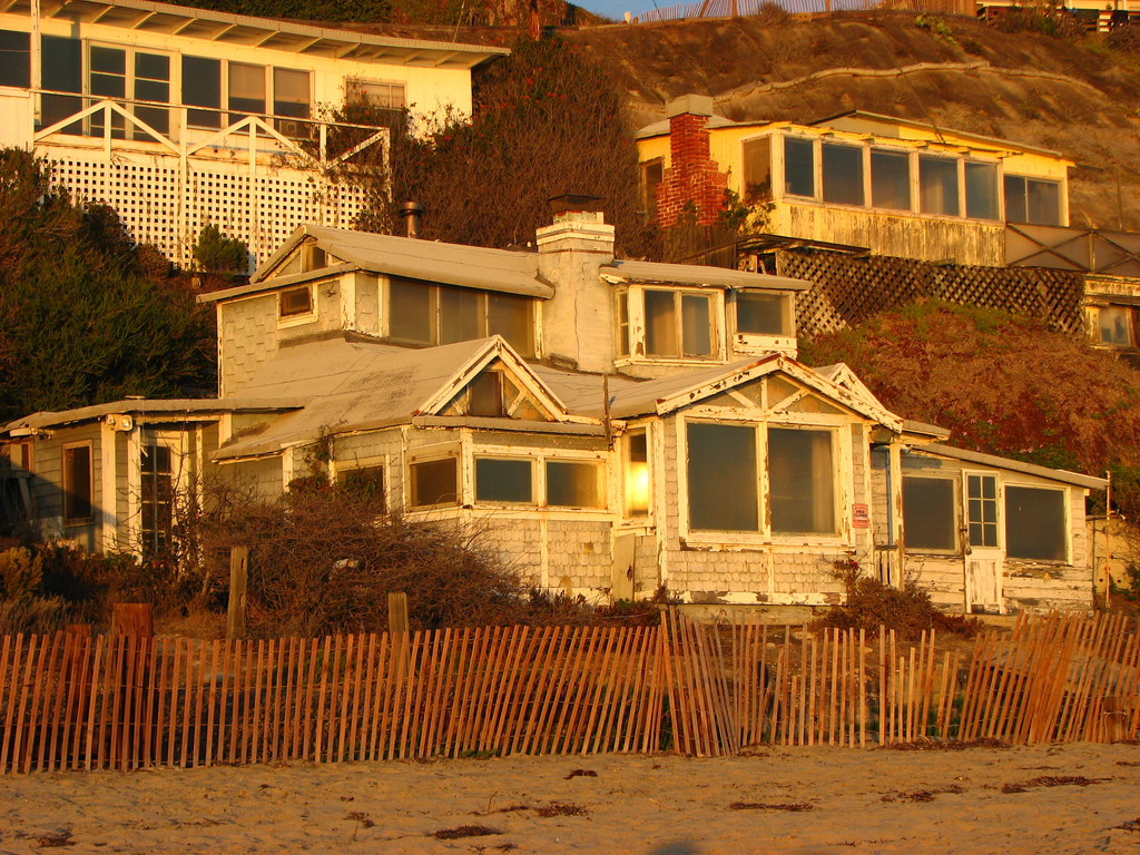
33°29′19″N 117°40′23″W / 33.488611°N 117.673056°WSan Juan Capistrano 18 Crystal Cove Historic District 
June 15, 1979 NW of Laguna Beach
33°34′29″N 117°50′26″W / 33.574722°N 117.840556°WLaguna Beach 19 C. Z. Culver House March 20, 1986 205 E. Palmyra
33°47′04″N 117°51′03″W / 33.784444°N 117.850833°WOrange 20 Dewella Apartments February 2, 2009 234-236 E. Wilshire Ave.
33°52′21″N 117°55′14″W / 33.872386°N 117.920475°WFullerton 21 Downtown Santa Ana Historic Districts (North, Government/Institutional and South, Retail) December 19, 1984 Roughly bounded by Civic Center Dr., First, Ross, and Spurgeon Sts.
33°44′54″N 117°52′05″W / 33.748333°N 117.868056°WSanta Ana 22 Oscar Easley Block February 17, 1983 101 El Camino Real
33°25′40″N 117°36′42″W / 33.427778°N 117.611667°WSan Clemente 23 Ebell Society of Santa Ana Valley July 2, 2001 625 N. French St.
33°45′03″N 117°51′49″W / 33.750833°N 117.863611°WSanta Ana 24 Elephant Packing House 
September 21, 1983 201 W. Truslow Ave.
33°52′03″N 117°55′32″W / 33.8675°N 117.925556°WFullerton 25 Esslinger Building May 16, 1988 31866 Camino Capistrano
33°30′00″N 117°39′40″W / 33.5°N 117.661111°WSan Juan Capistrano 26 Fairview Indian Site June 27, 1972 Address Restricted Costa Mesa 27 Farmers and Merchants Bank of Fullerton April 19, 1994 122 N. Harbor Blvd.
33°52′16″N 117°55′24″W / 33.871111°N 117.923333°WFullerton 28 First Baptist Church of Orange 
March 28, 1996 192 S. Orange St.
33°47′11″N 117°51′05″W / 33.786389°N 117.851389°WOrange 29 Frank A. Forster House September 11, 1986 27182 Ortega Hwy.
33°30′09″N 117°39′19″W / 33.5025°N 117.655278°WSan Juan Capistrano 30 Fox Fullerton Theatre Complex 
October 25, 2006 500-512 N. Harbor Blvd.
33°52′34″N 117°55′26″W / 33.876081°N 117.92392°WFullerton 31 Frances Packing House August 2, 1977 NE of Irvine
33°42′39″N 117°45′48″W / 33.710833°N 117.763333°WIrvine This building was demolished. 32 French Park Historic District May 12, 1999 Roughly bounded by N. Bush, E. Washington, and N. Garfield Sts., and Civic Center Dr. E.
33°45′12″N 117°51′47″W / 33.753333°N 117.863056°WSanta Ana 33 Fullerton City Hall 
May 22, 2003 237 W. Commonwealth Ave.
33°52′21″N 117°55′46″W / 33.8725°N 117.929444°WFullerton 34 Fullerton First Methodist Episcopal Church February 13, 2001 117 N. Pomona Ave.
33°52′17″N 117°55′18″W / 33.871389°N 117.921667°WFullerton 35 Fullerton Odd Fellows Temple April 26, 2002 112 E. Commonwealth Ave.
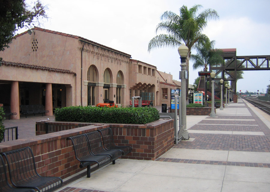
33°52′13″N 117°55′25″W / 33.870278°N 117.923611°WFullerton 36 Fullerton Union Pacific Depot 
October 12, 1983 100 E. Santa Fe Ave.
33°52′09″N 117°55′22″W / 33.869167°N 117.922778°WFullerton 37 Goldschmidt House October 14, 2004 243 Avenida La Cuesta
33°26′03″N 117°36′37″W / 33.434167°N 117.610278°WSan Clemente 38 Greystone Villa-Cabin 18 March 15, 2002 Sievers Canyon, Trabuco Ranger District
33°35′25″N 117°30′15″W / 33.590278°N 117.504167°WCleveland National Forest 39 Harmon-McNeil House November 7, 1985 322 E. Chestnut St.
33°44′32″N 117°51′48″W / 33.742222°N 117.863333°WSanta Ana 40 Harrison House August 21, 1979 27832 Ortega Hwy.
33°30′34″N 117°38′42″W / 33.509444°N 117.645°WSan Juan Capistrano 41 Helme-Worthy Store and Residence 
March 31, 1987 513-519 Walnut St. and 128 Sixth St.
33°39′32″N 118°00′06″W / 33.658889°N 118.001667°WHuntington Beach 42 Hetebrink House July 1, 1993 515 E. Chapman
33°52′32″N 117°54′50″W / 33.875556°N 117.913889°WFullerton 43 Hillcrest Park August 11, 2004 200 Brea Blvd.
33°52′58″N 117°55′14″W / 33.882778°N 117.920556°WFullerton 44 Hotel San Clemente August 31, 1989 114 Avenida Del Mar
33°25′37″N 117°36′46″W / 33.426944°N 117.612778°WSan Clemente 45 Howe-Waffle House and Carriage House April 13, 1977 Sycamore and Civic Center Dr.
33°45′02″N 117°51′56″W / 33.750556°N 117.865556°WSanta Ana 46 Huntington Beach Elementary School Gymnasium and Plunge December 29, 1994 1600 Palm Ave.
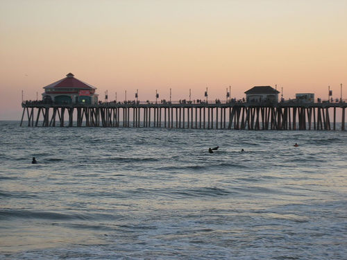
33°40′10″N 118°00′18″W / 33.669444°N 118.005°WHuntington Beach 47 Huntington Beach Municipal Pier 
August 24, 1989 Main St. and Ocean Ave.
33°39′12″N 118°00′17″W / 33.653333°N 118.004722°WHuntington Beach 48 Irvine Bean and Growers Association Building January 13, 1986 14972 Sand Canyon Ave.
33°40′29″N 117°45′25″W / 33.674722°N 117.756944°WIrvine 49 Irvine Blacksmith Shop March 20, 1986 14952 Sand Canyon Ave.
33°40′34″N 117°45′29″W / 33.676111°N 117.758056°WIrvine 50 Irvine Park April 7, 1983 21401 Chapman Ave.
33°47′43″N 117°44′54″W / 33.795278°N 117.748333°WOrange 51 George Key Ranch April 21, 1975 625 Bastanchury Rd.
33°53′49″N 117°52′03″W / 33.896944°N 117.8675°WPlacentia 52 Samuel Kraemer Building (American Savings Bank/First National Bank) June 16, 1983 76 S. Claudina St
33°50′09″N 117°54′46″W / 33.835833°N 117.912778°WAnaheim 53 Kroger-Melrose District June 19, 1985 Roughly bounded by Lincoln Ave., S. Kroger, W. Broadway and S. Philadelphia
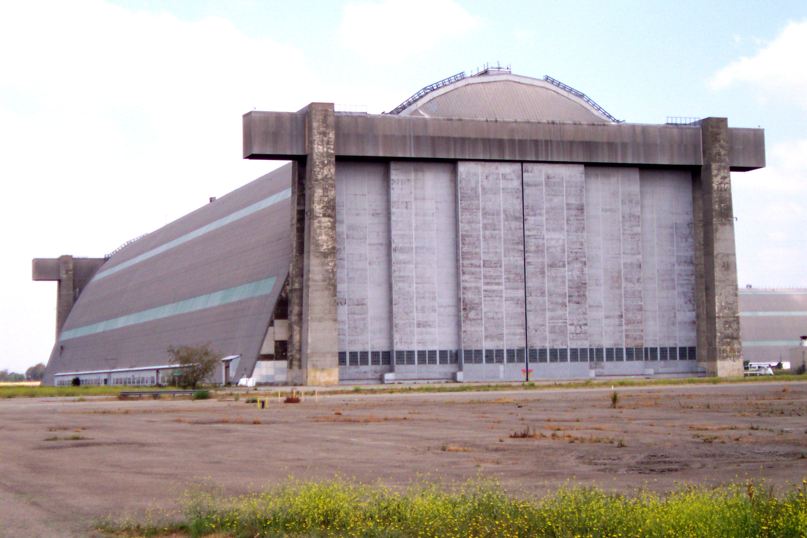
33°50′06″N 117°54′29″W / 33.835°N 117.908056°WAnaheim 54 Lighter-than-Air Ship Hangars 
April 3, 1975 Valencia and Redhill Aves.
33°42′13″N 117°49′23″W / 33.703611°N 117.823056°WSanta Ana 55 Los Rios Street Historic District April 4, 1983 31600-31921 Los Rios St.
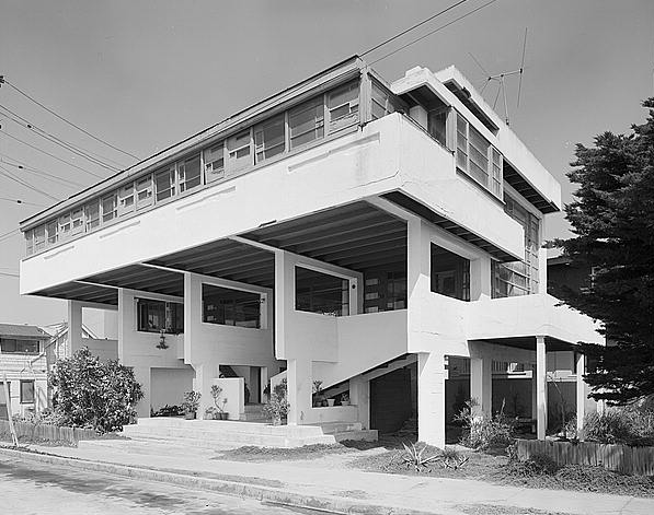
33°30′06″N 117°39′49″W / 33.501667°N 117.663611°WSan Juan Capistrano 56 Lovell Beach House 
February 5, 1974 1242 W. Ocean Front
33°36′21″N 117°55′04″W / 33.605897°N 117.917664°WNewport Beach 57 Mariona March 29, 1984 2529 S. Coast Hwy.
33°31′25″N 117°45′53″W / 33.523611°N 117.764722°WLaguna Beach 58 Masonic Temple March 31, 1995 501 N. Harbor Blvd.
33°52′27″N 117°55′25″W / 33.874167°N 117.923611°WFullerton 59 Melrose-Backs Neighborhood Houses April 3, 1986 226 and 228 E. Adele and 303, 307, 317, 321 N. Philadelphia
33°50′19″N 117°54′40″W / 33.838611°N 117.911111°WAnaheim 60 George W. Minter House June 9, 1980 322 W. 3rd St.
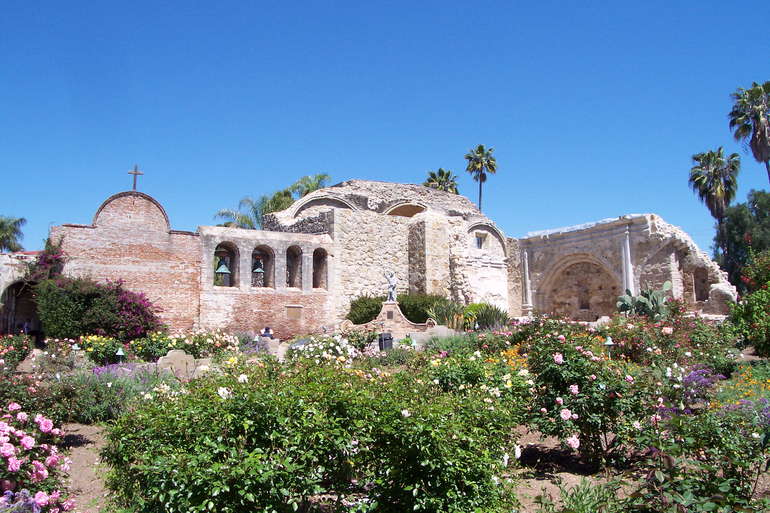
33°44′49″N 117°52′12″W / 33.746944°N 117.87°WSanta Ana 61 Mission San Juan Capistrano 
September 3, 1971 Camino Capistrano and Ortega Hwy.
33°30′10″N 117°39′42″W / 33.502778°N 117.661667°WSan Juan Capistrano 62 Modjeska House December 11, 1972 Modjeska Canyon Rd.
33°43′05″N 117°37′26″W / 33.718056°N 117.623889°WModjeska Canyon 63 Montanez Adobe April 21, 1975 31745 Los Rios St.
33°30′06″N 117°39′49″W / 33.501667°N 117.663611°WSan Juan Capistrano 64 Muckenthaler House May 31, 1980 1201 W. Malvern Ave.
33°52′33″N 117°56′35″W / 33.875833°N 117.943056°WFullerton 65 Newland House October 24, 1985 19820 Beach Blvd.
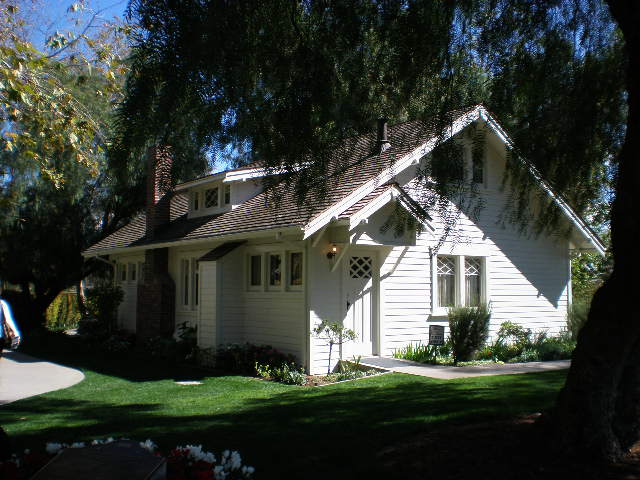
33°40′35″N 117°59′14″W / 33.676389°N 117.987222°WHuntington Beach 66 Richard Nixon Birthplace 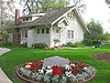
December 17, 1971 18061 Yorba Linda Blvd.
33°53′21″N 117°46′33″W / 33.889167°N 117.775833°WYorba Linda 67 Odd Fellows Hall August 18, 1983 309-311 N. Main St.
33°44′51″N 117°51′59″W / 33.7475°N 117.866389°WSanta Ana 68 Old Backs House October 14, 1980 215 N. Claudina St.
33°50′21″N 117°54′49″W / 33.839167°N 117.913611°WAnaheim 69 Old Towne Orange Historic District July 11, 1997 Roughly bounded by Walnut Ave., Waverly St., W.O. Hart Park, La Veta Ave., Clark St., and Atchison Topeka Railroad Track
33°47′02″N 117°51′02″W / 33.783889°N 117.850556°WOrange 70 Olive Civic Center October 7, 1993 3030 N. Magnolia Ave.
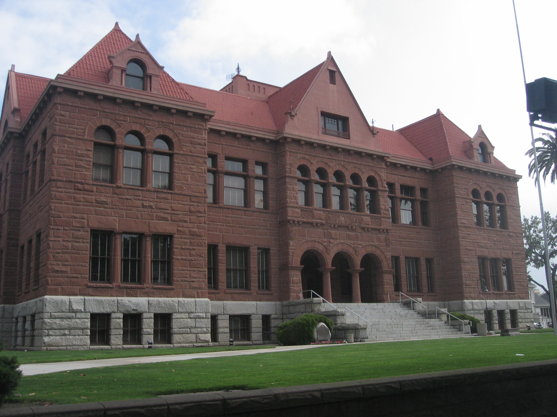
33°50′21″N 117°50′35″W / 33.839167°N 117.843056°WOrange 71 Orange County Courthouse 
August 29, 1977 211 W. Santa Ana Blvd.
33°45′01″N 117°52′09″W / 33.750278°N 117.869167°WSanta Ana 72 Orange Intermediate School-Central Grammar School April 13, 1993 370 N. Glassell St.
33°47′35″N 117°51′10″W / 33.793056°N 117.852778°WOrange 73 Orange Union High School 
April 14, 1975 333 N. Glassell St.
33°47′32″N 117°51′05″W / 33.792222°N 117.851389°WOrange 74 Pacific Electric Railway Company Depot October 25, 1979 18132 Imperial Hwy.
33°53′28″N 117°48′58″W / 33.891111°N 117.816111°WYorba Linda 75 Pacific Electric Sub-Station No. 14 September 22, 1983 802 E. 5th St.
33°44′55″N 117°51′34″W / 33.748611°N 117.859444°WSanta Ana 76 Parker House August 10, 1989 163 S. Cypress St.
33°47′12″N 117°51′22″W / 33.786667°N 117.856111°WOrange 77 Miguel Parra Adobe September 11, 1978 27832 Ortega Hwy.
33°30′35″N 117°38′42″W / 33.509722°N 117.645°WSan Juan Capistrano 78 Pickwick Hotel December 31, 1979 225 S. Anaheim Blvd.
33°50′03″N 117°54′47″W / 33.834167°N 117.913056°WAnaheim 79 Attlio and Jane Pierotti House September 2, 1993 1731 N. Bradford Ave.
33°53′12″N 117°51′57″W / 33.886667°N 117.865833°WFullerton 80 Plaza Historic District March 19, 1982 Roughly bounded by Maple and Almond Aves., Orange and Olive Sts.
33°47′16″N 117°51′08″W / 33.787778°N 117.852222°WOrange 81 The Plaza December 20, 1978 Chapman Ave. and Glassell St.
33°47′16″N 117°51′08″W / 33.787778°N 117.852222°WOrange 82 Louis Plummer Auditorium September 30, 1993 201 E. Chapman Ave.
33°52′28″N 117°55′09″W / 33.874444°N 117.919167°WFullerton 83 Porter-French House August 5, 1994 248 S. Batavia St.
33°47′06″N 117°51′41″W / 33.785°N 117.861389°WOrange 84 Rankin Building February 24, 1983 117 W. 4th St.
33°44′53″N 117°52′03″W / 33.748056°N 117.8675°WSanta Ana 85 San Clemente Beach Club April 9, 1981 Avenida Boca De La Playa
33°25′55″N 117°37′51″W / 33.431944°N 117.630833°WSan Clemente 86 Santa Ana City Hall 
November 10, 1982 217 N. Main St.
33°44′49″N 117°51′59″W / 33.746944°N 117.866389°WSanta Ana 87 Santa Ana Fire Station Headquarters No. 1 July 10, 1986 1322 N. Sycamore St.
33°45′23″N 117°52′05″W / 33.756389°N 117.868056°WSanta Ana 88 Santa Fe Railway Passenger and Freight Depot February 5, 1992 140 E. Santa Fe Ave.
33°52′08″N 117°55′16″W / 33.868889°N 117.921111°WFullerton 89 Santora Building December 27, 1982 207 N. Broadway
33°44′47″N 117°52′08″W / 33.746389°N 117.868889°WSanta Ana 90 Seal Beach City Hall 
August 11, 1983 201 8th St.
33°44′31″N 118°06′20″W / 33.74206°N 118.105677°WSeal Beach 91 Jose Serrano Adobe 
May 24, 1976 21802 Serrano Rd.
33°38′49″N 117°41′20″W / 33.646944°N 117.688889°WEl Toro 92 Smith and Clark Brothers Ranch and Grounds September 22, 1983 18922 Santiago Blvd.
33°48′51″N 117°48′02″W / 33.814167°N 117.800556°WVilla Park 93 Smith-Tuthill Funeral Parlors May 19, 1978 518 N. Broadway
33°44′58″N 117°52′09″W / 33.749444°N 117.869167°WSanta Ana 94 Southern Counties Gas Co. July 28, 1983 207 W. 2nd St.
33°44′48″N 117°52′06″W / 33.746667°N 117.868333°WSanta Ana 95 Spurgeon Block August 31, 1979 206 W. 4th St
33°44′51″N 117°52′06″W / 33.7475°N 117.868333°WSanta Ana 96 St. Francis by-the-Sea American Catholic Church June 30, 1988 430 Park Ave.
33°32′31″N 117°46′55″W / 33.541944°N 117.781944°WLaguna Beach 97 St. John's Lutheran Church October 16, 1991 185 S. Center St.
33°47′10″N 117°50′56″W / 33.786111°N 117.848889°WOrange 98 St. Michael's Episcopal Church February 11, 2004 311 West South St.
33°49′36″N 117°54′47″W / 33.826667°N 117.913056°WAnaheim 99 Phillip Ackley Stanton House November 21, 1980 2200 W. Sequoia Ave.
33°50′38″N 117°57′33″W / 33.843889°N 117.959167°WAnaheim House built in 1929, on the grounds of what is now Fairmont Preparatory Academy 100 Sherman Stevens House 
January 5, 1984 228 W. Main St.
33°44′30″N 117°49′30″W / 33.741667°N 117.825°WTustin 101 Carl Stroschein House October 14, 2009 31682 El Camino Real
33°30′10″N 117°39′42″W / 33.502647°N 117.661558°WSan Juan Capistrano 102 Truxaw-Gervais House October 29, 1982 887 S. Anaheim Blvd.
33°49′25″N 117°54′34″W / 33.823611°N 117.909444°WAnaheim 103 US Post Office Station-Spurgeon Station January 11, 1985 605 Bush St.
33°45′05″N 117°51′56″W / 33.751389°N 117.865556°WSanta Ana 104 Villa Park School March 27, 2003 10551 Center Dr.
33°48′30″N 117°48′49″W / 33.808333°N 117.813611°WVilla Park 105 Dana Point 106 Walkers Orange County Theater February 19, 1982 308 N. Main St.
33°44′51″N 117°52′01″W / 33.7475°N 117.866944°WSanta Ana 107 Newport Beach 108 Roger Y. Williams House January 10, 2007 29991 Camino Capistrano
33°31′43″N 117°40′19″W / 33.528611°N 117.671944°WSan Juan Capistrano 109 George L. Wright House November 12, 1982 831 N. Minter St.
33°45′10″N 117°51′46″W / 33.752778°N 117.862778°WSanta Ana 110 Domingo Yorba Adobe and Casa Manuel Garcia February 4, 1982 31781 Camino Capistrano
33°30′01″N 117°39′44″W / 33.500278°N 117.662222°WSan Juan Capistrano 111 Yost Theater-Ritz Hotel 
January 23, 1986 301-307 N. Spurgeon St.
33°44′50″N 117°51′52″W / 33.747222°N 117.864444°WSanta Ana 112 Young Men's Christian Association-Santa Ana-Tustin Chapter March 25, 1993 205 W. Civic Center Dr.
33°45′05″N 117°52′05″W / 33.751389°N 117.868056°WSanta Ana See also
- National Register of Historic Places listings in California
- List of National Historic Landmarks in California
References
- ^ The latitude and longitude information provided in this table was derived originally from the National Register Information System, which has been found to be fairly accurate for about 99% of listings. For about 1% of NRIS original coordinates, experience has shown that one or both coordinates are typos or otherwise extremely far off; some corrections may have been made. A more subtle problem causes many locations to be off by up to 150 yards, depending on location in the country: most NRIS coordinates were derived from tracing out latitude and longitudes off of USGS topographical quadrant maps created under North American Datum of 1927, which differs from the current, highly accurate GPS system used by Google maps. Chicago is about right, but NRIS longitudes in Washington are higher by about 4.5 seconds, and are lower by about 2.0 seconds in Maine. Latitudes differ by about 1.0 second in Florida. Some locations in this table may have been corrected to current GPS standards.
- ^ "National Register of Historic Places: Weekly List Actions". National Park Service, United States Department of the Interior. Retrieved on November 10, 2011.
- ^ Numbers represent an ordering by significant words. Various colorings, defined here, differentiate National Historic Landmark sites and National Register of Historic Places Districts from other NRHP buildings, structures, sites or objects.
- ^ "National Register Information System". National Register of Historic Places. National Park Service. . http://nrhp.focus.nps.gov/natreg/docs/All_Data.html.
- ^ Location derived from Koerper, Henry C., et al. "Additional Accelerator Mass Spectrometer (AMS) Radiocarbon Assays on Haliotis Fishhooks From CA-ORA-378". Journal of California and Great Basin Anthropology 17.2 (1995): 274. The NRIS lists the site as "Address Restricted."
U.S. National Register of Historic Places Topics Lists by states Alabama • Alaska • Arizona • Arkansas • California • Colorado • Connecticut • Delaware • Florida • Georgia • Hawaii • Idaho • Illinois • Indiana • Iowa • Kansas • Kentucky • Louisiana • Maine • Maryland • Massachusetts • Michigan • Minnesota • Mississippi • Missouri • Montana • Nebraska • Nevada • New Hampshire • New Jersey • New Mexico • New York • North Carolina • North Dakota • Ohio • Oklahoma • Oregon • Pennsylvania • Rhode Island • South Carolina • South Dakota • Tennessee • Texas • Utah • Vermont • Virginia • Washington • West Virginia • Wisconsin • WyomingLists by territories Lists by associated states Other  Category:National Register of Historic Places •
  Portal:National Register of Historic Places
Municipalities and communities of Orange County, California County seat: Santa Ana Cities Aliso Viejo | Anaheim | Brea | Buena Park | Costa Mesa | Cypress | Dana Point | Fountain Valley | Fullerton | Garden Grove | Huntington Beach | Irvine | La Habra | La Palma | Laguna Beach | Laguna Hills | Laguna Niguel | Laguna Woods | Lake Forest | Los Alamitos | Mission Viejo | Newport Beach | Orange | Placentia | Rancho Santa Margarita | San Clemente | San Juan Capistrano | Santa Ana | Seal Beach | Stanton | Tustin | Villa Park | Westminster | Yorba Linda
CDPs Unincorporated
communitiesAnaheim Island | Modjeska Canyon | Orange Park Acres | Santa Ana Heights | Santiago Canyon | Silverado | Trabuco Canyon
Categories:- Orange County, California
- National Register of Historic Places in California by county
- Lists of National Register of Historic Places in California
- History of Orange County, California
-


Wikimedia Foundation. 2010.