- Brea, California
-
City of Brea — City — Market City Cafe in Brea downtown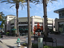

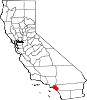
SealLocation of Brea within Orange County, California
Coordinates: 33°55′24″N 117°53′20″W / 33.92333°N 117.88889°WCoordinates: 33°55′24″N 117°53′20″W / 33.92333°N 117.88889°W Country  United States
State  California
County Orange Government – City Council Mayor Roy Moore
Mayor Pro Tem Don Schweitzer
Ron Garcia
Brett Murdock
Marty Simonoff– City Treasurer Glenn G. Parker – City Manager Tim O'Donnell – City Clerk Cheryl Balz Area[1] – Total 12.109 sq mi (31.363 km2) – Land 12.078 sq mi (31.283 km2) – Water 0.031 sq mi (0.080 km2) 0.26% Elevation 361 ft (110 m) Population (2010) – Total 39,282 – Density 3,243.9/sq mi (1,252.5/km2) Time zone PST (UTC-8) – Summer (DST) PDT (UTC-7) ZIP codes 92821-92823 Area code(s) 657/714 FIPS code 06-08100 GNIS feature ID 1660373 Website http://www.cityofbrea.net/ Brea is a city in Orange County, California. The population, as of the 2010 Census was 39,282.
The city began as a center of crude oil production, was later propelled by citrus production, and is now an important retail center because of the large Brea Mall and the recently redeveloped Brea Downtown. Brea is also known for its extensive public art program which began in 1975 and continues today with over 140 artworks in the collection placed and located throughout the city. Brea's public art program has been used as a model and inspiration for many Public Art programs nationwide.
Sunset magazine named Brea one of the five best suburbs to live in the Western United States in early 2006.[2]
Contents
History
The area was visited in 1769 by Gaspar de Portolà. A historical marker dedicated to his visit stands in Brea Canyon just north of town. He noted the local Native Americans as "dirty" without realizing that they used crude oil bubbling up in the canyon as topical medicine.
 Oil fields of the Brea area, early 1900s
The village of Olinda was founded in present-day Carbon Canyon at the beginning of the 19th century and many entrepreneurs came to the area searching for "black gold" (petroleum). In 1894, the owner of the land, Abel Stearns, sold 1,200 acres (4.9 km2) to the west of Olinda to the newly-created Union Oil Company, and by 1898 many nearby hills began sporting wooden oil-drilling towers on the newly-discovered Brea-Olinda Oil Field. In 1908 the village of Randolph was founded just south of Brea Canyon for the oil workers and their families (and named for Epes Randolph, an engineer on the Pacific Electric Railway). Baseball legend Walter Johnson grew up in Olinda at the turn of the century where he worked in the surrounding oil fields as a youth.[3]
The villages of Olinda and Randolph grew and merged as the economy boomed, and on January 19, 1911, the town's map was filed under the new name of Brea, from the Spanish language word for tar. With a population of 752, Brea was incorporated on February 23, 1917, as the eighth official city of Orange County.
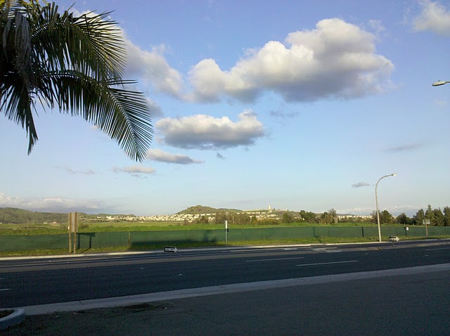
 Future site of La Floresta housing development[4] as seen from the Shell station at the intersection of Valencia Avenue and Imperial Highway, Diemer water filtration plant visible in background (Yorba Linda) as well as Chino Hills State Park
As oil production declined, some agricultural development took place, especially lemon and orange groves. In 1950 Brea had a population of 3,208. The citrus groves gave way gradually to industrial parks and residential development. In 1956, Carl N. Karcher opened the first two Carl's Jr. restaurants in Anaheim, California and Brea, California. The opening of the Orange Freeway (57) and the Brea Mall in the 1970s spurred further residential growth, including large planned developments east of the 57 Freeway in the 1980s, 90s, and 2000s. In the late 1990s, a 50-acre (200,000 m2) swath of downtown Brea centered on Brea Boulevard and Birch Street was heavily redeveloped into a shopping and entertainment area with movie theaters, sidewalk cafes, a live comedy club from The Improv chain, numerous shops and restaurants, and a weekly farmer's market. It is locally known and signed as Downtown Brea.
Geography
According to the United States Census Bureau, the city has a total area of 12.1 square miles (31 km2). 12.1 square miles (31 km2) of it is land and 0.26% is water.
It is bordered by unincorporated Orange County and Los Angeles County to the north and east, La Habra to the west, Fullerton to the southwest, Placentia to the south, and Yorba Linda to the southeast.
Government
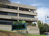 Brea City Hall, Civic & Cultural Center
Local
Brea is governed by a mayor-council system. The five member City Council is elected for four year terms in elections every two years to fill alternately two and three seats.[5] The Council is made up of the Mayor, the Mayor Pro Tem and three Councilmembers.[6] The Council elects a Mayor from the current councilmembers to serve a one-year term as Mayor. The City Council hires a City Manager to direct the city's departments and advise the Council. The Council appoints members of the Planning Commission; Parks, Recreation and Human Services Commission; Cultural Arts Commission and Traffic Committee.[5]
City services
Fire protection for Brea is provided by the Brea Fire Department[7] and law enforcement is provided by the Brea Police Department. In Carbon Canyon[8] in Olinda neighborhood of Brea[9] is situated Olinda Landfill,[10] a major waste management facility serving large part of Orange County.[11]
Management of the city and coordination of city services is provided by:[12]
Office Responsible City Manager Tim O’Donnell Administrative Services Director Bill Gallardo Community Development Director Eric Nicoll Community Services Director Chris Emeterio Fire Chief Wolfgang Knabe Police Chief Jack Conklin Public Works Director Charlie View State and federal
In the state legislature Brea is located in the 29th Senate District, represented by Republican Bob Huff, and in the 72nd Assembly District, represented by Republican Chris Norby. Federally, Brea is located in California's 42nd congressional district, which has a Cook PVI of R +10[13] and is represented by Republican Gary Miller.
Demographics
2010
The 2010 United States Census[14] reported that Brea had a population of 39,282. The population density was 3,243.9 people per square mile (1,252.5/km²). The racial makeup of Brea was 26,363 (67.1%) White, 549 (1.4%) African American, 190 (0.5%) Native American, 7,144 (18.2%) Asian, 69 (0.2%) Pacific Islander, 3,236 (8.2%) from other races, and 1,731 (4.4%) from two or more races. Hispanic or Latino of any race were 9,817 persons (25.0%).
The Census reported that 39,213 people (99.8% of the population) lived in households, 69 (0.2%) lived in non-institutionalized group quarters, and 0 (0%) were institutionalized.
There were 14,266 households, out of which 5,043 (35.3%) had children under the age of 18 living in them, 8,132 (57.0%) were opposite-sex married couples living together, 1,605 (11.3%) had a female householder with no husband present, 632 (4.4%) had a male householder with no wife present. There were 569 (4.0%) unmarried opposite-sex partnerships, and 100 (0.7%) same-sex married couples or partnerships. 3,070 households (21.5%) were made up of individuals and 1,265 (8.9%) had someone living alone who was 65 years of age or older. The average household size was 2.75. There were 10,369 families (72.7% of all households); the average family size was 3.23.
The population was spread out with 9,057 people (23.1%) under the age of 18, 3,654 people (9.3%) aged 18 to 24, 10,669 people (27.2%) aged 25 to 44, 10,952 people (27.9%) aged 45 to 64, and 4,950 people (12.6%) who were 65 years of age or older. The median age was 38.7 years. For every 100 females there were 95.2 males. For every 100 females age 18 and over, there were 91.9 males.
There were 14,785 housing units at an average density of 1,221.0 per square mile (471.4/km²), of which 9,266 (65.0%) were owner-occupied, and 5,000 (35.0%) were occupied by renters. The homeowner vacancy rate was 1.3%; the rental vacancy rate was 5.3%. 26,889 people (68.5% of the population) lived in owner-occupied housing units and 12,324 people (31.4%) lived in rental housing units.
2000
There were 13,067 households out of which 34.6% had children under the age of 18 living with them, 56.6% were married couples living together, 10.5% had a female householder with no husband present, and 28.8% were non-families. 23.0% of all households were made up of individuals and 8.5% had someone living alone who was 65 years of age or older. The average household size was 2.70 and the average family size was 3.21.
In the city the population was spread out with 25.6% under the age of 18, 8.5% from 18 to 24, 30.4% from 25 to 44, 24.1% from 45 to 64, and 11.4% who were 65 years of age or older. The median age was 36 years. For every 100 females there were 95.3 males. For every 100 females age 18 and over, there were 91.9 males.
The median income for a household in the city was $64,820, and the median income for a family was $68,423. Males had a median income of $50,500 versus $35,674 for females. The per capita income for the city was $26,307. About 3.4% of families and 5.3% of the population were below the poverty line, including 6.7% of those under age 18 and 5.2% of those age 65 or over.
Politics
As of June 25, 2009 there were 23,859 registered voters in the city of Brea:[15]:
- Republican Party - 11,854
- Democratic Party - 6,940
- declined to state - 4,180
- American Independent Party - 558
- Libertarian Party - 120
- Green Party- 86
- Peace and Freedom Party - 41
- Miscellaneous - 80
Economy
Top employers
According to the City's 2010 Comprehensive Annual Financial Report,[16] the top employers in the city are:
# Employer # of employees 1 Bank of America 3,000 2 Mercury Insurance Group 1,800 3 Beckman Coulter 1,000 4 Albertsons 900 5 Kirkhill-TA 650 6 Brea Olinda Unified School District 500 7 Harte-Hanks 500 8 VPI Pet Insurance 463 9 The Hartford 450 10 Avery Dennison 392 Education
The city is served by the Brea Olinda Unified School District which operates six elementary schools, one junior high school (Brea Junior High School), one high school (Brea Olinda High School) and one continuation high school. Also serving Brea is the Brea Olinda Friends School (Pre-6), Brea Congregational Pre-School, Brea Foursquare Church (Pre-5), Brea United Methodist Pre-School ("BUMPS"), Carbon Canyon Christian School (K-12), Christ Lutheran School (Pre-8), St. Angela Merici Catholic School (K-8), and Montessori of Brea (K-6). Brea is also home to the Southern California College of Business and Law and the Southern California extension of Golden Gate Baptist Theological Seminary. Private School: Arborland Montessori Children's Academy, 1700 W. Valencia Drive, Fullerton,CA 92833
School awards
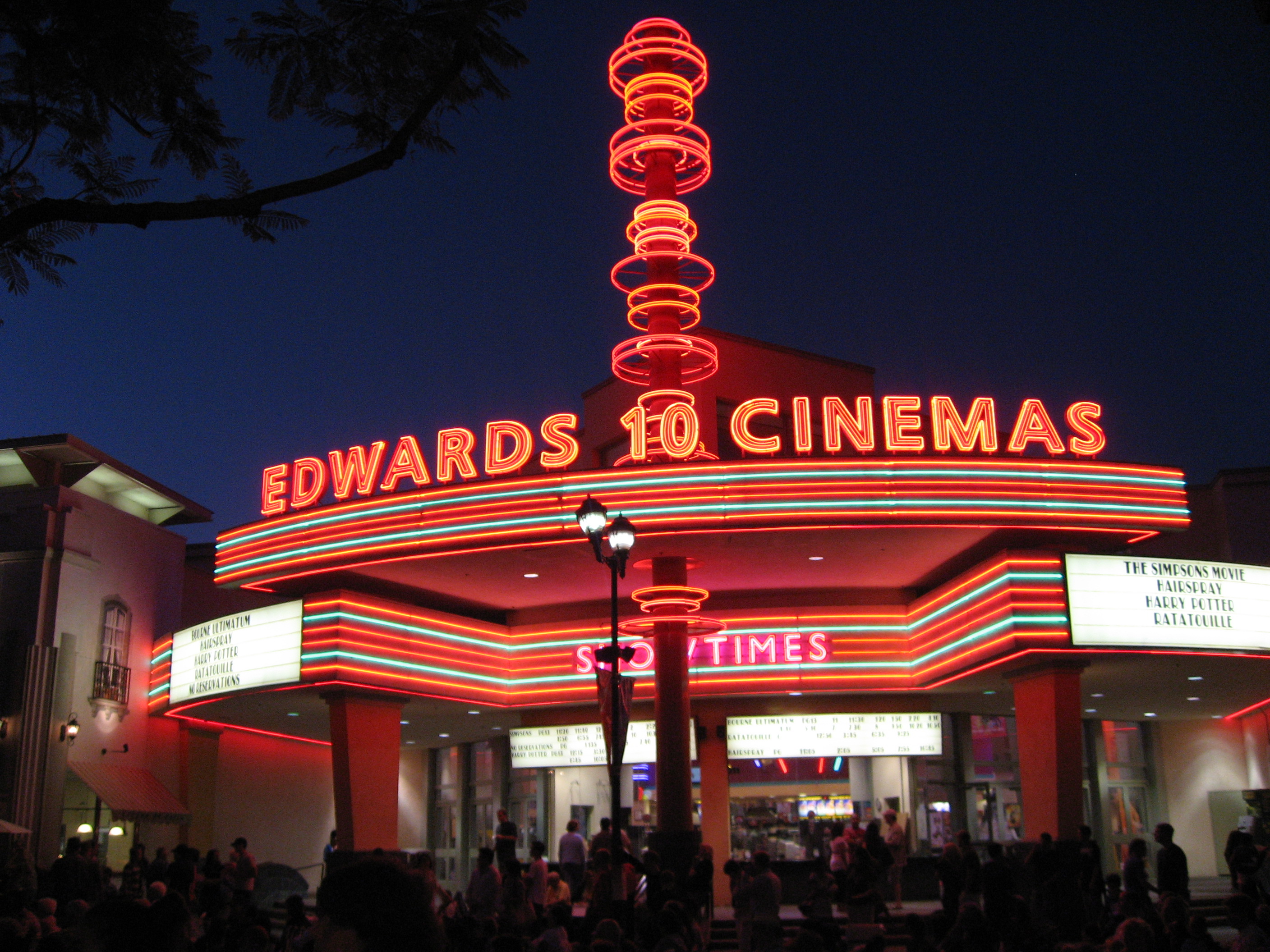
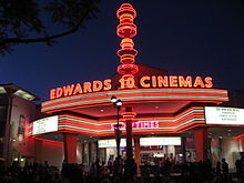 Edwards Cinemas movie theater in Brea downtown.
Local schools have won several awards. Brea Olinda High School and Olinda Elementary School have been named Blue Ribbon Schools. Additionally, Arovista Elementary, Country Hills Elementary, Fanning Elementary, Mariposa Elementary, Olinda Elementary, Brea Junior High and Brea Olinda High schools have been named California Distinguished Schools. Laurel Elementary received a Title I Academic Achievement Award.
Notable natives and residents
- Stephanie J. Block, Broadway actress/singer
- James Cameron, film director/producer/screenwriter
- Travis Denker, Major League baseball player (San Francisco Giants)
- James Hetfield, musician (Metallica)
- Walter Johnson, Major League baseball pitcher for the Washington Senators
- Joe Maddon, Major League baseball manager (Tampa Bay Rays)
- Alli Mauzey, Broadway actress/singer
- Evan Moore, Pro Football player (Green Bay Packers)
- Jeanette Pohlen, Women's National Basketball Association player ("Indiana Fever")
- Cruz Reynoso, jurist
- Caroline Zhang, figure skater
- Nikki Ziering, model and actress
- Norma Zimmer, singer. The famous "Champagne Lady" of the long-running Lawrence Welk Show
References
- Hardy, Purl. History of Brea, California: From Early Oil Field Days to 1950.
- "History of Brea". Brea Chamber of Commerce. Archived from the original on October 22, 2006. http://web.archive.org/web/20061022210154/http://www.breachamber.com/brea/history.asp. Retrieved October 27, 2006.
- "My Orange County: Brea History". Archived from the original on 2005-02-07. http://web.archive.org/web/20050207121626/http://www.myoc.com/community/brea/history/. Retrieved 2006.
- ^ U.S. Census
- ^ "Brea Wins Acclaim, Best Place To Live". Sunset. http://breadowntown.com/bdt-new.htm. Retrieved August 5, 2007.
- ^ Dufresne, Chris (2008-06-02). "The year the Big Train stopped in Brea, and brought the Babe". Los Angeles Times. http://www.latimes.com/news/local/orange/la-sp-breababe2-2008jun02,0,3088387.story?page=2. Retrieved 2008-06-02.
- ^ http://laflorestahomes.com/
- ^ a b "City Council". City of Brea. http://www.ci.brea.ca.us/article.cfm?id=36. Retrieved October 27, 2006.
- ^ "Brea City Council - 2005-2006". City of Brea. http://www.ci.brea.ca.us/section.cfm?id=230. Retrieved October 27, 2006.
- ^ "Fire Services". City of Brea. http://www.ci.brea.ca.us/section.cfm?id=35. Retrieved October 27, 2006.
- ^ Hills For Everyone - Friends of Puente-Chino Hills Wildlife Corridor. "Olinda Landfill at Hills For Everyone". http://hillsforeveryone.org/projects/olinda-landfill.html. Retrieved 2010-12-30.
- ^ City of Brea. "Olinda Landfill at City of Brea official website". http://www.ci.brea.ca.us/article.cfm?id=918. Retrieved 2010-12-30.
- ^ California Department of Resources Recycling and Recovery (CalRecycle). "Olinda Landfill at CalRecycle". http://www.calrecycle.ca.gov/Profiles/Facility/Landfill/LFProfile1.asp?COID=33&FACID=30-AB-0035. Retrieved 2010-12-30.
- ^ Orange County Waste & Recycling Department. "Olinda Landfill at Orange County Waste & Recycling Department". http://www.ocgov.com/portal/site/ocgov/menuitem.02b739dec30413a69add603d100000f7/?vgnextoid=32fcb0d5a553a110VgnVCM1000005b00610aRCRD&vgnextchannel=0cb245f36dce8110VgnVCM1000005b00610aRCRD&vgnextfmt=default. Retrieved 2010-12-30.
- ^ City of Brea Website, Retrieved 2009-06-03
- ^ "Will Gerrymandered Districts Stem the Wave of Voter Unrest?". Campaign Legal Center Blog. http://www.clcblog.org/blog_item-85.html. Retrieved 2008-02-10.
- ^ All data are derived from the United States Census Bureau reports from the 2010 United States Census, and are accessible on-line here. The data on unmarried partnerships and same-sex married couples are from the Census report DEC_10_SF1_PCT15. All other housing and population data are from Census report DEC_10_DP_DPDP1. Both reports are viewable online or downloadable in a zip file containing a comma-delimited data file. The area data, from which densities are calculated, are available on-line here. Percentage totals may not add to 100% due to rounding. The Census Bureau defines families as a household containing one or more people related to the householder by birth, opposite-sex marriage, or adoption. People living in group quarters are tabulated by the Census Bureau as neither owners nor renters. For further details, see the text files accompanying the data files containing the Census reports mentioned above.
- ^ From the Orange County Registrar
- ^ City of Brea CAFR
External links
- "City of Brea". http://www.ci.brea.ca.us/. Retrieved October 27, 2006.
- "Brea Downtown". http://breadowntown.com/bdt-index.htm. Retrieved October 27, 2006.
- "Brea Police Department". http://www.ci.brea.ca.us/section.cfm?id=409. Retrieved February 25, 2007.
- "Brea Police Department Recruitment". http://www.joinbreapd.net. Retrieved February 25, 2007.
- "Brea Fire Department". http://www.ci.brea.ca.us/section.cfm?id=35. Retrieved February 25, 2007.
- "Brea Olinda Unified School District". http://www.bousd.k12.ca.us/. Retrieved October 27, 2006.
- "Brea Soccer Association". http://www.breasoccer.org/. Retrieved June 25, 2007.
- City Of Brea Art Gallery
Municipalities and communities of Orange County, California Cities Aliso Viejo | Anaheim | Brea | Buena Park | Costa Mesa | Cypress | Dana Point | Fountain Valley | Fullerton | Garden Grove | Huntington Beach | Irvine | La Habra | La Palma | Laguna Beach | Laguna Hills | Laguna Niguel | Laguna Woods | Lake Forest | Los Alamitos | Mission Viejo | Newport Beach | Orange | Placentia | Rancho Santa Margarita | San Clemente | San Juan Capistrano | Santa Ana | Seal Beach | Stanton | Tustin | Villa Park | Westminster | Yorba Linda
CDPs Unincorporated
communitiesAnaheim Island | Modjeska Canyon | Orange Park Acres | Santa Ana Heights | Santiago Canyon | Silverado | Trabuco Canyon
Categories:- Cities in Orange County, California
- Populated places established in 1917
- Incorporated cities and towns in California


Wikimedia Foundation. 2010.