- Villa Park, California
Infobox Settlement
official_name = City of Villa Park, California
settlement_type =City
nickname =
motto = Villa Park, the Hidden Jewel
imagesize =
image_caption =
image_
mapsize = 250x200px
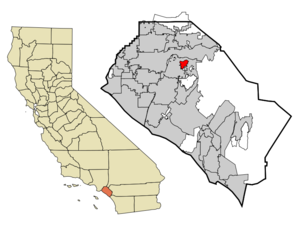
map_caption = Location of Villa Park within Orange County, California
mapsize1 =
map_caption1 =
subdivision_type = Country
subdivision_type1 = State
subdivision_type2 = County
subdivision_name =United States
subdivision_name1 =California
subdivision_name2 = Orange
government_type =
leader_title =Mayor
leader_name = W. Richard Ulmer
established_date =
area_magnitude = 1 E3
area_total_km2 = 5.5
area_land_km2 = 5.5
area_water_km2 = 0
area_total_sq_mi = 2.1
area_land_sq_mi = 2.1
area_water_sq_mi = 0.0
elevation_m = 104
elevation_ft = 341
latd = 33 |latm = 48 |lats = 58 |latNS = N
longd = 117 |longm = 48 |longs = 40 |longEW = W
population_as_of = 2000
population_note =
population_total = 5999 (city proper)
population_density_km2 = 367.4
timezone = PST
utc_offset = -8
timezone_DST = PDT
utc_offset_DST = -7
latitude = 33°48'58" N
longitude = 117°48'40" W
website = http://www.villapark.org
postal_code_type =ZIP code s
postal_code = 92861, 92867
area_code = 714
blank_name = FIPS code
blank_info = 06-82744
blank1_name = GNIS feature ID
blank1_info = 1661640
footnotes =Villa Park is an incorporated city located in northern
Orange County, California . Villa Park, founded in 1962 is the smallest Orange County city in population but not in area (La Palma is Orange County's smallest city in area). The population was 5,999 at the 2000 census. Villa Park currently includes about 2,000 homes and the land is about 99% built out. Except for one small shopping center, the city is zoned for single-family residences, most of them on half-acre lots. The shopping center includes aRalph's grocery store, banks, a pharmacy with a postal substation, a variety of stores and offices, City Hall and community room, and a branch of theOrange County Public Library . Three restaurants complete the shopping center. The city's public elementary, middle, and high school are part of theOrange Unified School District .Many homes in the area include back yards with pools or tennis courts which is atypical in surrounding cities, and are desired by residents for family living and entertaining. The many trees and flowers contribute to its rural and peaceful feel. Streets are commonly winding and have no sidewalks and no street lights. Villa Park is an enclave completely surrounded by the city of Orange.
History
Members of the
Tongva andJuaneño /Luiseño nations long inhabited this area. After the 1769 expedition ofGaspar de Portolà , a Spanish expedition led by FatherJunipero Serra named the areaVallejo de Santa Ana (Valley of Saint Anne). On November 1, 1776,Mission San Juan Capistrano became the areas first permanentEurope an settlement inAlta California ,New Spain .In 1801, the
Spanish Empire granted convert|62500|acre|km2 toJose Antonio Yorba , which he named Rancho San Antonio. Yorba's great rancho included the lands where the cities of Olive, Orange, Villa Park, Santa Ana, Tustin, Costa Mesa and Newport Beach stand today.After the
Mexican-American war in 1848, Alta California became part of theUnited States in 1850 and American settlers arrived in this area.Villa Park was not incorporated until 1962, but it was known in 1860's as Mountain View. Villa Park came into usage when the post office was founded and the name Mountain View was already taken by a city in Northern
California .Villa Park was, for many years, an agricultural area producing, in turn,
grapes ,walnuts ,apricots , and finally,citrus , which was the major crop for about 60 years and is most closely associated with its development. It was the citrus ranchers and their families who molded Villa Park into a vital community and organized its incorporation to save it from what they felt were unwelcome zoning practices from the eastward-moving city of Orange.These ranchers established the
Serrano Water District , which still provides Villa Park's water. (The district office is located on Lincoln Street.) They also founded the Villa Park Orchard's Association, still a thriving business in Orange, although the packing house that was the dominant Villa Park landmark for many years, located west of the shopping center, was torn down in 1983. The citrus groves have yielded to the developers, but these pioneers have left an enduring legacy in half-acre zoning for housing, which has been instrumental in shaping the city's character.Geography
Villa Park is located at coor dms|33|48|58|N|117|48|40|W|city (33.816183, -117.811106)GR|1.
According to the
United States Census Bureau , the city has a total area of 5.5 km² (2.1 mi²), all land.Government
The City is governed by five council members, each elected for four-year terms, who serve without pay and meet on the fourth Tuesday of each month at 7:30 p.m. Residents are encouraged to attend and participate in these meetings and the political life of the City. Council agendas are posted on the bulletin board outside of the City Hall. There are also a full-time appointed City Managers, a small office staff, and a maintenance crew. Police, fire, legal, and engineering services are contracted for outside of the City.
Federal, state, and county representation
Villa Park is part of the 40th Congressional District, which is represented in the
United States House of Representatives by RepublicanEd Royce , who has served in Congress since 1993. In theCalifornia State Legislature , the city is represented by SenatorDick Ackerman (a Republican from the 33rd Senate District) and AssemblymanBob Huff (a Republican from the 60th Assembly District). On the Orange CountyBoard of Supervisors , Villa Park is represented by the 3rd District's Bill Campbell.Demographics
As of the
census GR|2 of 2000, there were 5,999 people, 1,950 households, and 1,764 families residing in the city. Thepopulation density was 1,097.7/km² (2,844.9/mi²). There were 2,008 housing units at an average density of 367.4/km² (952.2/mi²). The racial makeup of the city was 82.40% White, 0.80% African American, 0.43% Native American, 12.92% Asian, 0.03% Pacific Islander, 0.93% from other races, and 2.48% from two or more races. Hispanic or Latino of any race were 5.90% of the population.There were 1,950 households out of which 34.4% had children under the age of 18 living with them, 82.1% were married couples living together, 6.1% had a female householder with no husband present, and 9.5% were non-families. 7.9% of all households were made up of individuals and 4.3% had someone living alone who was 65 years of age or older. The average household size was 3.07 and the average family size was 3.22.
In the city the population was spread out with 24.7% under the age of 18, 6.5% from 18 to 24, 21.2% from 25 to 44, 32.9% from 45 to 64, and 14.8% who were 65 years of age or older. The median age was 44 years. For every 100 females there were 101.2 males. For every 100 females age 18 and over, there were 98.6 males.
The median income for a household in the city was $116,203, and the median income for a family was $124,852. Males had a median income of $78,563 versus $46,667 for females. The
per capita income for the city was $53,130. About 2.2% of families and 2.6% of the population were below thepoverty line , including 0.4% of those under age 18 and 4.2% of those age 65 or over.chools
*
Serrano Elementary School — Home of the Eagles
*Villa Park Elementary — Home of the Bobcats
*Cerro Villa Middle School — Home of the Vikings
*Villa Park High School — Home of the SpartansNotable natives
*
Kevin Costner graduated fromVilla Park High School in 1973.
* Henry DiCarlo (Wiehebrink), Television Meteorologist, KCBS-2 Los Angeles, graduated from Villa Park High School in 1985External links
* [http://www.villapark.org/ City of Villa Park official website]

Wikimedia Foundation. 2010.