- Las Flores, California
Infobox Settlement
official_name = Las Flores, Rancho Santa Margarita, California
settlement_type = CDP
imagesize =
image_caption =
imagesize =
image_caption =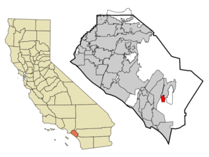
mapsize = 250x200px
map_caption = Location of Las Flores withinOrange County, California .
mapsize1 =
map_caption1 =
subdivision_type = Country
subdivision_type1 = State
subdivision_type2 = County
subdivision_name =United States
subdivision_name1 =California
subdivision_name2 = Orange
government_type =
leader_title =
leader_name =
established_date =
area_magnitude = 1 E8
area_total_km2 = 5.2
area_land_km2 = 5.2
area_water_km2 = 0.0
area_total_sq_mi = 2.0
area_land_sq_mi = 2.0
area_water_sq_mi = 0.0
elevation_m = 218
elevation_ft = 715
latd = 33 |latm = 35 |lats = 13 |latNS = N
longd = 117 |longm = 37 |longs = 39 |longEW = W
population_as_of = 2000
population_total = 5625
population_density_km2 = 1085.9
timezone = PST
utc_offset = -8
timezone_DST = PDT
utc_offset_DST = -7
latitude = 33°35'13" N
longitude = 117°37'39" W
other =
postal_code_type =ZIP Code
postal_code = 92688
area_code = 949
blank_name = FIPS code
blank_info = 06-40526
blank1_name = GNIS feature ID
blank1_info = 1853398
footnotes =
website =Las Flores is an unincorporated
census-designated place (CDP) inOrange County, California ,United States , located adjacent to the City of Rancho Santa Margarita, California. The population was 5,625 at the 2000 census. Las Flores doesn't have its own zip code and is served by Rancho Santa Margarita's zip code instead. [ [http://www.cityofrsm.org/depts/public_works/gis_maps.asp GIS Maps of Rancho Santa Margarita CA] ] The Rancho Santa Margarita dog/skate park is located in the CDP and is served by the Orange County Sheriff's Dept. and Orange County Fire Authority. [ [http://www.ocsd.org/Operations/SouthOpsPatrolBureauDefault.asp OC Sheriff South Patrol Bureau] ] [ [http://www.ocfa.org/ocfamain.asp?pgn1=4 OCFA Battalion 5 & 6 Area Map] ]Geography
Las Flores is located at coor dms|33|35|13|N|117|37|39|W|city (33.586924, -117.627414)GR|1, near the intersection of Oso Parkway and Antonio Parkway in Rancho Santa Margarita running several miles adjacent to Antonio Parkway and Oso Parkway.
According to the
United States Census Bureau , the CDP has a total area of 5.2km² (2.0 mi²), all land.Demographics
As of the
census GR|2 of 2000, there were 5,625 people, 1,936 households, and 1,486 families residing in the CDP. Thepopulation density was 1,085.9/km² (2,816.0/mi²). There were 1,999 housing units at an average density of 385.9/km² (1,000.7/mi²). The racial makeup of the CDP was 78.17% White, 1.88% African American, 0.46% Native American, 10.22% Asian, 0.09% Pacific Islander, 4.21% from other races, and 4.96% from two or more races. Hispanic, of any race were 11.88% of the population.There were 1,936 households out of which 51.8% had children under the age of 18 living with them, 67.9% were married couples living together, 6.7% had a female householder with no husband present, and 23.2% were non-families. 14.7% of all households were made up of individuals and 0.7% had someone living alone who was 65 years of age or older. The average household size was 2.91 and the average family size was 3.31.
In the CDP the population was spread out with 32.4% under the age of 18, 5.9% from 18 to 24, 46.7% from 25 to 44, 12.4% from 45 to 64, and 2.5% who were 65 years of age or older. The median age was 30 years. For every 100 females there were 99.3 males. For every 100 females age 18 and over, there were 95.5 males.
The median income for a household in the CDP was $89,978, and the median income for a family was $100,448. Males had a median income of $70,397 versus $46,029 for females. The
per capita income for the CDP was $38,241. About 0.3% of families and 1.1% of the population were below thepoverty line , including 0.8% of those under age 18 and none of those age 65 or over.Served by Rancho Santa Margarita's zip code 92688. It is named in reference to
Rancho Santa Margarita y Las Flores . It was established when Rancho Santa Margarita was unincorporated in the 1990s and was never officially annexed whenRSM incorporated in 2000. [ [http://zip4.usps.com/zip4/zcl_3_results.jsp Acceptabe City names for 92688] ]Politics
In the state legislature Las Flores is located in the 33rd Senate District, represented by Republican
Dick Ackerman , and in the 71st Assembly District, represented by RepublicanTodd Spitzer . Federally, Las Flores is located in California's 42nd and 44th congressional districts, which have Cook PVIs of R +10 and R +6 respectively [cite web | title = Will Gerrymandered Districts Stem the Wave of Voter Unrest? | publisher = Campaign Legal Center Blog | url=http://www.clcblog.org/blog_item-85.html | accessdate = 2008-02-10] and is represented by RepublicansGary Miller andKen Calvert respectively.Education
The CDP is served by
Capistrano Unified School District .Las Flores is the home to Las Flores Elementary and Middle Schools (Adjoined campuses), as well as Tesoro High School. All three schools are honored as California Distinguished Schools.
External links
References
Wikimedia Foundation. 2010.