- Antelope Valley
-
For other uses, see Antelope Valley (disambiguation).
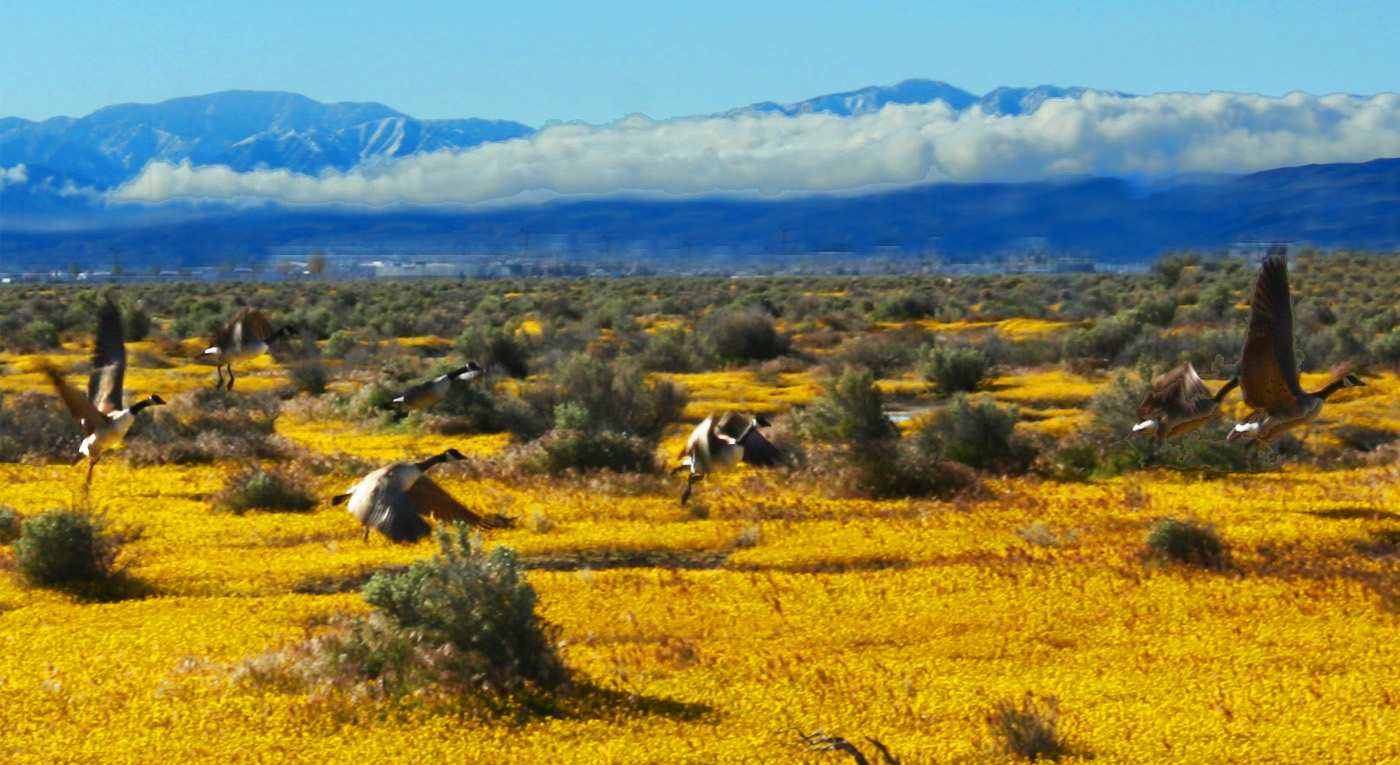
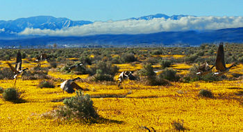 Canada geese take flight over wildflowers near Lancaster, California, 2011.
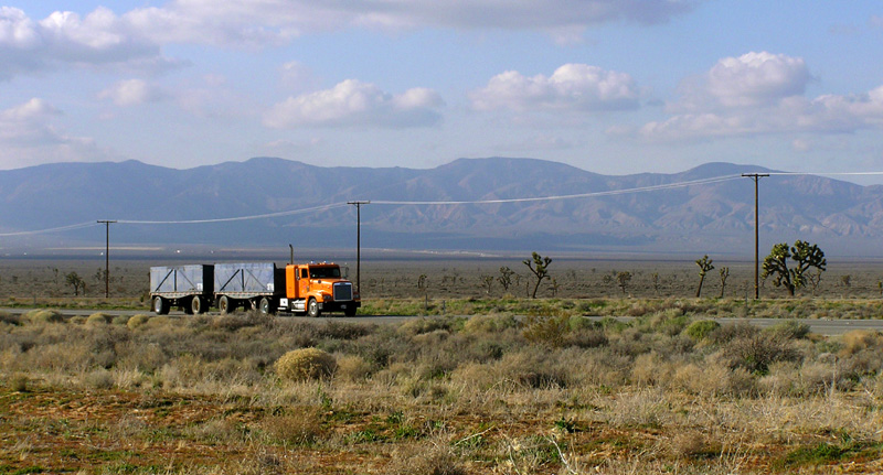
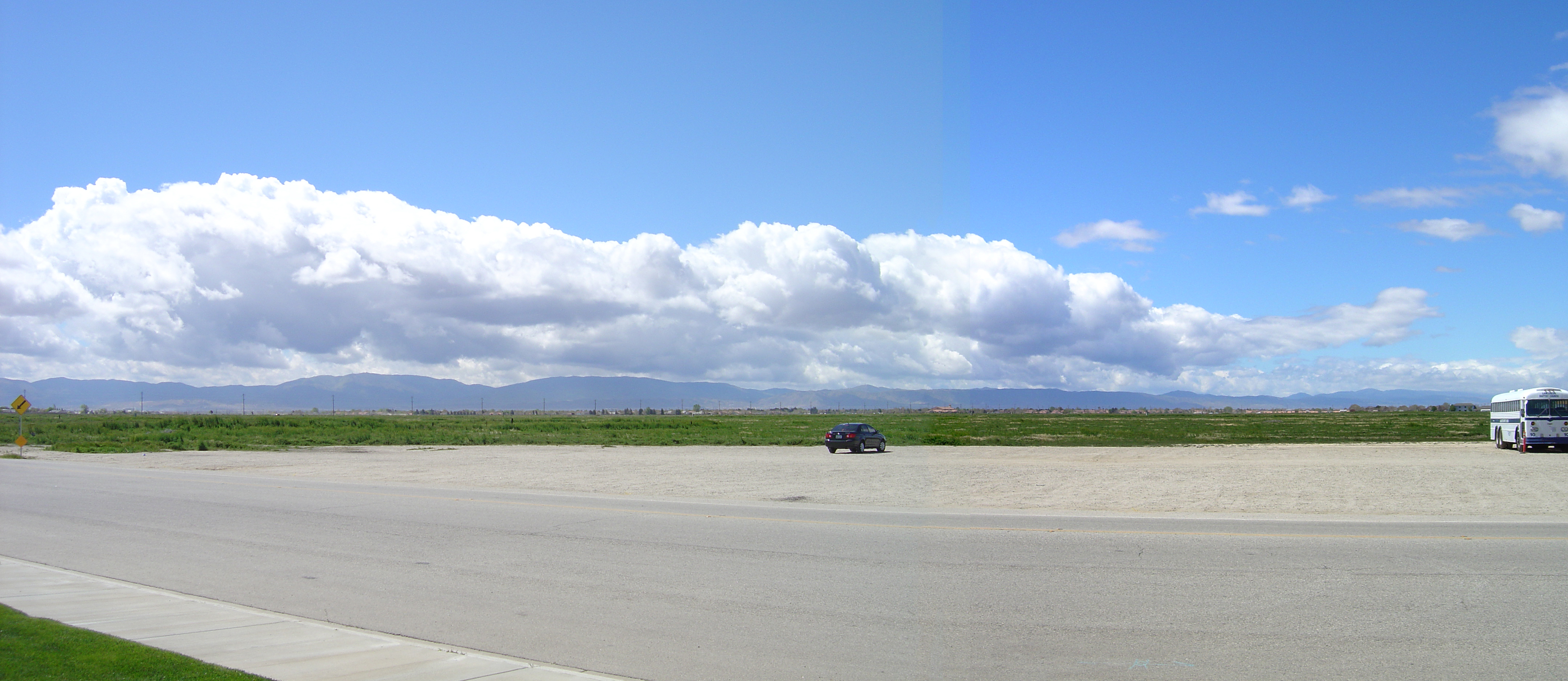
 A truck passes eastbound along the busy Highway 58 through the Antelope Valley. The Tehachapi Mountains are visible in the distance.
The Antelope Valley in California, United States, is located in northern Los Angeles County and the southeastern portion of Kern County, California, and constitutes the western tip of the Mojave Desert. It is situated between the Tehachapi and the San Gabriel Mountains.[1]
The valley was named for the graceful pronghorn antelopes that are said to have roamed there until being eliminated by hunters and bad weather in the 1880s.[1] The principal cities in the Antelope Valley are Palmdale and Lancaster.
Contents
Geography
Shaped like a sideways letter "V", the Antelope Valley comprises the western tip of the Mojave Desert, opening up to the Victor Valley and the Great Basin to the east. Lying north of the San Gabriel Mountains and southeast of the Tehachapis, this desert ecosystem spans approximately 2,200 square miles (5,698 km2). Precipitation in the surrounding mountain ranges contributes to groundwater recharge.
Flora and fauna
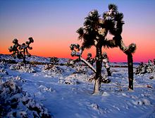 Joshua trees in snow, near Lancaster, California
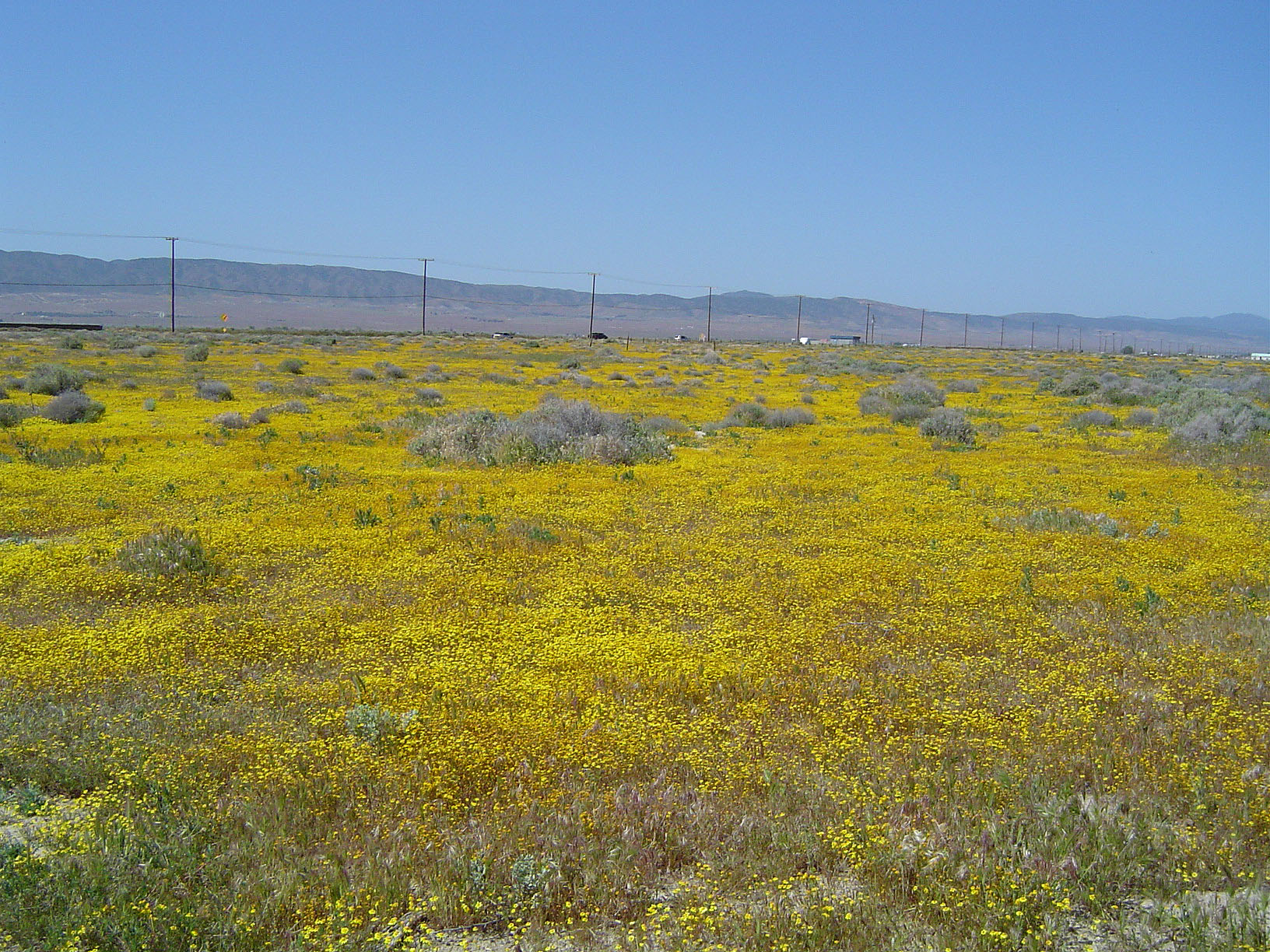
The Antelope Valley is home to a wide range of plants and animals. It is home to hundreds of plants like the Joshua tree, scrub oak, Creosote, and the California poppy. Winter brings much-needed rain which slowly penetrates the area's dry ground, bringing up native grasses and wildflowers. Poppy season depends completely on the precipitation, but a good bloom can be killed off by the unusual weather in the late winter and early spring months. Snow is not unusual for the Antelope Valley in spring, because it is often the most unstable weather the valley receives. The Antelope Valley gets its name from its history of pronghorn antelope grazing in large numbers. In 1882-85, the valley lost 30,000 head of antelope, almost half of the antelope for which it was named. Unusually heavy snows in both the mountains and the valley floor drove the antelope toward their normal feeding grounds in the eastern part of the valley. Since they would not cross the railroad tracks, many of them starved to death. Others were attacked by coyotes and wildcats or became easy prey for hunters. Once abundant, they mostly died off or migrated into the Central Valley. A drought in the early 1900s caused a scarcity in bunch grass, their main food source. Now the sighting of a pronghorn is rare, although there are still a small number in the valley. black bears are resident, with sightings as recent as July 17, 2008; they like to hide in the hills behind the towns and often are only in the valley for foraging or resting in caves. When they come into towns, they are sometimes tranquilized and relocated (but often just outside of town). Bobcats and coyotes are very common. Coyotes often howl or cry at night or day during spring, summer, and fall months. tortoises are not rare, but they often hide in burrows to escape the desert heat.
Water issues
Human water use in the Antelope Valley depends mainly on pumping of groundwater from the valley's aquifers and on importing of additional water from the Los Angeles aqueduct. Long-term groundwater pumping has lowered the water table, thereby increasing pumping lifts, reducing well efficiency, and causing land subsidence.[2] While aqueducts supply additional water to meet increasing human demand for agricultural, industrial, and domestic uses, diversion of water from the Sacramento-San Joaquin River Delta in northern California has had, and continues to have, adverse environmental and social effects in the delta. "Over decades, [the] competing uses for water supply and habitat have jeopardized the Delta’s ability to meet either need. All stakeholders agree the estuary is in trouble and requires long-term solutions to ensure reliable, quality water supplies and a healthy ecosystem".[3]
Antelope Valley's rapid human population growth and development place considerable stress on the local and regional water systems. According to David Leighton of the United States Geological Survey (USGS), "A deliberate management effort will be required to meet future water demand in the Antelope Valley without incurring significant economic and environmental costs associated with overuse of the ground-water resource".[4]
Human history
The first peoples of the Antelope Valley include the Kawaiisu,[5] Kitanemuk, Serrano, and Tataviam. The valley was first entered by Europeans in the 1770s during colonization of North America. Father Francisco Garces, a Spanish Franciscan friar, is believed to have traveled the west end of the valley in 1776. By 1808, the invaders forced native peoples out of the valley and into missions.[6]
 Panoramic view of Lancaster
Jedediah Smith came through in 1827, and John C. Fremont made a scientific observation of the valley in 1844 along with his other California explorations.
Stagecoach lines came through the valley along its foothills after Fremont's visit and were the preferred way of travel for colonists before the coming of the Southern Pacific Railroad in 1876. The rail service linking the valley to the Central Valley and Los Angeles started the first large influx of white settlers to the valley, and farms and towns soon sprouted on the valley floor.
The aircraft (now referred to as aerospace) industry took hold in the valley at Plant 42 in 1952. Edwards AFB, then called Muroc Army Air Field, was established in 1933.
Demographics
In recent decades the valley has become a bedroom community,[citation needed] to the Greater Los Angeles area. Major housing tract development and population growth took off beginning in 1983, which has increased the population of Palmdale around 12 times its former size as of 2006. Neighboring Lancaster has increased its population since the early 1980s to around 3 times its former level. Major retail has followed the population influx, centered on Palmdale's Antelope Valley Mall. The Antelope Valley is home to over 475,000 people, and the population is expected to reach 1,000,000 by the year 2020.[citation needed]
Non-Hispanic whites make up approximately 48% of the population of the Antelope Valley and form a majority or plurality in most of its cities and towns. Hispanics are the next largest group, followed by African Americans and Asian Americans.
Some long-term residents living far out in the desert have been cited by Los Angeles County's Nuisance Abatement Teams for code violations, forcing them to make improvements or move. One of the properties is a church building which was used to film "Kill Bill". The code enforcers have arrived on some of their visits in SWAT team formats. [7]
Military base

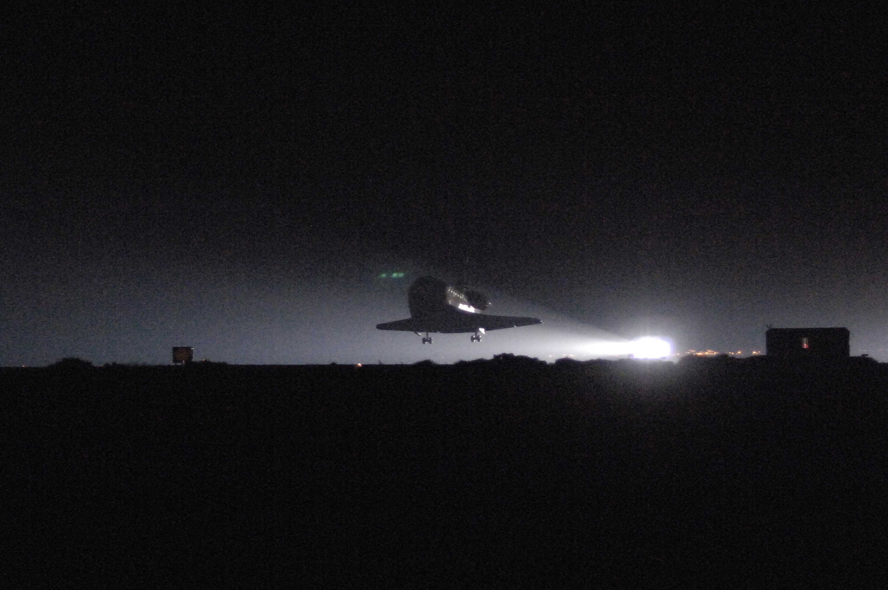
Edwards Air Force Base lies east of Rosamond, 37 miles (60 km) northeast of Palmdale. Edwards AFB's dry lakebeds are the lowest geographic elevation in the valley. Significant amounts of U.S. military flight testing is performed there, and it has been the site of many important aeronautical accomplishments, including the first flight to break the sound barrier. NASA space shuttles originally landed at Edwards because the lake beds offer a vast landing area. NASA has since built a huge landing strip at Kennedy Space Center, and Edwards remains the backup in case of bad weather at Cape Canaveral.
NASA Hugh L. Dryden Flight Research Center is a tenant organization at Edwards AFB. The Center is best known for the X-15 experimental rocket ship program. It has been the home of NASA's high-performance aircraft research since it was founded for the X-1 program. The Orbiter is serviced there when it lands at Edwards.
Industry
Aerospace

U. S. Air Force Plant 42 in northeast Palmdale is home to Lockheed Martin, Boeing, Northrop Grumman, and BAE Systems, among other aerospace-related companies. Notable projects assembled and/or designed there include the space shuttle orbiters, B-2 Spirit bomber, F-117 Nighthawk fighter, F-35 Joint Strike Fighter, and the Lockheed L-1011 Tristar, a passenger jet aircraft.
The newly dedicated Mojave Air & Space Port is also located in this region. The spaceport is famous as the base of operations for Scaled Composites, the company that designed SpaceShipOne and won the X-Prize.
Much of the work done at these facilities is performed in coordination with Edwards Air Force Base and the NASA Dryden Flight Research Center (see above), from the creation and testing of proof-of-concept X-planes, to Space Shuttle operations, to the manufacturing and integration and testing of new military aviation equipment.
Agriculture
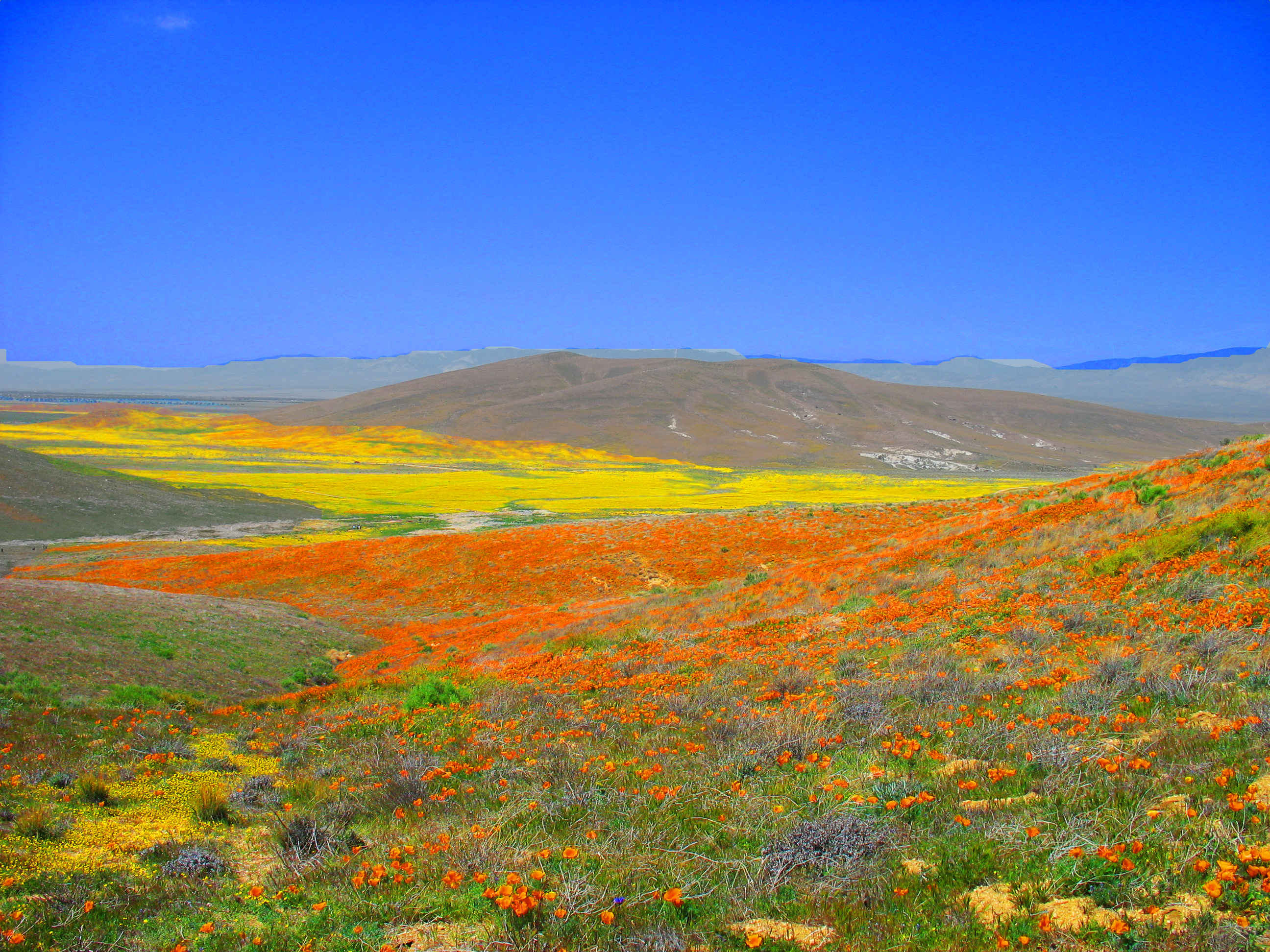
 Antelope Valley in spring covered by a carpet of goldfields Lasthenia californica.
The valley's first main industry as a part of the United States was agriculture. Historically known regionally for its extensive alfalfa fields and fruit crops, farmers now are growing a wider variety of crops, such as carrots, onions, lettuce, and potatoes. As housing tracts continue to build in the middle of the valley, the farm operations are now found farther to the west and east sides than in previous decades.
Mining
The world's largest borax open-pit mine in the world is located near Boron. Public touring is available.
Manufacturing
- U.S. Pole Company Inc.
- Senior Systems Technology
- Delta Scientific
- Lance Camper Manufacturing Corporation
- Harvest Farms Inc.
Education
Colleges and universities
- The University of Antelope Valley is the first native University to the Antelope Valley. It consists of two campuses located in Lancaster and a satellite classroom in Rosamond, CA. UAV offers a variety of certificate programs and several courses for Associate and Bachelor degrees, along with one Master's program in Criminal Justice.
- The Antelope Valley Community College District is the local public college system that covers the area with a primary service area of 1,945 square miles (5,040 km2) covering portions of Los Angeles and Kern counties. Instruction is offered at multiple sites, including Palmdale and Lancaster, as well as through online and instructional television courses. It has 2 campuses. The main one, Antelope Valley College is a comprehensive community college located in Lancaster. The college offers Associate in Arts/Associate in Science (two-year) degrees in 67 fields, as well as certificate programs in 56 vocational areas. It also hosts a satellite location of California State University, Bakersfield-Antelope Valley, where students can obtain bachelor's and master's degrees. Enrollment for the 2007-2008 academic year exceeds 14,000. The second campus is a satellite campus in Palmdale with an enrollment of just over 500.
- University of Phoenix has a satellite campus in Lancaster.
- University of La Verne has a satellite campus in Palmdale.
- DeVry University and its Keller Graduate School of Management has a satellite campus in Palmdale.
- Chapman University has a satellite campus in Palmdale.
- The AERO Institute at the Palmdale Institute of Technology is a facility in Palmdale at the Civic Center. It is operated by the National Aeronautics and Space Administration (NASA), and the City of Palmdale, and distance learning through a number of universities is available including Purdue, USC, University of San Diego, Pepperdine University, Embry-Riddle Aeronautical University, Caltech and Cal Poly Pomona. This specialized school offers graduate and undergraduate education in aerospace science, engineering, and technical skills.
- West Coast Baptist College in Lancaster, is an unaccredited Independent Fundamental Baptist Bible college offering graduate and undergraduate degrees in Pastoral studies, evangelism, missions, church ministries, music, Christian education, youth ministry, and secretarial studies. West Coast opened in 1995, and now has about 1,000 students.
- The Lancaster University Center in Lancaster provides local students education in engineering and technology. The $3.5 million reconstruction of Challenger Hall, located at the old Antelope Valley Fairgrounds, gave the new campus 13 classrooms, 2 of which are high tech distance learning rooms and 2 of which are lab classrooms, as well as office space. The school was created through partnerships with California State University, Bakersfield, California State University, Fresno, and local aerospace companies.
- Career Care Institute, Inc. in Lancaster, is an accredited vocational school offering training in allied health field programs such as vocational nursing, medical assisting, medical billing, and limited permit x-ray technician. The school was founded in 1998, by Edmund Carrasco, who serves as the Chief Executive Officer. Career Care Institute has experienced steady growth by opening its second campus in the City of Ventura in 2004, and its third campus in the Moreno Valley Mall in 2007. The school maintains the best passage rates on the National Council Licensure Examination for Practical Nurses in the Antelope Valley.
High schools
- The Antelope Valley Union High School District is the primary public school district covering the vast majority of high school education in the metropolitan Palmdale and Lancaster area. The district has 25,000 students in 8 regular high schools in Palmdale and Lancaster, a continuation school in each city, and a trade school in Palmdale. These are:
- Antelope Valley High School - Lancaster
- Antelope Valley Regional Occupational Program (AV ROP) - Palmdale
- Desert Winds High School - Lancaster
- Eastside High School - Lancaster
- Highland High School - Palmdale
- Lancaster High School - Lancaster
- Littlerock High School - Littlerock, California
- Palmdale High School - Palmdale
- Pete Knight High School - Palmdale
- Quartz Hill High School - Quartz Hill
- R. Rex Parris Continuation High School - Palmdale
- The Southern Kern Unified School District provides all public school education in Rosamond and nearby Willow Springs.
- The Muroc Joint Unified School District provides all public school education for Edwards Air Force Base, and the northern Antelope Valley communities of North Edwards, and Boron.
- The Mojave Unified School District provides all public school education in the northern Antelope Valley communities of Mojave and California City.
There are also several private and home school high schools in the area, most notably:
- Abraham Lincoln High School - Rosamond
- Paraclete High School
- Bethel Christian High School
- Antelope Valley Christian School - Lancaster
- Desert Christian High School
- Pearblossom High School
- Desert Sands Charter Schools - Lancaster
- Desert Sands Charter Schools - Palmdale
- Opportunities for Learning Charter Schools - Lancaster
- Opportunities for Learning Charter Schools - Palmdale
School districts
- The Palmdale School District is the area's largest school district, with an enrollment of over 28,000 in 29 schools. The district covers the central portion of the city.
- The Lancaster School District is the area's third largest school district after Palmdale and the A.V. High School District. This school district covers most of central and part of eastern Lancaster with 15,000 students in 19 schools.
- The Westside Union School District covers western Palmdale and Lancaster and their immediate suburbs including Quartz Hill, Del Sur, Leona Valley, and Antelope Acres. It has over 8,250 students in 11 schools.
- The Eastside Union School District covers eastern Lancaster with 3,500 students in 4 schools.
- The Keppel Union School District covers eastern Palmdale and its immediate suburbs, including the eastern Antelope Valley communities of Lake Los Angeles, Pearblossom, Littlerock, Sun Village, Llano, and Valyermo. It has 6 schools with over 3,000 students.
- The Southern Kern Unified School District provides all public school education in Rosamond and nearby Willow Springs.
- The Muroc Joint Unified School District provides all public school education for Edwards Air Force Base, and the northern Antelope Valley communities of North Edwards, and Boron.
- The Mojave Unified School District provides all public school education in the northern Antelope Valley communities of Mojave and California City.
Culture
The Antelope Valley Symphony Orchestra is a professional ensemble that performs four concerts each year at the Lancaster Performing Arts Center. It is an auxiliary of Antelope Valley College, and performs regularly with the Antelope Valley College Civic Orchestra.
Parks
 Antelope Valley California Poppy Reserve, March 2008
Hospitals
- Antelope Valley Hospital
- Palmdale Regional Medical Center
The Antelope Valley was formerly served by a county hospital, High Desert Hospital, which was converted into an urgent care clinic in 2003 due to the county's budget problems. As a result, indigent patients with serious but non-life-threatening medical conditions must seek treatment at Olive View – UCLA Medical Center in Sylmar, which is over 50 miles away.
Transportation

Major highways and roads
Include:
- Angeles Forest Highway, a key county road, connects Palmdale with Angeles Crest Highway as an alternate route to the Los Angeles basin.
- The Antelope Valley Freeway (State Route 14)
- State Route 18 (connects SR 138 east of Palmdale to Victor Valley and U.S.Route 395) There is currently a proposal to turn this into a freeway.
- State Route 138 (of which Pearblossom Highway comprises its eastern leg)
- State Route 58 (freeway status now that the new Mojave bypass has been completed)
- U.S. Route 395 (which technically lies east of the Valley proper)
On the ridgeline of the San Gabriel Mountains, the Angeles Crest Highway (State Route 2) snakes 60 miles (100 km) through the Angeles National Forest to La Canada Flintridge and the Greater Los Angeles metropolitan region.
Rail
- Metrolink passenger rail service to the Los Angeles Basin and other parts of Southern California provides service to Antelope Valley commuters at its Lancaster, Palmdale, and Vincent Grade/Acton stations.
- Amtrak passenger rail service has a commuter bus that stops at the Palmdale Transportation Center and the Lancaster Metrolink station, connecting Antelope Valley residents to the national rail network.
- A future rail line is planned between the Palmdale Transportation Center and Palmdale Regional Airport. This will connect the airport directly with the extensive Southern California mass transit network. As of 2007 it is still unknown whether this will be a subway or an elevated rail line.
- The California High Speed Rail authority has designated Palmdale as a stop on the future rail line between San Francisco and San Diego. Due to a lack of funding, as of 2007 it will be several years before this project is begun.
Bus
- The Antelope Valley Transit Authority is the local city-bus system for metropolitan Palmdale and Lancaster. The service also operates a commuter bus network from its hubs at the Palmdale Transportation Center and the Lancaster Park & Ride to several locations in Los Angeles.
- Greyhound Bus has stops at the Palmdale Transportation Center and the Lancaster Metrolink station.
Airports
- Palmdale Regional Airport, co-sited with USAF Plant 42 is by far the largest and busiest airport in the valley and is owned by Los Angeles World Airports (LAWA), the Los Angeles city government entity which owns and operates LAX. Although mostly military flights occur at this airport, it also has an unused commercial terminal.
- General William J. Fox Airfield in Lancaster is the valley's busiest general aviation airport. It is the fourth largest airport in the valley. Charter air service and helicopter rides are available. This airport also has the valley's only aviation school.
- Inyokern Airport in Inyokern, near Ridgecrest, is a large general aviation airport with limited commercial airline service to Los Angeles International Airport, serving the northern Antelope Valley and Indian Wells Valley communities. Charter service is also available. It is the area's third largest airport.
- Mojave Air & Space Port in Mojave is a large civil aviation center and the second largest airport in the valley. Voyager and SpaceShipOne were developed and flown from its location.
- Mountain Valley Airport in Tehachapi is a gliderport, privately owned but open to the public, which offers glider training for civilian and military pilots
- Tehachapi Municipal Airport in Tehachapi is a small general aviation airport.
- Agua Dulce Airpark in Agua Dulce is a medium sized general aviation airport.
- Rosamond Skypark Airport in Rosamond is a small general aviation airport, privately owned and operated.
- California City Municipal Airport in California City is a small general aviation airport.
- Crystalaire Airport in Llano is a small airstrip principally dedicated to glider flights.
Notable people
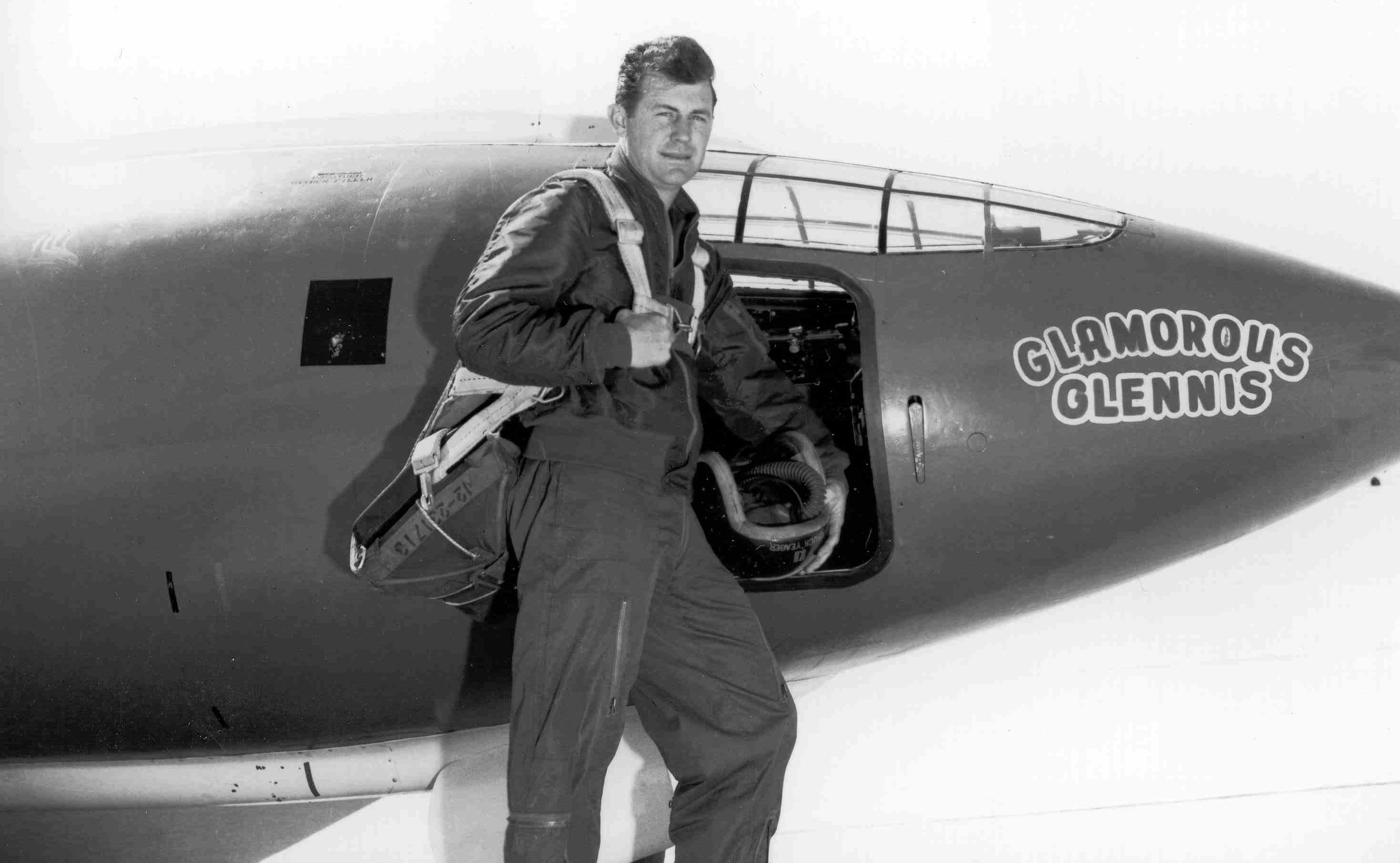
 Chuck Yeager with Glamorous Glennis at Muroc, circa 1947
Some people of note have spent time in the valley, including:
- Erik Audé, actor/stuntman turned professional poker player, went to Paraclete High School before transferring over to Bethel Christian.
- Judy Garland, then known in the valley as Frances Gumm. As a girl, she would sing in public to her Lancaster neighbors.
- John Wayne, then known as Marion Morrison, was briefly a Lancaster schoolboy who was known not to tie up his horse properly when he left it by the street, as was the old time custom.
- Daniel Fry, a contactee, attended Antelope Valley High School in Lancaster during the 1920s.
- The 90's R&B group All-4-One was from the AV.
- Aldous Huxley drew writing inspiration from the solitude found at his Llano home. A little known children's book, The Crows of Pearblossom, is set in the valley and was the only children's book he is known to have written.
- Pancho Barnes the legendary aviatrix and friend to the U.S. Air Force's test pilots of what is now called Edwards Air Force Base, established the celebrated Happy Bottom Riding Club near Rogers Dry Lake in 1935, later living in Cantil and Boron.
- Chuck Yeager was an early USAF test pilot at then-Muroc Army Air Field, now known as Edwards Air Force Base, where he became the first to break the sound barrier on October 14, 1947.
- Frank Zappa attended Antelope Valley High School in Lancaster, graduating in 1958. He met Don Van Vliet (Captain Beefheart) there, a fellow student at the time.
- Terence McKenna noted writer, public speaker, philosopher, psychonaut, and ethnobotanist graduated from Antelope Valley High School in 1965.
- Jeff Dandurand, more frequently known as Jeff Duran, lives in Palmdale due to his daily radio show.
- Tippi Hedren, who made her major motion picture debut in The Birds, is an Acton resident since at least 1981 (Acton not being in the valley proper, but nearby to the south).
- Michael Deaver, former aide to Ronald Reagan, is a former Mojave resident.
- Kathleen Soliah, who achieved notoriety as a member of the Symbionese Liberation Army in the 1970s and then as a fugitive living a quiet, middle-class life in St. Paul, Minnesota, grew up in Desert View Highlands, graduating from Palmdale High School in 1965.
- Burt Rutan and his brother Dick Rutan of Scaled Composites, the firm which produced SpaceShipOne and the Voyager aerospace vehicles, work out of Mojave Air & Space Port in Mojave.
- R. Lee Ermey of Full Metal Jacket and Mail Call fame is a current Palmdale resident.
- Home to members of the punk bands Slick Shoes and Killradio.
- Joseph Foreman, more frequently known as Afroman, lives in Palmdale.
See also Aerospace Walk of Honor - downtown Lancaster sidewalk tribute to the U. S. Air Force flight test community.
- Vilma Drever, who started the non-profit animal rescue called Antelope Valley Dog and Cat Rescue where Vilma ventures out into the desert to find, rescue and rehabilitate abandoned pets.
Valley place names
Cities over 100,000 population
- Lancaster (population 156,633) - incorporated in 1977
- Palmdale (population 152,750) - incorporated in 1962
Cities less than 100,000 population
- California City (population 14,828) - incorporated in 1965
- Centennial (planned for 70,000).[8]
Unincorporated towns and districts
Over 10,000 population
- Rosamond (18,150)
- Lake Los Angeles (12,328)
- Quartz Hill (10,912)
- Sun Village (11,302)
Under 10,000 population
- Acton (technically in the San Gabriel Mountains) (7,596)
- Agua Dulce (technically in the San Gabriel Mountains) (4,254)
- Antelope Acres (3,059)
- Boron (2,253)
- Del Sur (1,750)
- Elizabeth Lake (technically in the Leona Valley) (1,756)
- Inyokern (technically in the Indian Wells Valley)
- Johannesburg
- Juniper Hills (1,101)
- Lake Hughes (technically in the Leona Valley)
- Leona Valley (technically in the Leona Valley)
- Littlerock (1,377)
- Llano (739)
- Mojave (2,942)
- Monolith (technically in the Tehachapi Valley)
- Neenach (560)
- North Edwards
- Pearblossom (2,435)
- Pinon Hills (technically in the Victor Valley)
- Randsburg
- Saltdale
- Valyermo (691)
- Wilsona Gardens (210)
- Willow Springs (1,784)
References
- ^ a b Dale Pitt (2000). "Antelope Valley". Los Angeles A to Z: an encyclopedia of the city and county. University of California Press. p. 20. ISBN 9780520205307.
- ^ Ikehara and Phillips (1994). Determination of land subsidence related to ground-water-level declines using global positioning system and leveling surveys in Antelope Valley and Los Angeles and Kern Counties, California, [1]
- ^ Department of Water Resources
- ^ USGS
- ^ [2]
- ^ [3]
- ^ Melnicoff, Mars (9/16/2011). "L A County's Private Property War". :A Weekly News. http://www.laweekly.com/2011-06-23/news/l-a-county-s-private-property-war/. Retrieved 30 August 2011.
- ^ Jon Gertner, "Playing Sim City for Real," New York Times Magazine, March 18, 2007
External links
- The Geography of Suburban Sprawl in the Antelope Valley: In-depth study of the Valley's historical development and recent (1990s) urban conditions
- Antelope Valley New Press
- Antelope Valley Restaurant Guide Antelope Valleys Restaurant menu listing and directory.
- Antelope Valley Press
- Antelope Valley Weekly
- Antelope Valley Indian Museum and State Historical Park
- Antelope Valley Conservancy
- Antelope Valley Business Directory
Greater Los Angeles Area Central city Counties Satellite cities Cities
>200kCities and towns
100k–200kBurbank • Compton • Corona • Costa Mesa • Downey • East Los Angeles • El Monte • Fontana • Fullerton • Garden Grove • Inglewood • Lancaster • Mission Viejo • Moreno Valley • Murrieta • Norwalk • Ontario • Orange • Palmdale • Pasadena • Pomona • Rancho Cucamonga • Santa Clarita • Simi Valley • South Gate • Temecula • Thousand Oaks • Torrance • Ventura • Victorville • West CovinaArea regions Antelope Valley • Conejo Valley • Downtown Los Angeles • East Los Angeles • Gateway Cities • Greater Hollywood • Harbor Area • Inland Empire • Palos Verdes Hills • Pomona Valley • San Bernardino Valley • San Fernando Valley • San Gabriel Valley • Santa Ana Valley • Santa Clarita Valley • South Bay • South Los Angeles • Westside Los AngelesLandforms Los Angeles Basin • Baldwin Hills (range) • Calico Mountains • Catalina Island • Channel Islands • Coachella Valley • High Desert—Mojave Desert • Low Desert—Colorado Desert • San Fernando Valley • San Bernardino Mountains • San Gabriel Mountains • Santa Ana Mountains • Santa Monica Mountains • Santa Susana Mountains • Verdugo MountainsBodies of water Los Angeles River • Aliso Creek • Arroyo Seco • Ballona Creek • Bell Creek • Big Bear Lake • Coyote Creek • Lake Arrowhead • Lake Perris • Lake Piru • Malibu Creek • Pacific Ocean • Pyramid Lake • Rio Hondo • San Gabriel River • San Juan Creek • San Pedro Bay • Santa Ana River • Santa Clara River • Santa Margarita River • Santa Monica BayCoordinates: 34°45′05″N 118°15′08″W / 34.7513712°N 118.2522977°W
Categories:- Los Angeles County regions
- Landforms of Kern County, California
- Valleys of California
- Valleys of the Mojave Desert
- Palmdale, California
- Lancaster, California
- Valleys of Los Angeles County, California


Wikimedia Foundation. 2010.