- Yolo County, California
-
County of Yolo — County — 
SealLocation in the state of California California's location in the United States
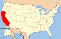
Coordinates: 38°33′14″N 121°44′17″W / 38.55389°N 121.73806°WCoordinates: 38°33′14″N 121°44′17″W / 38.55389°N 121.73806°W Country  United States
State  California
Region Sacramento Valley Metro area Greater Sacramento Incorporated 1850 County seat Woodland Largest city Davis Area – Total 2,649.3 km2 (1,022.89 sq mi) – Land 2,624.4 km2 (1,013.27 sq mi) – Water 24.9 km2 (9.62 sq mi) Population (2010) – Total 200,849 – Density 75.8/km2 (196.4/sq mi) Time zone Pacific Standard Time (UTC-8) – Summer (DST) Pacific Daylight Time (UTC-7) Website www.yolocounty.org Yolo County is a county located in the northern part of the U.S. state of California, bordered by the other counties of Sacramento, Solano, Napa, Lake, Colusa, and Sutter. The city of Woodland is its county seat, though Davis is its largest city.
As of the 2010 census, Yolo County had a population of 200,849. Excluding the conurbation of the University of California, Davis and the surrounding City of Davis, and the neighboring City of Sacramento, Yolo County remains a relatively rural agricultural region. This is evidenced by the multi-billion dollar California tomato industry, centering around Yolo County, dominating 90% of the canning and processed tomato market in the United States.
Yolo County is part of the Greater Sacramento area.
Contents
History
Yolo County was one of the original counties of California, created in 1850 at the time of statehood.
In the original act of 1850 the name was spelled "Yola." Yolo is a Native American name variously believed to be a corruption of a tribal name Yo-loy meaning "a place abounding in rushes" or of the name of the chief, Yodo, or of the village of Yodoi.
Government
The county is governed by a board of five district supervisors as well as the governments of its four incorporated cities: Davis, West Sacramento, Winters, and Woodland.
Geography
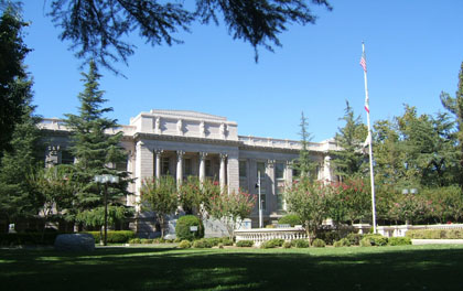
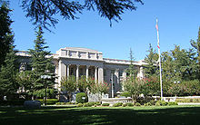 Yolo County Courthouse in Woodland
According to the 2000 census, the county has a total area of 1,022.89 square miles (2,649.3 km2), of which 1,013.27 square miles (2,624.4 km2) (or 99.06%) is land and 9.62 square miles (24.9 km2) (or 0.94%) is water.[1]
Cities and towns
Incorporated cities
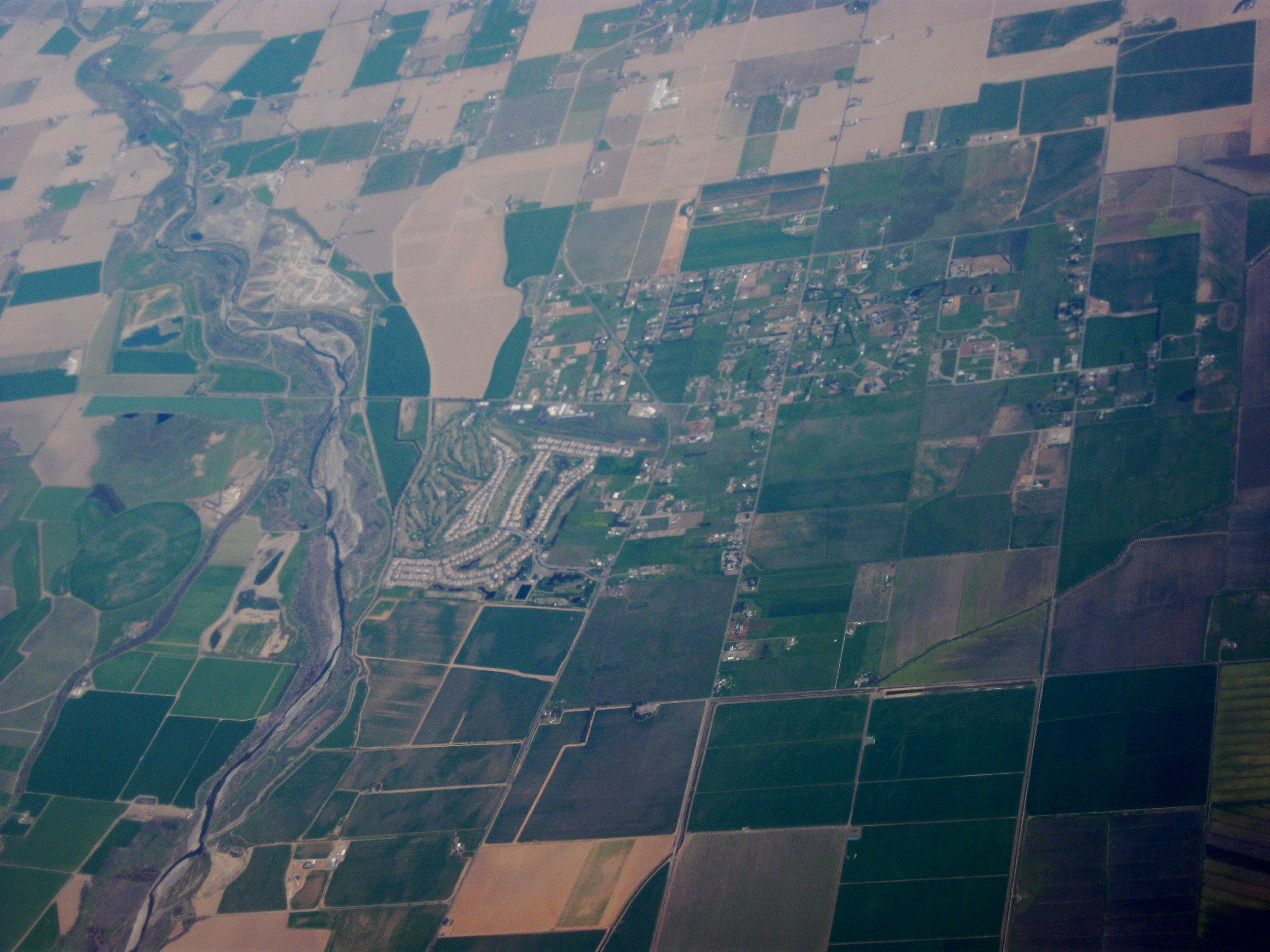
 Aerial view of Watts Woodland Airport and surrounding area
Unincorporated communities
Other unincorporated areas or communities not incorporated into the above cities, include:
- Brooks
- Capay
- Clarksburg (a CDP)
- Conaway
- Dunnigan (a CDP)
- El Macero
- Esparto (a CDP)
- Guinda (a CDP)
- Knights Landing (a CDP)
- Madison (a CDP)
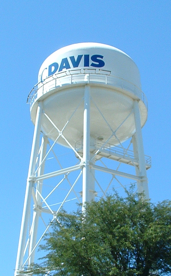
 UC Davis
Adjacent counties
- Sacramento County, California - east
- Solano County, California - south
- Napa County, California - west
- Lake County, California - northwest
- Colusa County, California - north
- Sutter County, California - northeast
Transportation infrastructure
Major highways
 Interstate 5 enters the eastern portion of the county at the Sacramento River and continues through the northern terminus of the county, north of Dunnigan, CA.
 Interstate 80 enters the eastern portion of the county at the Sacramento River and continues to the southern terminus southeast of Davis, CA.
 Interstate 505 splits off from I-5 south of Dunnigan and continues through the southern terminus of Yolo County near Winters, CA
 State Route 16 enters the county from the northwestern county boundary northwest of Rumsey, CA and continues through to Woodland, CA interchanging with I-5.
 State Route 45 begins in Knights Landing, CA at California State Route 113 and continues through the northern county line.
 State Route 113 enters the county southeast of Davis, CA and continues through the northeastern terminus near Knights Landing, CA.
 State Route 128 enters the county from the west near Lake Berryessa and continues to I-505 near Winters, CA.
County Roads
Transportation in Yolo County is based on a system of numbered County Roads. The numbering system works in the following way:
- North/South roads have numbers from 41 to 117 and increase from west to east
- East/West roads have numbers from 1 to 38A, and then from 151 to 161 and increase from north to south.
Each integer road number is one mile (1.6 km) apart, with letters designating occasional roads less than one mile (1.6 km) apart. County roads entering urban areas generally are named once they cross the city boundary. Some examples include County Road 101 in Woodland being renamed Pioneer Ave and County Road 102 in Davis being named Pole Line Road.
Public transportation
- Yolobus (Yolo County Transportation District) runs buses throughout Yolo County and into Sacramento, and Sacramento International Airport.
- The City of Davis and the University of California, Davis jointly run Unitrans, a combination local city bus and campus shuttle.
- Fairfield-Suisun Transit Line 30 also stops in Davis on its runs between Fairfield (Solano County) and Sacramento.
- Amtrak has a station in Davis.
Airports
- Sacramento International Airport is located in nearby Sacramento County.
- Watts Woodland Airport, UC Davis University Airport and Yolo County Airport are three general aviation airports located within Yolo County.
- Borges airport a small airport located near Clarksburg
Politics
Yolo County vote
by party in presidential electionsYear GOP DEM Others 2008 30.9% 24,592 67.1% 53,488 2.1% 1,669 2004 38.8% 28,005 59.3% 42,885 1.9% 1,379 2000 37.5% 23,057 54.9% 33,747 7.5% 4,632 1996 32.4% 18,807 56.9% 33,033 10.7% 6,239 1992 28.2% 17,574 53.3% 33,297 18.5% 11,565 1988 41.9% 22,358 57.0% 30,429 1.1% 585 1984 47.8% 24,329 50.9% 25,879 1.3% 645 1980 39.5% 19,603 43.3% 21,527 17.2% 8,560 1976 42.4% 18,376 54.3% 23,533 3.3% 1,408 1972 42.0% 17,969 55.4% 23,694 2.5% 1,075 1968 38.4% 11,123 54.7% 15,833 6.9% 2,004 1964 30.4% 7,976 69.5% 18,266 0.1% 32 1960 44.7% 10,104 54.9% 12,395 0.4% 90 1956 48.0% 9,347 51.7% 10,075 0.3% 57 1952 53.2% 9,375 46.0% 8,119 0.8% 139 1948 43.8% 5,560 52.5% 6,655 3.7% 469 1944 41.8% 4,233 57.7% 5,837 0.5% 46 1940 40.3% 4,373 58.8% 6,380 0.9% 101 1936 29.8% 2,594 68.9% 5,992 1.2% 106 1932 29.5% 2,515 67.8% 5,780 2.8% 234 1928 57.0% 3,545 42.4% 2,641 0.6% 38 1924 45.4% 2,470 14.6% 797 40.0% 2,180 1920 62.0% 3,375 32.8% 1,787 5.3% 286 Yolo is a strongly Democratic county in Presidential and congressional elections. The last Republican to win a majority in the county was Dwight Eisenhower in 1952.
Yolo is part of California's 1st and 2nd congressional districts, which are held by Democrat Mike Thompson and Republican Wally Herger respectively. In the state legislature, Yolo is in the 2nd and 8th Assembly districts, which are held by Republican Jim Nielsen and Democrat Mariko Yamada, respectively, and the 5th Senate district, which is held by Democrat Lois Wolk.
In November 2008, Yolo was one of just three counties in California's interior in which voters rejected Proposition 8 to ban gay marriage. Yolo voters rejected Proposition 8 by 58.4 percent to 41.6 percent. The other interior counties in which Proposition 8 failed to receive a majority of votes were Alpine County and Mono County.[2]
Demographics
2010
The 2010 United States Census reported that Yolo County had a population of 200,849. The racial makeup of Yolo County was 126,883 (63.2%) White, 5,208 (2.6%) African American, 2,214 (1.1%) Native American, 26,052 (13.0%) Asian, 910 (0.5%) Pacific Islander, 27,882 (13.9%) from other races, and 11,700 (5.8%) from two or more races. Hispanic or Latino of any race were 60,953 persons (30.3%).[3]
Population reported at 2010 United States Census The County Total
PopulationWhite African
AmericanNative
AmericanAsian Pacific
Islanderother
racestwo or
more racesHispanic
or Latino
(of any race)Yolo County 200,849 126,883 5,208 2,214 26,052 910 27,882 11,700 60,953 Incorporated
cityTotal
PopulationWhite African
AmericanNative
AmericanAsian Pacific
Islanderother
racestwo or
more racesHispanic
or Latino
(of any race)Davis 65,622 42,571 1,528 339 14,355 136 3,121 3,572 8,172 West Sacramento 48,744 29,521 2,344 798 5,106 534 6,709 3,732 15,282 Winters 6,624 4,635 43 56 63 7 1,488 332 3,469 Woodland 55,468 34,904 855 726 3,458 169 12,488 2,868 26,289 Census-designated
placeTotal
PopulationWhite African
AmericanNative
AmericanAsian Pacific
Islanderother
racestwo or
more racesHispanic
or Latino
(of any race)Clarksburg 418 339 2 2 16 1 37 21 109 Dunnigan 1,416 836 107 25 19 1 339 89 583 Esparto 3,108 1,855 45 50 129 6 904 119 1,538 Guinda 254 175 26 0 1 1 43 8 68 Knights Landing 995 560 4 10 7 0 338 76 644 Madison 503 224 1 8 3 3 235 29 384 Monument Hills 1,542 1,163 20 32 77 17 153 80 403 University of California, Davis 5,786 2,443 144 22 2,443 7 364 363 728 Unincorporated
communitiesTotal
PopulationWhite African
AmericanNative
AmericanAsian Pacific
Islanderother
racestwo or
more racesHispanic
or Latino
(of any race)All others not CDPs (combined) 10,369 7,657 89 146 375 28 1,663 411 3,284 2000
As of the census[4] of 2000, there were 168,660 people, 59,375 households, and 37,465 families residing in the county. The population density was 166 people per square mile (64/km²). There were 61,587 housing units at an average density of 61 per square mile (23/km²). The racial makeup of the county was 67.67% White, 2.03% Black or African American, 1.16% Native American, 9.85% Asian, 0.30% Pacific Islander, 13.76% from other races, and 5.23% from two or more races. 25.91% of the population were Hispanic or Latino of any race. 10.0% were of German, 6.6% English and 6.4% Irish ancestry according to Census 2000. 68.5% spoke English, 19.5% Spanish, 2.1% Chinese or Mandarin and 1.8% Russian as their first language.
There were 59,375 households out of which 33.6% had children under the age of 18 living with them, 47.6% were married couples living together, 11.1% had a female householder with no husband present, and 36.9% were non-families. 23.3% of all households were made up of individuals and 7.3% had someone living alone who was 65 years of age or older. The average household size was 2.71 and the average family size was 3.25.
In the county the population was spread out with 25.2% under the age of 18, 18.3% from 18 to 24, 28.2% from 25 to 44, 18.9% from 45 to 64, and 9.4% who were 65 years of age or older. The median age was 30 years. For every 100 females there were 95.6 males. For every 100 females age 18 and over, there were 92.2 males.
The median income for a household in the county was $40,769, and the median income for a family was $51,623. Males had a median income of $38,022 versus $30,687 for females. The per capita income for the county was $19,365. About 9.5% of families and 18.4% of the population were below the poverty line, including 16.0% of those under age 18 and 7.4% of those age 65 or over.
Education
Colleges and universities
- University of California, Davis
- Woodland Community College
Public schools
The county's public schools are managed by the Yolo County Office of Education.
See also
- List of school districts in Yolo County, California
- National Register of Historic Places listings in Yolo County, California
References
- ^ "Census 2000 U.S. Gazetteer Files: Counties". United States Census. http://www.census.gov/tiger/tms/gazetteer/county2k.txt. Retrieved 2011-02-13.
- ^ County-by-County Map, California Propositions: The Los Angeles Times
- ^ "2010 Census P.L. 94-171 Summary File Data". United States Census Bureau. http://www2.census.gov/census_2010/01-Redistricting_File--PL_94-171/California/.
- ^ "American FactFinder". United States Census Bureau. http://factfinder.census.gov. Retrieved 2008-01-31.
- Olney, Caroline M. (September 1902). "Orchards, Vineyards and Farms of Yolo County". Overland Monthly, and Out West Magazine XL (2): 171–194. http://books.google.com/?id=1gYNAQAAIAAJ&pg=RA1-PA171. Retrieved 2009-08-15.
External links
- County of Yolo website
- Yolo County, California USENET FAQ
- Yolo County Visitors Bureau website
- Yolo County District Attorney
- Yolo County Community website
- Yolo County CAGenWeb Project (history & genealogy)
- Yolo County, Calif., map 185-? at The Bancroft Library

Lake County Colusa County Sutter County Napa County 
Sacramento County  Yolo County, California

Solano County Municipalities and communities of Yolo County, California Cities Davis | West Sacramento | Winters | Woodland
CDPs Unincorporated
communitiesArcade | Arroz | Beatrice | Brooks | Browns Corner | Cadenasso | Capay | Central | Citrona | Conaway | Coniston | Daisie | Dufour | El Macero | El Rio Villa | Fremont | Green | Greendale | Hershey | Jacobs Corner | Kiesel | King Farms | Lovdal | Lund | Merritt | Mikon | Morgans Landing | Norton | Peethill | Plainfield | Riverview | Rumsey | Saxon | Sorroca | Sugarfield | Swingle | Tancred | Tyndall Landing | Valdez | Vin | Webster | Willow Point | Zamora
Ghost towns Greater Sacramento Counties Douglas (NV) · El Dorado · Nevada · Placer · Sacramento · Sutter · Yolo · Yuba
Major City Cities
and
towns100k–200k25k–100kArden Arcade · Auburn · Carmichael · Citrus Heights · Davis · Folsom · Florin · Laguna · Lincoln · North Highlands · Orangevale · Parkway-South Sacramento · Rancho Cordova · Rocklin · West Sacramento · Woodland · Yuba City
10k–25kCameron Park · El Dorado Hills · Fair Oaks · Foothill Farms · Galt · Gardnerville Ranchos (NV) · Granite Bay · Grass Valley · La Riviera · Linda · Marysville · North Auburn · Olivehurst · Placerville · Rosemont · Rio Linda · South Lake Tahoe · South Yuba City · Truckee · Vineyard
Sub-regions Gold Country · Lake Tahoe · Sacramento Valley · Sierra Nevada · Yuba-Sutter Area
Categories:- California counties
- Yolo County, California
- Sacramento metropolitan area


Wikimedia Foundation. 2010.