- Cache Creek (Yolo County, California)
Geobox|River
name = Cache Creek
native_name =
other_name = Rivière la Cache
category =stream
etymology =
nickname =
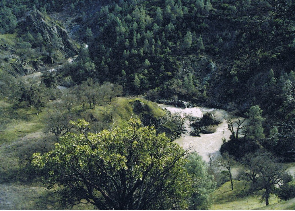
image_caption = Cache Creek, Lake County section, California
country =United States
state =California
region = Yolo County
region1 = Colusa County
region2 = Lake County
district =
municipality =
parent =
tributary_left =
tributary_right =
city =
landmark =
river =
source = Clear Lake
source_location = southwest ofClearlake, California
source_region = | source_country =
source_elevation_imperial =
source_lat_d = 38 | source_lat_m = 56 | source_lat_s = 10 | source_lat_NS = N
source_long_d = 122 | source_long_m = 38 | source_long_s = 35 | source_long_EW = W
source_coordinates_note = gnis|233595|Cache Creek]
source1 =
source1_location = | source1_region = | source1_country =
source1_elevation_imperial =
source1_lat_d = | source1_lat_m = | source1_lat_s = | source1_lat_NS =
source1_long_d = | source1_long_m = | source1_long_s = | source1_long_EW =
source_confluence =
source_confluence_location = | source_confluence_region = | source_confluence_country =
source_confluence_elevation_imperial =
source_confluence_lat_d = | source_confluence_lat_m = | source_confluence_lat_s = | source_confluence_lat_NS =
source_confluence_long_d = | source_confluence_long_m = | source_confluence_long_s = | source_confluence_long_EW =
mouth = Cache Creek Settling Basin
mouth_location = east ofWoodland, California
mouth_region = | mouth_country =
mouth_elevation_imperial = 30
mouth_elevation_note = gnis|220357|Cache Creek Settling Basin]
mouth_lat_d = 38 | mouth_lat_m = 41 | mouth_lat_s = 24 | mouth_lat_NS = N
mouth_long_d = 121 | mouth_long_m = 41 | mouth_long_s = 30 | mouth_long_EW = W
mouth_coordinates_note =
length_imperial =
length_orientation =
width_imperial = | width_orientation =
depth_imperial =
volume_imperial =
watershed_imperial =
discharge_imperial =
discharge_max_imperial =
discharge_min_imperial =
free = | free_type =
map_caption =
map_background =
map_locator =
map_locator_x =
map_locator_y =
website =
footnotes =Cache Creek is a large
stream inLake County, California ,Colusa County, California andYolo County, California . The South Fork begins atClear Lake in Lake County, roughly parallels State Route 20, and turns south at the junction with State Route 16 in Colusa County. The North Fork presently begins at Indian Valley Dam and Reservoir in Lake County, joining the South Fork near the highway junction at Wilbur Springs.Bear Creek (California) , the main tributary, travels along a scenic canyon from Wilbur Springs to Woodside, paralleling State Route 16.History
The name of the waterbody comes from
Hudson's Bay Company trappers who cached their furs along the Sacramento River and smaller tributaries, one of which became known to them as Cache Creek. One of their camps, recognized by early settlers as French Camp, was situated in a grove of oaks on the north bank of Cache Creek one mile east of the present town ofYolo, California . Cache Creek was originally known to the Hudson's Bay Company trappers as "Rivière la Cache" [http://www.pa-roots.com/~yolo/maps/locations1.html#C] .Hydrology
The Cache Creek Dam on the South Fork of Cache Creek, five miles downstream from
Clear Lake , was built to increase Clear Lake's capacity and to regulate outflow for downstream users of Cache Creek water. The dam was later modified to include a 3 MWhydroelectric plant. The stream has a relatively small capacity, less than a quarter of the amount thedam is able to release. There is a rock ledge a mile and a half downstream of Clear Lake, called the Grigsby Riffle, near the bridge on State Route 53. This sill restricts the amount of water that can flow through at that point. The limited capacity of the stream means that it takes a very long time to drain excess flow from Clear Lake, increasing the chance offlood ing around the lake. The bottleneck is seen as a backup to prevent flooding downstream and Yolo County is prohibited from increasing the capacity of the channel by the Bemmerly Decree. The Capay Diversion Dam, 49 miles (79 km) downstream from the Cache Creek Dam, diverts water for distribution throughout Yolo County using a 175 mile (280 km) network ofcanal s.Water rights and flooding protection have been in dispute between Yolo and Lake Counties since the late 19th century. The Yolo County Flood Control & Water Conservation District holds appropriative rights for up to 150,000 acre feet (185,000,000 m³) per year from Clear Lake. Current treaties attempt to ensure a balance between the needs of the two counties, although high-water conditions can cause temporary disagreements.
A large part of the creek within Lake County is designated a Wildlife Area by the state of California and the federal
Bureau of Land Management , and the wildlife within the area enjoys protection from hunting or other interference. The South Fork presently hosts a growing population of the rare tule elk, plus winter populations ofbald eagles . The ruggedness of the area tends to ensure its isolation from human activity. In 2006 theUnited States Congress designated 27,245 acres (110 km²) of the area as a federally protectedwilderness . [http://www.wilderness.net/index.cfm?fuse=NWPS&sec=pubLawLibResults&PLID=150&WID=0]The Indian Valley Dam on the North Fork of Cache Creek forms
Indian Valley Reservoir . The dam's primary purpose is water storage forirrigation , but a 3.3 MW hydroelectric plant was built to take advantage of the falling water.Whitewater boating on Cache Creek includes
kayaking , rafting,canoeing and innertubing which are popular in the summertime using the water released from the dams for downstream agriculture.Nominally a tributary of the
Sacramento River , Cache Creek now only reaches it during extremely wet years due to damming and diversion of the stream's water. Degradation of the channel caused by invasive plants, such as "Arundo donax " and "Tamarix " spp., as well as gravelmining has left no suitable habitat forChinook salmon and steelhead to spawn, even if there is enough water. Consequently, there are no longer anyanadromous fish species in Cache Creek.References
* [http://watershed.co.lake.ca.us/clkinfo/flows.htm Lake County Water Resources Division]
* [http://www.ycfcwcd.org/pageWMP5F.html Yolo County Flood Control & Water Conservation District]
* [http://bioregion.ucdavis.edu/book/13_Lower_Cache_Creek/13_02_moyle_irrigating.html Cache Creek Bioregion Information from UC Davis]
* [http://www.tpl.org/content_documents/G06_cachecreek.pdf Trust for Public Land] (PDF)
* [http://www.blm.gov/ca/ukiah/cachecreek.html Cache Creek Natural Area BLM website]ee also
*
List of rivers of California
Wikimedia Foundation. 2010.