- Cottonwood, Yolo County, California
-
Coordinates: 38°39′30″N 121°58′16″W / 38.65833°N 121.97111°W
Cottonwood — Former settlement — Location in California
 Cottonwood
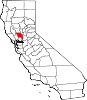
Coordinates: 38°39′30″N 121°58′16″W / 38.65833°N 121.97111°W Country United States State California County Yolo County Elevation[1] 164 ft (50 m) Cottonwood is a former settlement in Yolo County, California. It was located 2 miles (3.2 km) south of Madison,[2] at an elevation of 164 feet (50 m). It still appears on maps as of 1917.
History
Cottonwood was named so simply because of large amount of cottonwood trees in the vicinity. Charles Heinrich founded the town in 1852 when he established a store. The same year he bought 160 acres (65 ha), which were bounded on each side by land purchased by others. This area was served by the Cache Creek Post Office which began its service on March 24, 1852. A racetrack was constructed by Andrew Work about one mile northeast of the store that Heinrich built. The upkeep of animals at the racetrack made way for the establishment of a local blacksmith in 1852.[3]
In 1861 Henry and Caroline Fredrick gave three acres for a Union School on the corner of roads 90 and 23. By 1870 the area had a hotel, a saloon, two stores, a blacksmith, a wagon maker, a saddler, and a shoemaker. An abandoned Congregational Church building was also present.[3]
Many of the buildings, businesses, and residents of Cottonwood moved from their little town to Madison, one mile north, when the a rail line connecting Vaca Valley to the Clear Lake Railroad line bypassed them on its way to Madison. The decision to bypass Cottonwood was made when D.B. Hurlbut gave the right-of-way through his land and a $1,000 donation for the rail-company to construct a terminal in Madison. The road was graded from Winters to Hurlbut's land by area resident George W. Scott. Even the Cache Creek Post Office moved to Madison on March 29, 1877. The only thing left in Cottonwood was the Cottonwood Cemetery with tombstones from the 1860s and 1870s. [3][4]
References
- ^ U.S. Geological Survey Geographic Names Information System: Cottonwood, Yolo County, California
- ^ Durham, David L. (1998). California's Geographic Names: A Gazetteer of Historic and Modern Names of the State. Quill Driver Books. p. 470. ISBN 9781884995149.
- ^ a b c Three Maps of Yolo County. Woodland, CA: Yolo County Historical Society. 1970. pp. 6.
- ^ "Capay Valley Historical Timeline". Capay Valley Vision. http://www.capayvalleyvision.org/timeline.html. Retrieved 2008-12-19.
Municipalities and communities of Yolo County, California County seat: Woodland Cities Davis | West Sacramento | Winters | Woodland
CDPs Unincorporated
communitiesArcade | Arroz | Beatrice | Brooks | Browns Corner | Cadenasso | Capay | Central | Citrona | Conaway | Coniston | Daisie | Dufour | El Macero | El Rio Villa | Fremont | Green | Greendale | Hershey | Jacobs Corner | Kiesel | King Farms | Lovdal | Lund | Merritt | Mikon | Morgans Landing | Norton | Peethill | Plainfield | Riverview | Rumsey | Saxon | Sorroca | Sugarfield | Swingle | Tancred | Tyndall Landing | Valdez | Vin | Webster | Willow Point | Zamora
Ghost towns Categories:- Former settlements in Yolo County, California
- Ghost towns in California
- Populated places established in 1852
- Yolo County, California geography stubs
- California ghost town stubs


Wikimedia Foundation. 2010.