- Davis, California
-
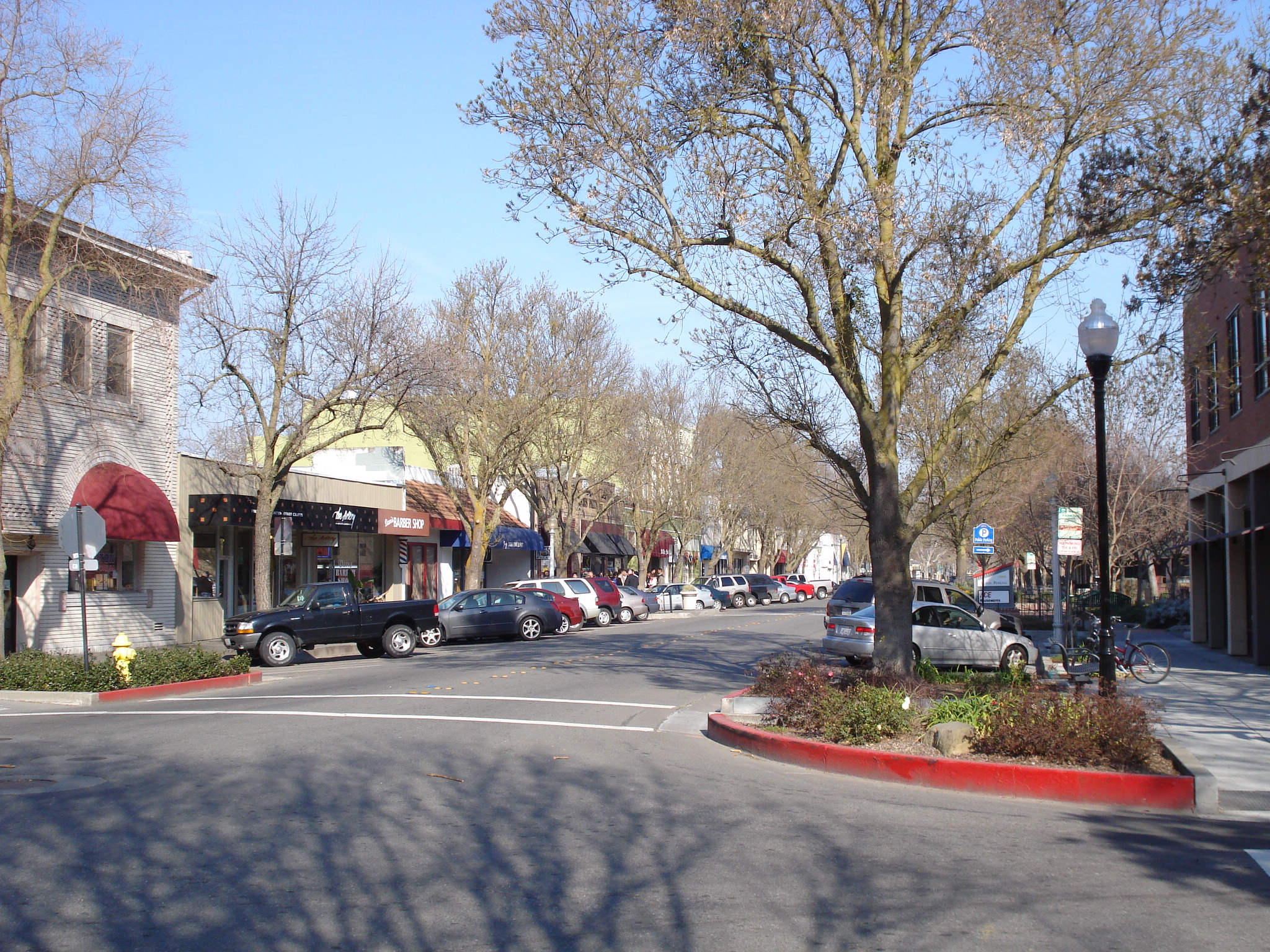
City of Davis — City — Downtown Davis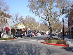
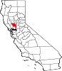
LogoMotto: Most bicycle friendly town in the world Location in Yolo County and the state of California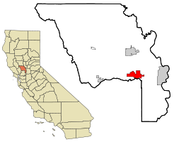
Coordinates: 38°33′14″N 121°44′17″W / 38.55389°N 121.73806°WCoordinates: 38°33′14″N 121°44′17″W / 38.55389°N 121.73806°W Country  United States
State  California
County Yolo Settled 1868 Incorporated March 28, 1917 Government - Mayor Joe Krovoza[1] - Senate Lois Wolk (D) - Assembly Mariko Yamada (D) - U. S. Congress Mike Thompson (D) Area[2] - Total 25.690 km2 (9.919 sq mi) - Land 25.608 km2 (9.887 sq mi) - Water 0.082 km2 (0.032 sq mi) 0.32% Elevation 16 m (52 ft) Population (2010) - Total 65,622 - Density 2,554.4/km2 (6,615.8/sq mi) US Census Time zone PST (UTC−8) - Summer (DST) PDT (UTC−7) ZIP codes 95616-95618 Area code(s) 530 FIPS code 06-18100 GNIS feature ID 0277498 Website cityofdavis.org/ Davis is a city in Yolo County, California, United States. It is part of the Sacramento–Arden-Arcade–Roseville Metropolitan Statistical Area. According to estimates published by the US Census Bureau, the city had a total population of 65,622 in 2010[3] (60,308 in 2000)[4], neither of which includes the on-campus population of UC Davis, which was 5,786 people according to the 2010 United States Census [3] while the "total student enrollment" is listed as 32,290 by the UC Davis website. It is the largest city in Yolo County, and the 122nd largest in the state, by population.[5] Davis is known for its liberal politics, for having many bicycles and bike paths, and for the campus of the University of California, Davis. In 2006, Davis was ranked as the second most educated city (in terms of the percentage of residents with graduate degrees) in the US by CNN Money Magazine, after Arlington, Virginia.[6]
Contents
History
Davis grew around a Southern Pacific Railroad depot built in 1868. It was then known as "Davisville," named for Jerome C. Davis, a prominent local farmer. However, the post office at Davisville shortened the town name to simply "Davis" in 1907. The name stuck, and the city of Davis was incorporated on March 28, 1917.[7]
From its inception as a farming community, Davis has been known for its contributions to agriculture along with veterinary care and animal husbandry. Following the passage of the University Farm Bill in 1905 by the California State Legislature, Governor George Pardee selected Davis out of 50 other sites as the future home to the University of California's University Farm, officially opening to students in 1908.[8] The farm, later renamed the Northern Branch of the College of Agriculture in 1922, was upgraded into the seventh UC campus, the University of California, Davis, in 1959. Contemporary Davis is also known for its contributions in the areas of biotechnology, medicine, and other life sciences.
Geography and environment
Location
Davis is located in Yolo County, California, 18 km (11 mi) west of Sacramento, 113 km (72 mi) northeast of San Francisco, 619 km (385 mi) north of Los Angeles, at the intersection of Interstate 80 and State Route 113. Neighboring towns include Dixon, Winters, and Woodland.
Davis lies in the Sacramento Valley, the northern portion of the Central Valley, in Northern California, at an elevation of about 16 m (52 ft) above sea level.
According to the United States Census Bureau, the city has a total area of 10.5 square miles (27 km2). 10.4 square miles (27 km2) of it is land and 0.04 square miles (0.10 km2) of it (0.19%) is water.
The topography is flat, which has helped Davis to become known as a haven for bicyclists.
Climate
The Davis climate resembles that of nearby Sacramento and is typical of California's Central Valley. The dry, hot summers and cool, rainy, winters are those of a Mediterranean climate. It is classified as a Köppen Csa climate. Thick ground fog named "Tule Fog" settles into Davis during late fall and winter. The characteristics of the fog are dense with visibility to less than 500 feet. Many accidents occurring in the winter season of Davis are often due to the Tule Fog.
Climate data for Davis Month Jan Feb Mar Apr May Jun Jul Aug Sep Oct Nov Dec Year Record high °F (°C) 77
(25)78
(26)80
(27)98
(37)106
(41)115
(46)116
(47)114
(46)112
(44)104
(40)91
(33)76
(24)116
(47)Average high °F (°C) 53
(12)60
(16)65
(18)72
(22)80
(27)88
(31)93
(34)92
(33)88
(31)79
(26)64
(18)54
(12)74.0
(23.3)Average low °F (°C) 37
(3)40
(4)42
(6)45
(7)50
(10)55
(13)56
(13)55
(13)53
(12)48
(9)41
(5)36
(2)46.5
(8.1)Record low °F (°C) 18
(−8)4
(−16)26
(−3)26
(−3)33
(1)36
(2)43
(6)40
(4)36
(2)26
(−3)23
(−5)12
(−11)4
(−16)Precipitation inches (mm) 4.04
(102.6)3.76
(95.5)3.03
(77)0.97
(24.6)0.55
(14)0.18
(4.6)0.03
(0.8)0.04
(1)0.30
(7.6)0.90
(22.9)2.44
(62)2.81
(71.4)19.05
(483.9)Source: [9] Neighborhoods
Davis is internally divided by two freeways (Interstate 80 and State Route 113), a north-south railroad (California Northern), an east-west mainline (Union Pacific) and several major streets. The city is unofficially divided into six main districts made up of smaller neighborhoods:
 Part of the UC Davis Arboretum.
- Central Davis, north of Fifth Street and Russell Boulevard, south of Covell Blvd., east of SR 113, and west of the railroad tracks running along G Street.
- Downtown Davis, roughly the numbered-and-lettered grid north of I-80, south of Fifth Street, east of A Street, and west of the railroad tracks.
- East Davis, north of I-80, south of Covell Blvd., and east of the railroad tracks, and includes Mace Ranch and Lake Alhambra Estates.
- North Davis, north of Covell Blvd.
- South Davis, south of I-80, and includes Willowbank. El Macero, California, although outside the city limits, is sometimes considered part of South Davis; El Macero is part of the Davis Joint Unified School District, and El Macero children who attend public schools attend Davis' public schools.
- West Davis, north of I-80 and west of SR 113. West Davis includes Westwood, Evergreen, Aspen, Stonegate (west of Lake Boulevard and including Stonegate Lake and the Stonegate Country Club) and the eco-friendly Village Homes development, known for its solar-powered houses.
The University of California, Davis is located south of Russell Boulevard and west of A Street and then south of 1st Street. The land occupied by the university is not incorporated within the boundaries of the city of Davis and lies within both Yolo and Solano Counties.
Environment
On November 14, 1984, the Davis City Council declared the city to be a nuclear free zone.[10]
Demographics
Historical populations Census Pop. %± 1870 500 — 1880 441 −11.8% 1890 547 24.0% 1900 700 28.0% 1910 800 14.3% 1920 939 17.4% 1930 1,243 32.4% 1940 1,672 34.5% 1950 3,554 112.6% 1960 8,910 150.7% 1970 23,488 163.6% 1980 36,640 56.0% 1990 46,209 26.1% 2000 60,308 30.5% 2010 65,622 8.8% 2010
The 2010 United States Census[11] reported that Davis had a population of 65,622. The population density was 6,615.8 people per square mile (2,554.4/km²). The racial makeup of Davis was 42,571 (64.9%) White, 1,528 (2.3%) African American, 339 (0.5%) Native American, 14,355 (21.9%) Asian, 136 (0.2%) Pacific Islander, 3,121 (4.8%) from other races, and 3,572 (5.4%) from two or more races. Hispanic or Latino of any race were 8,172 persons (12.5%).
Davis' Asian population of 14,355 was spread out with 1,631 Indian Americans, 6,395 Chinese Americans, 1,033 Filipino Americans, 953 Japanese Americans, 1,560 Korean Americans, 1,185 Vietnamese Americans, and 1,598 other Asian Americans.[12]
Davis' Hispanic and Latino population of 8,172 was spread out with 5,618 Mexican American, 221 Puerto Rican American, 80 Cuban American, and 2,253 other Hispanic and Latino.[12]
Davis, California population reported at 2010 United States Census[13][14] Race Total
PopulationNot
Hispanic
or LatinoHispanic
or LatinoWhite 42,571 38,641 3,930 African
American1,528 1,415 113 Native
American339 166 173 Asian 14,355 14,213 142 Pacific
Islander136 120 16 other
races3,121 181 2,940 two or
more races3,572 2,714 858 The Census reported that 63,522 people (96.8% of the population) lived in households, 1,823 (2.8%) lived in non-institutionalized group quarters, and 277 (0.4%) were institutionalized.
There were 24,873 households, out of which 6,119 (24.6%) had children under the age of 18 living in them, 9,343 (37.6%) were opposite-sex married couples living together, 1,880 (7.6%) had a female householder with no husband present, 702 (2.8%) had a male householder with no wife present. There were 1,295 (5.2%) unmarried opposite-sex partnerships, and 210 (0.8%) same-sex married couples or partnerships. 5,952 households (23.9%) were made up of individuals and 1,665 (6.7%) had someone living alone who was 65 years of age or older. The average household size was 2.55. There were 11,925 families (47.9% of all households); the average family size was 2.97.
The population was spread out with 10,760 people (16.4%) under the age of 18, 21,757 people (33.2%) aged 18 to 24, 14,823 people (22.6%) aged 25 to 44, 12,685 people (19.3%) aged 45 to 64, and 5,597 people (8.5%) who were 65 years of age or older. The median age was 25.2 years. For every 100 females there were 90.5 males. For every 100 females age 18 and over, there were 88.0 males.
There were 25,869 housing units at an average density of 2,608.0 per square mile (1,007.0/km²), of which 10,699 (43.0%) were owner-occupied, and 14,174 (57.0%) were occupied by renters. The homeowner vacancy rate was 0.9%; the rental vacancy rate was 3.5%. 27,594 people (42.0% of the population) lived in owner-occupied housing units and 35,928 people (54.7%) lived in rental housing units.
2000
As of the United States 2000 Census,[15] there were 60,308 people, 22,948 households, and 11,290 families residing in the city. The population density was 5,769.2 inhabitants per square mile (2,228.2/km2). There were 23,617 housing units at an average density of 2,259.3 per square mile (872.6/km2). The racial makeup of the city was 70.07% White, 2.35% Black or African American, 0.67% Native American, 17.5% Asian, 0.24% Pacific Islander, 4.26% from other races, and 4.87% from two or more races. 9.61% of the population were Hispanic or Latino of any race.[16]
There were 22,948 households out of which 26.4% had children under the age of 18 living with them, 38.3% were married couples living together, 8.2% had a female householder with no husband present, and 50.8% were non-families. 25.0% of all households were made up of individuals and 5.2% had someone living alone who was 65 years of age or older. The average household size was 2.50 and the average family size was 3.00.
In the city the population was spread out with 18.6% under the age of 18, 30.9% from 18 to 24, 27.1% from 25 to 44, 16.7% from 45 to 64, and 6.6% who were 65 years of age or older. The median age was 25 years. For every 100 females there were 91.2 males. For every 100 females age 18 and over, there were 87.8 males.
The median income for a household in the city was $42,454, and the median income for a family was $74,051. Males had a median income of $51,189 versus $36,082 for females. The per capita income for the city was $22,937. About 5.4% of families and 24.5% of the population were below the poverty line, including 6.8% of those under age 18 and 2.8% of those age 65 or over.
This city of approximately 62,000 people abuts a university campus of 32,000 students. Although the university's land is not incorporated within the city, many students live in city apartments.
Economy
Top employers
According to the City's 2009 Comprehensive Annual Financial Report,[17] the top employers in the city are:
# Employer # of Employees 1 University of California, Davis 30,201 2 Davis Joint Unified School District 976 3 City of Davis 630 4 Sutter Davis Hospital 380 5 Pacific Gas & Electric 270 6 Safeway 230 7 United States Department of Agriculture 200 8 Nugget Markets 197 9 Davis Food Co-op 143 10 Sierra Health Care Center 125 Bicycling
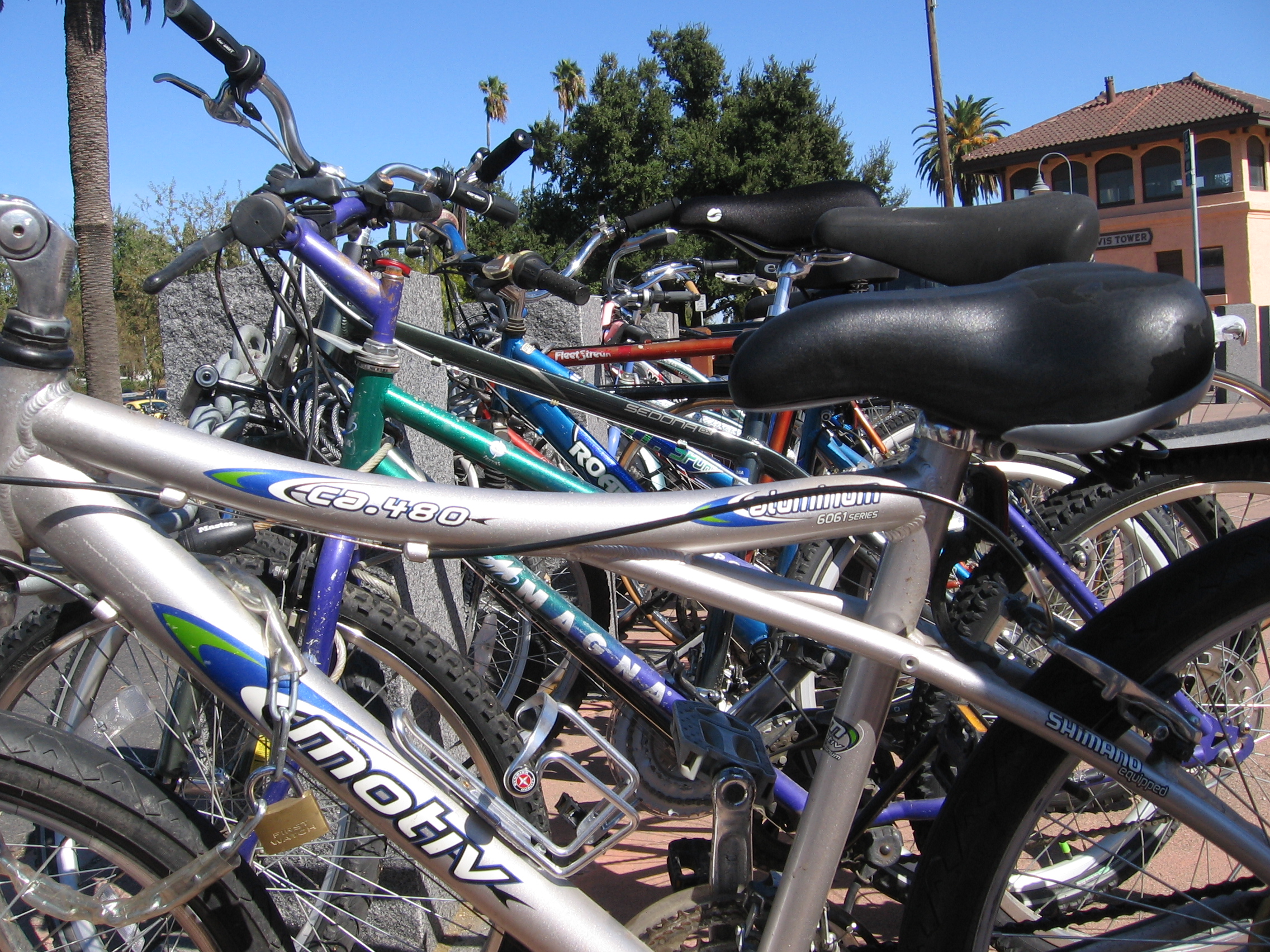
 Bikes in front of the Davis Amtrak station.
Bicycling has been a popular mode of transportation in Davis for decades, particularly among UC Davis students. In 2010, Davis became the new home of the United States Bicycling Hall of Fame.
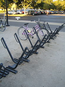 Davis racks
Bicycle infrastructure became a political issue in the 1960s, culminating in the election of a pro-bicycle majority to the City Council in 1966.[18] By the early 1970s, Davis became a pioneer in the implementation of cycling facilities. As the city expands, new facilities are usually mandated. As a result, Davis residents today enjoy an extensive network of bike lanes, bike paths, and grade-separated bicycle crossings.[19][20][21] The flat terrain and temperate climate are also conducive to bicycling.
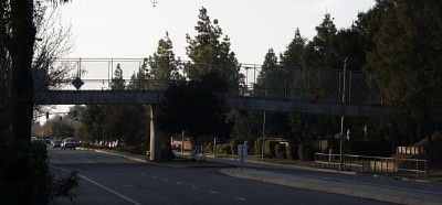
 Bicycle crossing over Covell Blvd.
In 2005 the Bicycle-Friendly Community program of the League of American Bicyclists recognized Davis as the first Platinum Level city in the US[22][23] In March 2006, Bicycling Magazine named Davis the best small town for cycling in its compilation of "America's Best Biking Cities."[24] Bicycling appears to be declining among Davis residents: from 1990 to 2000, the US Census Bureau reported a decline in the fraction of commuters traveling by bicycle, from 22 percent to 15 percent.[25] This resulted in the reestablishment of the city's Bicycle Advisory Commission and creation of advocate groups such as "Davis Bicycles!".
In 1996, 2001, 2006, and 2009 the UC Davis "Cal Aggie Cycling" Team won the national road cycling competition.[26] The team also competes off-road and on the track, and has competed in the national competitions of these disciplines. In 2007, UC Davis also organized a record breaking bicycle parade numbering 822 bicycles.[27]
The iOS application Davis Routes was released in 2010, and was designed for bicycle riders who travel within Davis. It gives a layout of the city, complete with bicycle shops, pumps, routes, and sites within the city.[28]
Sights and culture
Whole Earth Festival
A continuous stream of bands, speakers and various workshops occurs throughout Mother's Day weekend on each of Whole Earth Festival's (WEF) three stages and other specialty areas. The majority of the festival is solar powered. WEF is organized primarily by UC Davis students, in association with the Associated Students of UC Davis, Experimental College, and the university.
Picnic Day
Main article: Picnic Day (UC Davis)Picnic Day is an annual event at the University of California, Davis and is always held on the third Saturday in April. It is the largest student-run event in the US. Picnic Day starts off with a parade, which features the UC Davis California Aggie Marching Band-uh!, and runs through campus and around downtown Davis and ends with the Battle of the Bands, which lasts until the last band stops playing (sometimes until 2 am). There are over 150 free events and over 50,000 attend every year. Other highlights include: the Dachshund races, aka the Doxie Derby, held in the Pavilion; the Davis Rock Challenge, the Chemistry Magic Show, and the sheep dog trials. Many departments have exhibits and demonstrations, such as the Cole Facility, which until recently showed a fistulated cow (a cow that has been fitted with a plastic portal (a "fistula") into its digestive system to observe digestion processes). Its name was "Hole-y Cow".
Mondavi Center
Main article: Mondavi CenterThe Mondavi Center, located on the UC Davis campus, is one of the biggest non-seasonal attractions to Davis. The Mondavi Center is a theater which hosts many world-class touring acts, including star performers such as Yo-Yo Ma and Cecilia Bartoli, and draws a large audience from Sacramento.
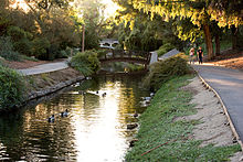
UC Davis Arboretum
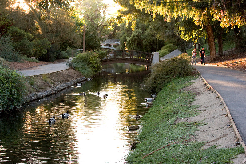
Main article: University of California, Davis, ArboretumThe UC Davis Arboretum is an arboretum and botanical garden. Plants from all over the world grow in different sections of the park. There are notable oak and native plant collections and a small redwood grove. A small waterway spans the arboretum along the bed of the old North Fork of Putah Creek. Occasionally herons, kingfishers, and cormorants can be seen around the waterways, as well as the ever present ducks. Tours of the arboretum led by volunteer naturalists are often held for grade-school children.
Farmers market
The Davis Farmers Market is held every Wednesday evening and Saturday morning. Participants sell a range of fruits and vegetables, baked goods, dairy and meat products (often from certified organic farms), crafts, and plants and flowers. From April to October, the market hosts Picnic in the Park, with musical events and food sold from restaurant stands.[29] The Davis Farmers Market won first place in the 2009, and second place in the 2010 America’s Favorite Farmers Markets held by the American Farmland Trust under the large Farmers market classification.[30][31]
Media
Davis has one daily newspaper, the Davis Enterprise, founded in 1897. UC Davis also has a daily newspaper called The California Aggie which covers campus, local and national news. There is a community television station (DCTV),[32] along with numerous commercial stations broadcasting from nearby Sacramento. There are also two community radio stations: KDVS 90.3 FM, on the University of California campus, and KDRT 95.7 FM, a subsidiary of DMA and one of the first low-power FM radio stations in the United States. Davis has the world's largest English-language local wiki, DavisWiki.
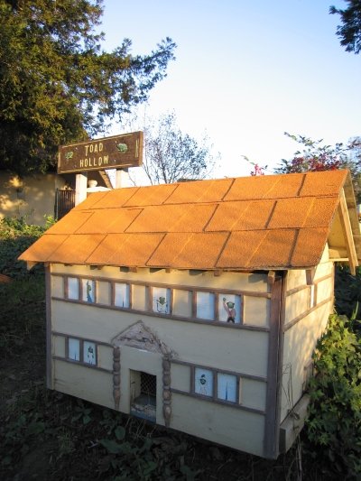
Toad Tunnel
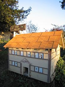 Entrance to the Toad Tunnel in front of the Post Office
Davis' Toad Tunnel is a wildlife crossing that was constructed in 1995 and has drawn much attention over the years, including a mention on The Daily Show. Because of the building of an overpass, animal lovers worried about toads being killed by cars commuting from South Davis to North Davis, since the toads hopped from one side of a dirt lot (which the overpass replaced) to the reservoir at the other end. After much controversy, a decision was made to build a toad tunnel, which runs beneath the Pole Line Road overpass which crosses Interstate 80. The project cost $14,000. The tunnel is 21 inches (53 cm) wide and 18 inches (46 cm) high.
The tunnel has created problems of its own. The toads originally refused to use the tunnel and so the tunnel was lit to encourage its use. The toads then died from the heat of the lamps inside the tunnel. Once through the tunnel, the toads also had to contend with birds who grew wise to the toad-producing hole in the ground.[citation needed] The exit to the toad tunnel has been decorated by the Postmaster to resemble a toad town.
Education
University of California
Main article: University of California, DavisThe University of California, Davis, or UC Davis, a campus of the University of California, had an 2009 Fall enrollment of 32,153 students.[33][34] UC Davis has a dominant influence on the social and cultural life of the town.
D-Q University
Main article: D-Q University Entrance and mural at D-Q University.
Also known as Deganawidah-Quetzalcoatl University and much smaller than UC Davis, D-Q University was a two-year institution located on Road 31 in Yolo County 6.7 miles (11 km) west of State Route 113. This is just west of Davis near the Yolo County Airport. About four miles (6 km) to the west, the Road 31 exit from Interstate 505 is marked with cryptic signage, "DQU." The site is about 100 feet (30 m) above mean sea level (AMSL). NAD83 coordinates for the campus are 38°34′02″N 121°53′12″W / 38.56722°N 121.88667°W
The college closed in 2005. The curriculum was said to include heritage and traditional American Indian ceremonies. The 643 acres (2.60 km2) and 5 buildings were formerly a military reservation according to a National Park Service publication, Five Views. The full name of the school is included here so that readers can accurately identify the topic. According to some tribal members, use of the spelled-out name of the university can be offensive. People who want to be culturally respectful refer to the institution as D-Q University. Tribal members in appropriate circumstances may use the full name.
Other colleges
An off-campus branch of Sacramento City College is located in Davis.
Public schools
Davis' public school system is administrated by the Davis Joint Unified School District.
The city has nine public elementary schools (North Davis, Birch Lane, Pioneer Elementary, Patwin, Cesar Chavez, Robert E. Willett, Marguerite Montgomery, Fred T. Korematsu at Mace Ranch, and Fairfield Elementary (which is outside the city limits but opened in 1866 and is Davis Joint Unified School District's oldest public school)). Davis has one school for independent study (Davis School for Independent Study), three public junior high schools (Ralph Waldo Emerson, Oliver Wendell Holmes, and Frances Harper), one main high school (Davis Senior High School), an alternative high school (Martin Luther King High School), and a small technology-based high school (Leonardo da Vinci High School). Cesar Chavez is a Spanish immersion school, with no English integration until the third grade. The junior high schools contain grades 7 through 9. Due to a decline in the school-age population in Davis, several of the elementary schools may be closed. Valley Oak was closed after the 2007–08 school year, and their campus was granted to Da Vinci High (which had formerly been located in the back of Davis Senior High's campus) and a special-ed preschool.
At one time, Chavez and Willett were incorporated together to provide elementary education K–6 to both English-speaking and Spanish immersion students in West Davis. Cesar Chavez served grades K–3 and was called West Davis Elementary, and Robert E. Willett (named for a long-time teacher at the school, now deceased) served grades 4–6 and was known as West Davis Intermediate. Willett now serves K–6 English-speaking students, and Chavez supports the Spanish immersion program for K–6.
Private schools
- Peregrine School (Preschool and Elementary)
- Merryhill School (K–8)
- Saint James School (K–8)
- Grace Valley Christian Academy (K–9)
- Davis Waldorf School (Pre-K–8)
Notable natives and residents
- Joe Craven, musician
- Beth Rodden, Professional Rock Climber
- Peter S. Beagle, author (The Last Unicorn)
- Colin Carter, professor (UC Davis)
- Isaac Skinner Chiles, early pioneer[35]
- Joseph Ballinger Chiles, Trail Blazer and Early Pioneer
- Tony Cline, Jr., NFL tight end
- Denise Curry, basketball player
- Josh Davis, AKA DJ Shadow, famous for his critically acclaimed sample based Trip-Hop
- David Dionisi, author of American Hiroshima
- Delaine Eastin, former California State Superintendent of Public Instruction
- Trenton Edwards, materials scientist
- Jason Fisk, former NFL defensive tackle
- Karen Joy Fowler, author
- Michael Franti, musician
- Myril Hoag, former MLB outfielder
- Sam Horrigan, Actor
- Rita Hosking, musician
- Gary Huckabay, author (Baseball Prospectus)
- Evan Hudson, rower
- Nyjah Huston, professional skateboarder
- John Lescroart, author
- Mike May, entrepreneur and athlete, regained sight after decades of complete blindness
- Barry Melton, musician
- Gina Miles, 2008 Beijing Olympic Silver Medalist, Equestrian Eventing team
- Paul Moller, inventor and professor
- Kim Stanley Robinson, science-fiction author; famous works include Mars trilogy
- Stephen Robinson, astronaut (received Bachelor's degree from UC Davis, 1978)
- Paul Scheuring, screenwriter (Prison Break, A Man Apart)
- Dave Scott, triathlete – six times Ironman Triathlon world champion
- G. Ledyard Stebbins, botanist
- Sean Stewart, author
- Charles Tart, parapsychologist
- Alan Taylor, Pulitzer Prize-winning author and professor of history
- Jessica Utts, Professor of Statistics, parapsychologist
- Nick Watney, PGA Tour professional golfer
- Gary Lee Yoder, musician, part of several 1960s psychedelic rock bands
- Martin Yan, cooking show host
Sister cities
Davis has 7 sister cities[36]
 Los Baños, Laguna, Philippines
- Muñoz, Philippines
 Qufu, People's Republic of China
 Rutilio Grande, El Salvador
 Sangju, South Korea
 Uman, Ukraine
- Wuxi, People's Republic of China
References
- ^ Davis City Website
- ^ http://www.census.gov/geo/www/gazetteer/files/Gaz_places_national.txt US Census Bureau
- ^ a b http://factfinder2.census.gov/faces/tableservices/jsf/pages/productview.xhtml?pid=DEC_10_PL_GCTPL1.ST13&prodType=table
- ^ "Davis, California Population Finder". US Census Bureau. http://factfinder.census.gov/servlet/SAFFPopulation?_event=ChangeGeoContext&geo_id=16000US0618100&_geoContext=01000US&_street=&_county=Davis&_cityTown=Davis&_state=04000US06&_zip=&_lang=en&_sse=on&ActiveGeoDiv=geoSelect&_useEV=&pctxt=fph&pgsl=010&_submenuId=population_0&ds_name=null&_ci_nbr=null&qr_name=null®=null%3Anull&_keyword=&_industry=. Retrieved December 8, 2008.
- ^ http://factfinder2.census.gov/faces/tableservices/jsf/pages/productview.xhtml?pid=DEC_10_PL_GCTPL1.ST13&prodType=table 2010 Census Report
- ^ MONEY magazine: Best places to live 2006: Top 25 Most Educated
- ^ Jerome C. Davis
- ^ Davis: Historical Overview University of California History Retrieved on 02-17-08
- ^ "The WeatherChannel". http://www.weather.com/weather/wxclimatology/monthly/graph/95616.
- ^ Nuclear Free Zone – Davis Wiki
- ^ All data are derived from the United States Census Bureau reports from the 2010 United States Census, and are accessible on-line here. The data on unmarried partnerships and same-sex married couples are from the Census report DEC_10_SF1_PCT15. All other housing and population data are from Census report DEC_10_DP_DPDP1. Both reports are viewable online or downloadable in a zip file containing a comma-delimited data file. The area data, from which densities are calculated, are available on-line here. Percentage totals may not add to 100% due to rounding. The Census Bureau defines families as a household containing one or more people related to the householder by birth, opposite-sex marriage, or adoption. People living in group quarters are tabulated by the Census Bureau as neither owners nor renters. For further details, see the text files accompanying the data files containing the Census reports mentioned above.
- ^ a b "Census 2010: Table 3 — Total Population by Race, including Detailed Asian Race" (Excel). California Department of Finance. http://www.dof.ca.gov/research/demographic/state_census_data_center/census_2010/documents/2010Census_DemoProfile3.xls. Retrieved May 31, 2010.
- ^ http://factfinder2.census.gov/faces/tableservices/jsf/pages/productview.xhtml?pid=DEC_10_PL_GCTPL1.ST13&prodType=table US Census Bureau
- ^ "Census 2010: Table 3A — Total Population by Race (Hispanic exclusive) and Hispanic or Latino: 2010" (Excel). California Department of Finance. http://www.dof.ca.gov/research/demographic/state_census_data_center/census_2010/documents/2010Census_Table3A_RedistrictingFile.xls. Retrieved May 31, 2010.
- ^ "American FactFinder". United States Census Bureau. http://factfinder.census.gov. Retrieved 2008-01-31.
- ^ Factfinder.census.gov Retrieved on May 15, 2007
- ^ City of Davis Comprehensive Annual Financial Report, Fiscal Year Ended June 30, 2009 Retrieved September 26, 2010
- ^ http://www.ci.davis.ca.us/pw/pdfs/2006_BikePlan_withMaps.pdf Ci.davis.ca.us Retrieved on May 15, 2007
- ^ Bike lanes
- ^ Bike paths
- ^ Bicycle crossing
- ^ http://www.bikeleague.org/programs/bicyclefriendlyamerica/communities/bfc_davis.php Bikeleague.org Retrieved on September 27, 2010
- ^ Bike League press release, citing Davis as first platinum community
- ^ http://www.davisenterprise.com/articles/2006/01/29/news/339new5.txt Davisenterprise.com Retrieved on May 15, 2007
- ^ http://factfinder.census.gov/servlet/DatasetMainPageServlet?_program=DEC&_submenuId=datasets_0&_lang=en Factfinder.census.gov Retrieved on May 15, 2007
- ^ Cal Aggie Cycling
- ^ World's Largest Bicycle parade
- ^ http://daviswiki.org/Davis_Routes
- ^ Picnic in the Park
- ^ http://action.farmland.org/site/PageNavigator/Americas-Favorite-Farmers-Markets/best_local_farmers_market_vote
- ^ http://action.farmland.org/site/PageNavigator/Americas-Favorite-Farmers-Markets/top_farmers_markets
- ^ Davis Community Television
- ^ UC Davis News & Information:: UC Davis Facts: Student Population Headcount, Fall 1997–2007
- ^ UC Davis Student Population
- ^ Isaac Skinner Chiles
- ^ "Sister Cities – City of Davis". City of Davis. http://cityofdavis.org/cmo/sistercities/. Retrieved July 14, 2010.
External links
- Web site for the city government
- DavisWiki.org – Community wiki for Davis, CA
- Yolo County Visitors Bureau – information on hotels, restaurants and attractions in Davis
- Directory
Municipalities and communities of Yolo County, California Cities Davis | West Sacramento | Winters | Woodland
CDPs Unincorporated
communitiesArcade | Arroz | Beatrice | Brooks | Browns Corner | Cadenasso | Capay | Central | Citrona | Conaway | Coniston | Daisie | Dufour | El Macero | El Rio Villa | Fremont | Green | Greendale | Hershey | Jacobs Corner | Kiesel | King Farms | Lovdal | Lund | Merritt | Mikon | Morgans Landing | Norton | Peethill | Plainfield | Riverview | Rumsey | Saxon | Sorroca | Sugarfield | Swingle | Tancred | Tyndall Landing | Valdez | Vin | Webster | Willow Point | Zamora
Ghost towns Greater Sacramento Counties Douglas (NV) · El Dorado · Nevada · Placer · Sacramento · Sutter · Yolo · Yuba
Major City Cities
and
towns100k–200k25k–100kArden Arcade · Auburn · Carmichael · Citrus Heights · Davis · Folsom · Florin · Laguna · Lincoln · North Highlands · Orangevale · Parkway-South Sacramento · Rancho Cordova · Rocklin · West Sacramento · Woodland · Yuba City
10k–25kCameron Park · El Dorado Hills · Fair Oaks · Foothill Farms · Galt · Gardnerville Ranchos (NV) · Granite Bay · Grass Valley · La Riviera · Linda · Marysville · North Auburn · Olivehurst · Placerville · Rosemont · Rio Linda · South Lake Tahoe · South Yuba City · Truckee · Vineyard
Sub-regions Gold Country · Lake Tahoe · Sacramento Valley · Sierra Nevada · Yuba-Sutter Area
Categories:- Davis, California
- Nuclear-free zones
- Sacramento metropolitan area
- Cities in Yolo County, California
- Incorporated cities and towns in California


Wikimedia Foundation. 2010.