- Elk Grove, California
Infobox Settlement
official_name = Elk Grove, California
native_name =
settlement_type = CDP
nickname =
motto =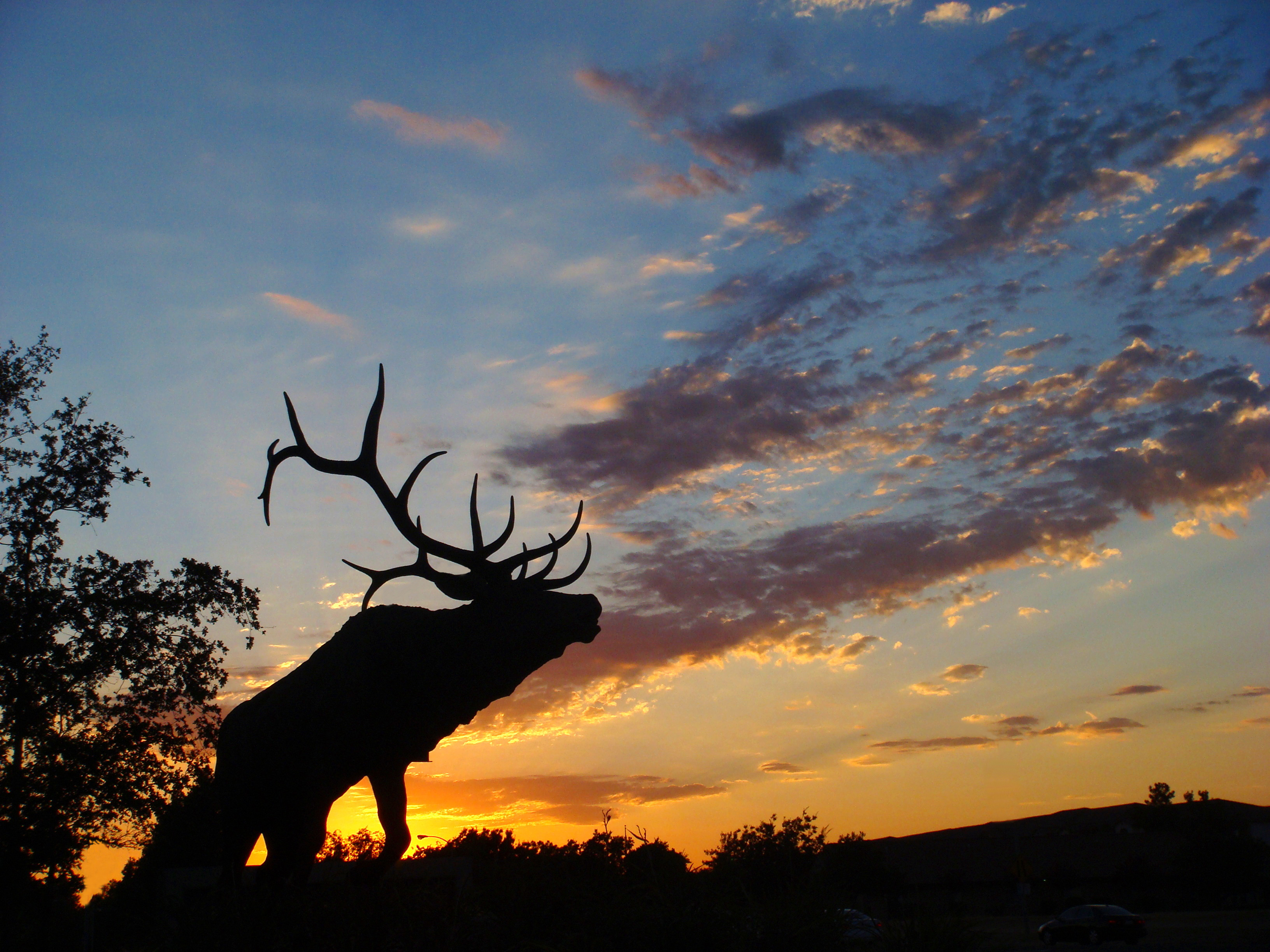
imagesize = 250px
image_caption = Sunset on Laguna Boulevard in Elk Grove
image_
image_shield =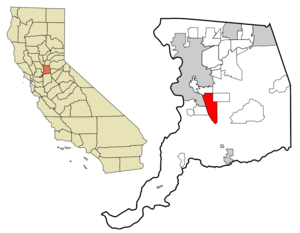
mapsize = 250x200px
map_caption =
mapsize1 =
map_caption1 =
subdivision_type = Country
subdivision_name =United States
subdivision_type1 = State
subdivision_name1 =California
subdivision_type2 = County
subdivision_name2 = Sacramento
government_type =
leader_title =Mayor
leader_name = Gary Davis
leader_title1 = Vice Mayor
leader_name1 = Patrick Hume
leader_title2 = Chief Of Police
leader_name2 = Robert Simmons
leader_title3 = Assistiant Chief of Police
leader_name3 = Edward J. Kelly
established_title =
established_date =
established_title2 =
established_date2 =
established_title3 = Incorporated
established_date3 =July 1 ,2000
area_magnitude =
area_total_km2 = 39.4
area_total_sq_mi = 15.2
area_land_km2 = 39.4
area_land_sq_mi = 15.2
area_water_km2 = 0.0
area_water_sq_mi = 0.0
area_water_percent =
area_urban_km2 =
area_urban_sq_mi =
area_metro_km2 =
area_metro_sq_mi =
population_as_of = 2005
population_note =
population_total = 112338
population_footnotes =
population_density_km2 = 1524.0
population_density_sq_mi = 3947.0
population_metro =
population_density_metro_km2 =
population_density_metro_sq_mi =
population_urban =
population_density_urban_km2 =
population_density_urban_sq_mi =
timezone = PST
utc_offset = -8
timezone_DST = PDT
utc_offset_DST = -7
latd = 38 |latm = 26 |lats = 18 |latNS = N
longd = 121 |longm = 22 |longs = 55 |longEW = W
elevation_m = 14
elevation_ft = 45
postal_code_type =ZIP code
postal_code = 95624, 95758, 95759
area_code = 916
website = http://elkgrovecity.org/
blank_name = FIPS code
blank_info = 06-22020
blank1_name = GNIS feature ID
blank1_info = 0277506
footnotes =Elk Grove is a
city inSacramento County, California , located just south of the state capital of Sacramento. It is part of the Sacramento–Arden-Arcade–Roseville Metropolitan Statistical Area. State population estimates place the city's population at 136,318 as of January 1, 2007. [http://www.dof.ca.gov/HTML/demograp/ReportsPapers/Estimates/E4/E4-01-06/HistE-4.asp] . The second-largest city in Sacramento County, Elk Grove earned the title of the fastest growing city in the U.S between July 1, 2004 and July 1, 2005. [ [http://www.census.gov/Press-Release/www/releases/archives/population/007001.html US Census Press Release] ]History
Elk Grove was founded in 1850 as a stage stop. It is located about convert|15|mi|km south of historic Sutter’s Fort and thus became a crossroads for business, entertainment, mail service and agriculture, and acted as home base for gold miners in nearby communities. After it played its part in the early gold rush and statehood history in California, a close-knit community evolved with a distinctly rural and western lifestyle.
Initially, the town developed around a stage stop on the Monterey Trail, though after the railroad passed by east of town, Elk Grove's center shifted to its present location. "Old Town" Elk Grove is located about a mile east of State Route 99 (formerly U.S. Route 99, the north-south artery of the
California Central Valley ). Although the town developed around agriculture, it would eventually become a residential suburb of Sacramento. Most newer housing developments in Elk Grove lie west between Highway 99 and Interstate 5, the major north-south highway for the U.S. West Coast, in two areas locally called "Laguna Creek" and "Laguna West".In 2000, Elk Grove incorporated as a city.
In 2008
CNN stated that areas of Elk Grove suffered from the subprime mortgage crisis. [" [http://www.cnn.com/2008/TECH/06/16/suburb.city/index.html Is America's suburban dream collapsing into a nightmare?] ." "CNN ". AccessedJune 17 ,2008 .]Annual Events
Elk Grove Western Festival - Held the first full weekend in May every year, the Western Festival is two days of good old-fashioned fun for the entire family.
Strauss Festival - In late July each year, spectators on grassy knolls in the Elk Grove Regional Park see the waltzes of Johann Strauss come alive through the performances of period-costumed dancers, actors and a professional symphonic orchestra.
"Elk Grove Giant Pumpkin & Harvest Festival"' - This event, occurring annually during the first full weekend in October, is complete with crafts, food, and fun for the entire family. In 1998, it became the official California weigh-off site for the Giant Pumpkin Commonwealth's giant pumpkin weigh-off contest. In 2006, the Festival hosted California's heftiest pumpkin to date, 1280.5 lbs., grown by Gary Miller of Napa, California. The Festival is hosted by the Cosumnes Community Services District.
Dickens Faire - During the Christmas season, Old Town Elk Grove hosts an old-fashioned street fair featuring local retailers and craft vendors located in the historic section of Elk Grove.
www.oldtownelkgrove.org
Geography
Elk Grove is located at 38°26'18" North, 121°22'55" West (38.438222, -121.381925)GR|1.
According to the
United States Census Bureau , the CDP has a total area of 15.2 square miles (39.4 km²), of which, 15.2 square miles (39.4 km²) of it is land and none of it is covered by water.Demographics
As of the census of 2000, there were 59,984 people, 18,526 households, and 15,358 families residing in the CDP. State population estimates place the city's population at 136,318 as of January 1, 2007 The
population density was 3,947.0 people per square mile (1,523.7/km²). There were 18,894 housing units at an average density of 1,243.3/sq mi (479.9/km²). The racial makeup of the CDP was 59.12% White, 8.52% Black or African American, 0.94% Native American, 17.59% Asian, 0.59% Pacific Islander, 6.44% from other races, and 6.79% from two or more races. 14.00% of the population were Hispanic or Latino of any race.There were 18,526 households out of which 49.4% had children under the age of 18 living with them, 65.0% are married couples living together, 12.6% had a female householder with no husband present, and 17.1% were non-families. 12.9% of all households were made up of individuals and 3.5% had someone living alone who is 65 years of age or older. The average household size was 3.22 and the average family size is 3.51.
In the CDP the population was spread out with 32.9% under the age of 18, 8.1% from 18 to 24, 31.9% from 25 to 44, 20.3% from 45 to 64, and 6.8% who were 65 years of age or older. The median age was 32 years. For every 100 females there were 95.3 males. For every 100 females age 18 and over, there were 90.9 males.
According to a 2006 estimate, the median
income for a household was $77,064, and the median income for a family was $81,771. [http://factfinder.census.gov/servlet/ACSSAFFFacts?_event=Search&geo_id=16000US0619766&_geoContext=01000US%7C04000US06%7C16000US0619766&_street=&_county=elk+grove&_cityTown=elk+grove&_state=04000US06&_zip=&_lang=en&_sse=on&ActiveGeoDiv=geoSelect&_useEV=&pctxt=fph&pgsl=160&_submenuId=factsheet_1&ds_name=ACS_2006_SAFF&_ci_nbr=null&qr_name=null®=null%3Anull&_keyword=&_industry=] 5.2% of the population and 3.8% of families were below thepoverty line . Out of the total population, 6.0% of those under the age of 18 and 4.9% of those 65 and older were living below the poverty line.Area Codes and Zip Codes
Elk Grove's telephone
area code is 916. ItsZIP codes are:Education
The
Elk Grove Unified School District is the 5th largest school district in California and one of the fastest growing school districts in the nation. Located in southern Sacramento County, the district covers convert|320|sqmi|km2, one-third of the county. For the 2002-03 school year, the district served more than 52,500 students, and expects to reach 73,000 students by 2010. Those students attend 38 elementary schools, 8 middle schools, 8 high schools and 4 alternative high schools.There are also several private schools in town, such as
Montessori Country Academy http://www.montessoricountryacademy.com and several locations of Merryhill Schools. A local community college,Cosumnes River College , offers both vocational training and a transfer program to four-year universities. Located nearby areCalifornia State University, Sacramento and theUniversity of California, Davis , as well as branches ofGolden Gate University and St. Mary's College. Elk Grove is also the home of the private six-year Universalist religious collegeQuest Seminary .Public Libraries
The Elk Grove Public Library is located at 8962 Elk Grove Boulevard. The Franklin Community Library, which also functions as the library for Franklin High School and Toby Johnson Middle School, is located at 10055 Franklin High Road.
Climate
Elk Grove's climate varies from low temperatures of 24 to 44
degrees Fahrenheit to highs of 80 to 115 degrees. Average annual rainfall is convert|22|in|mm per year falling primarily from October through April. The elevation of the city is convert|45|ft|m.City and County Government
Local
The City of Elk Grove incorporated on July 1, 2000. It is a general law city and operates on the Manager-City Council type of governance. The Mayor of Elk Grove for 2008 is Gary Davis who represents District 4. The remaining councilpersons are Patrick Hume (District 2) also serving as Vice-Mayor, James Cooper (District 1), Michael Leary (District 3) and Sophia Scherman (District 5).
Elk Grove is represented on the
Sacramento County Board of Supervisors by Don Nottoli, 5th district supervisor.Fire protection, emergency medical services, and parks and recreation services in Elk Grove are provided by the Cosumnes Community Services District, an independent special district agency.
tate and Federal
In the state legislature Elk Grove is located in the 1st Senate District, represented by Republican
Dave Cox , , and in the 10th and 15th Assembly Districts, represented by RepublicansAlan Nakanishi andGuy S. Houston respectively. Federally, Elk Grove is located in California's 3rd and 5th congressional districts, which have Cook PVIs of R +7 and D +14 respectively [cite web | title = Will Gerrymandered Districts Stem the Wave of Voter Unrest? | publisher = Campaign Legal Center Blog | url=http://www.clcblog.org/blog_item-85.html | accessdate = 2008-02-10] and is represented by RepublicanDan Lungren and DemocratDoris Matsui respectively.tate and Federal Representatives
Elk Grove is represented by a variety of Democrats and Republicans in
Sacramento andWashington, DC .Congressmen
Elk Grove is split between the 3rd congressional district which is represented by
Dan Lungren , a Republican and the 5th Congressional District which is represented byDoris Matsui , a Democrat.tate Assemblymen
Elk Grove is split between the 9th assembly district which is represented by Dave Jones, a Democrat, the 10th assembly district which is represented by
Alan Nakanishi , a Republican and the 15th State Assembly Districts which is represented byGuy S. Houston , also a Republican.tate Senators
Elk Grove is also split between the 1st Senate District which is represented by
Dave Cox , a Republican, the 5th State Senate District which is represented byMike Machado , a Democrat, and the 9th State Senate District which is represented byDarrell Steinberg , also a Democrat.Neighborhoods
Elk Grove is divided into several major areas which are: Laguna West, Laguna Creek, Elk Grove proper, East Elk Grove, and big parts of the Sheldon, Wilton, and Franklin townships. Laguna West is between Interstate 5 and the
Union Pacific railroad tracks. Laguna Creek is bordered by thecity limits to the south, Sheldon Road to the north, theUnion Pacific railroad tracks to the west, and Highway 99 to the east. Elk Grove proper is bordered by Highway 99 to the west, Waterman Road to the east, Calvine Road to the north, and Grant Line Road to the south and includes old Elk Grove east of Elk Grove-Florin Road. East Elk Grove is bordered by Calvine Road to the north, Grant Line Road to the east and south, and Waterman Road to the west.Transportation
Two major freeways pass through Elk Grove. They are Interstate 5, which skims the western part of town, and State Route 99, which passes more directly through town. Major surface streets in Elk Grove include Elk Grove Boulevard, Laguna Boulevard, Bond Road, Sheldon Road, Calvine Road, Franklin Boulevard, Bruceville Road, Big Horn Boulevard, Elk Grove-Florin Road, Waterman Road, Bradshaw Road, and Grant Line Road.
The primary hub for air transportation for the Sacramento region, including Elk Grove, is
Sacramento International Airport . The airport is located about convert|25|mi|km north of Elk Grove. Elk Grove is also served by the Elk Grove Airport, a privately owned public use facility located on Grant Line Road near Bradshaw Road.Elk Grove also has adopted its own public transit system, called
e-tran .Police
Until July 2006, the police forces within the city of Elk Grove were operated under contract with the Sacramento County Sheriff's Department. Effective July 1, 2006, the city of Elk Grove completed the establishment of its own independent police force, which has patrolled the city since then.
Famous residents
*
Cruz Bustamante , Former Lt. Governor
*Scott Boras , Sports Agent
*Lance Briggs , NFL linebacker, Chicago Bears
*Chester Gorman , Anthropologist
*Petri Hawkins Byrd , Judge Judy Baliff
*Dana Howard , News10 Anchor/Reporter
*Stephanie Lopez , Professional Soccer Player
*Tom McClintock , Longtime California politician
*DeMarcus Nelson , NBA Shooting Guard, Golden State Warriors
*Dale Schornack , News10 Anchor
*Monica Woods , News10 Meteorologist
*Del Rodgers , Sports Anchor News3/Former NFL kick returner
*Jamil Zainasheff , Award-winning homebrewer and author
*Walter Campbell , Comedian, Entertaineree also
*
Indigenous Tribes to the Elk Grove Region Elk Grove has one of California's largest Native American populations, an estimated 4 percent are descendants of local and other American Indian tribes.References
External links
* [http://www.elkgrovecity.org/ City of Elk Grove website]
* [http://www.egusd.net/ Elk Grove Unified School District website]
* [http://www.yourcsd.com/ Cosumnes Community Services District website]
* [http://www.elkgroveclassifieds.com/ Elk Grove Classifieds (free) website]
* [http://www.elkgrovecarpool.com/ Elk Grove Carpool (free) website]
* [http://www.egcommunity.com/ Elk Grove Community - Online! (forums) website]

Wikimedia Foundation. 2010.