- Yolo, California
-
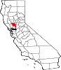
Yolo — Unincorporated community — Location in California
 Yolo
YoloCoordinates: 38°43′55″N 121°48′28″W / 38.73194°N 121.80778°WCoordinates: 38°43′55″N 121°48′28″W / 38.73194°N 121.80778°W Country  United States
State  California
County Yolo County Area[1] – Total 1.380 sq mi (3.574 km2) – Land 1.380 sq mi (3.574 km2) – Water 0 sq mi (0 km2) 0% Elevation[2] 82 ft (25 m) Population (2010) – Total 450 – Density 326.1/sq mi (125.9/km2) Time zone Pacific (PST) (UTC-8) – Summer (DST) PDT (UTC-7) ZIP Code GNIS feature IDs 1660214; 2583187 U.S. Geological Survey Geographic Names Information System: Yolo, California; U.S. Geological Survey Geographic Names Information System: Yolo, California Yolo (formerly, Cacheville, Cochran's Crossing, Cochranes Crossing, Hutton's Ranch, and Travelers Home) is an unincorporated community and census-designated place[3] in Yolo County, California. It is located 5 miles northwest of the county seat, Woodland. Yolo's ZIP Code is 95697 and its area code 530. It lies at an elevation of 82 feet (25 m). The population was 450 at the 2010 census.
Contents
History
The town of Yolo was originally called Cochran's Crossing after its founder Thomas Cochran. Cochran settled there most likely in 1849, building a hotel. This hotel drew the Yolo Post Office on February 3, 1853. Cochran sold his 160 acres (65 ha) in 1855 to William Hammock, who was residing on the property, and who at one point would run the area hotel. Hammock sold part of this newly obtained land to his business partner, James A. Hutton, in February 1856. Hutton was later appointed as the postmaster, as well as elected County Judge. The town was known as Hutton's in the 1855 General Election when only eight men voted.[4]
Hutton's was appointed as the County Seat on June 1, 1857 by the State Legislature, with the condition that the name of the town be changed to Cacheville.[4] The name Cacheville probably came from the nearby flowing Cache Creek stream. A town plat was recorded on October 10, 1857, and the County Seat title equated to expansion in the town. It was at this stage in 1857 when Yolo County's first weekly newspaper, the Yolo Democrat, was published.
A Protestant cemetery and chapel was built two miles north of Cacheville at the intersection of roads 15 and 98. This was built on land that was donated in the 1850s by Elizabeth Pockman. It is now called Mary's Chapel, and the current chapel building was built in 1900. The cemetery has graves dating from 1857.[4]
Cacheville lost the County Seat position to Washington in the General Election of September 1860. The County Court House was abandoned and was moved about two blocks away, to a lot donated by Hutton for use by the school and another organization. The area continued to grow despite the County Seat being moved away from it, and by 1870 there were 124 registered male voters.[4]
Education
Cache Creek High School, a continuation high school named after a nearby stream of water, is located in Yolo and is a part of the Woodland Joint Unified School District. Students residing in Yolo go to schools located in Woodland, unless high school students choose to attend Cache Creek.
Geography
According to the United States Census Bureau, the CDP covers an area of 1,4 square miles (3.6 km²), all of it land.
Demographics
The 2010 United States Census[5] reported that Yolo had a population of 450. The population density was 326.1 people per square mile (125.9/km²). The racial makeup of Yolo was 278 (61.8%) White, 0 (0.0%) African American, 9 (2.0%) Native American, 0 (0.0%) Asian, 0 (0.0%) Pacific Islander, 151 (33.6%) from other races, and 12 (2.7%) from two or more races. Hispanic or Latino of any race were 293 persons (65.1%).
The Census reported that 450 people (100% of the population) lived in households, 0 (0%) lived in non-institutionalized group quarters, and 0 (0%) were institutionalized.
There were 149 households, out of which 67 (45.0%) had children under the age of 18 living in them, 81 (54.4%) were opposite-sex married couples living together, 21 (14.1%) had a female householder with no husband present, 10 (6.7%) had a male householder with no wife present. There were 8 (5.4%) unmarried opposite-sex partnerships, and 1 (0.7%) same-sex married couples or partnerships. 30 households (20.1%) were made up of individuals and 11 (7.4%) had someone living alone who was 65 years of age or older. The average household size was 3.02. There were 112 families (75.2% of all households); the average family size was 3.49.
The population was spread out with 135 people (30.0%) under the age of 18, 33 people (7.3%) aged 18 to 24, 113 people (25.1%) aged 25 to 44, 128 people (28.4%) aged 45 to 64, and 41 people (9.1%) who were 65 years of age or older. The median age was 35.9 years. For every 100 females there were 90.7 males. For every 100 females age 18 and over, there were 85.3 males.
There were 165 housing units at an average density of 119.6 per square mile (46.2/km²), of which 71 (47.7%) were owner-occupied, and 78 (52.3%) were occupied by renters. The homeowner vacancy rate was 2.7%; the rental vacancy rate was 4.9%. 205 people (45.6% of the population) lived in owner-occupied housing units and 245 people (54.4%) lived in rental housing units.
References
- ^ U.S. Census
- ^ U.S. Geological Survey Geographic Names Information System: Yolo, California
- ^ U.S. Geological Survey Geographic Names Information System: Yolo, California
- ^ a b c d Three Maps of Yolo County. Woodland, CA: Yolo County Historical Society. 1970. pp. 5–6.
- ^ All data are derived from the United States Census Bureau reports from the 2010 United States Census, and are accessible on-line here. The data on unmarried partnerships and same-sex married couples are from the Census report DEC_10_SF1_PCT15. All other housing and population data are from Census report DEC_10_DP_DPDP1. Both reports are viewable online or downloadable in a zip file containing a comma-delimited data file. The area data, from which densities are calculated, are available on-line here. Percentage totals may not add to 100% due to rounding. The Census Bureau defines families as a household containing one or more people related to the householder by birth, opposite-sex marriage, or adoption. People living in group quarters are tabulated by the Census Bureau as neither owners nor renters. For further details, see the text files accompanying the data files containing the Census reports mentioned above.
- United States Geological Survey
- U.S. Geological Survey Geographic Names Information System: Yolo, California
Municipalities and communities of Yolo County, California Cities Davis | West Sacramento | Winters | Woodland
CDPs Clarksburg | Dunnigan | Esparto | Guinda | Knights Landing | Madison | Monument Hills | University of California, Davis | Yolo
Unincorporated
communitiesArcade | Arroz | Beatrice | Brooks | Browns Corner | Cadenasso | Capay | Central | Citrona | Conaway | Coniston | Daisie | Dufour | El Macero | El Rio Villa | Fremont | Green | Greendale | Hershey | Jacobs Corner | Kiesel | King Farms | Lovdal | Lund | Merritt | Mikon | Morgans Landing | Norton | Peethill | Plainfield | Riverview | Rumsey | Saxon | Sorroca | Sugarfield | Swingle | Tancred | Tyndall Landing | Valdez | Vin | Webster | Willow Point | Zamora
Ghost towns Categories:- Census-designated places in Yolo County, California
- Unincorporated communities in California
- Sacramento metropolitan area
- Former county seats in California


Wikimedia Foundation. 2010.