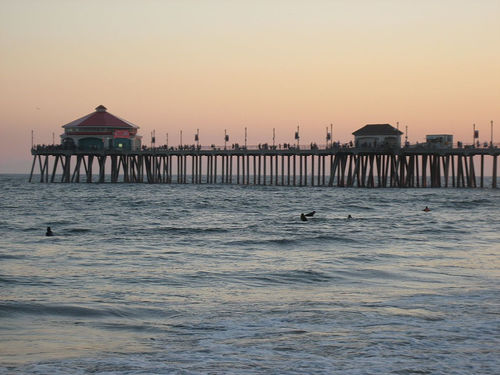
- Huntington Beach Pier
Infobox nrhp
name = Huntington Beach Municipal Pier
nrhp_type =

caption =
location = Main St. and Pacific Coast Highway.Huntington Beach, California
nearest_city =
latitude = 33.655093° N
longitude = 118.004193° W
latd = 33 |latm = 65 |lats = 51 |latNS = N
longd = 118 |longm = 0 |longs = 0 |longEW = W
area =
built =
architect = Moffatt & Nichol Engineers
architecture =
added =August 24 ,1989
visitation_num =
visitation_year =
refnum =89001203
mpsub =
governing_body = The Huntington Beach Pier is a municipal pier located inHuntington Beach, California . At convert|1850|ft|m in length, it is one of the longest publicpiers on the West Coast. (The longest isOceanside Pier at 1,942 feet). It has been damaged or destroyed four times; in 1912, 1939, 1983 and most recently onJanuary 17 ,1988 destroying the End Cafe for the second time in the decade. The most recent reincarnation of the pier is designed of steel-reinforced concrete to withstand convert|31|ft|m|sing=onwaves or a 7.0 magnitude earthquake and uses an increased space between piles to accommodatesurfers - as requested by the City. The pier slopes gently up toward the seaward end in a straight line which alternates with three octagonal platforms and one rotated square (108 feet on a side) that forms a diamond at the pier's seaward end. Not only is the pier structurally sound, it also retains a number of design elements from the original pier including haunches at the pile caps and corbels supporting light standards.The pier is frequented by sport fishermen as well as
surfing spectators. ARuby's is located at the end of the pier.
Wikimedia Foundation. 2010.
