- National Register of Historic Places listings in Butte County, California
-
This list includes properties and districts listed on the National Register of Historic Places in Butte County, California. Click the "Map of all coordinates" link to the right to view a Google map of all properties and districts with latitude and longitude coordinates in the table below.[1]
-
- This National Park Service list is complete through NPS recent listings posted November 10, 2011.[2]
[3] Landmark name [4] Image Date listed Location City or town Summary 1 Allen-Sommer-Gage House April 13, 1977 410 Normal St.
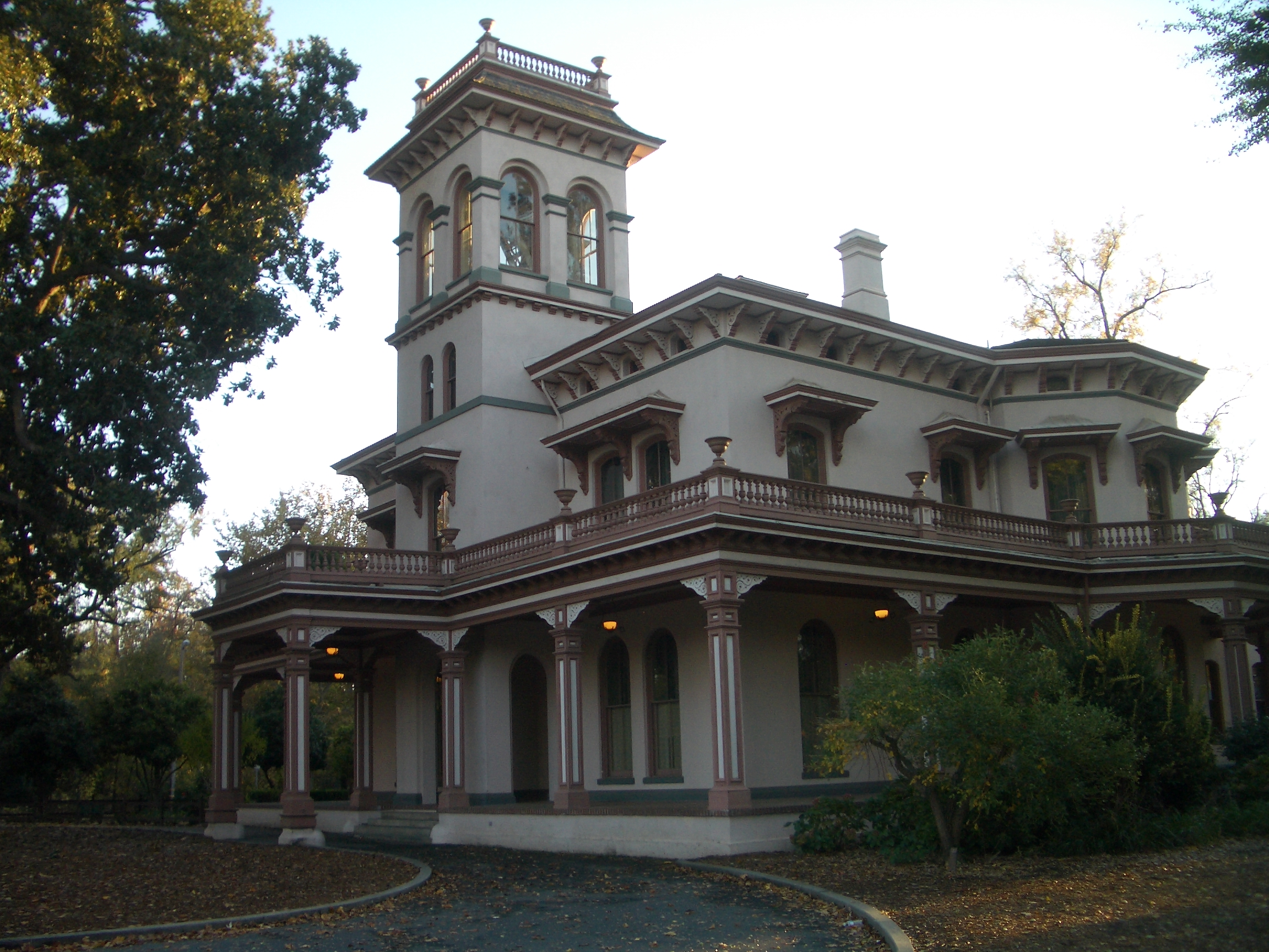
39°43′36″N 121°50′25″W / 39.726667°N 121.840278°WChico 2 Bidwell Mansion 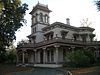
March 24, 1972 Sowillenno Ave.
39°43′59″N 121°50′32″W / 39.733056°N 121.842222°WChico 3 Centerville Schoolhouse March 24, 1972 2 mi. NE of Paradise on Humbug Rd.
39°47′17″N 121°39′17″W / 39.788056°N 121.654722°WParadise 4 A. H. Chapman House January 28, 1982 256 E. 12th St.
39°43′30″N 121°50′27″W / 39.725°N 121.840833°WChico 5 W. W. Durham House April 2, 1992 2280 Durham-Dayton Rd.
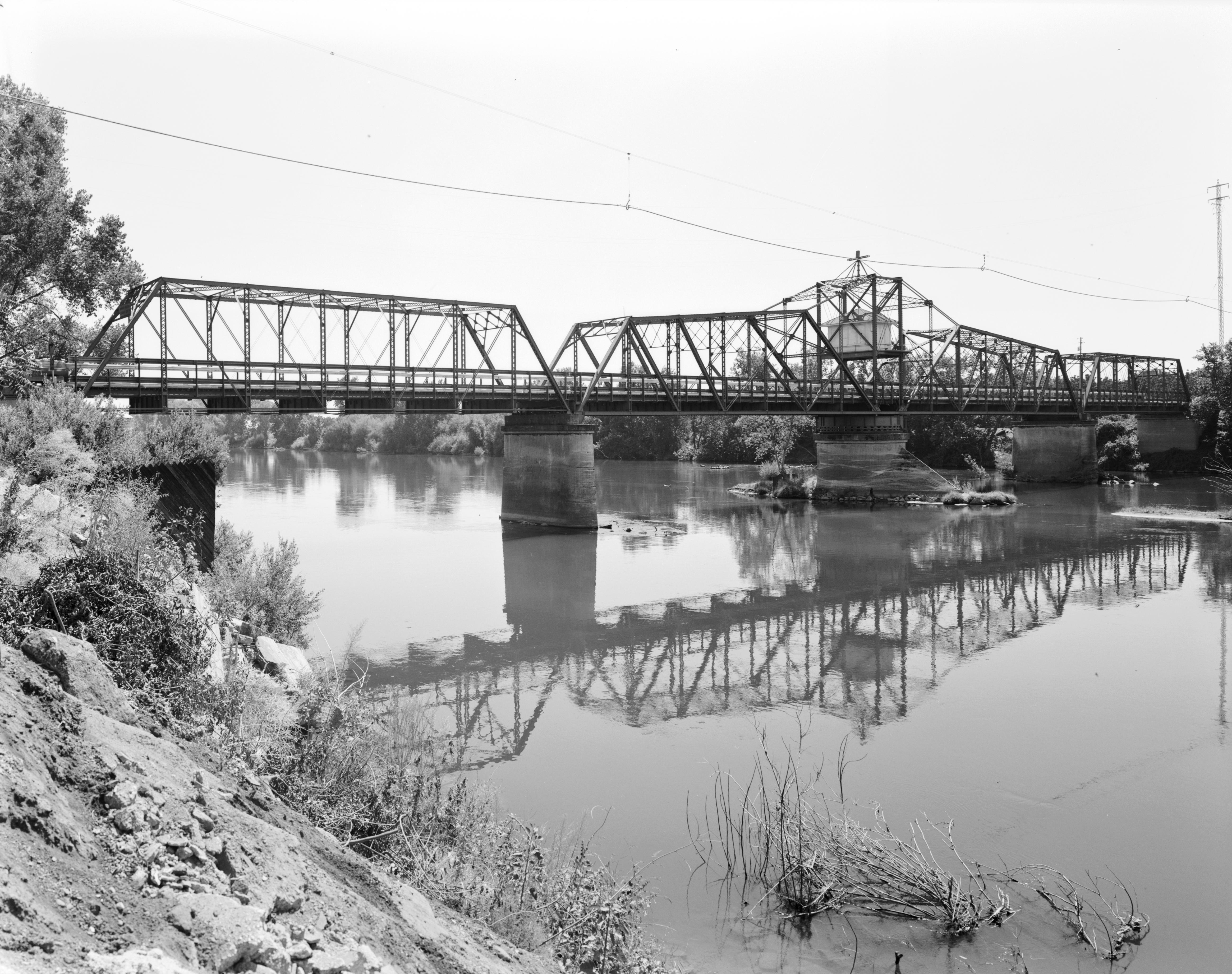
39°38′48″N 121°47′36″W / 39.646667°N 121.793333°WDurham 6 Forks of Butte January 2, 2004 Travel northeast on State Highway 32 from Chico, 20 miles to Forest Ranch, then southeast on Doe Mill Road (graded dirt road), three and one-half miles to Butte Creek trailhead. Paradise 7 Gianella Bridge 
July 8, 1982 CA 32
39°45′04″N 121°59′46″W / 39.751111°N 121.996111°WHamilton City Demolished in 1987.[5] 8 Hazel Hotel 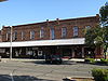
July 13, 2001 850, 860, 880, 890 Hazel St., and 602,608, 620 Kentuckey
39°21′54″N 121°41′43″W / 39.365°N 121.695278°WGridley 9 Honey Run Covered Bridge 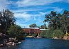
June 23, 1988 Honey Run Humbug Rd.
39°43′44″N 121°42′09″W / 39.728889°N 121.7025°WChico 10 Inskip Hotel May 2, 1975 6 mi. N of Stirling on Skyway (Old Humbug Rd.)
39°59′N 121°32′W / 39.99°N 121.54°WStirling City 11 Fong Lee Company March 11, 1982 1500 Broderick Street Oroville 12 Magalia Community Church January 11, 1982 Stirling Hwy.
39°48′36″N 121°34′40″W / 39.81°N 121.577778°WMagalia 13 Mud Creek Canyon August 14, 1973 Address Restricted Chico 14 Oroville Carnegie Library May 8, 2007 1675 Montgomery St.
39°30′46″N 121°33′28″W / 39.512778°N 121.557778°WOroville 15 Oroville Chinese Temple 
July 30, 1976 1500 Broderick St.
39°30′49″N 121°33′39″W / 39.513611°N 121.560833°WOroville 16 Oroville Commercial District (old) 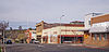
July 28, 1983 Montgomery, Myers and Huntoon Sts. and Miner Alley
39°30′50″N 121°33′19″W / 39.513889°N 121.555278°WOroville 17 Oroville Inn September 13, 1990 2066 Bird St.
39°25′23″N 121°33′17″W / 39.423056°N 121.554722°WOroville 18 Patrick Ranch House February 23, 1972 3 mi. SE of Chico off U.S. 99E
39°40′55″N 121°48′00″W / 39.681944°N 121.8°WChico 19 Patrick Rancheria February 23, 1972 Address Restricted Chico 20 Silberstein Park Building 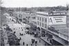
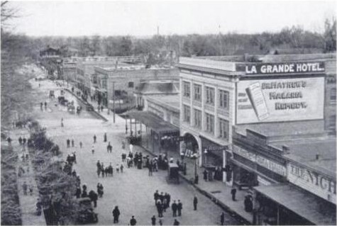
February 17, 1983 426, 430, 434 Broadway
39°43′41″N 121°50′17″W / 39.728056°N 121.838056°WChico Downtown building designed by A.J. Byron, and used as a movie theater, The Lyric, and La Grande Hotel. 21 South Campus Neighborhood June 24, 1991 Bounded by W. 2nd, Normal, W. 6th and Cherry Sts.
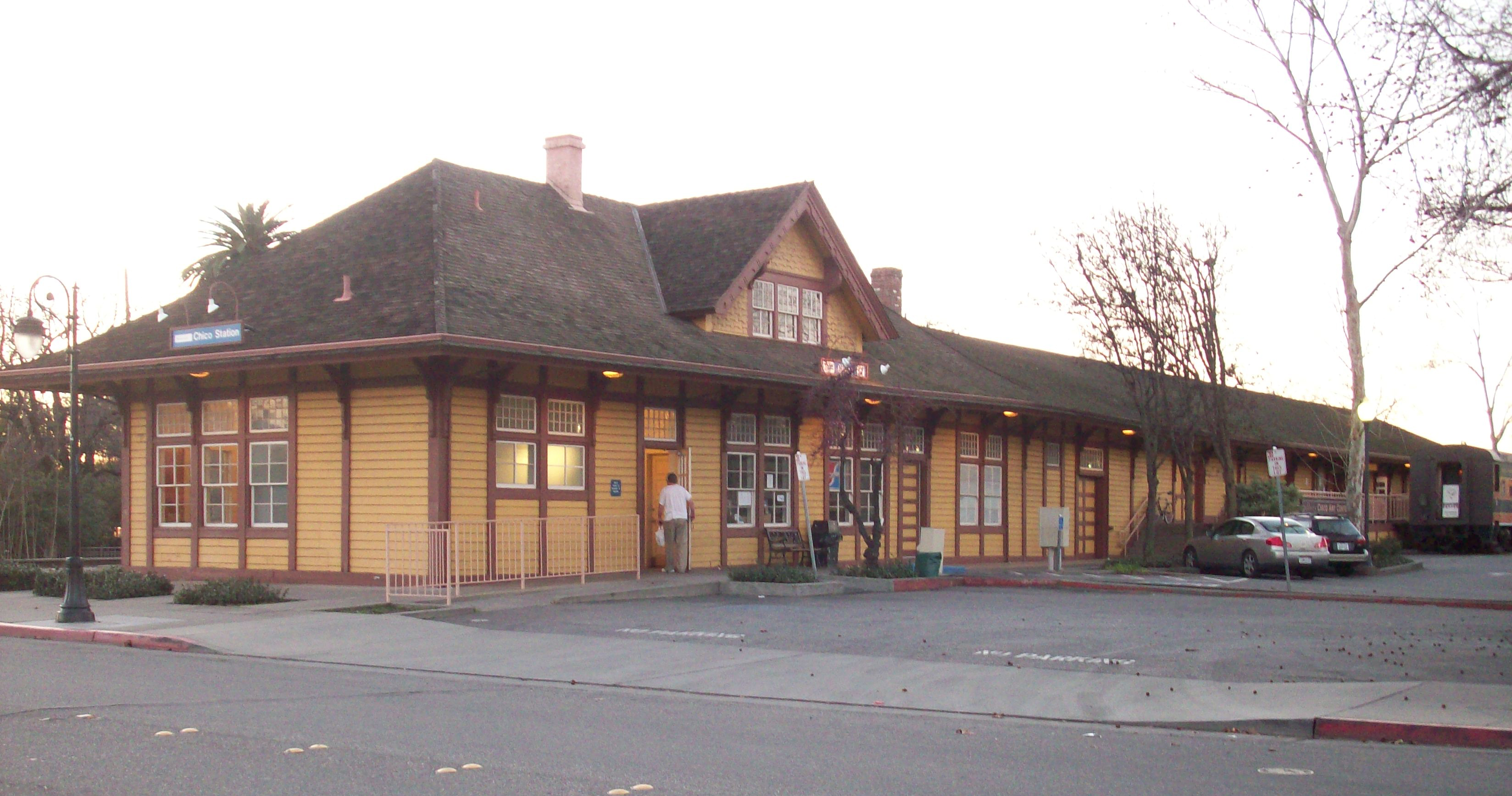
39°43′34″N 121°50′30″W / 39.726111°N 121.841667°WChico 22 Southern Pacific Depot 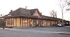
January 29, 1987 430 Orange St.
39°43′24″N 121°50′42″W / 39.723333°N 121.845°WChico 23 St. John's Episcopal Church January 21, 1982 230 Salem St.
39°43′44″N 121°50′25″W / 39.728889°N 121.840278°WChico 24 Stansbury House June 5, 1975 307 W. 5th St.
39°43′37″N 121°50′19″W / 39.726944°N 121.838611°WChico 25 State Theatre September 13, 1991 1489 Myers St.
39°30′44″N 121°33′14″W / 39.512222°N 121.553889°WOroville 26 Chico Midtown Station January 11, 1985 141 W. 5th St.
39°43′39″N 121°50′16″W / 39.7275°N 121.837778°WChico 27 US Post Office-Oroville Main January 11, 1985 1735 Robinson St.
39°30′50″N 121°33′21″W / 39.513889°N 121.555833°WOroville See also
References
- ^ The latitude and longitude information provided in this table was derived originally from the National Register Information System, which has been found to be fairly accurate for about 99% of listings. For about 1% of NRIS original coordinates, experience has shown that one or both coordinates are typos or otherwise extremely far off; some corrections may have been made. A more subtle problem causes many locations to be off by up to 150 yards, depending on location in the country: most NRIS coordinates were derived from tracing out latitude and longitudes off of USGS topographical quadrant maps created under the North American Datum of 1927, which differs from the current, highly accurate WGS84 GPS system used by Google maps. Chicago is about right, but NRIS longitudes in Washington are higher by about 4.5 seconds, and are lower by about 2.0 seconds in Maine. Latitudes differ by about 1.0 second in Florida. Some locations in this table may have been corrected to current GPS standards.
- ^ "National Register of Historic Places: Weekly List Actions". National Park Service, United States Department of the Interior. Retrieved on November 10, 2011.
- ^ Numbers represent an ordering by significant words. Various colorings, defined here, differentiate National Historic Landmark sites and National Register of Historic Places Districts from other NRHP buildings, structures, sites or objects.
- ^ "National Register Information System". National Register of Historic Places. National Park Service. . http://nrhp.focus.nps.gov/natreg/docs/All_Data.html.
- ^ http://www.orovillemr.com/news/ci_18659398
U.S. National Register of Historic Places Topics Lists by states Alabama • Alaska • Arizona • Arkansas • California • Colorado • Connecticut • Delaware • Florida • Georgia • Hawaii • Idaho • Illinois • Indiana • Iowa • Kansas • Kentucky • Louisiana • Maine • Maryland • Massachusetts • Michigan • Minnesota • Mississippi • Missouri • Montana • Nebraska • Nevada • New Hampshire • New Jersey • New Mexico • New York • North Carolina • North Dakota • Ohio • Oklahoma • Oregon • Pennsylvania • Rhode Island • South Carolina • South Dakota • Tennessee • Texas • Utah • Vermont • Virginia • Washington • West Virginia • Wisconsin • WyomingLists by territories Lists by associated states Other Municipalities and communities of Butte County, California Cities and towns 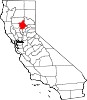
CDPs Bangor | Berry Creek | Butte Creek Canyon | Butte Meadows | Butte Valley | Cherokee | Clipper Mills | Cohasset | Concow | Durham | Forbestown | Forest Ranch | Honcut | Kelly Ridge | Magalia | Nord | Oroville East | Palermo | Rackerby | Richvale | Robinson Mill | South Oroville | Stirling City | Thermalito | Yankee Hill
Unincorporated
communitiesAnita | Barber | Big Bar | Big Bend | Blavo | Brush Creek | Camp Eighteen | Cana | Centerville | Chapmantown | Craig | Cresta | Dayton | Deadwood | DeSabla | Dodge Place | Dodgeland | East Biggs | East Gridley | Elsey | Esquon | Fagan | Feather Falls | Helltown | Hughes Place | Hurleton | Inskip | Irish Town | James | Jonesville | Junction House | Kister | Kramm | Lomo | Lovelock | Lumpkin | Mayaro | Merrills Landing | Merrimac | Mineral Slide | Nelson | Nelsons Crossing | Nimshew | Oak Grove | Old Forbestown | Oregon City | Oroleve | Oroville Junction | Paradise Pines | Parkhill | Peachton | Pentz | Poe | Powellton | Pulga | Ramada | Rancho Llano Seco | Riceton | Richardson Springs | Robinsons Corner | Roble | Rogerville | Shippee | Stirling Junction | Sunnyslope | The Pines | Toadtown | Vista Robles | Wicks Corner | Wyandotte
Ghost towns Appleton | Avon | Bagdad | Bauka | Bayu | Berdan | Bidwell | Bidwell's Bar | Big Ripples | Blinzing | Bloomer | Brush | Butte Creek | Center Ville | Chandon | Channel | Chardon | Clear Creek | Colbys Landing | Coutolenc | Craig | Crouch | David | Dawlytown | Diamondville | Dredge | Enterprise | Eskini | Evans | Evansville | Flea Valley | Gimbal | Gold Lake | Greenland | Gridley Colony Number One | Gridley Colony Number Two | Hamilton | Haselbusch | Hawk Ravine | Hokomo | Holhoto | Honcut City | Hume | Hylandville | Intake | Isaiah | Johnson | Kalkalya | Kulaiapto | Land | Las Plumas | Lava Beds | Long's Bar | Lorraine | Losee | Luce | Lynchburg | Martinsburgh | McKay Meadow | Michopdo | Mill City | Millers Ranch | Mortimer | Moseley | Mulberry | Neals Diggins | Nelson Bar | New Blinzing | Oak Arbor | Ololopa | Omit Bar | Optimo | Oregon Bar | Orloff | Ostrander | Otaki | Pacific Heights | Paki | Paradise Flat | Phillips Corner | Pipers | Platts | Pond | Potter's Bar | Powellton Meadow | Quartz | Richland | Rio Seco | Rock Creek | Savona | Soto | South Fork | Speedway | Stanwood | Summit | Sundale | Sunusi | Swayne | Swedes Flat | Sycamore Crossing | Tadoiko | Taikus | Tarr's Ranch | Tilden | Tolle's Old Diggings | Totoma | Tsuka | Virginia Mills | Wagners | Wagstaff | Ward | West Branch | Whiskey Flat (east) | Whiskey Flat (west) | Yankee Flat | Yauko | Yuman
Categories:- Butte County, California
- National Register of Historic Places in California by county
- Lists of National Register of Historic Places in California
-


Wikimedia Foundation. 2010.