- Dayton, California
-
For the former town in Lassen County with this name, see Dayton, Lassen County, California.
Coordinates: 39°38′55″N 121°52′20″W / 39.64861°N 121.87222°W
Dayton — Unincorporated community — Location in California
 Dayton
Coordinates: 39°38′55″N 121°52′20″W / 39.64861°N 121.87222°W Country United States State California County Butte County Elevation[1] 141 ft (43 m) Dayton (formerly, Day Town and Grainland) is a small unincorporated community in Butte County, California. Its zip code is 95926 and its area code is 530. It lies at an elevation of 141 feet (43 m).
Contents
History
Dayton was first settled by Joseph Wiggins and Samuel Van Ness in 1859. In 1868 a listing of the businesses in Dayton included 1 brothel, 1 hotel, 2 bars, smithy, school, and a church. Its importance as a trading center declined as Durham grew after the California and Oregon Railroad was completed through Butte County.[2]
The Grainland post office was established in 1867 and closed later that year; it was reopened in 1873, closed again in 1892, reopened in 1893, and closed for good in 1902.[3]
Government
County
State
The citizens of Dayton, as members of California's 3rd Assembly District, are represented by Rick Keene (R, Chico) in the California State Assembly; and as members of California's 4th Senate District, are represented by Doug LaMalfa (R, Grass Valley) in the California State Senate.
Federal
The citizens of Dayton, as members of California's 2nd congressional district (which has a PVI of R +13[4]) are represented by Wally Herger (R, Rio Oso) in the United States House of Representatives.
References
- ^ U.S. Geological Survey Geographic Names Information System: Dayton, California
- ^ http://history.sloco.net/Butte1882.html The History of Butte County California
- ^ Durham, David L. (1998). California's Geographic Names: A Gazetteer of Historic and Modern Names of the State. Quill Driver Books. p. 221. ISBN 9781884995149.
- ^ "Will Gerrymandered Districts Stem the Wave of Voter Unrest?". Campaign Legal Center Blog. http://www.clcblog.org/blog_item-85.html. Retrieved 2007-10-20.
Municipalities and communities of Butte County, California Cities and towns 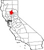
CDPs Bangor | Berry Creek | Butte Creek Canyon | Butte Meadows | Butte Valley | Cherokee | Clipper Mills | Cohasset | Concow | Durham | Forbestown | Forest Ranch | Honcut | Kelly Ridge | Magalia | Nord | Oroville East | Palermo | Rackerby | Richvale | Robinson Mill | South Oroville | Stirling City | Thermalito | Yankee Hill
Unincorporated
communitiesAnita | Barber | Big Bar | Big Bend | Blavo | Brush Creek | Camp Eighteen | Cana | Centerville | Chapmantown | Craig | Cresta | Dayton | Deadwood | DeSabla | Dodge Place | Dodgeland | East Biggs | East Gridley | Elsey | Esquon | Fagan | Feather Falls | Helltown | Hughes Place | Hurleton | Inskip | Irish Town | James | Jonesville | Junction House | Kister | Kramm | Lomo | Lovelock | Lumpkin | Mayaro | Merrills Landing | Merrimac | Mineral Slide | Nelson | Nelsons Crossing | Nimshew | Oak Grove | Old Forbestown | Oregon City | Oroleve | Oroville Junction | Paradise Pines | Parkhill | Peachton | Pentz | Poe | Powellton | Pulga | Ramada | Rancho Llano Seco | Riceton | Richardson Springs | Robinsons Corner | Roble | Rogerville | Shippee | Stirling Junction | Sunnyslope | The Pines | Toadtown | Vista Robles | Wicks Corner | Wyandotte
Ghost towns Appleton | Avon | Bagdad | Bauka | Bayu | Berdan | Bidwell | Bidwell's Bar | Big Ripples | Blinzing | Bloomer | Brush | Butte Creek | Center Ville | Chandon | Channel | Chardon | Clear Creek | Colbys Landing | Coutolenc | Craig | Crouch | David | Dawlytown | Diamondville | Dredge | Enterprise | Eskini | Evans | Evansville | Flea Valley | Gimbal | Gold Lake | Greenland | Gridley Colony Number One | Gridley Colony Number Two | Hamilton | Haselbusch | Hawk Ravine | Hokomo | Holhoto | Honcut City | Hume | Hylandville | Intake | Isaiah | Johnson | Kalkalya | Kulaiapto | Land | Las Plumas | Lava Beds | Long's Bar | Lorraine | Losee | Luce | Lynchburg | Martinsburgh | McKay Meadow | Michopdo | Mill City | Millers Ranch | Mortimer | Moseley | Mulberry | Neals Diggins | Nelson Bar | New Blinzing | Oak Arbor | Ololopa | Omit Bar | Optimo | Oregon Bar | Orloff | Ostrander | Otaki | Pacific Heights | Paki | Paradise Flat | Phillips Corner | Pipers | Platts | Pond | Potter's Bar | Powellton Meadow | Quartz | Richland | Rio Seco | Rock Creek | Savona | Soto | South Fork | Speedway | Stanwood | Summit | Sundale | Sunusi | Swayne | Swedes Flat | Sycamore Crossing | Tadoiko | Taikus | Tarr's Ranch | Tilden | Tolle's Old Diggings | Totoma | Tsuka | Virginia Mills | Wagners | Wagstaff | Ward | West Branch | Whiskey Flat (east) | Whiskey Flat (west) | Yankee Flat | Yauko | Yuman
Categories:- Populated places in Butte County, California
- Unincorporated communities in California
- Butte County, California geography stubs


Wikimedia Foundation. 2010.