- Big Bar, Butte County, California
-
Coordinates: 39°48′20″N 121°26′17″W / 39.80556°N 121.43806°W
- For the community formerly of this name, see Pulga, California.
Big Bar — Unincorporated community — Location in California
 Big Bar
Coordinates: 39°48′20″N 121°26′17″W / 39.80556°N 121.43806°W Country United States State California County Butte County Elevation[1] 1,414 ft (431 m) Big Bar (formerly, Montreal Bar and Pulga Bar) is an unincorporated community in Butte County, California, on the North Fork of the Feather River, 0.5 mi (0.8 km) east of Pulga.[2] It lies at an elevation of 1414 feet (431 m).
References
- ^ U.S. Geological Survey Geographic Names Information System: Big Bar, Butte County, California
- ^ Durham, David L. (1998). California's Geographic Names: A Gazetteer of Historic and Modern Names of the State. Quill Driver Books. p. 194. ISBN 9781884995149.
Municipalities and communities of Butte County, California Cities and towns 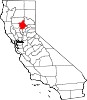
CDPs Bangor | Berry Creek | Butte Creek Canyon | Butte Meadows | Butte Valley | Cherokee | Clipper Mills | Cohasset | Concow | Durham | Forbestown | Forest Ranch | Honcut | Kelly Ridge | Magalia | Nord | Oroville East | Palermo | Rackerby | Richvale | Robinson Mill | South Oroville | Stirling City | Thermalito | Yankee Hill
Unincorporated
communitiesAnita | Barber | Big Bar | Big Bend | Blavo | Brush Creek | Camp Eighteen | Cana | Centerville | Chapmantown | Craig | Cresta | Dayton | Deadwood | DeSabla | Dodge Place | Dodgeland | East Biggs | East Gridley | Elsey | Esquon | Fagan | Feather Falls | Helltown | Hughes Place | Hurleton | Inskip | Irish Town | James | Jonesville | Junction House | Kister | Kramm | Lomo | Lovelock | Lumpkin | Mayaro | Merrills Landing | Merrimac | Mineral Slide | Nelson | Nelsons Crossing | Nimshew | Oak Grove | Old Forbestown | Oregon City | Oroleve | Oroville Junction | Paradise Pines | Parkhill | Peachton | Pentz | Poe | Powellton | Pulga | Ramada | Rancho Llano Seco | Riceton | Richardson Springs | Robinsons Corner | Roble | Rogerville | Shippee | Stirling Junction | Sunnyslope | The Pines | Toadtown | Vista Robles | Wicks Corner | Wyandotte
Ghost towns Appleton | Avon | Bagdad | Bauka | Bayu | Berdan | Bidwell | Bidwell's Bar | Big Ripples | Blinzing | Bloomer | Brush | Butte Creek | Center Ville | Chandon | Channel | Chardon | Clear Creek | Colbys Landing | Coutolenc | Craig | Crouch | David | Dawlytown | Diamondville | Dredge | Enterprise | Eskini | Evans | Evansville | Flea Valley | Gimbal | Gold Lake | Greenland | Gridley Colony Number One | Gridley Colony Number Two | Hamilton | Haselbusch | Hawk Ravine | Hokomo | Holhoto | Honcut City | Hume | Hylandville | Intake | Isaiah | Johnson | Kalkalya | Kulaiapto | Land | Las Plumas | Lava Beds | Long's Bar | Lorraine | Losee | Luce | Lynchburg | Martinsburgh | McKay Meadow | Michopdo | Mill City | Millers Ranch | Mortimer | Moseley | Mulberry | Neals Diggins | Nelson Bar | New Blinzing | Oak Arbor | Ololopa | Omit Bar | Optimo | Oregon Bar | Orloff | Ostrander | Otaki | Pacific Heights | Paki | Paradise Flat | Phillips Corner | Pipers | Platts | Pond | Potter's Bar | Powellton Meadow | Quartz | Richland | Rio Seco | Rock Creek | Savona | Soto | South Fork | Speedway | Stanwood | Summit | Sundale | Sunusi | Swayne | Swedes Flat | Sycamore Crossing | Tadoiko | Taikus | Tarr's Ranch | Tilden | Tolle's Old Diggings | Totoma | Tsuka | Virginia Mills | Wagners | Wagstaff | Ward | West Branch | Whiskey Flat (east) | Whiskey Flat (west) | Yankee Flat | Yauko | Yuman
Categories:- Butte County, California geography stubs
- Populated places in Butte County, California
- Unincorporated communities in California


Wikimedia Foundation. 2010.