- Nord, California
-
Nord — census-designated place — Location in California
 Nord
NordCoordinates: 39°46′47″N 121°57′26″W / 39.77972°N 121.95722°WCoordinates: 39°46′47″N 121°57′26″W / 39.77972°N 121.95722°W Country  United States
State  California
County Butte County Area[1] - Total 2.105 sq mi (5.453 km2) - Land 2.105 sq mi (5.453 km2) - Water 0 sq mi (0 km2) 0% Elevation[2] 151 ft (46 m) Population (2010) - Total 320 - Density 152/sq mi (58.7/km2) Time zone Pacific (PST) (UTC-8) - Summer (DST) PDT (UTC-7) ZIP Code 95973 Area code(s) 530 GNIS feature ID 1659766; 2612484 U.S. Geological Survey Geographic Names Information System: Nord, California; U.S. Geological Survey Geographic Names Information System: Nord, California Nord is a census-designated place[3] in Butte County, California. Its zip code is 95926 and its area code is 530. It lies at an elevation of 151 feet (46 m). Nord's population was 320 at the 2010 census.
Contents
History
A post office operated at Nord from 1871 to 1933, with an interruption from 1919 to 1920.[4]
Demographics
The 2010 United States Census[5] reported that Nord had a population of 320. The population density was 152.0 people per square mile (58.7/km²). The racial makeup of Nord was 233 (72.8%) White, 1 (0.3%) African American, 6 (1.9%) Native American, 16 (5.0%) Asian, 0 (0.0%) Pacific Islander, 48 (15.0%) from other races, and 16 (5.0%) from two or more races. Hispanic or Latino of any race were 122 persons (38.1%).
The Census reported that 320 people (100% of the population) lived in households, 0 (0%) lived in non-institutionalized group quarters, and 0 (0%) were institutionalized.
There were 104 households, out of which 42 (40.4%) had children under the age of 18 living in them, 65 (62.5%) were opposite-sex married couples living together, 5 (4.8%) had a female householder with no husband present, 6 (5.8%) had a male householder with no wife present. There were 7 (6.7%) unmarried opposite-sex partnerships, and 1 (1.0%) same-sex married couples or partnerships. 19 households (18.3%) were made up of individuals and 7 (6.7%) had someone living alone who was 65 years of age or older. The average household size was 3.08. There were 76 families (73.1% of all households); the average family size was 3.61.
The population was spread out with 83 people (25.9%) under the age of 18, 33 people (10.3%) aged 18 to 24, 79 people (24.7%) aged 25 to 44, 99 people (30.9%) aged 45 to 64, and 26 people (8.1%) who were 65 years of age or older. The median age was 36.5 years. For every 100 females there were 117.7 males. For every 100 females age 18 and over, there were 115.5 males.
There were 108 housing units at an average density of 51.3 per square mile (19.8/km²), of which 81 (77.9%) were owner-occupied, and 23 (22.1%) were occupied by renters. The homeowner vacancy rate was 0%; the rental vacancy rate was 4.2%. 247 people (77.2% of the population) lived in owner-occupied housing units and 73 people (22.8%) lived in rental housing units.
Government
County
State
The citizens of Nord, as members of California's 3rd Assembly District, are represented by Rick Keene (R, Chico) in the California State Assembly; and as members of California's 4th Senate District, are represented by Doug LaMalfa (R, Grass Valley) in the California State Senate.
Federal
The citizens of Nord, as members of California's 2nd congressional district (which has a PVI of R +13[6]) are represented by Wally Herger (R, Rio Oso) in the United States House of Representatives.
References
- ^ U.S. Census
- ^ U.S. Geological Survey Geographic Names Information System: Nord, California
- ^ U.S. Geological Survey Geographic Names Information System: Nord, California
- ^ Durham, David L. (1998). California's Geographic Names: A Gazetteer of Historic and Modern Names of the State. Quill Driver Books. p. 285. ISBN 9781884995149.
- ^ All data are derived from the United States Census Bureau reports from the 2010 United States Census, and are accessible on-line here. The data on unmarried partnerships and same-sex married couples are from the Census report DEC_10_SF1_PCT15. All other housing and population data are from Census report DEC_10_DP_DPDP1. Both reports are viewable online or downloadable in a zip file containing a comma-delimited data file. The area data, from which densities are calculated, are available on-line here. Percentage totals may not add to 100% due to rounding. The Census Bureau defines families as a household containing one or more people related to the householder by birth, opposite-sex marriage, or adoption. People living in group quarters are tabulated by the Census Bureau as neither owners nor renters. For further details, see the text files accompanying the data files containing the Census reports mentioned above.
- ^ "Will Gerrymandered Districts Stem the Wave of Voter Unrest?". Campaign Legal Center Blog. http://www.clcblog.org/blog_item-85.html. Retrieved 2007-10-20.
Municipalities and communities of Butte County, California Cities and towns 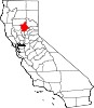
CDPs Bangor | Berry Creek | Butte Creek Canyon | Butte Meadows | Butte Valley | Cherokee | Clipper Mills | Cohasset | Concow | Durham | Forbestown | Forest Ranch | Honcut | Kelly Ridge | Magalia | Nord | Oroville East | Palermo | Rackerby | Richvale | Robinson Mill | South Oroville | Stirling City | Thermalito | Yankee Hill
Unincorporated
communitiesAnita | Barber | Big Bar | Big Bend | Blavo | Brush Creek | Camp Eighteen | Cana | Centerville | Chapmantown | Craig | Cresta | Dayton | Deadwood | DeSabla | Dodge Place | Dodgeland | East Biggs | East Gridley | Elsey | Esquon | Fagan | Feather Falls | Helltown | Hughes Place | Hurleton | Inskip | Irish Town | James | Jonesville | Junction House | Kister | Kramm | Lomo | Lovelock | Lumpkin | Mayaro | Merrills Landing | Merrimac | Mineral Slide | Nelson | Nelsons Crossing | Nimshew | Oak Grove | Old Forbestown | Oregon City | Oroleve | Oroville Junction | Paradise Pines | Parkhill | Peachton | Pentz | Poe | Powellton | Pulga | Ramada | Rancho Llano Seco | Riceton | Richardson Springs | Robinsons Corner | Roble | Rogerville | Shippee | Stirling Junction | Sunnyslope | The Pines | Toadtown | Vista Robles | Wicks Corner | Wyandotte
Ghost towns Appleton | Avon | Bagdad | Bauka | Bayu | Berdan | Bidwell | Bidwell's Bar | Big Ripples | Blinzing | Bloomer | Brush | Butte Creek | Center Ville | Chandon | Channel | Chardon | Clear Creek | Colbys Landing | Coutolenc | Craig | Crouch | David | Dawlytown | Diamondville | Dredge | Enterprise | Eskini | Evans | Evansville | Flea Valley | Gimbal | Gold Lake | Greenland | Gridley Colony Number One | Gridley Colony Number Two | Hamilton | Haselbusch | Hawk Ravine | Hokomo | Holhoto | Honcut City | Hume | Hylandville | Intake | Isaiah | Johnson | Kalkalya | Kulaiapto | Land | Las Plumas | Lava Beds | Long's Bar | Lorraine | Losee | Luce | Lynchburg | Martinsburgh | McKay Meadow | Michopdo | Mill City | Millers Ranch | Mortimer | Moseley | Mulberry | Neals Diggins | Nelson Bar | New Blinzing | Oak Arbor | Ololopa | Omit Bar | Optimo | Oregon Bar | Orloff | Ostrander | Otaki | Pacific Heights | Paki | Paradise Flat | Phillips Corner | Pipers | Platts | Pond | Potter's Bar | Powellton Meadow | Quartz | Richland | Rio Seco | Rock Creek | Savona | Soto | South Fork | Speedway | Stanwood | Summit | Sundale | Sunusi | Swayne | Swedes Flat | Sycamore Crossing | Tadoiko | Taikus | Tarr's Ranch | Tilden | Tolle's Old Diggings | Totoma | Tsuka | Virginia Mills | Wagners | Wagstaff | Ward | West Branch | Whiskey Flat (east) | Whiskey Flat (west) | Yankee Flat | Yauko | Yuman
Categories:- Census-designated places in Butte County, California
- Butte County, California geography stubs


Wikimedia Foundation. 2010.