- Feather Falls, California
-
Coordinates: 39°35′36″N 121°15′23″W / 39.59333°N 121.25639°W
Feather Falls — Unincorporated community — Location in California
 Feather Falls
Coordinates: 39°35′36″N 121°15′23″W / 39.59333°N 121.25639°W Country United States State California County Butte County Elevation[1] 2,982 ft (909 m) Feather Falls (formerly, Mooretown[2], Moresville[2] and Feather River[3]) is a rural unincorporated community in Butte County, California north and east of Lake Oroville. It lies at an elevation of 2982 feet (909 m).[2] It is home to Feather Falls Elementary School, a K-8 facility. It takes its name from nearby Feather Falls, the sixth highest waterfall in the United States.
There are large forested areas with not many towns on maps of the area. This part of the county is partly inside of Plumas National Forest. Three other small communities are about five miles (8 km) distant in different directions. Camp Eighteen lies 4.9 miles (7.9 km) distant at 61 degrees off true North, straight-line distance. Clipper Mills is about 6.5 miles (10.5 km) at 128 degrees off true North. Forbestown is roughly 5.3 miles (8.5 km) at 188 degrees off true North.
The US Geological Survey defines it as a populated place with a feature ID of 1656010. The community is 2,980 feet (910 m) above mean sea level. The area is inside area code 530. The community's ZIP code is 95940, which is shared with part of Oroville.
History
The Mooretown post office operated from 1888 to 1913. The Feather River post office opened for a time in 1919, and was re-established in 1921. The name was changed to Feather Falls that same year, and moved to its present location in 1938.[3]
In history, the community was called Mooretown and Moresville according to the US Geological Survey.
Other nearby communities to the north and east along Lumpkin Road are named Lumpkin and Rogerville.
References
- ^ U.S. Geological Survey Geographic Names Information System: Feather Falls, California
- ^ a b c U.S. Geological Survey Geographic Names Information System: Feather Falls, California
- ^ a b Durham, David L. (1998). California's Geographic Names: A Gazetteer of Historic and Modern Names of the State. Quill Driver Books. p. 234. ISBN 9781884995149.
- U.S. Geological Survey Geographic Names Information System: Feather Falls, California
- US Geological Survey, National Geographic Names Database
- Map: Forbestown, California, 7.5 minute quadrangle, 1994, US Geological Survey.
- Map: Clipper Mills, California, 7.5 minute quadrangle, 1994, US Geological Survey.
Municipalities and communities of Butte County, California Cities and towns 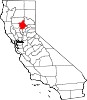
CDPs Bangor | Berry Creek | Butte Creek Canyon | Butte Meadows | Butte Valley | Cherokee | Clipper Mills | Cohasset | Concow | Durham | Forbestown | Forest Ranch | Honcut | Kelly Ridge | Magalia | Nord | Oroville East | Palermo | Rackerby | Richvale | Robinson Mill | South Oroville | Stirling City | Thermalito | Yankee Hill
Unincorporated
communitiesAnita | Barber | Big Bar | Big Bend | Blavo | Brush Creek | Camp Eighteen | Cana | Centerville | Chapmantown | Craig | Cresta | Dayton | Deadwood | DeSabla | Dodge Place | Dodgeland | East Biggs | East Gridley | Elsey | Esquon | Fagan | Feather Falls | Helltown | Hughes Place | Hurleton | Inskip | Irish Town | James | Jonesville | Junction House | Kister | Kramm | Lomo | Lovelock | Lumpkin | Mayaro | Merrills Landing | Merrimac | Mineral Slide | Nelson | Nelsons Crossing | Nimshew | Oak Grove | Old Forbestown | Oregon City | Oroleve | Oroville Junction | Paradise Pines | Parkhill | Peachton | Pentz | Poe | Powellton | Pulga | Ramada | Rancho Llano Seco | Riceton | Richardson Springs | Robinsons Corner | Roble | Rogerville | Shippee | Stirling Junction | Sunnyslope | The Pines | Toadtown | Vista Robles | Wicks Corner | Wyandotte
Ghost towns Appleton | Avon | Bagdad | Bauka | Bayu | Berdan | Bidwell | Bidwell's Bar | Big Ripples | Blinzing | Bloomer | Brush | Butte Creek | Center Ville | Chandon | Channel | Chardon | Clear Creek | Colbys Landing | Coutolenc | Craig | Crouch | David | Dawlytown | Diamondville | Dredge | Enterprise | Eskini | Evans | Evansville | Flea Valley | Gimbal | Gold Lake | Greenland | Gridley Colony Number One | Gridley Colony Number Two | Hamilton | Haselbusch | Hawk Ravine | Hokomo | Holhoto | Honcut City | Hume | Hylandville | Intake | Isaiah | Johnson | Kalkalya | Kulaiapto | Land | Las Plumas | Lava Beds | Long's Bar | Lorraine | Losee | Luce | Lynchburg | Martinsburgh | McKay Meadow | Michopdo | Mill City | Millers Ranch | Mortimer | Moseley | Mulberry | Neals Diggins | Nelson Bar | New Blinzing | Oak Arbor | Ololopa | Omit Bar | Optimo | Oregon Bar | Orloff | Ostrander | Otaki | Pacific Heights | Paki | Paradise Flat | Phillips Corner | Pipers | Platts | Pond | Potter's Bar | Powellton Meadow | Quartz | Richland | Rio Seco | Rock Creek | Savona | Soto | South Fork | Speedway | Stanwood | Summit | Sundale | Sunusi | Swayne | Swedes Flat | Sycamore Crossing | Tadoiko | Taikus | Tarr's Ranch | Tilden | Tolle's Old Diggings | Totoma | Tsuka | Virginia Mills | Wagners | Wagstaff | Ward | West Branch | Whiskey Flat (east) | Whiskey Flat (west) | Yankee Flat | Yauko | Yuman
Categories:- Populated places in Butte County, California
- Unincorporated communities in California
- Butte County, California geography stubs


Wikimedia Foundation. 2010.