- Mebane, North Carolina
-
Mebane, North Carolina — City — 
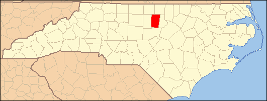
SealLocation within the state of North Carolina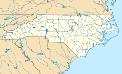
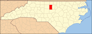
 Mebane, North Carolina
Coordinates: 36°5′45″N 79°16′15″W / 36.09583°N 79.27083°WCoordinates: 36°5′45″N 79°16′15″W / 36.09583°N 79.27083°W Country United States State North Carolina Counties Alamance, Orange Area - Total 5.9 sq mi (15.2 km2) - Land 5.9 sq mi (15.2 km2) - Water 0.0 sq mi (0.0 km2) Elevation 673 ft (205 m) Population (2008) - Total 10,624 - Density 1,244.2/sq mi (480.4/km2) Time zone Eastern (EST) (UTC-5) - Summer (DST) EDT (UTC-4) ZIP code 27302 Area code(s) 919 FIPS code 37-42240[1] GNIS feature ID 1021404[2] Mebane (/ˈmɛbən/) is a city located mostly in Alamance County, North Carolina, United States, with a part of it in Orange County, North Carolina. It is part of the Burlington, North Carolina Metropolitan Statistical Area. The current population estimate (2008) is 10,624.[3] According to the Official website of Mebane, NC, the town was named for General Alexander Mebane, Jr., a Revolutionary War figure and member of the U. S. Congress. It was incorporated as Mebanesville in 1881, then the name was changed to Mebane. In 1987, the official name became the City of Mebane.
Contents
Geography
Mebane is located at 36°5′45″N 79°16′15″W / 36.09583°N 79.27083°W (36.095957, -79.270861).[4] According to the United States Census Bureau, the city has a total area of 5.8 square miles (15.2 km²).None of the area is covered with water, except for Lake Michael and a few scattered ponds.
Demographics
As of the census[1] of 2000, there were 7,284 people, 2,936 households, and 2,040 families residing in the city. The population density was 1,244.2 people per square mile (480.7/km²). There were 3,246 housing units at an average density of 554.5 per square mile (214.2/km²). The racial makeup of the city was 77.40% White, 17.48% African American, 0.23% Native American, 0.62% Asian, 0.01% Pacific Islander, 2.88% from other races, and 1.37% from two or more races. Hispanic or Latino of any race were 5.24% of the population.
There were 2,936 households out of which 35.9% had children under the age of 18 living with them, 50.6% were married couples living together, 15.4% had a female householder with no husband present, and 30.5% were non-families. 25.7% of all households were made up of individuals and 8.5% had someone living alone who was 65 years of age or older. The average household size was 2.48 and the average family size was 2.98. In the city the population was spread out with 27.0% under the age of 18, 8.1% from 18 to 24, 34.5% from 25 to 44, 19.8% from 45 to 64, and 10.6% who were 65 years of age or older. The median age was 34 years. For every 100 females there were 91.5 males. For every 100 females age 18 and over, there were 86.1 males. The median income for a household in the city was $39,524, and the median income for a family was $47,672. Males had a median income of $37,889 versus $26,126 for females. The per capita income for the city was $20,315. About 9.3% of families and 11.8% of the population were below the poverty line, including 14.0% of those under age 18 and 16.4% of those age 65 or over.
Telephone service
Because of its unique location, Mebane straddles both the Research Triangle and the Piedmont Triad areas of North Carolina. However, a majority of the phone numbers listed for that city are in the 919 area code, whereas the rest of Alamance County is situated in the 336 area code (originally 910). This arrangement was made to keep the Mebane numbers located on the Orange County side uniform with the other telephone districts serving the county.
Airport
Mebane is home to Hurdle Field.
Education
The local public schools located in Mebane, NC include: Hawfields Middle School,Eastern Alamance High School, Woodlawn Middle School, Audrey W. Garrett Elementary School, South Mebane Elementary School, and E. M. Yoder Elementary School. The local school systems are known as the Alamance-Burlington School System (which was created by a merger between the Alamance County School System and the Burlington City School System in 1996) and Orange County Schools.
There is one private school in Mebane, Bradford Academy, a classical Christian school started in 2008.
Downtown
Mebane is filled with stories ranging from the historic railroad to the old White Furniture Factory. The downtown area is gradually retransforming into a quaint city that is based on Clay Street. The downtown that was once bustling with people going to the drug store, the hospital, and all other necessities is now a street filled with stores and eateries. Clay Street now consists of a few antique stores, a Portuguese bakery/deli called Martinho's, two artsy stores (Solgarden and Art & Soul), a martini bar, a few normal bars, a cafe, an auto parts and lawn and garden equipment store (A-1 Auto Parts, Inc.), an incense, novelty, and tobacco accessories shop, Dollar General, and various other stores.
Weather
Jan Feb Mar Apr May Jun Jul Aug Sep Oct Nov Dec Avg. High 48° 51° 61° 71° 78° 85° 88° 87° 81° 71° 62° 52° Avg. Low 27° 28° 37° 45° 55° 64° 67° 66° 58° 47° 38° 30° Mean 38° 41° 50° 58° 67° 75° 78° 77° 70° 58° 50° 41° Avg. Precip. 3.5 in 3.6 in 3.9 in 3.1 in 4.3 in 4.3 in 4.6 in 4.3 in 3.6 in 3.3 in 3.1 in 3.5 in References
- ^ a b "American FactFinder". United States Census Bureau. http://factfinder.census.gov. Retrieved 2008-01-31.
- ^ "US Board on Geographic Names". United States Geological Survey. 2007-10-25. http://geonames.usgs.gov. Retrieved 2008-01-31.
- ^ http://factfinder.census.gov/servlet/GCTTable?_bm=y&-geo_id=04000US37&-_box_head_nbr=GCT-T1&-ds_name=PEP_2008_EST&-_lang=en&-redoLog=false&-mt_name=PEP_2008_EST_GCTT1_ST9&-format=ST-9&-_sse=on
- ^ "US Gazetteer files: 2010, 2000, and 1990". United States Census Bureau. 2011-02-12. http://www.census.gov/geo/www/gazetteer/gazette.html. Retrieved 2011-04-23.
External links
- Official website of Mebane, NC
- Alamance-Burlington School System
- MebaneGuide.com Guide to Mebane and the surrounding area.
Municipalities and communities of Alamance County, North Carolina County seat: Graham Cities Burlington‡ | Graham | Mebane‡
Towns Elon | Gibsonville‡ | Green Level | Haw River | Ossipee | Swepsonville
Village CDPs Unincorporated
communitiesBellemont | Carolina | Dogwood Acres | Eli Whitney | Glencoe | Hawfields | Mandale | McCray | Mount Hermon | Pleasant Grove | Snow Camp | Union Ridge
Footnotes ‡This populated place also has portions in an adjacent county or counties
Municipalities and communities of Orange County, North Carolina County seat: Hillsborough Cities Durham‡ | Mebane‡

Towns Unincorporated
communitiesBlackwood | Buckhorn | Caldwell | Calvander | Carr | Cedar Grove | Dogwood Acres | Efland | Eno | Eubanks | Hurdle Mills | McDade | Miles | Oaks | Rougemont | Schley | Teer | University
Footnotes ‡This populated place also has portions in an adjacent county or counties
Categories:- Cities in North Carolina
- Populated places in Alamance County, North Carolina
- Populated places in Orange County, North Carolina


Wikimedia Foundation. 2010.