- National Register of Historic Places listings in Hartford County, Connecticut
-
 Location of Hartford County in Connecticut
This is a list of the National Register of Historic Places listings in Hartford County, Connecticut.
This is intended to be a complete list of the properties and districts on the National Register of Historic Places in Hartford County, Connecticut, United States. The locations of National Register properties and districts for which the latitude and longitude coordinates are included below, may be seen in various online maps.[1]
There are 411 properties and districts listed on the National Register in the county, including 20 National Historic Landmarks. More than half of these listings are in the city of Hartford (130) and the towns of Windsor (41), Southington (40) and West Hartford (32). They are listed separately, while the 177 properties and districts in the remaining parts of the county are listed below. Three properties and districts extend into Hartford, Southington and/or New Haven County and appear in more than one list.
Contents: Counties in Connecticut Fairfield (city of Bridgeport) (town of Greenwich) (city of Stamford) | Hartford (city of Hartford) (town of Southington) (town of West Hartford) (town of Windsor) | Litchfield | Middlesex (city of Middletown) | New Haven (city of New Haven) | New London | Tolland | Windham
-
- This National Park Service list is complete through NPS recent listings posted November 10, 2011.[2]
Current listings
Hartford
Southington
West Hartford
Windsor
Other cities and towns
[3] Landmark name [4] Image Date listed Location City or town Summary 1 Academy Hall 
October 7, 1977 785 Old Main St.
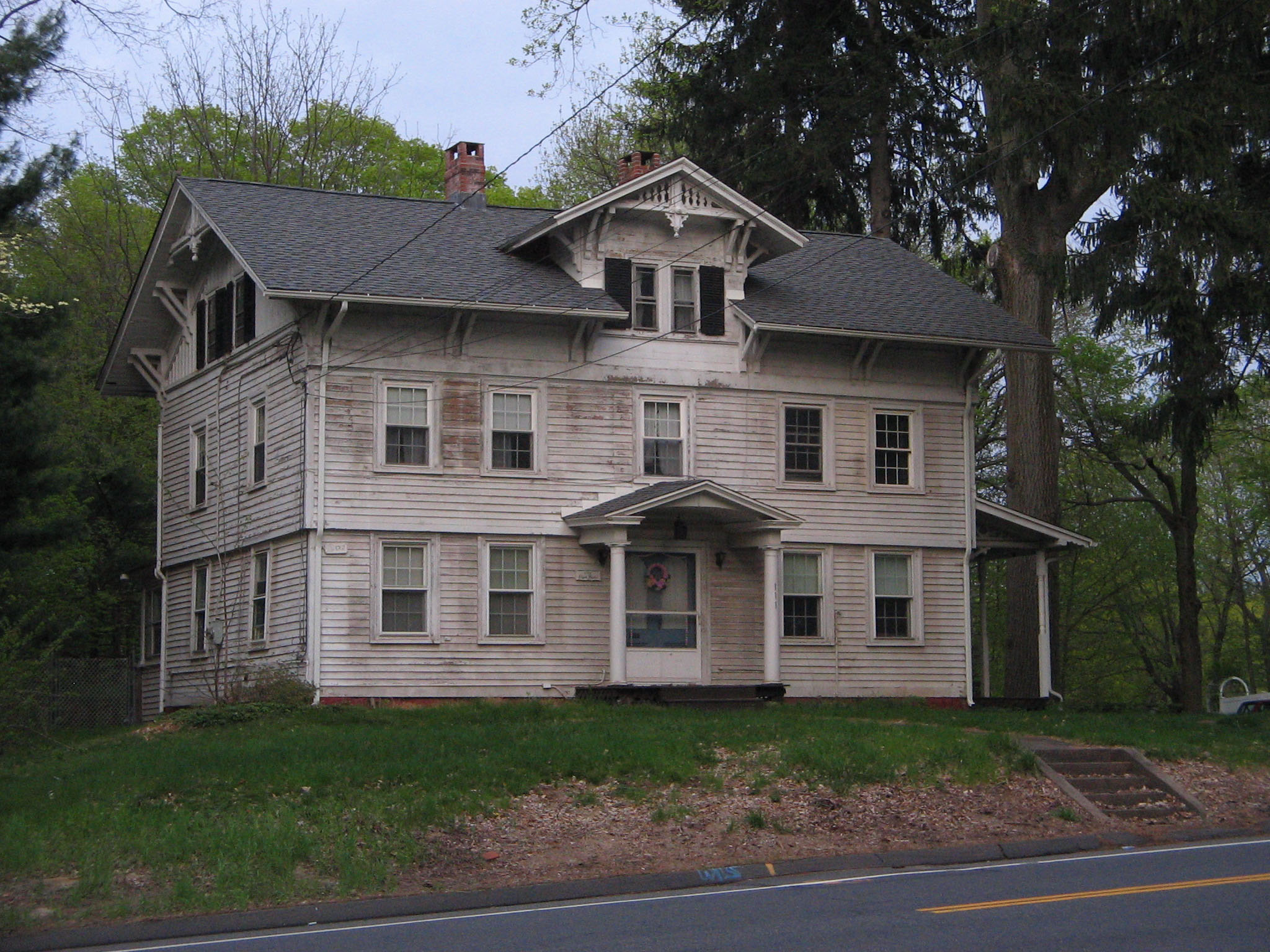
41°39′58″N 72°38′20″W / 41.666111°N 72.638889°WRocky Hill Built in 1803, a Federal style building which served as a school from 1803 to 1941. It was believed to be one of few original Federal style buildings in Connecticut that had been little altered in its exterior.[5] 2 Allen's Cider Mill 
April 28, 1992 7 Mountain Rd.
41°59′44″N 72°49′56″W / 41.995556°N 72.832222°WGranby Built in 1783; one of few surviving wooden cider mills in Connecticut[6] 3 Avon Congregational Church 
November 7, 1972 Junction of U.S. Routes 44 and 202
41°48′36″N 72°49′52″W / 41.81°N 72.831111°WAvon 4 Babb's Beach July 12, 2006 435 Babbs Rd.
42°01′48″N 72°45′04″W / 42.03°N 72.751111°WSuffield 5 Horace Belden School and Central Grammar School 
March 25, 1993 933 Hopmeadow St. and 29 Massaco St.
41°52′52″N 72°48′12″W / 41.881111°N 72.803333°WSimsbury 6 Beleden House March 15, 1982 50 Bellevue Ave.
41°40′31″N 72°56′25″W / 41.675278°N 72.940278°WBristol 7 Makens Bemont House March 25, 1982 307 Burnside Ave.
41°46′33″N 72°37′31″W / 41.775833°N 72.625278°WEast Hartford 8 Bigelow-Hartford Carpet Mills Historic District November 25, 1994 Roughly bounded by Lafayette St., Hartford Ave., Alden Ave., and Pleasant, High, Spring, South, and Prospect Sts.
41°59′59″N 72°36′06″W / 41.999722°N 72.601667°WEnfield 9 Bigelow-Hartford Carpet Mills March 10, 1983 Main and Pleasant Sts.
42°00′01″N 72°36′11″W / 42.000278°N 72.603056°WEnfield 10 Selden Brewer House June 4, 1979 137 High St.
41°44′27″N 72°38′04″W / 41.740833°N 72.634444°WEast Hartford 11 Bridge No. 455 September 29, 2004 CT 159 at Stony Brook
41°57′30″N 72°37′40″W / 41.958333°N 72.627778°WSuffield 12 Bristol Girls' Club June 3, 1987 47 Upson St.
41°40′07″N 72°56′51″W / 41.668611°N 72.9475°WBristol 13 Broad Brook Company May 2, 1985 Main St.
41°54′58″N 72°32′53″W / 41.916111°N 72.548056°WEast Windsor 14 Brown Tavern May 5, 1972 George Washington Turnpike
41°46′07″N 72°57′57″W / 41.768611°N 72.965833°WBurlington 15 Bulkeley Bridge 
December 10, 1993 Interstate 84 over the Connecticut River
41°46′09″N 72°39′58″W / 41.769167°N 72.666111°WEast Hartford Extends into Hartford 16 Edward L. Burnham Farm April 12, 1982 580 Burnham St.
41°47′59″N 72°34′50″W / 41.799722°N 72.580556°WManchester 17 Burritt Hotel July 28, 1983 67 W. Main St.
41°40′04″N 72°47′01″W / 41.667778°N 72.783611°WNew Britain 18 Ernest R. Burwell House August 18, 1992 161 Grove St.
41°40′54″N 72°56′11″W / 41.681667°N 72.936389°WBristol 19 Roger Butler House 
August 15, 1996 146 Jordan Ln.
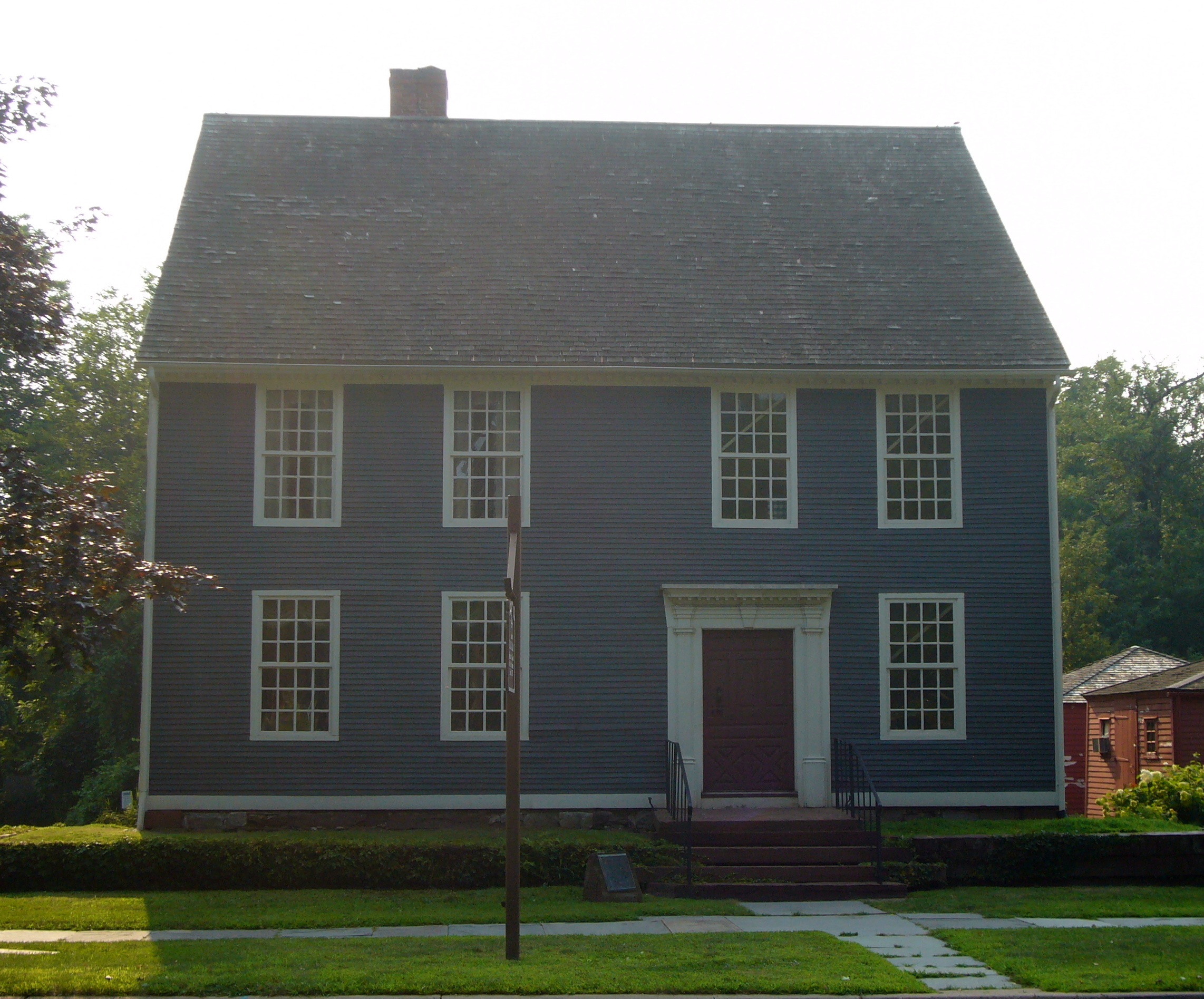
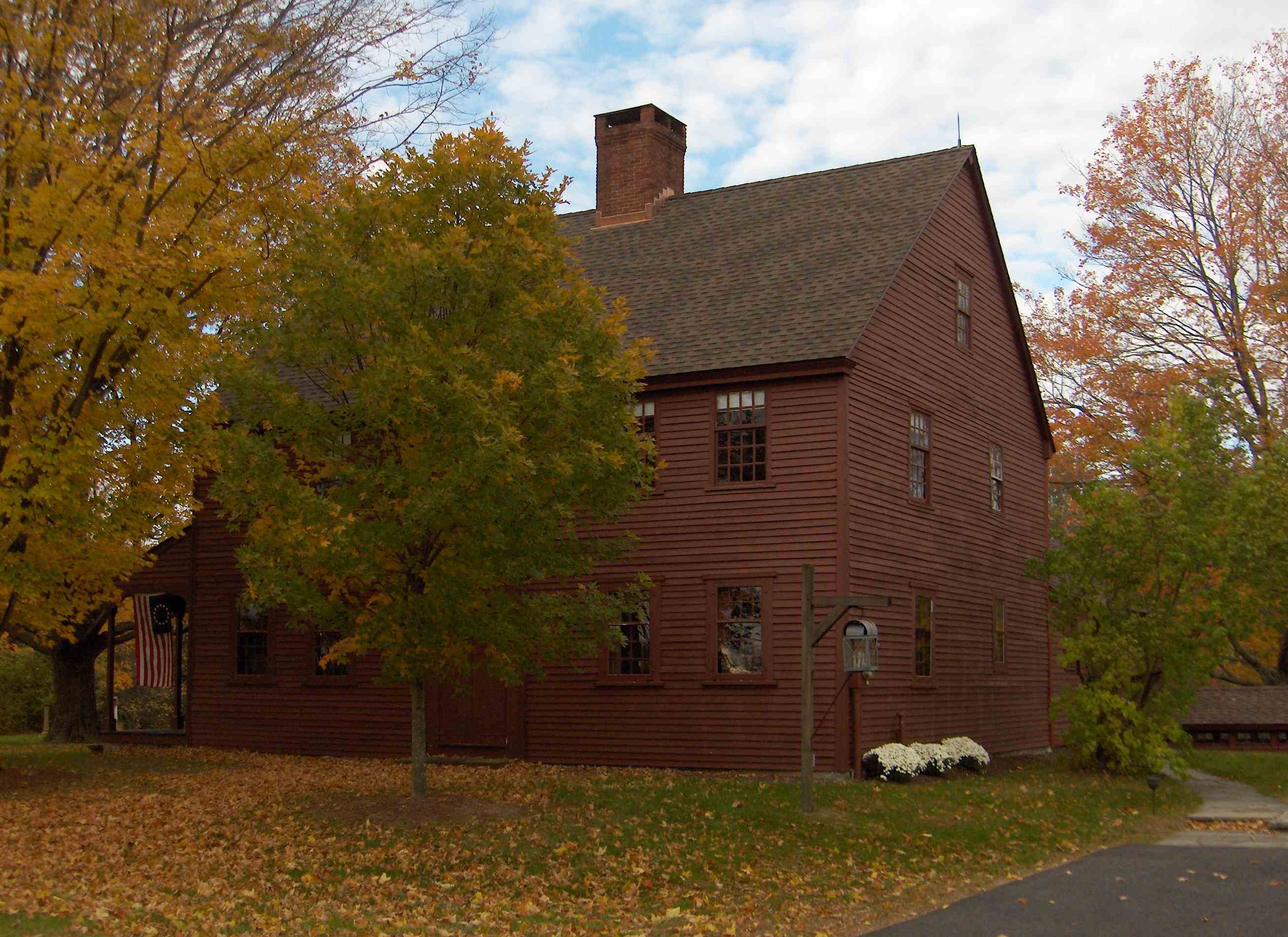
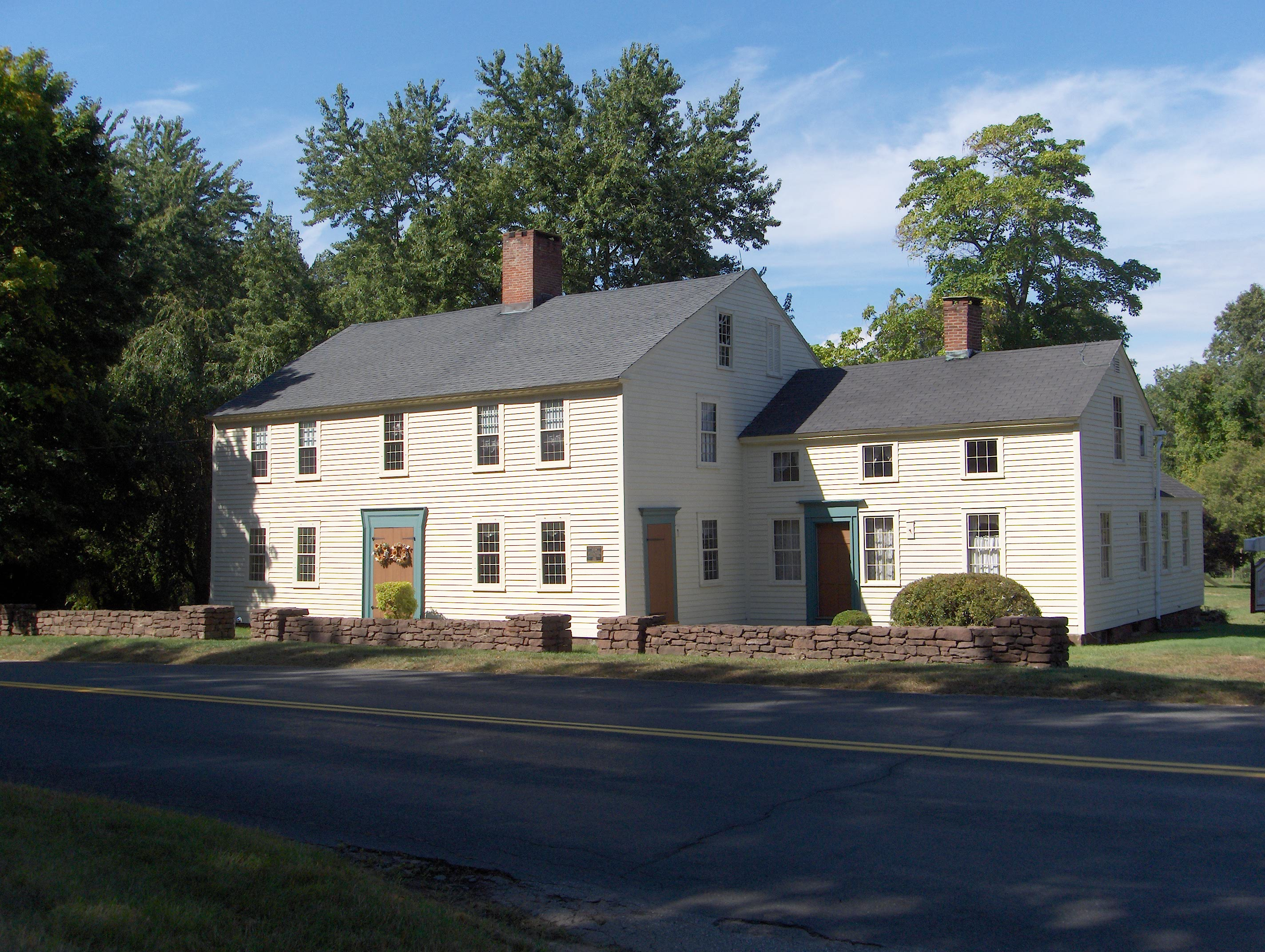
41°43′55″N 72°40′18″W / 41.731944°N 72.671667°WWethersfield 20 Buttolph-Williams House 
November 24, 1968 249 Broad St.
41°42′39″N 72°39′04″W / 41.710833°N 72.651111°WWethersfield Exemplifies traditional early New England design. 21 Canton Center Historic District October 7, 1997 Roughly along Barbourtown, E. Mountain, Humphrey, West, and W. Mountain Rds.
41°51′28″N 72°54′58″W / 41.857778°N 72.916111°WCanton 22 Case Brothers Historic District June 30, 2009 680-728 Spring St., 40 Glen Rd., and rough boundaries of Case Mountain Recreation Area and Manchester Land
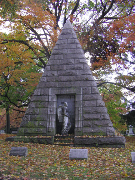
41°45′46″N 72°29′20″W / 41.762708°N 72.489011°WManchester 23 Cedar Hill Cemetery 
April 28, 1997 453 Fairfield Ave.
41°43′20″N 72°42′12″W / 41.722222°N 72.703333°WNewington and Wethersfield Extends into Hartford 24 Central Avenue-Center Cemetery Historic District April 19, 1993 Center Ave. from Main St. to Elm St. and Center Cemetery to the north
41°46′09″N 72°38′29″W / 41.769167°N 72.641389°WEast Hartford 25 Cheney Brothers Historic District 
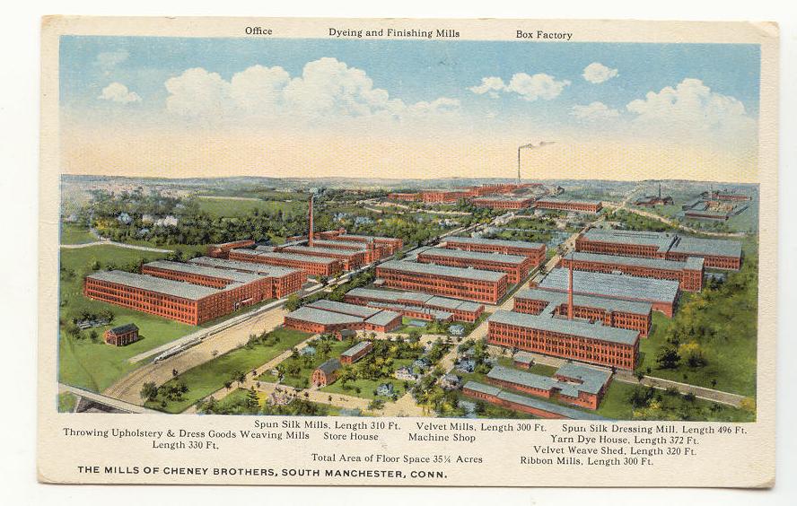
June 2, 1978 Bounded by Hartford Rd. and Laurel, Spruce, and Lampfield Sts.
41°46′00″N 72°31′43″W / 41.766667°N 72.528611°WManchester A nineteenth century silk mill and traditional company town. 26 City Hall-Monument District February 28, 1973 W. Main St. and Central Park
41°40′05″N 72°46′59″W / 41.668056°N 72.783056°WNew Britain 27 Clark Farm Tenant House Site 
January 31, 2002 Address Restricted East Granby 28 Collinsville Historic District June 23, 1976 CT 179
41°48′44″N 72°55′22″W / 41.812222°N 72.922778°WCanton 29 Commercial Trust Company Building March 17, 2009 51–55 West Main Street
41°40′04″N 72°46′59″W / 41.667778°N 72.783056°WNew Britain 30 Connecticut General Life Insurance Company Headquarters 
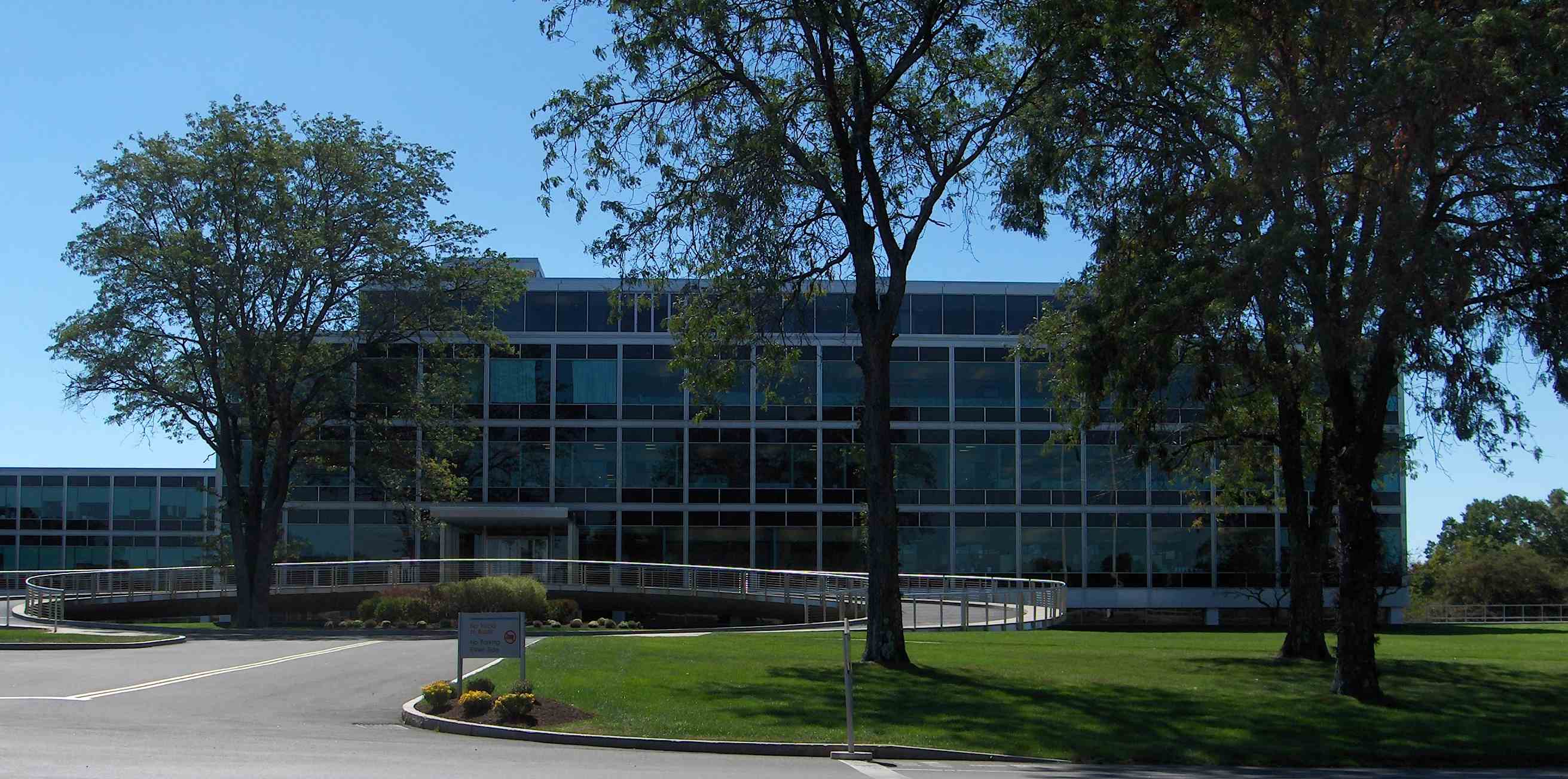
January 27, 2010 900 Cottage Grove Rd.
41°48′49″N 72°44′42″W / 41.813708°N 72.7449°WBloomfield 31 Copper Ledges and Chimney Crest August 21, 1992 Along Founders Dr. between Bradley and Woodland Sts.
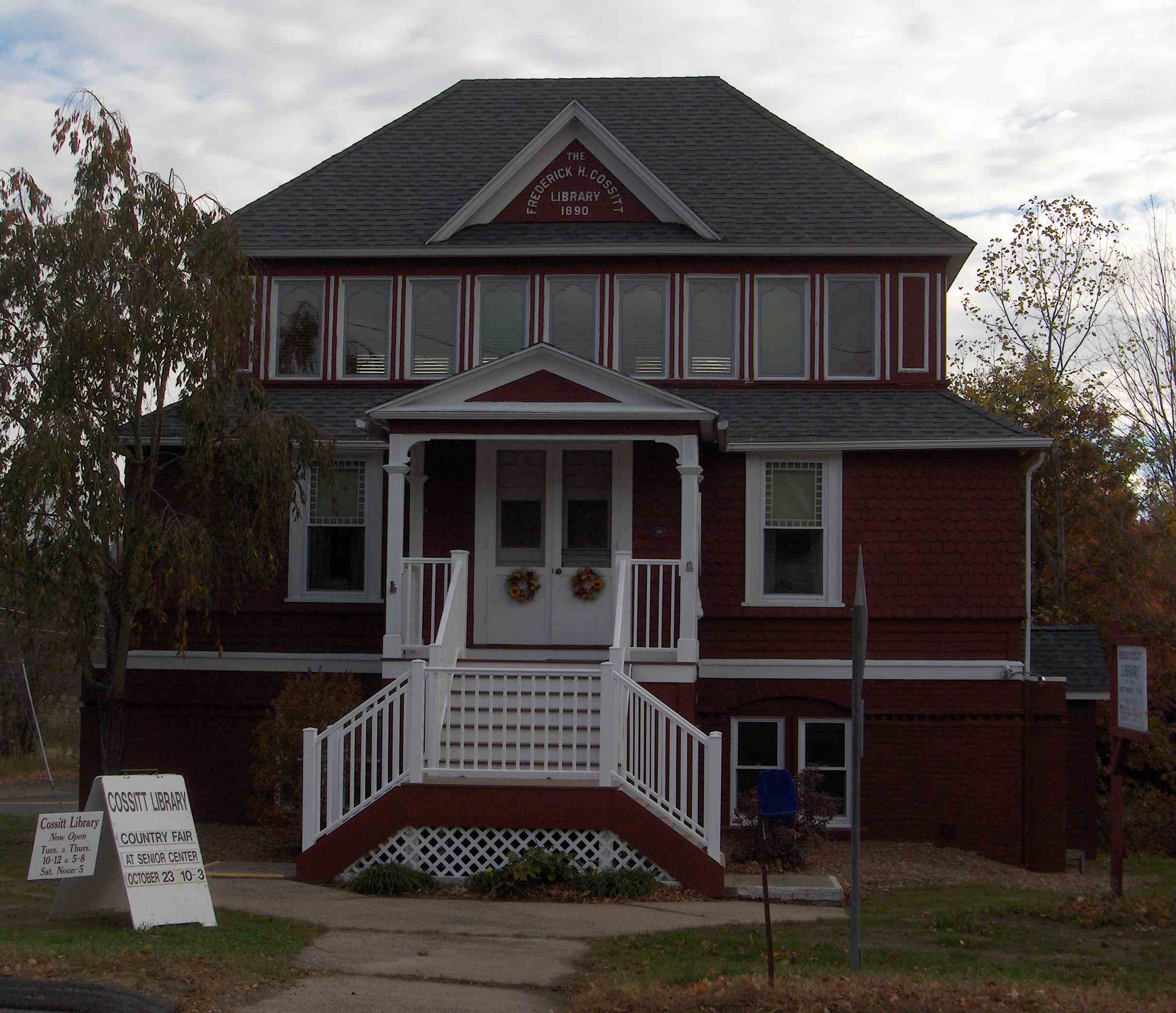
41°40′45″N 72°56′03″W / 41.679167°N 72.934167°WBristol 32 Frederick H. Cossitt Library 
June 22, 1988 388 N. Granby Rd.
41°59′45″N 72°49′51″W / 41.995833°N 72.830833°WGranby 33 Abraham Coult House August 11, 2000 1695 Hebron Ave.
41°43′08″N 72°32′39″W / 41.718889°N 72.544167°WGlastonbury 34 Gen. George Cowles House 
May 11, 1982 130 Main St.
41°43′03″N 72°50′09″W / 41.7175°N 72.835833°WFarmington 35 Curtisville Historic District December 14, 1992 Roughly Pratt St. from Naubuc Ave. to the west of Main St., also Parker Terrace; Parker Terrace extended and adjacent parts of Naubuc
41°43′03″N 72°37′03″W / 41.7175°N 72.6175°WGlastonbury 36 Robert and Julia Darling House 
January 3, 1991 720 Hopmeadow St.
41°52′20″N 72°48′10″W / 41.872222°N 72.802778°WSimsbury 37 Silas Deane House 
October 6, 1970 203 Main St.
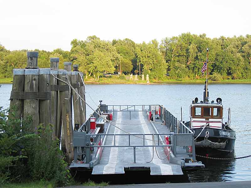
41°41′42″N 72°39′13″W / 41.695°N 72.653611°WWethersfield Home of America's first foreign diplomat 38 Downtown Main Street Historic District 
December 20, 1996 Roughly bounded by Main St., Governor St., Chapman Pl., and Burnside Ave.
41°46′11″N 72°38′38″W / 41.769722°N 72.643889°WEast Hartford 39 Drake Hill Road Bridge 
July 19, 1984 Drake Hill Rd. at the Farmington River
41°52′06″N 72°48′01″W / 41.868333°N 72.800278°WSimsbury 40 East Granby Historic District August 25, 1988 Church and East Sts., Nicholson and Rainbow Rds., N. Main, School and S. Main Sts.
41°56′32″N 72°43′28″W / 41.942222°N 72.724444°WEast Granby 41 East Weatogue Historic District 
July 19, 1990 Roughly properties on East Weatogue St. from just north of Riverside Dr. to Hartford Rd., and Folly Farm property to the south
41°50′51″N 72°47′58″W / 41.8475°N 72.799444°WSimsbury 42 East Windsor Academy December 3, 1998 115 Scantic Rd.
41°54′02″N 72°34′49″W / 41.900556°N 72.580278°WEast Windsor 43 East Windsor Hill Historic District May 30, 1986 Roughly bounded by the Scantic River, John Fitch Boulevard, Sullivan Ave., and the Connecticut River
41°51′23″N 72°36′45″W / 41.856389°N 72.6125°WSouth Windsor 44 Elm Street Historic District April 13, 1998 18-191 Elm St.
41°39′53″N 72°38′40″W / 41.664722°N 72.644444°WRocky Hill 45 Elmore Houses August 23, 1985 78 and 87 Long Hill Rd.
41°48′10″N 72°35′42″W / 41.802778°N 72.595°WSouth Windsor 46 Endee Manor Historic District February 29, 1996 Roughly along Sherman, Mills and Putnam Sts.
41°40′44″N 72°57′28″W / 41.678889°N 72.957778°WBristol 47 Enfield Canal 
April 22, 1976 Along the Connecticut River from Windsor Locks north to Thompsonville
41°57′00″N 72°37′10″W / 41.95°N 72.619444°WWindsor Locks 48 Enfield Historic District August 10, 1979 1106-1492 Enfield St.
41°58′34″N 72°35′37″W / 41.976111°N 72.593611°WEnfield 49 Enfield Shakers Historic District 
May 21, 1979 Shaker, Taylor, and Cybulski Rds.
42°00′42″N 72°30′57″W / 42.011667°N 72.515833°WEnfield 50 Enfield Town Meetinghouse September 10, 1974 Enfield St. at South Rd.
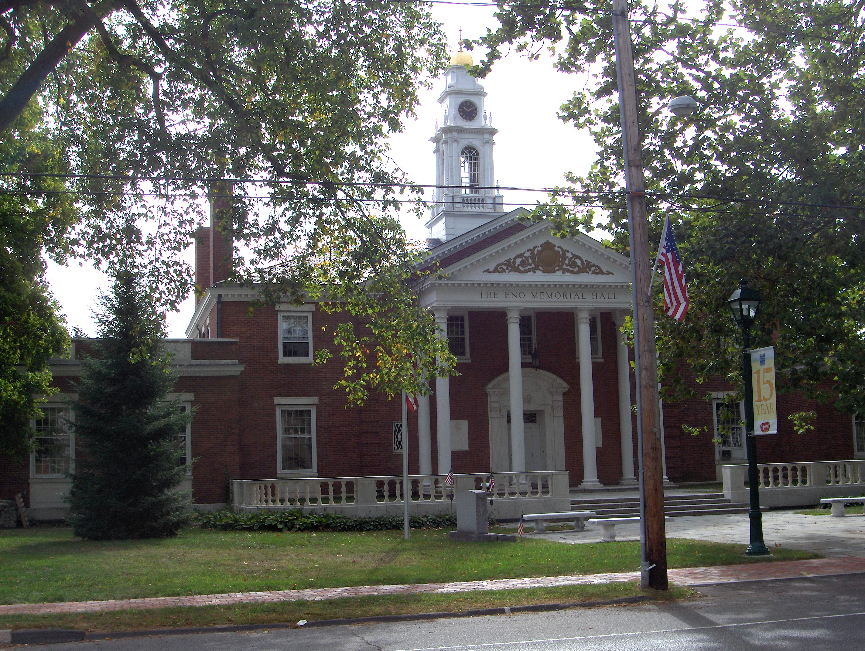
41°58′16″N 72°35′25″W / 41.971111°N 72.590278°WEnfield 51 Eno Memorial Hall 
April 2, 1993 754 Hopmeadow St.
41°52′28″N 72°48′06″W / 41.874444°N 72.801667°WSimsbury 52 Amos Eno House 
April 3, 1975 Off U.S. Route 202 on Hopmeadow Rd.
41°52′21″N 72°48′14″W / 41.8725°N 72.803889°WSimsbury 53 Erwin Home for Worthy and Indigent Women April 12, 2002 140 Bassett St.
41°39′26″N 72°46′48″W / 41.657222°N 72.78°WNew Britain 54 Farmington Canal-New Haven and Northampton Canal 
September 12, 1985 Roughly from Suffield in Hartford County to New Haven in New Haven County
41°37′14″N 72°51′54″W / 41.620556°N 72.865°WAvon, East Granby, Farmington, Granby, Plainville, Simsbury, Suffield Extends into Southington and New Haven County. First a canal, later a railroad, and now a multi-use trail. 55 Farmington Historic District 
March 17, 1972 Porter and Mountain Rds., Main and Garden Sts., Hatter's and Hillstead Lanes, and Farmington Ave.
41°43′11″N 72°49′45″W / 41.719722°N 72.829167°WFarmington 56 Federal Hill Historic District August 28, 1986 Roughly bounded by Summer, Maple, Woodland, Goodwin, and High Sts.
41°40′35″N 72°56′27″W / 41.676389°N 72.940833°WBristol 57 Capt. Oliver Filley House 
May 15, 2007 130 Mountain Ave.
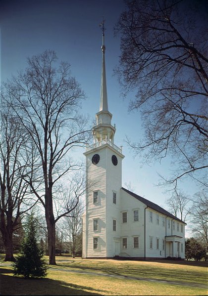
41°50′05″N 72°45′44″W / 41.8347°N 72.7623°WBloomfield 58 First Church of Christ 
May 15, 1975 75 Main St.
41°43′14″N 72°49′47″W / 41.720556°N 72.829722°WFarmington Church of the Amistad freed slaves. 59 First Congregational Church of East Hartford and Parsonage 
March 25, 1982 829-837 Main St.
41°46′08″N 72°38′41″W / 41.768889°N 72.644722°WEast Hartford 60 First Lutheran Church of the Reformation August 30, 2010 77 Franklin Square
41°39′46″N 72°46′50″W / 41.662778°N 72.780556°WNew Britain 61 Forestville Passenger Station April 19, 1978 171 Central St.
41°40′24″N 72°53′54″W / 41.673333°N 72.898333°WBristol 62 John Fuller House March 15, 1982 463 Halliday Ave.
42°00′58″N 72°39′23″W / 42.016111°N 72.656389°WSuffield 63 Garvan-Carroll Historic District August 26, 1991 Roughly bounded by S. Prospect, Chapel and Main Sts., and Interstate 84
41°46′01″N 72°38′52″W / 41.766944°N 72.647778°WEast Hartford 64 Francis Gillette House 
March 25, 1982 559 Bloomfield Ave.
41°48′50″N 72°44′23″W / 41.813889°N 72.739722°WBloomfield 65 Gilman-Hayden House August 16, 1984 1871 Main St.
41°47′31″N 72°38′46″W / 41.791944°N 72.646111°WEast Hartford 66 Glastonbury Historic District 
August 2, 1984 Roughly Main St. from Hebron Ave. to Talcott Rd.
41°42′09″N 72°36′34″W / 41.7025°N 72.609444°WGlastonbury 67 Glastonbury-Rocky Hill Ferry Historic District 
September 21, 2005 Roughly along Tryon St., Ferry Ln. and Glastonbury Ave., Meadow and Riverview Rds.
41°39′46″N 72°37′19″W / 41.662778°N 72.621944°WGlastonbury 68 Gothic Cottage February 25, 1982 1425 Mapleton Ave.
42°01′04″N 72°37′17″W / 42.017778°N 72.621389°WSuffield 69 Granby Center Historic District 
October 17, 1985 3-8 E. Granby Rd., 2 Park Pl., and 207-265 Salmon Brook St. S
41°57′00″N 72°47′33″W / 41.95°N 72.7925°WGranby 70 Ebenezer Grant House 
September 19, 1977 1653 Main St.
41°51′05″N 72°36′31″W / 41.851389°N 72.608611°WSouth Windsor 71 Gridley-Parsons-Staples Homestead July 30, 1981 1554 Farmington Ave.
41°45′01″N 72°56′29″W / 41.750278°N 72.941389°WFarmington 72 Dr. Elizur Hale House 
November 13, 1989 3181 Hebron Ave.
41°42′29″N 72°28′44″W / 41.708056°N 72.478889°WGlastonbury 73 Hart's Corner Historic District July 8, 1987 247 Monce Rd. and 102 and 105 Stafford Rd.
41°43′41″N 72°54′50″W / 41.728056°N 72.913889°WBurlington 74 Hastings Hill Historic District September 14, 1979 987-1308 Hill St., 1242 Spruce St., and 1085-1162 Russell Ave.
42°00′35″N 72°40′38″W / 42.009722°N 72.677222°WSuffield 75 Hatheway House August 6, 1975 55 S. Main St.
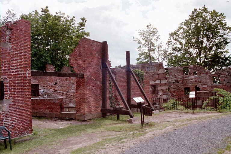
41°58′48″N 72°39′10″W / 41.98°N 72.652778°WSuffield 76 Samuel Hayes II House April 27, 1992 67 Barndoor Hills Rd.
41°56′42″N 72°49′06″W / 41.945°N 72.818333°WGranby 77 Hazardville Historic District February 19, 1980 Hazardville (near CT 190 and CT 192)
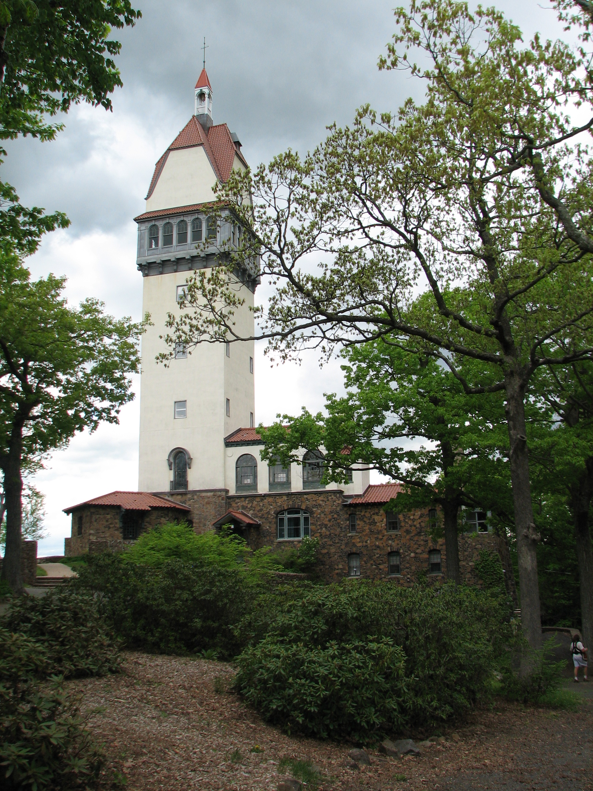
41°58′33″N 72°31′54″W / 41.975833°N 72.531667°WEnfield 78 Heublein Tower 
June 30, 1983 Talcott Mountain State Park
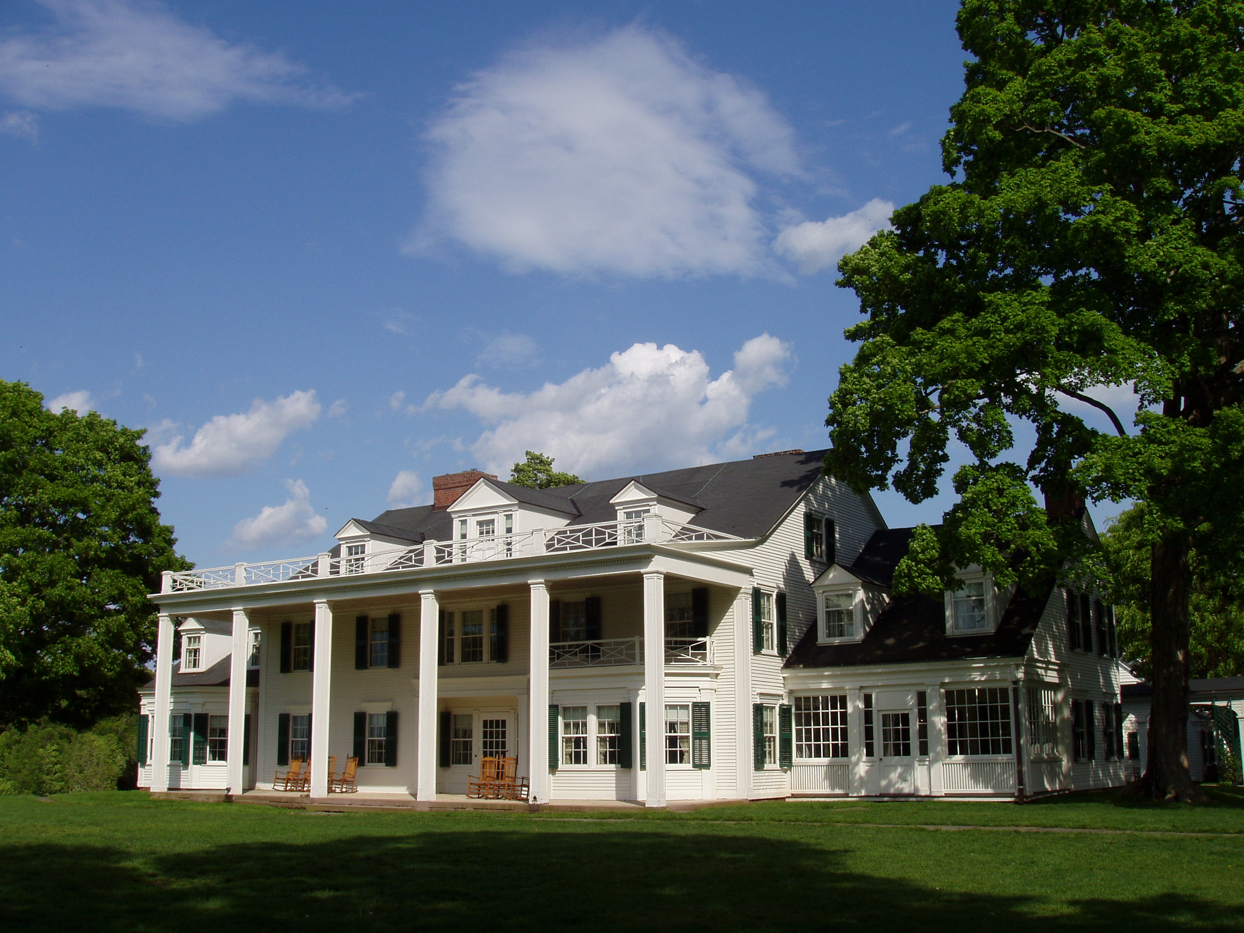
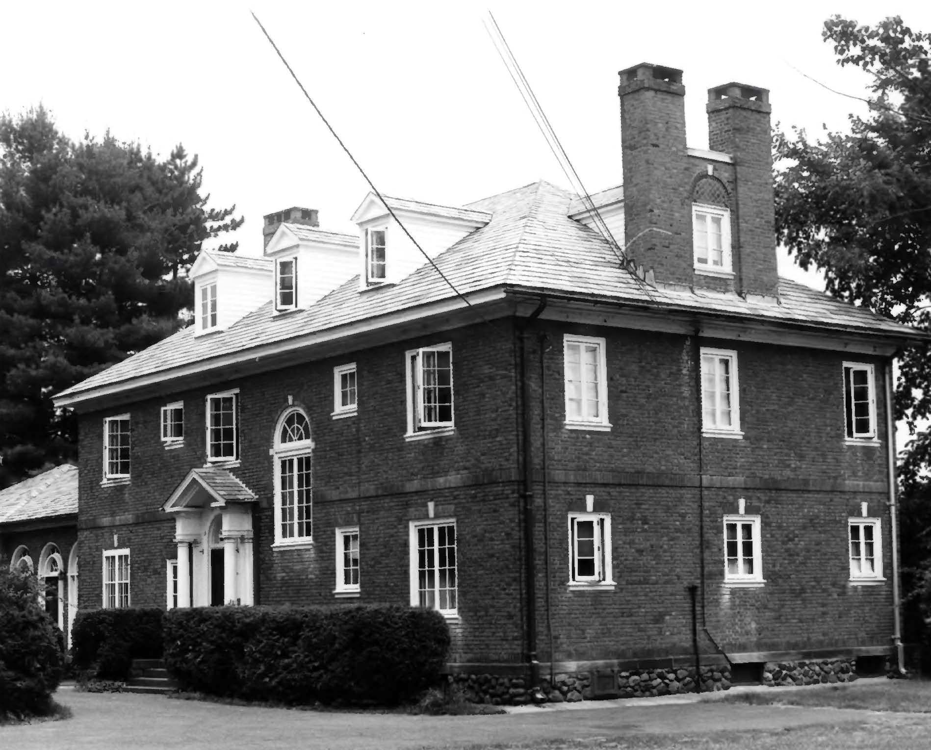
41°49′25″N 72°47′51″W / 41.823611°N 72.7975°WSimsbury 79 Hill-Stead 
July 17, 1991 35 Mountain Rd.
41°43′13″N 72°49′09″W / 41.720278°N 72.819167°WFarmington Colonial revival house and art museum located in the Farmington Historic District 80 Hilltop Farm January 12, 2005 1550-1760 Mapleton Ave.
42°01′30″N 72°36′50″W / 42.025°N 72.613889°WSuffield 81 Hitchcock-Schwarzmann Mill September 13, 1977 North of Burlington at Foote and Vineyard Rds.
41°46′54″N 72°57′42″W / 41.781667°N 72.961667°WBurlington 82 Judah Holcomb House June 16, 1988 257 N. Granby Rd.
41°58′50″N 72°49′08″W / 41.980556°N 72.818889°WGranby 83 Nathaniel Holcomb III House 
April 29, 1982 45 Bushy Hill Rd.
41°57′00″N 72°48′40″W / 41.95°N 72.811111°WGranby 84 John Hollister House November 7, 1972 14 Tryon St.
41°40′01″N 72°36′32″W / 41.666944°N 72.608889°WGlastonbury 85 Francis H. Holmes House June 28, 1984 349 Rocky Hill Ave.
41°39′14″N 72°45′34″W / 41.653889°N 72.759444°WNew Britain 86 Henry Hooker House 
November 29, 1978 111 High Rd.
41°38′41″N 72°47′22″W / 41.644722°N 72.789444°WBerlin 87 John Humphrey House 
November 15, 1990 115 E. Weatogue St.
41°51′48″N 72°47′43″W / 41.863333°N 72.795278°WSimsbury 88 William I Jerome House June 2, 1987 367 Jerome Ave.
41°41′59″N 72°55′46″W / 41.699722°N 72.929444°WBristol 89 Gen. Martin Kellogg House 
October 1, 1987 679 Willard Ave.
41°44′21″N 72°40′58″W / 41.739167°N 72.682778°WNewington The home of General Martin Kellog III, also known as the Kellogg-Eddy House 90 Enoch Kelsey House 
June 28, 1982 1702 Main St.
41°41′05″N 72°43′27″W / 41.684722°N 72.724167°WNewington 91 Ezekiel Kelsey House September 16, 1977 429 Beckley Rd.
41°37′43″N 72°43′24″W / 41.628611°N 72.723333°WBerlin 92 Kimberly Mansion 
September 17, 1974 1625 Main St.
41°41′22″N 72°36′26″W / 41.689444°N 72.607222°WGlastonbury Home of Abby and Julia Evelina Smith, suffragists who fought the town of Glastonbury and won. 93 King's Field House March 11, 1982 827 North St.
42°00′26″N 72°38′42″W / 42.007222°N 72.645°WSuffield 94 Alexander King House April 26, 1976 232 S. Main St.
41°58′31″N 72°39′12″W / 41.975278°N 72.653333°WSuffield 95 Lewis-Zukowski House February 21, 1990 1095 S. Grand St.
41°57′41″N 72°42′41″W / 41.961389°N 72.711389°WSuffield 96 Main Street Historic District August 15, 1995 Roughly Main St. from School St. to Summer St. and adjacent areas of Prospect St.
41°40′19″N 72°56′35″W / 41.671944°N 72.943056°WBristol 97 Main Street Historic District April 18, 1996 Roughly Main St. from Center St. to Eldridge St.
41°46′16″N 72°31′18″W / 41.771111°N 72.521667°WManchester 98 Manchester Historic District August 2, 2000 Roughly bounded by Center Spring Park, Main St., Interstate 384, and Campfield Rd.
41°46′12″N 72°31′42″W / 41.77°N 72.528333°WManchester 99 Marlborough Congregational Church 
December 10, 1993 35 S. Main St.
41°37′44″N 72°27′19″W / 41.628889°N 72.455278°WMarlborough 100 Marlborough House September 2, 1993 226 Grove St.
41°40′52″N 72°56′02″W / 41.681111°N 72.933889°WBristol 101 Marlborough Tavern 
December 6, 1978 Off CT 66
41°37′52″N 72°27′35″W / 41.631111°N 72.459722°WMarlborough 102 Masonic Temple July 21, 1995 265 W. Main St.
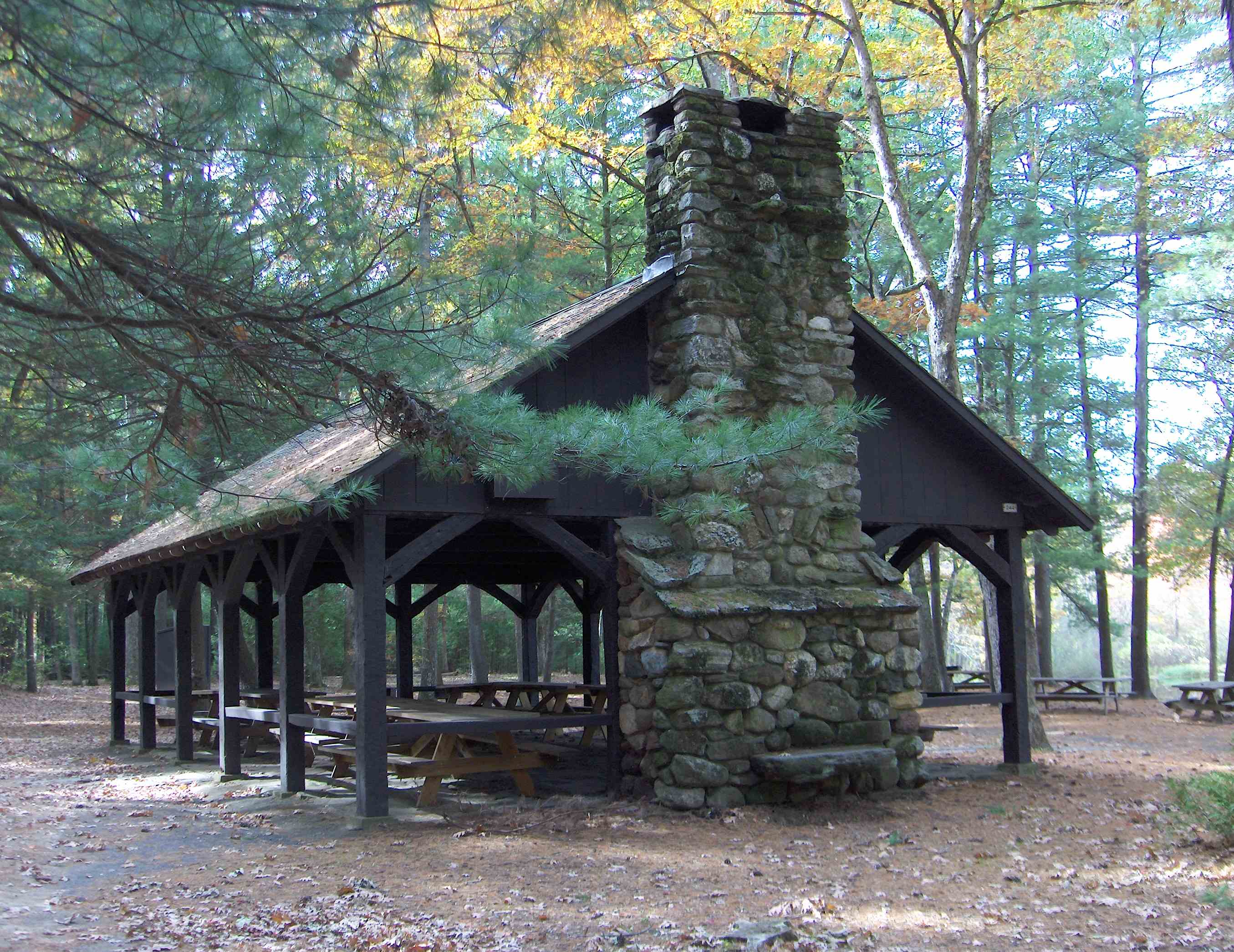
41°39′57″N 72°47′27″W / 41.665833°N 72.790833°WNew Britain 103 Massacoe Forest Pavilion 
September 4, 1986 Off Old Farms Rd., Stratton Brook State Park
41°51′49″N 72°50′10″W / 41.863611°N 72.836111°WSimsbury 104 Melrose August 26, 2010 Broad Brook Rd. and Melrose Rd.
41°56′15″N 72°31′38″W / 41.9375°N 72.527222°WEast Windsor 105 Melrose Road Bridge August 5, 1999 Melrose Rd. over the Scantic River
41°56′18″N 72°32′51″W / 41.938333°N 72.5475°WEast Windsor 106 Memorial Hall June 2, 1987 Junction of S. Main and Elm Sts.
41°55′19″N 72°37′41″W / 41.921944°N 72.628056°WWindsor Locks 107 Naubuc Avenue-Broad Street Historic District December 4, 1998 Roughly along Broad St. and Naubuc Ave.
41°43′48″N 72°37′38″W / 41.73°N 72.627222°WEast Hartford 108 New Britain Opera House October 7, 1977 466-468 Main St.
41°40′14″N 72°46′55″W / 41.670556°N 72.781944°WNew Britain 109 New Haven District Campground May 19, 1980 Off CT 177
41°41′10″N 72°53′23″W / 41.686111°N 72.889722°WPlainville 110 Newington Junction North Historic District 
June 2, 1987 55-108 Willard Ave.
41°43′05″N 72°44′15″W / 41.718056°N 72.7375°WNewington 111 Newington Junction Railroad Depot 
December 22, 1986 160 Willard and 200 Francis Aves.
41°42′55″N 72°44′13″W / 41.715278°N 72.736944°WNewington 112 Newington Junction South Historic District 
June 2, 1987 268-319 Willard Ave.
41°42′41″N 72°44′15″W / 41.711389°N 72.7375°WNewington 113 Newington Junction West Historic District June 2, 1987 175 and 181-183 Willard Ave. and 269-303 W. Hill Rd.
41°42′54″N 72°44′21″W / 41.715°N 72.739167°WNewington 114 Charles H. Norton House 
May 11, 1976 132 Redstone Hill
41°39′32″N 72°53′06″W / 41.658889°N 72.885°WPlainville Home of the inventor of precision grinding equipment. 115 Old Farm Schoolhouse 
October 18, 1972 Junction of Park Ave. and School St.
41°49′25″N 72°42′32″W / 41.823611°N 72.708889°WBloomfield 116 Old Newgate Prison 
October 15, 1970 Newgate Rd.
41°57′43″N 72°44′44″W / 41.961944°N 72.745556°WEast Granby Colonial prison; loyalists were held here during the American Revolutionary War 117 Old Wethersfield Historic District 
December 29, 1970 Bounded by Hartford, railroad tracks, Interstate 91, and Rocky Hill
41°42′32″N 72°39′23″W / 41.708889°N 72.656389°WWethersfield 118 Pequabuck Bridge 
July 19, 1984 Meadow Rd. at the Pequabuck River
41°42′59″N 72°50′25″W / 41.716389°N 72.840278°WFarmington 119 Capt. Elisha Phelps House 
September 22, 1972 800 Hopmeadow St.
41°52′34″N 72°48′05″W / 41.876111°N 72.801389°WSimsbury 120 Ezekiel Phelps House 
February 25, 1982 38 Holcomb St.
41°56′36″N 72°44′47″W / 41.943333°N 72.746389°WEast Granby 121 Pine Grove Historic District February 11, 1980 CT 167
41°46′09″N 72°51′25″W / 41.769167°N 72.856944°WAvon 122 David Pinney House and Barn July 25, 1977 58 West St.
41°55′57″N 72°38′24″W / 41.9325°N 72.64°WWindsor Locks 123 Pitkin Glassworks Ruin April 9, 1979 Address Restricted Manchester 124 John Robbins House September 20, 1988 262 Old Main St.
41°40′56″N 72°39′05″W / 41.682222°N 72.651389°WRocky Hill 125 Unni Robbins II House 
September 21, 2005 1692 Main St.
41°41′12″N 72°43′19″W / 41.686667°N 72.721944°WNewington 126 Rockwell Park May 21, 1987 Dutton Ave. and Jacobs St.
41°40′27″N 72°59′01″W / 41.674167°N 72.983611°WBristol 127 Rocky Hill Center Historic District March 9, 2007 Roughly bounded by Old Main, Pratt, and Washington Sts., Glastonbury Ave., and Riverview Rd.
41°39′54″N 72°38′06″W / 41.664947°N 72.634933°WRocky Hill 128 Rocky Hill Congregational Church 
May 7, 1982 805-817 Old Main St.
41°39′56″N 72°38′21″W / 41.665556°N 72.639167°WRocky Hill 129 Rowe and Weed Houses January 18, 1978 208 Salmon Brook St.
41°56′45″N 72°47′27″W / 41.945833°N 72.790833°WGranby 130 St. John's Episcopal Church 
November 28, 1983 1160 Main St.
41°46′25″N 72°38′27″W / 41.773611°N 72.640833°WEast Hartford 131 St. John's Episcopal Church 
April 27, 1982 92 Main St.
41°55′43″N 72°37′06″W / 41.928611°N 72.618333°WEast Windsor 132 St. Mary's Parochial School April 3, 1991 Beaver St. south of Broad St.
41°40′18″N 72°46′58″W / 41.671667°N 72.782778°WNew Britain 133 Shade Swamp Shelter September 4, 1986 U.S. Route 6 east of New Britain Ave.
41°42′15″N 72°51′35″W / 41.704167°N 72.859722°WFarmington 134 Simeon North Factory Site August 18, 1990 Address Restricted Berlin 135 Simsbury Bank and Trust Company Building 
November 20, 1986 760-762 Hopmeadow St.
41°52′31″N 72°48′06″W / 41.875278°N 72.801667°WSimsbury 136 Simsbury Center Historic District 
April 12, 1996 Roughly Hopmeadow St. from West St. to Massaco St.
41°52′31″N 72°48′11″W / 41.875278°N 72.803056°WSimsbury 137 Simsbury Railroad Depot 
March 26, 1976 Railroad Ave. at Station St.
41°52′27″N 72°48′02″W / 41.874167°N 72.800556°WSimsbury 138 Simsbury Townhouse 
April 2, 1993 695 Hopmeadow St.
41°52′18″N 72°48′17″W / 41.871667°N 72.804722°WSimsbury 139 Sloper-Wesoly House January 7, 1999 27 Grove Hill St.
41°40′00″N 72°47′30″W / 41.666667°N 72.791667°WNew Britain 140 South Congregational Church April 6, 1990 90 Main St.
41°39′54″N 72°46′56″W / 41.665°N 72.782222°WNew Britain 141 South End Historic District January 19, 2001 Roughly bounded by East Rd., Willis St., George St., and South St.
41°39′55″N 72°56′33″W / 41.665278°N 72.9425°WBristol 142 South Glastonbury Historic District November 23, 1984 High, Hopewell, Main, and Water Sts.; also 999-1417 and 1032-1420 Main St., 6 and 7 Chestnut Hill Rd.
41°39′59″N 72°36′15″W / 41.666389°N 72.604167°WGlastonbury Second set of boundaries represent a boundary increase of September 24, 2009 143 Southwest District School 
July 24, 1992 430 Simsbury Rd.
41°49′04″N 72°46′02″W / 41.817778°N 72.767222°WBloomfield 144 Stanley-Whitman House 
October 15, 1966 37 High St.
41°43′16″N 72°49′32″W / 41.721111°N 72.825556°WFarmington Classic seventeenth-century New England saltbox. 145 Suffield Historic District September 25, 1979 Runs along N. and S. Main St.
41°58′51″N 72°39′06″W / 41.980833°N 72.651667°WSuffield 146 Tariffville Historic District 
April 2, 1993 Roughly bounded by Winthrop St., Main St., Mountain Rd., Laurel Hill Rd., and Elm St.
41°54′36″N 72°45′53″W / 41.91°N 72.764722°WSimsbury 147 Tephereth Israel Synagogue May 11, 1995 76 Winter St.
41°40′19″N 72°46′44″W / 41.671944°N 72.778889°WNew Britain 148 Terry's Plain Historic District 
December 10, 1993 Roughly bounded by Pharos, Quarry, and Terry's Plain Rds., and the Farmington River
41°53′01″N 72°47′05″W / 41.883611°N 72.784722°WSimsbury 149 Terry-Hayden House March 25, 1982 125 Middle St.
41°39′57″N 72°55′17″W / 41.665833°N 72.921389°WBristol 150 William H. Thompson Farmstead April 18, 2003 215 and 219 Melrose Rd.
41°56′16″N 72°31′22″W / 41.937778°N 72.522778°WEast Windsor 151 Town Bridge August 5, 1999 Town Bridge over the Farmington River
41°49′28″N 72°55′43″W / 41.824444°N 72.928611°WCanton 152 Townsend G. Treadway House December 19, 1991 100 Oakland St.
41°40′51″N 72°56′10″W / 41.680833°N 72.936111°WBristol 153 Treadwell House April 27, 1982 George Washington Turnpike
41°46′10″N 72°59′21″W / 41.769444°N 72.989167°WBurlington 154 Trinity Methodist Episcopal Church 
July 21, 2007 69 Main St.
41°40′02″N 72°46′51″W / 41.667222°N 72.780833°WNew Britain 155 Tunxis Forest Headquarters House September 4, 1986 Western side of Pell Rd. 0.2 miles north of Town Rd.
42°00′13″N 72°54′43″W / 42.003611°N 72.911944°WHartland 156 Tunxis Forest Ski Cabin September 5, 1986 Western end of Balance Rock Rd.
42°00′32″N 72°55′47″W / 42.008889°N 72.929722°WHartland 157 Tunxis Hose Firehouse July 28, 1983 Lovely St. and Farmington Ave.
41°45′31″N 72°53′14″W / 41.758611°N 72.887222°WFarmington 158 Union Village Historic District August 6, 2002 Roughly bounded by Union Pond, Oakland St., railroad right-of-way, Marble St., and the Hockanum River
41°47′47″N 72°31′43″W / 41.796389°N 72.528611°WManchester 159 US Post Office-Manchester Main January 21, 1986 479 Main St. at Center St.
41°46′35″N 72°31′21″W / 41.776389°N 72.5225°WManchester 160 Viets' Tavern 
February 23, 1972 Newgate Rd.
41°57′43″N 72°44′42″W / 41.961944°N 72.745°WEast Granby 161 Walnut Hill District September 2, 1975 Irregular pattern roughly bounded by Winthrup, Arch, and Lake Sts., and Walnut Hill Park
41°39′50″N 72°47′09″W / 41.663889°N 72.785833°WNew Britain 162 Walnut Hill Park November 30, 1982 W. Main St.
41°39′43″N 72°47′31″W / 41.661944°N 72.791944°WNew Britain 163 Washington School July 19, 1984 High and Carmody Sts.
41°40′40″N 72°47′18″W / 41.677778°N 72.788333°WNew Britain 164 Joseph Webb House 
October 15, 1966 211 Main St.
41°42′42″N 72°39′13″W / 41.711667°N 72.653611°WWethersfield Site of the American Revolutionary War conference between General George Washington and Rochambeau planning for the Siege of Yorktown 165 Gideon Welles House October 6, 1970 37 Hebron Ave.
41°42′46″N 72°35′31″W / 41.712778°N 72.591944°WGlastonbury 166 Welles-Shipman-Ward House September 19, 1977 972 Main St.
41°40′08″N 72°36′07″W / 41.668889°N 72.601944°WGlastonbury 167 West End Historic District December 24, 1998 Roughly along Park Place, Vine, Forest, Lincoln, Liberty, Sunnyledge, Hart, Lexington, Murray, and Woodbine Sts.
41°39′40″N 72°47′42″W / 41.661111°N 72.795°WNew Britain 168 West End Library April 25, 2000 15 School St.
41°45′31″N 72°53′15″W / 41.758611°N 72.8875°WFarmington 169 West Granby Historic District 
May 1, 1992 Broad Hill, Hartland, W. Granby and Simsbury Rds., and Day St. S.
41°56′48″N 72°50′19″W / 41.946667°N 72.838611°WGranby 170 John Wiard House March 25, 1982 CT 4
41°46′33″N 72°58′50″W / 41.775833°N 72.980556°WBurlington 171 Willard Homestead 
December 22, 1986 372 Willard Ave.
41°42′55″N 72°44′13″W / 41.715278°N 72.736944°WNewington 172 Austin F. Williams Carriagehouse and House 
August 5, 1998 127 Main Street
41°43′21″N 72°49′41″W / 41.7225°N 72.828056°WFarmington Temporary quarters for the Amistad Africans and "station" on the Underground Railroad 173 J. B. Williams Co. Historic District April 7, 1983 Hubbard, Williams, and Willieb Sts.
41°42′08″N 72°35′49″W / 41.702222°N 72.596944°WGlastonbury 174 Windsor Farms Historic District April 11, 1986 Roughly bounded by Strong Rd., U.S. Route 5, Interstate 291, and the Connecticut River
41°49′22″N 72°37′35″W / 41.822778°N 72.626389°WSouth Windsor 175 Windsor Locks Passenger Station September 2, 1975 Main St.
41°56′01″N 72°37′39″W / 41.933611°N 72.6275°WWindsor Locks 176 Woodbridge Farmstead August 5, 1999 495 Middle Turnpike East
41°47′05″N 72°30′01″W / 41.784722°N 72.500278°WManchester 177 Worthington Ridge Historic District 
July 13, 1989 Roughly Worthington Ridge from Mill St. to Sunset Ln.
41°37′06″N 72°44′49″W / 41.618333°N 72.746944°WBerlin See also
- List of National Historic Landmarks in Connecticut
- National Register of Historic Places listings in Connecticut
References
- ^ The latitude and longitude information provided in this table was derived originally from the National Register Information System, which has been found to be fairly accurate for about 99% of listings. For about 1% of NRIS original coordinates, experience has shown that one or both coordinates are typos or otherwise extremely far off; some corrections may have been made. A more subtle problem causes many locations to be off by up to 150 yards, depending on location in the country: most NRIS coordinates were derived from tracing out latitude and longitudes off of USGS topographical quadrant maps created under North American Datum of 1927, which differs from the current, highly accurate GPS system used by Google maps. Chicago is about right, but NRIS longitudes in Washington are higher by about 4.5 seconds, and are lower by about 2.0 seconds in Maine. Latitudes differ by about 1.0 second in Florida. Some locations in this table may have been corrected to current GPS standards.
- ^ "National Register of Historic Places: Weekly List Actions". National Park Service, United States Department of the Interior. Retrieved on November 10, 2011.
- ^ Numbers represent an ordering by significant words. Various colorings, defined here, differentiate National Historic Landmark sites and National Register of Historic Places Districts from other NRHP buildings, structures, sites or objects.
- ^ "National Register Information System". National Register of Historic Places. National Park Service. . http://nrhp.focus.nps.gov/natreg/docs/All_Data.html.
- ^ T. Robins Brown (May, 1976). "National Register of Historic Places Inventory-Nomination: Academy Hall". National Park Service. http://pdfhost.focus.nps.gov/docs/NRHP/Text/77001419.pdf. and Accompanying photo, exterior, from 1976
- ^ Mark Williams (September 1, 1991). "National Register of Historic Places Registration: Allen's Cider Mill". National Park Service. http://pdfhost.focus.nps.gov/docs/NRHP/Text/92000389.pdf. and Accompanying nine photos, exterior and interior, from 1989-1991 (see captions page 13 of text document)
U.S. National Register of Historic Places Topics Lists by states Alabama • Alaska • Arizona • Arkansas • California • Colorado • Connecticut • Delaware • Florida • Georgia • Hawaii • Idaho • Illinois • Indiana • Iowa • Kansas • Kentucky • Louisiana • Maine • Maryland • Massachusetts • Michigan • Minnesota • Mississippi • Missouri • Montana • Nebraska • Nevada • New Hampshire • New Jersey • New Mexico • New York • North Carolina • North Dakota • Ohio • Oklahoma • Oregon • Pennsylvania • Rhode Island • South Carolina • South Dakota • Tennessee • Texas • Utah • Vermont • Virginia • Washington • West Virginia • Wisconsin • WyomingLists by territories Lists by associated states Other  Category:National Register of Historic Places •
  Portal:National Register of Historic PlacesCategories:
- Hartford County, Connecticut
- National Register of Historic Places in Connecticut by county
-


Wikimedia Foundation. 2010.