- National Register of Historic Places listings in Tolland County, Connecticut
-
 Location of Tolland County in Connecticut
This is a list of the National Register of Historic Places listings in Tolland County, Connecticut.
This is intended to be a complete list of the properties and districts on the National Register of Historic Places in Tolland County, Connecticut, United States. The locations of National Register properties and districts for which the latitude and longitude coordinates are included below, may be seen in a Google map.[1]
There are 49 properties and districts listed on the National Register in the county.
Contents: Counties in Connecticut Fairfield (city of Bridgeport) (town of Greenwich) (city of Stamford) | Hartford (city of Hartford) (town of Southington) (town of West Hartford) (town of Windsor) | Litchfield | Middlesex (city of Middletown) | New Haven (city of New Haven) | New London | Tolland | Windham
-
- This National Park Service list is complete through NPS recent listings posted November 10, 2011.[2]
Current listings
[3] Landmark name [4] Image Date listed Location City or town Summary 1 Andover Center Historic District April 18, 2003 Roughly along Hebron Rd., Boston Hill Rd., and U.S. Route 6
41°44′03″N 72°22′30″W / 41.734167°N 72.375°WAndover 2 Bolton Green Historic District 
April 12, 2001 Roughly the Green, 219, 220, 222, 228, 233, 266 Bolton Center Rd. and 3 Hebron Rd.
41°46′20″N 72°25′42″W / 41.772222°N 72.428333°WBolton 3 Brigham's Tavern March 25, 1982 12 Boston Turnpike
41°47′58″N 72°18′53″W / 41.799444°N 72.314722°WCoventry 4 John Cady House April 12, 1982 484 Mile Hill Rd.
41°49′51″N 72°24′00″W / 41.830833°N 72.4°WTolland 5 Capron-Phillips House April 27, 1982 1129 Main St.
41°46′00″N 72°17′54″W / 41.766667°N 72.298333°WCoventry 6 Captain Nathan Hale Monument January 28, 2002 120 Lake St.
41°46′04″N 72°18′24″W / 41.767778°N 72.306667°WCoventry 7 Columbia Green Historic District December 6, 1990 Along CT 87 at its junction with CT 66
41°42′05″N 72°18′10″W / 41.701389°N 72.302778°WColumbia 8 Jared Cone House 
February 21, 1990 25 Hebron Rd.
41°45′58″N 72°26′02″W / 41.766111°N 72.433889°WBolton 9 Coventry Glass Factory Historic District August 27, 1987 U.S. Route 44 and N. River Rd.
41°47′56″N 72°21′02″W / 41.798889°N 72.350556°WCoventry 10 Eldredge Mills Archeological District 
October 20, 2000 Address Restricted Willington 11 Ellington Center Historic District November 15, 1990 Roughly Maple St. from Berr Ave. to just west of the High School and Main St. from Jobs Hill Rd. to East Green
41°54′15″N 72°28′17″W / 41.904167°N 72.471389°WEllington 12 Farwell Barn January 26, 2001 Horsebarn Hill Rd.
41°49′08″N 72°14′57″W / 41.818889°N 72.249167°WMansfield 13 Fifth Camp of Rochambeau's Infantry April 30, 2001 Address Restricted Bolton 14 Florence Mill July 18, 1978 121 W. Main St.
41°51′52″N 72°27′15″W / 41.864444°N 72.454167°WVernon 15 Gurleyville Historic District December 30, 1975 North of Mansfield Center off CT 195 at the junction of Gurleyville and Chaffeeville Rds.
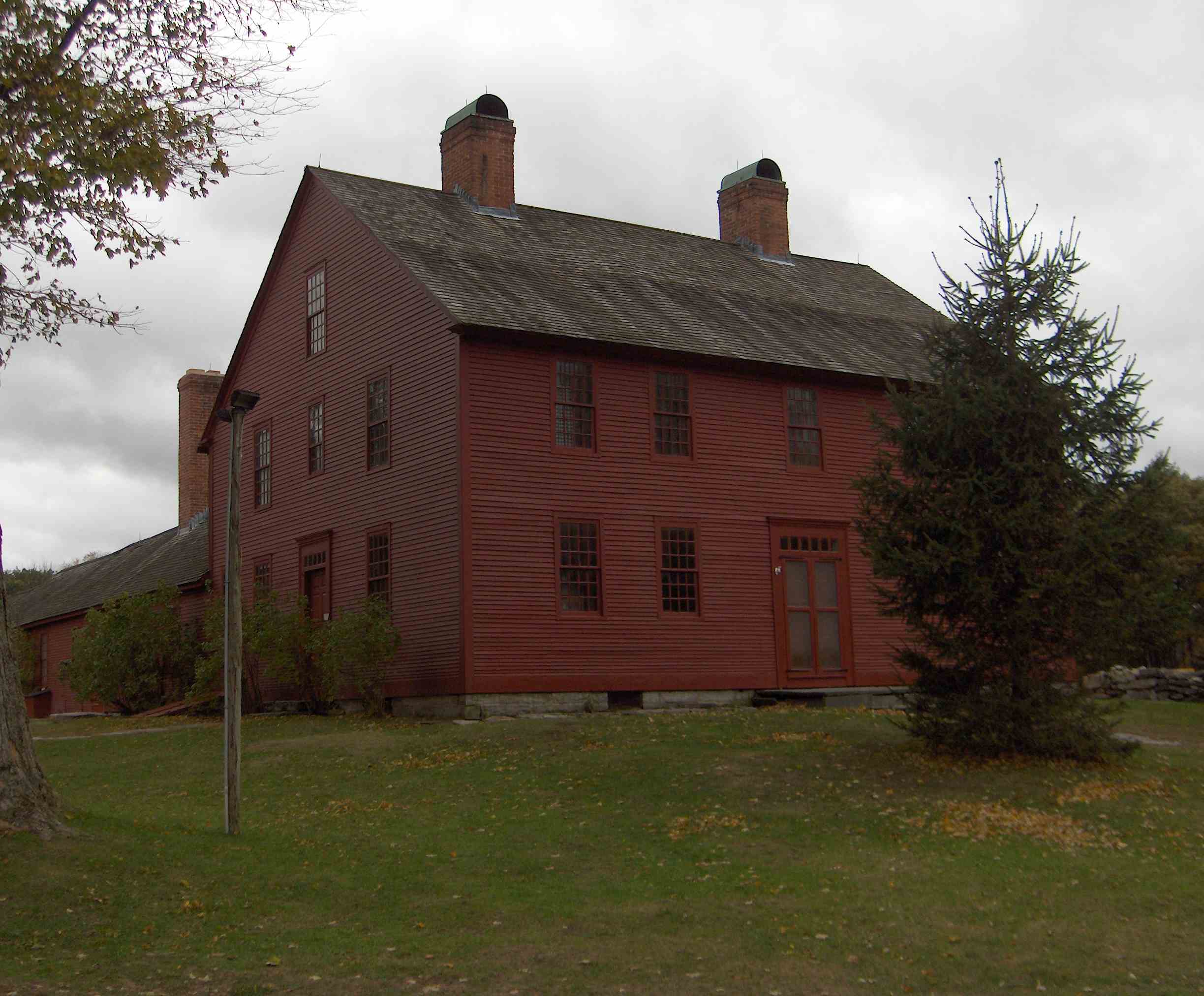
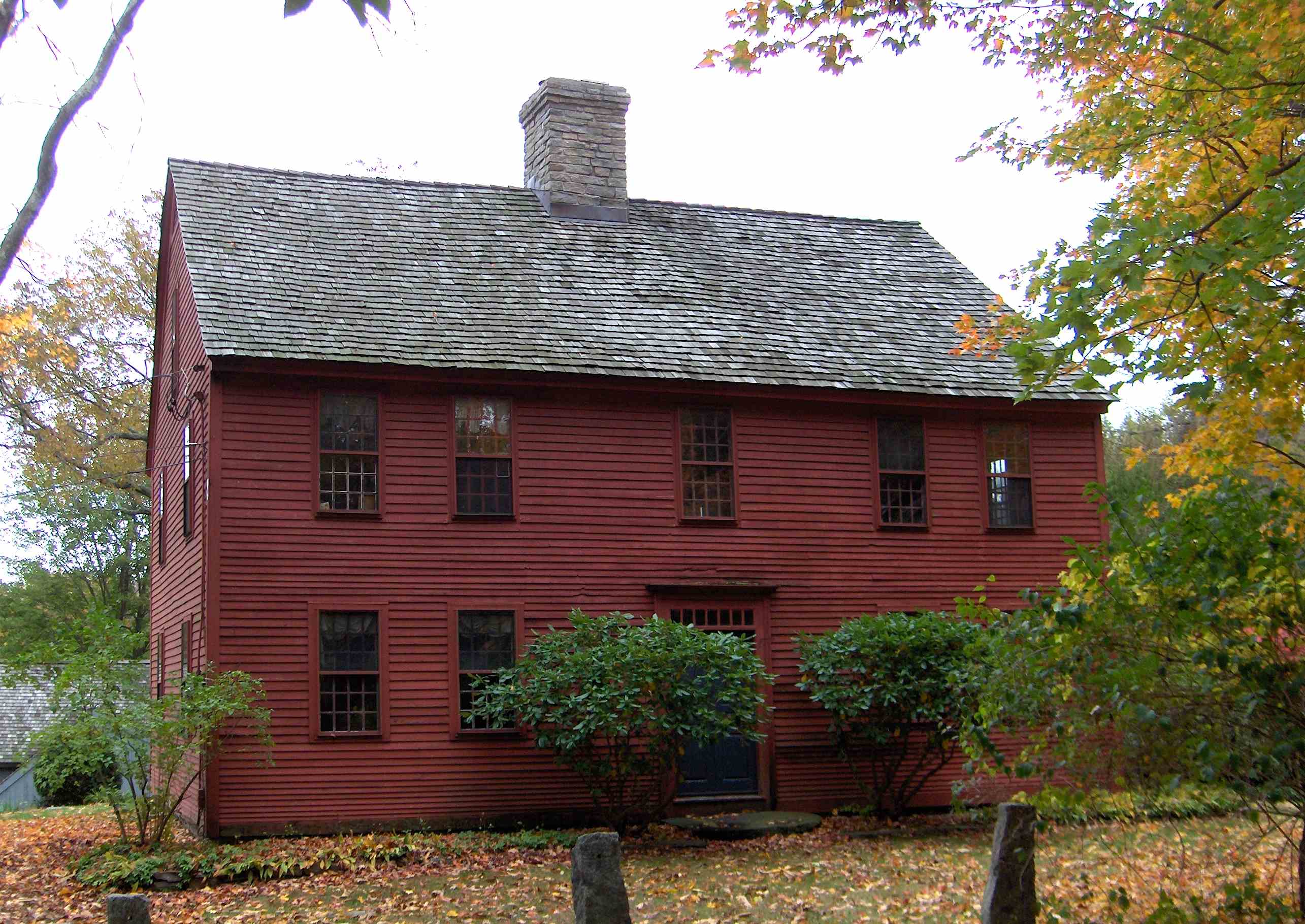
41°48′47″N 72°13′21″W / 41.813056°N 72.2225°WMansfield 16 Nathan Hale Homestead 
October 22, 1970 South St.
41°45′50″N 72°20′47″W / 41.763889°N 72.346389°WCoventry 17 Hebron Center Historic District July 30, 1993 Church, Gilead, Main, Wall, and West Sts. and Marjorie Cir.
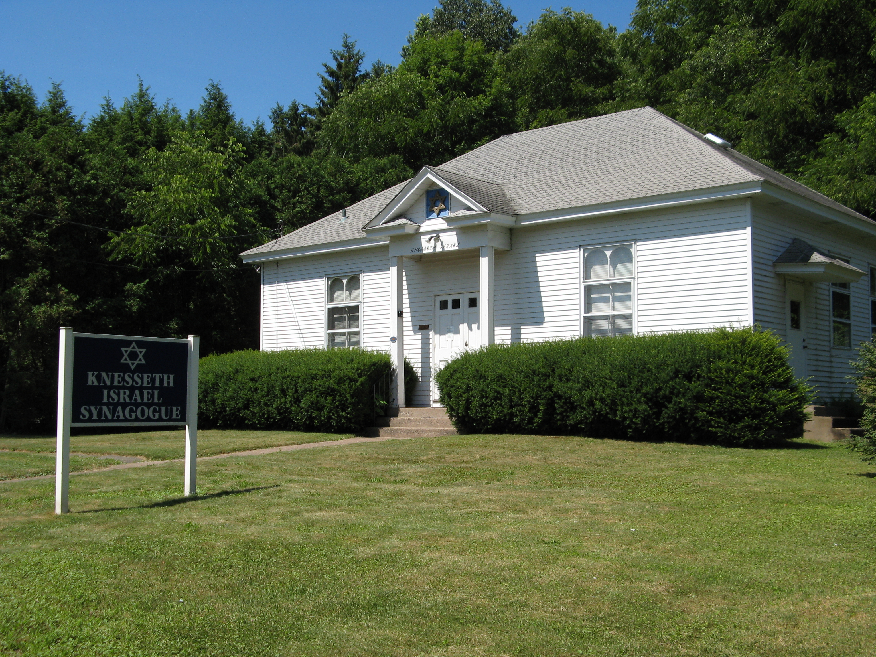
41°39′26″N 72°22′08″W / 41.657222°N 72.368889°WHebron 18 Knesseth Israel Synagogue 
July 21, 1995 236 Pinney St.
41°53′50″N 72°28′48″W / 41.897222°N 72.48°WEllington 19 Loomis-Pomeroy House April 26, 1994 1747 Boston Tpk.
41°47′52″N 72°22′35″W / 41.797778°N 72.376389°WCoventry 20 Mansfield Center Cemetery July 24, 1992 Junction of Storrs and Cemetery Rds.
41°45′43″N 72°11′46″W / 41.761944°N 72.196111°WMansfield 21 Mansfield Center Historic District February 23, 1972 Storrs Rd.
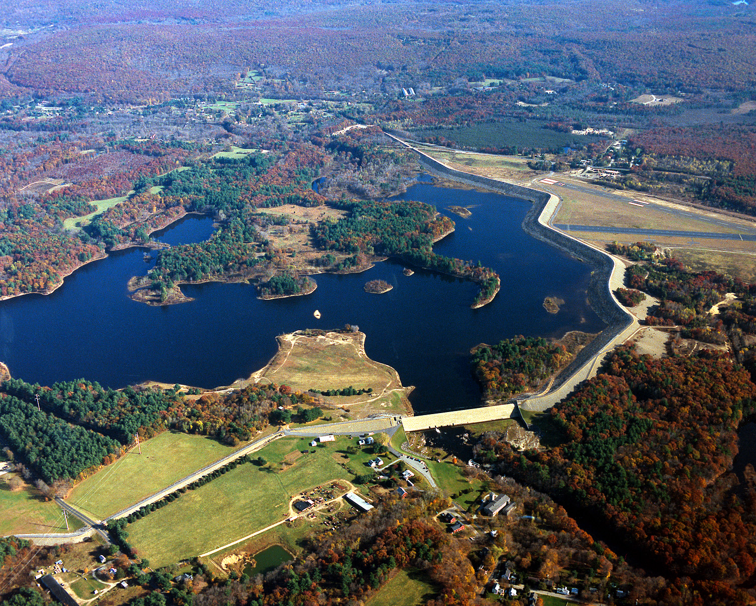
41°46′37″N 72°11′55″W / 41.776944°N 72.198611°WMansfield 22 Mansfield Hollow Dam 
April 12, 2009 141 Mansfield Hollow Rd.
41°45′20″N 72°10′54″W / 41.75569°N 72.18163°WMansfield and Windham 23 Mansfield Hollow Historic District May 21, 1979 86-127 Mansfield Hollow Rd.
41°45′25″N 72°11′09″W / 41.756944°N 72.185833°WMansfield 24 Mansfield Training School and Hospital December 22, 1987 Junction of CT 32 and CT 44
41°48′22″N 72°18′16″W / 41.806111°N 72.304444°WMansfield 25 March Route of Rochambeau's Army: Bailey Road 
January 8, 2003 Bailey Rd.
41°45′44″N 72°24′49″W / 41.762222°N 72.413611°WBolton 26 March Route Rochambeau's Army-Hutchinson Road May 6, 2002 Hutchinson Road from its junction with Hendee Rd. southward to its end
41°45′26″N 72°23′59″W / 41.757355°N 72.399688°WAndover 27 Minterburn Mill February 16, 1984 215 E. Main St.
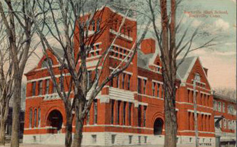
41°52′04″N 72°25′59″W / 41.867778°N 72.433056°WVernon 28 Old Rockville High School and East School 
April 27, 1981 School and Park Sts.
41°52′07″N 72°26′53″W / 41.868611°N 72.448056°WVernon 29 Oliver White Tavern 
May 6, 2002 2 Brandy St.
41°46′11″N 72°25′29″W / 41.769722°N 72.424722°WBolton 30 Parker-Hutchinson Farm April 29, 1982 Parker Bridge Rd.
41°44′27″N 72°19′23″W / 41.740833°N 72.323056°WCoventry 31 Augustus Post House June 28, 1982 4 Main St.
41°39′28″N 72°21′59″W / 41.657778°N 72.366389°WHebron 32 Rockville Historic District 
September 13, 1984 Roughly bounded by Snipsic St., Davis Ave., and West and South Sts.
41°51′51″N 72°27′04″W / 41.864167°N 72.451111°WVernon 33 Saxony Mill November 10, 1983 66 West St.
41°51′58″N 72°27′56″W / 41.866111°N 72.465556°WVernon 34 Sharpe's Trout Hatchery Site March 31, 1997 Address Restricted Vernon 35 Somers Historic District September 23, 1982 Main and Battle Sts., Bugbee Lane, and Springfield Rd.
41°59′07″N 72°26′48″W / 41.985278°N 72.446667°WSomers 36 Somersville Historic District April 13, 1995 Roughly along Main, Maple and School Sts., Pinney and Shaker Rd. and Quality Ave.
41°58′52″N 72°29′24″W / 41.981111°N 72.49°WSomers 37 South Coventry Historic District May 6, 1991 Roughly Main St. and adjacent streets from Armstrong Rd. to Lake St. and Lake from High St. to Main
41°46′03″N 72°17′54″W / 41.767535°N 72.298279°WCoventry 38 Elias Sprague House November 2, 1987 2187 South St.
41°45′56″N 72°20′29″W / 41.765556°N 72.341389°WCoventry 39 Spring Hill Historic District October 10, 1979 Roughly along Storrs Rd.
41°47′23″N 72°13′39″W / 41.78972°N 72.2275°W[5]Mansfield 40 Stafford Hollow Historic District 
October 15, 1987 Roughly parts of Leonard, Murphy, Old Monson, Orcuttville, and Patten Rds.
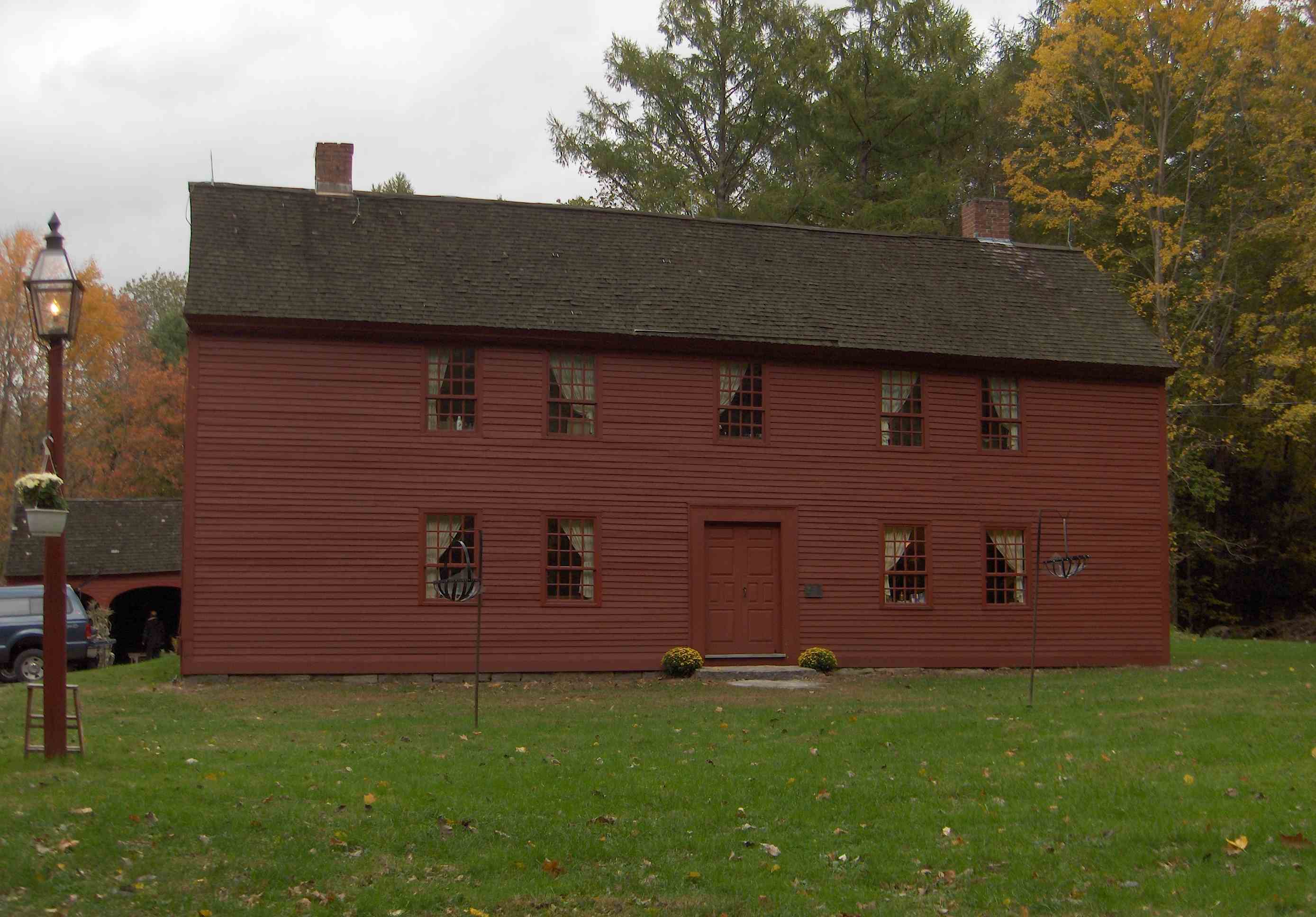
41°59′08″N 72°17′26″W / 41.985556°N 72.290556°WStafford 41 Strong House 
January 15, 1988 2382 South St.
41°45′58″N 72°20′55″W / 41.766111°N 72.348611°WCoventry 42 Talcottville Historic District January 5, 1989 13-44 Elm Hill Rd. and 11-132 Main St.
41°49′12″N 72°29′51″W / 41.82°N 72.4975°WVernon 43 Tolland Green Historic District 
August 1, 1997 Roughly along Old Post, Tolland Stage, and Cider Mill Rds.
41°52′11″N 72°22′36″W / 41.869722°N 72.376667°WTolland 44 Union Green Historic District July 19, 1990 Roughly the area north of the junction of Buckley Highway and Cemetery Rd. to the junction of Kinney Hollow and Town Hall Rds.
41°59′23″N 72°09′36″W / 41.989722°N 72.16°WUnion 45 University of Connecticut Historic District-Connecticut Agricultural School January 31, 1989 Roughly CT 195/Storrs Rd. at Eagleville Rd.
41°48′29″N 72°15′03″W / 41.808056°N 72.250833°WMansfield 46 Valley Falls Cotton Mill Site March 28, 1997 Address Restricted Vernon 47 White's Tavern 
July 26, 1991 131 U.S. Route 6
41°45′12″N 72°23′51″W / 41.753333°N 72.3975°WAndover 48 Eleazer Williams House March 11, 1971 Storrs Rd. (Route 195)
41°46′01″N 72°11′58″W / 41.766944°N 72.199444°WMansfield 49 Willington Common Historic District December 18, 1990 Properties around Willington Common and east on the Tolland Turnpike past Old Farms Rd.
41°52′31″N 72°15′52″W / 41.875278°N 72.264444°WWillington See also
- List of National Historic Landmarks in Connecticut
- National Register of Historic Places listings in Connecticut
References
- ^ The latitude and longitude information provided in this table was derived originally from the National Register Information System, which has been found to be fairly accurate for about 99% of listings. For about 1% of NRIS original coordinates, experience has shown that one or both coordinates are typos or otherwise extremely far off; some corrections may have been made. A more subtle problem causes many locations to be off by up to 150 yards, depending on location in the country: most NRIS coordinates were derived from tracing out latitude and longitudes off of USGS topographical quadrant maps created under North American Datum of 1927, which differs from the current, highly accurate GPS system used by Google maps. Chicago is about right, but NRIS longitudes in Washington are higher by about 4.5 seconds, and are lower by about 2.0 seconds in Maine. Latitudes differ by about 1.0 second in Florida. Some locations in this table may have been corrected to current GPS standards.
- ^ "National Register of Historic Places: Weekly List Actions". National Park Service, United States Department of the Interior. Retrieved on November 10, 2011.
- ^ Numbers represent an ordering by significant words. Various colorings, defined here, differentiate National Historic Landmark sites and National Register of Historic Places Districts from other NRHP buildings, structures, sites or objects.
- ^ "National Register Information System". National Register of Historic Places. National Park Service. . http://nrhp.focus.nps.gov/natreg/docs/All_Data.html.
- ^ Geocode coordinates based on description on Connecticut Commission on Culture and Tourism Historic Preservation and Museum Division web site.
U.S. National Register of Historic Places Topics Lists by states Alabama • Alaska • Arizona • Arkansas • California • Colorado • Connecticut • Delaware • Florida • Georgia • Hawaii • Idaho • Illinois • Indiana • Iowa • Kansas • Kentucky • Louisiana • Maine • Maryland • Massachusetts • Michigan • Minnesota • Mississippi • Missouri • Montana • Nebraska • Nevada • New Hampshire • New Jersey • New Mexico • New York • North Carolina • North Dakota • Ohio • Oklahoma • Oregon • Pennsylvania • Rhode Island • South Carolina • South Dakota • Tennessee • Texas • Utah • Vermont • Virginia • Washington • West Virginia • Wisconsin • WyomingLists by territories Lists by associated states Other  Category:National Register of Historic Places •
  Portal:National Register of Historic PlacesCategories:
- Tolland County, Connecticut
- National Register of Historic Places in Connecticut by county
-


Wikimedia Foundation. 2010.