- Mansfield Hollow Historic District
-
Mansfield Hollow Historic District
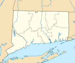
Location: 86-127 Mansfield Hollow Rd., Mansfield, Connecticut Coordinates: 41°45′25″N 72°11′9″W / 41.75694°N 72.18583°WCoordinates: 41°45′25″N 72°11′9″W / 41.75694°N 72.18583°W Area: 18 acres (7.3 ha) Built: 1800 Architect: Fitch,Edwin; Multiple Architectural style: Greek Revival Governing body: State NRHP Reference#: 79002667[1] Added to NRHP: May 21, 1979 The Mansfield Hollow Historic District is a 18-acre (7.3 ha) historic district in the town of Mansfield, Connecticut.
It was listed on the National Register of Historic Places in 1979. At that time, there were 17 buildings that were deemed to contribute to the historic character of the area, and one other contributing site.[1]
It includes and is "visually dominated" by a stone mill known as "Kirby's Mill" on the Natchaug River.[2]
Other significant contributing properties include:[2]
- Fearing Swift House, 103 Mansfield Hollow Road (see interior photo #10 in photos accompanying nomination)
- George Swift House, 100 Mansfield Hollow Road
- Oliver Binghouse, 90 Mansfield Hollow Road, probably the oldest house in the district
References
- ^ a b "National Register Information System". National Register of Historic Places. National Park Service. 2009-03-13. http://nrhp.focus.nps.gov/natreg/docs/All_Data.html.
- ^ a b Bruce Clouette (November 16, 1978). "National Register of Historic Places Inventory-Nomination: Mansfield Hollow Historic District". National Park Service. http://pdfhost.focus.nps.gov/docs/NRHP/Text/79002667.pdf. and Accompanying 10 photos, exterior and interior, from 1976 and 1978 (see photo map page 13 of text document)
U.S. National Register of Historic Places Topics Lists by states Alabama • Alaska • Arizona • Arkansas • California • Colorado • Connecticut • Delaware • Florida • Georgia • Hawaii • Idaho • Illinois • Indiana • Iowa • Kansas • Kentucky • Louisiana • Maine • Maryland • Massachusetts • Michigan • Minnesota • Mississippi • Missouri • Montana • Nebraska • Nevada • New Hampshire • New Jersey • New Mexico • New York • North Carolina • North Dakota • Ohio • Oklahoma • Oregon • Pennsylvania • Rhode Island • South Carolina • South Dakota • Tennessee • Texas • Utah • Vermont • Virginia • Washington • West Virginia • Wisconsin • WyomingLists by territories Lists by associated states Other  Category:National Register of Historic Places •
  Portal:National Register of Historic PlacesCategories:
- Historic districts in Connecticut
- Mansfield, Connecticut
- Historic districts in Tolland County, Connecticut
- Connecticut Registered Historic Place stubs
Wikimedia Foundation. 2010.

