- Oil Township, Perry County, Indiana
-
Oil Township — Township — Location in Perry County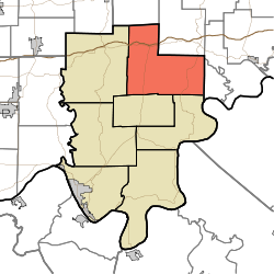
Coordinates: 38°10′47″N 86°33′49″W / 38.17972°N 86.56361°WCoordinates: 38°10′47″N 86°33′49″W / 38.17972°N 86.56361°W Country  United States
State  Indiana
County Perry Government - Type Indiana township Area - Total 66.57 sq mi (172.41 km2) - Land 66.33 sq mi (171.78 km2) - Water 0.24 sq mi (0.62 km2) 0.36% Elevation 528 ft (161 m) Population (2000) - Total 2,032 - Density 30.6/sq mi (11.8/km2) ZIP codes 47118, 47137, 47514, 47515, 47520, 47551, 47576, 47586 GNIS feature ID 0453686 Oil Township is one of seven townships in Perry County, Indiana, USA. As of the 2000 census, its population was 2,032.[1]
Contents
Geography
According to the United States Census Bureau, Oil Township covers an area of 66.57 square miles (172.4 km2); of this, 66.33 square miles (171.8 km2) (99.63 percent) is land and 0.24 square miles (0.62 km2) (0.36 percent) is water.
Unincorporated towns
- Apalona at 38°09′16″N 86°37′56″W / 38.1545037°N 86.6322075°W
- Bandon at 38°08′14″N 86°36′01″W / 38.1372822°N 86.6002618°W
- Branchville at 38°09′49″N 86°34′47″W / 38.1636715°N 86.5797058°W
- Celina at 38°11′17″N 86°36′46″W / 38.1881152°N 86.6127629°W
- Doolittle Mills at 38°15′03″N 86°36′11″W / 38.2508929°N 86.6030412°W
- Oriole at 38°10′08″N 86°30′17″W / 38.1689508°N 86.5047033°W
- Saint Croix at 38°13′26″N 86°35′11″W / 38.2239489°N 86.5863736°W
(This list is based on USGS data and may include former settlements.)
Cemeteries
The township contains these sixteen cemeteries: Bangle, Colby, Ewing, German Ridge, Guillaume, Jeffries, Jones, Luxenburger, Miller, Rickenbaugh, Senn, Sprinkle, Underhill, Valley, Walker and Woolums.
Major highways
Indiana state road 62 indidna state road 66
School districts
- Perry Central Community School Corporation
Political districts
- State House District 73
- State Senate District 47
References
- "Oil Township, Perry County, Indiana". Geographic Names Information System, U.S. Geological Survey. http://geonames.usgs.gov/pls/gnispublic/f?p=gnispq:3:::NO::P3_FID:0453686. Retrieved 2009-11-21.
- United States Census Bureau 2009 TIGER/Line Shapefiles
- IndianaMap
External links
- Indiana Township Association
- United Township Association of Indiana
- City-Data.com page for Oil Township

Johnson Township, Crawford County Union Township, Crawford County Clark Township 
Boone Township, Crawford County
Ohio Township, Crawford County Oil Township

Leopold Township Union Township Municipalities and communities of Perry County, Indiana County seat: Tell City Cities 
Town Townships Unincorporated
communitiesAdyeville | Apalona | Bandon | Branchville | Bristow | Celina | Derby | Dexter | Dodd | Doolittle Mills | Fenn Haven | Gatchel | Gerald | Kitterman Corners | Leopold | Lilly Dale | Magnet | Mount Pleasant | Oriole | Ranger | Rome | St. Croix | Sassafras | Siberia | Terry | Tobinsport
Categories:- Townships in Perry County, Indiana

Wikimedia Foundation. 2010.