- Chrisney, Indiana
-
Town of Chrisney, Indiana — Town — Location in the state of Indiana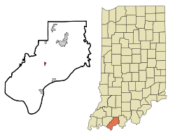
Coordinates: 38°0′49″N 87°2′8″W / 38.01361°N 87.03556°WCoordinates: 38°0′49″N 87°2′8″W / 38.01361°N 87.03556°W Country United States State Indiana County Spencer Township Grass Area – Total 0.4 sq mi (1.0 km2) – Land 0.4 sq mi (1.0 km2) – Water 0.0 sq mi (0.0 km2) Elevation 469 ft (143 m) Population (2010) – Total 481 – Density 1,470.3/sq mi (567.7/km2) Time zone CST (UTC-6) – Summer (DST) CDT (UTC-5) ZIP code 47611 Area code(s) 812 FIPS code 18-12574[1] GNIS feature ID 0432490[2] Chrisney is a town in Grass Township, Spencer County, Indiana, United States. The population was 481 at the 2010 census. It was originally known as Spring's Station, and renamed Chrisney in 1882 after John B. Chrisney, who owned the land where the first rail station and post office were built.
Geography
Chrisney is located at 38°00′49″N 87°02′08″W / 38.013663°N 87.035601°W.[3]
According to the United States Census Bureau, the town has a total area of 0.4 square miles (1.0 km2), all of it land.
Demographics
As of the census[1] of 2000, there were 544 people, 210 households, and 140 families residing in the town. The population density was 1,484.9 people per square mile (567.7/km²). There were 233 housing units at an average density of 636.0 per square mile (243.1/km²). The racial makeup of the town was 97.79% White, 0.74% Native American, 0.37% from other races, and 1.10% from two or more races. Hispanic or Latino of any race were 0.55% of the population.
There were 210 households out of which 34.3% had children under the age of 18 living with them, 54.3% were married couples living together, 7.1% had a female householder with no husband present, and 33.3% were non-families. 30.5% of all households were made up of individuals and 14.8% had someone living alone who was 65 years of age or older. The average household size was 2.59 and the average family size was 3.25.
In the town the population was spread out with 29.0% under the age of 18, 7.7% from 18 to 24, 27.8% from 25 to 44, 19.3% from 45 to 64, and 16.2% who were 65 years of age or older. The median age was 34 years. For every 100 females there were 84.4 males. For every 100 females age 18 and over, there were 82.9 males.
The median income for a household in the town was $34,464, and the median income for a family was $45,000. Males had a median income of $30,000 versus $19,125 for females. The per capita income for the town was $14,127. About 14.1% of families and 15.1% of the population were below the poverty line, including 25.6% of those under age 18 and 7.8% of those age 65 or over.
References
- ^ a b "American FactFinder". United States Census Bureau. http://factfinder.census.gov. Retrieved 2008-01-31.
- ^ "US Board on Geographic Names". United States Geological Survey. 2007-10-25. http://geonames.usgs.gov. Retrieved 2008-01-31.
- ^ "US Gazetteer files: 2010, 2000, and 1990". United States Census Bureau. 2011-02-12. http://www.census.gov/geo/www/gazetteer/gazette.html. Retrieved 2011-04-23.
Municipalities and communities of Spencer County, Indiana City 
Towns Chrisney | Dale | Gentryville | Grandview | Richland City | Santa Claus
Townships Unincorporated
communitiesAfrica | Bloomfield | Buffaloville | Centerville | Clay City | Enterprise | Eureka | Evanston | Fulda | Hatfield | Huffman | Kennedy | Lake Mill | Lamar | Liberal | Lincoln City | Mariah Hill | Maxville | Midway | New Boston | Newtonville | Patronville | Pueblo | Reo | Rock Hill | Rockport Junction | Saint Meinrad | Sand Ridge | Santa Fe | Schley | Silverdale
Categories:- Communities of Southwestern Indiana
- Populated places in Spencer County, Indiana
- Towns in Indiana

Wikimedia Foundation. 2010.