- National Register of Historic Places listings in Cass County, Indiana
-
 Location of Cass County in Indiana
This is a list of the National Register of Historic Places listings in Cass County, Indiana.
This is intended to be a complete list of the properties and districts on the National Register of Historic Places in Cass County, Indiana, United States. Latitude and longitude coordinates are provided for many National Register properties and districts; these locations may be seen together in a Google map.[1]
There are 15 properties and districts listed on the National Register in the county, including 1 National Historic Landmark.
-
- This National Park Service list is complete through NPS recent listings posted November 10, 2011.[2]
Current listings
[3] Landmark name [4] Image Date listed Location City or town Summary 1 Josephus Atkinson Farm June 24, 2010 4474 W. 400S
40°42′24″N 86°27′29″W / 40.706667°N 86.458056°WClymers 2 Bankers Row Historic District September 17, 1999 Eel River Ave. from Market to 3rd
40°45′13″N 86°22′09″W / 40.753611°N 86.369167°WLogansport 3 Thompson Barnett House August 14, 1986 State Road 25
40°47′02″N 86°21′01″W / 40.783889°N 86.350278°WLogansport 4 Courthouse Historic District March 12, 1999 Roughly between 3rd and 6th Sts., E. Melbourne Ave., and High St.
40°45′14″N 86°21′53″W / 40.753889°N 86.364722°WLogansport 5 Ferguson House June 30, 1983 803 E. Broadway
40°45′18″N 86°21′35″W / 40.755°N 86.359722°WLogansport 6 Jerolaman-Long House March 28, 1985 1004 E. Market St.
40°45′17″N 86°21′20″W / 40.754722°N 86.355556°WLogansport 7 John Keip House December 6, 2004 2500 E. Broadway Ave.
40°45′34″N 86°20′11″W / 40.759444°N 86.336389°WLogansport 8 Kendrick-Baldwin House September 9, 1982 706 E. Market St.
40°45′13″N 86°21′39″W / 40.753611°N 86.360833°WLogansport 9 Pipe Creek Falls Resort September 14, 1995 Junction of County Roads 850E and 275S at Pipe Creek
40°43′36″N 86°13′02″W / 40.726667°N 86.217222°WWalton 10 Willard B. Place House August 14, 1998 900 E. Broadway
40°45′19″N 86°21′30″W / 40.755278°N 86.358333°WLogansport 11 Pleasant Hill Church January 11, 1996 Junction of County Roads 400S and 675W
40°42′44″N 86°30′06″W / 40.712222°N 86.501667°WLogansport 12 Point Historic District September 17, 1999 Roughly between Eel River Ave., 3rd, St., and E. Melbourne Ave.
40°45′09″N 86°22′07″W / 40.7525°N 86.368611°WLogansport 13 Pollard-Nelson House October 29, 1975 7th and Market Sts.
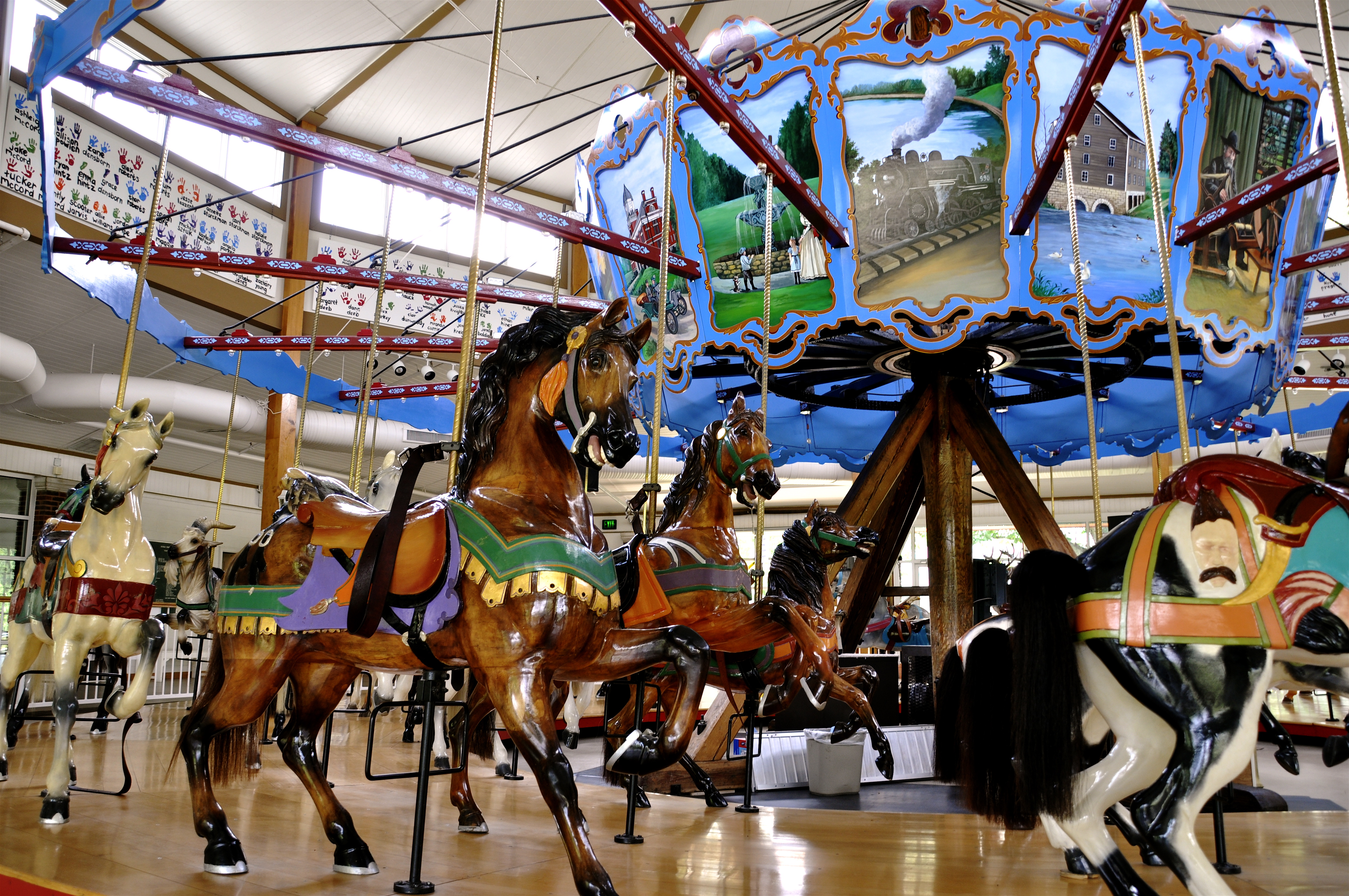
40°45′12″N 86°21′40″W / 40.753333°N 86.361111°WLogansport 14 Spencer Park Dentzel Carousel 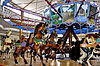
February 27, 1987 Riverside Park
40°45′34″N 86°21′20″W / 40.759444°N 86.355556°WLogansport 15 Henry Tousley House October 15, 2002 1912 High St.
40°45′37″N 86°20′42″W / 40.760278°N 86.345°WLogansport See also
- List of National Historic Landmarks in Indiana
- National Register of Historic Places listings in Indiana
References
- ^ The latitude and longitude information provided in this table was derived originally from the National Register Information System, which has been found to be fairly accurate for about 99% of listings. For about 1% of NRIS original coordinates, experience has shown that one or both coordinates are typos or otherwise extremely far off; some corrections may have been made. A more subtle problem causes many locations to be off by up to 150 yards, depending on location in the country: most NRIS coordinates were derived from tracing out latitude and longitudes off of USGS topographical quadrant maps created under North American Datum of 1927, which differs from the current, highly accurate GPS system used by Google maps. Chicago is about right, but NRIS longitudes in Washington are higher by about 4.5 seconds, and are lower by about 2.0 seconds in Maine. Latitudes differ by about 1.0 second in Florida. Some locations in this table may have been corrected to current GPS standards.
- ^ "National Register of Historic Places: Weekly List Actions". National Park Service, United States Department of the Interior. Retrieved on November 10, 2011.
- ^ Numbers represent an ordering by significant words. Various colorings, defined here, differentiate National Historic Landmark sites and National Register of Historic Places Districts from other NRHP buildings, structures, sites or objects.
- ^ "National Register Information System". National Register of Historic Places. National Park Service. . http://nrhp.focus.nps.gov/natreg/docs/All_Data.html.
U.S. National Register of Historic Places Topics Lists by states Alabama • Alaska • Arizona • Arkansas • California • Colorado • Connecticut • Delaware • Florida • Georgia • Hawaii • Idaho • Illinois • Indiana • Iowa • Kansas • Kentucky • Louisiana • Maine • Maryland • Massachusetts • Michigan • Minnesota • Mississippi • Missouri • Montana • Nebraska • Nevada • New Hampshire • New Jersey • New Mexico • New York • North Carolina • North Dakota • Ohio • Oklahoma • Oregon • Pennsylvania • Rhode Island • South Carolina • South Dakota • Tennessee • Texas • Utah • Vermont • Virginia • Washington • West Virginia • Wisconsin • WyomingLists by territories Lists by associated states Other  Category:National Register of Historic Places •
  Portal:National Register of Historic Places
Municipalities and communities of Cass County, Indiana County seat: Logansport City 
Towns Galveston | Onward | Royal Center | Walton
Townships Unincorporated
communitiesAdamsboro | Anoka | Clymers | Danes | Deacon | Dunkirk | Georgetown | Grissom JARB‡ | Hoover | Kenneth | Lake Cicott | Leases Corner | Lewisburg | Lincoln | Lucerne | Metea | Miami Bend | Mount Pleasant | New Waverly | Potawatomi Point | Twelve Mile | Young America
Footnotes ‡This populated place also has portions in an adjacent county or counties
Categories:- Cass County, Indiana
- National Register of Historic Places in Indiana by county
-

Wikimedia Foundation. 2010.