- Old Hill, Indiana
-
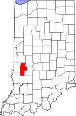
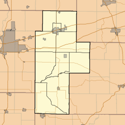
Old Hill — Unincorporated town — Clay County's location in Indiana Location in Clay County Coordinates: 39°18′07″N 87°12′27″W / 39.30194°N 87.2075°WCoordinates: 39°18′07″N 87°12′27″W / 39.30194°N 87.2075°W Country United States State Indiana County Clay Township Lewis Elevation 538 ft (164 m) GNIS feature ID 440570[1] Old Hill is an unincorporated community in northern Lewis Township, Clay County, Indiana. It is right near the intersection of Lewis Township with Harrison and Perry Townships. Old Hill is part of the Terre Haute Metropolitan Statistical Area.
Geography
Old Hill is located at 39°18′07″N 87°12′27″W / 39.30194°N 87.2075°W.
References
- ^ "Old Hill, Indiana". Geographic Names Information System, U.S. Geological Survey. http://geonames.usgs.gov/pls/gnispublic/f?p=gnispq:3:::NO::P3_FID:440570. Retrieved 2010-08-20.
Municipalities and communities of Clay County, Indiana City Towns Carbon | Center Point | Clay City | Harmony | Knightsville | Staunton
Townships Brazil | Cass | Dick Johnson | Harrison | Jackson | Lewis | Perry | Posey | Sugar Ridge | Van Buren | Washington
Unincorporated
communitiesArt | Ashboro | Asherville | Barrick Corner | Bee Ridge | Benwood | Billtown | Billville | Bogle Corner | Bowling Green | Brunswick | Buchanan Corner | Cardonia | Cloverland | Coalmont | Cory | Cottage Hill | Eel River | Hoffman Crossing | Hoosierville | Howesville | Lap Corner | Middlebury | Old Hill | Perth | Poland | Pontiac | Prairie City | Purdy Hill | Roadman Corner | Saline City | Shady Lane | Six Points | Stearleyville | Turner | Twin Beach
Categories:- Populated places in Clay County, Indiana
- Unincorporated communities in Indiana
- Terre Haute metropolitan area
- Southern Indiana geography stubs
Wikimedia Foundation. 2010.


