- National Register of Historic Places listings in Brazoria County, Texas
-
List of Registered Historic Places in Bee County, Texas
This is intended to be a complete list of properties and districts listed on the National Register of Historic Places in Brazoria County, Texas. The locations of National Register properties and districts (at least for all showing latitude and longitude coordinates below) may be seen in a Google map by clicking on "Map of all coordinates".[1]
-
- This National Park Service list is complete through NPS recent listings posted November 10, 2011.[2]
[3] Landmark name [4] Image Date listed Location City or town Summary 1 Brazoria Bridge June 14, 1991 0.9 mi. E of TX 36 on TX 332
29°03′15″N 95°33′25″W / 29.054167°N 95.556944°WBrazoria 2 Alden B. Dow Office and Lake Jackson City Hall March 1, 2010 101 S. Parking Place
29°02′28″N 95°26′55″W / 29.041211°N 95.448614°WLake Jackson 3 Durazno Plantation September 2, 1980 S of Jones Creek off TX 36
28°57′22″N 95°26′57″W / 28.956111°N 95.449167°WJones Creek 4 East Columbia Historic District October 28, 1991 S. Main St.
29°08′31″N 95°36′54″W / 29.141944°N 95.615°WEast Columbia 5 Gazebo for James Richard Marmion October 22, 2004 1214 County Rd.
29°02′34″N 95°38′40″W / 29.042778°N 95.644444°WSweeny Sculpture by Dionicio Rodriguez 6 GEN. C. B. COMSTOCK (dredge) Shipwreck Site July 6, 1995 Address Restricted Surfside Beach 7 John McCroskey Cabin August 28, 1975 2 mi. NE of Cedar Lake on Stringfellow Ranch
28°56′22″N 95°36′54″W / 28.939444°N 95.615°WCedar Lake 8 Old Brazoria County Courthouse March 12, 1979 Public Sq.
29°10′08″N 95°25′52″W / 29.168889°N 95.431111°WAngleton 9 Palapa Table for James Richard Marmion October 22, 2004 1214 County Rd.
29°02′38″N 95°38′51″W / 29.043889°N 95.6475°WSweeny Sculpture by Dionicio Rodriguez 10 Ammon Underwood House June 24, 1976 Main St.
29°08′20″N 95°37′03″W / 29.138889°N 95.6175°WEast Columbia 11 Varner-Hogg Plantation 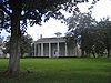
April 9, 1980 2 mi. NE of West Columbia off FM 2852
29°09′47″N 95°38′25″W / 29.163056°N 95.640278°WWest Columbia See also
- Registered Historic Places in Texas, Counties A-C
References
- ^ The latitude and longitude information provided in this table was derived originally from the National Register Information System, which has been found to be fairly accurate for about 99% of listings. For about 1% of NRIS original coordinates, experience has shown that one or both coordinates are typos or otherwise extremely far off; some corrections may have been made. A more subtle problem causes many locations to be off by up to 150 yards, depending on location in the country: most NRIS coordinates were derived from tracing out latitude and longitudes off of USGS topographical quadrant maps created under North American Datum of 1927, which differs from the current, highly accurate GPS system used by Google maps. Chicago is about right, but NRIS longitudes in Washington are higher by about 4.5 seconds, and are lower by about 2.0 seconds in Maine. Latitudes differ by about 1.0 second in Florida. Some locations in this table may have been corrected to current GPS standards.
- ^ "National Register of Historic Places: Weekly List Actions". National Park Service, United States Department of the Interior. Retrieved on November 10, 2011.
- ^ Numbers represent an ordering by significant words. Various colorings, defined here, differentiate National Historic Landmark sites and National Register of Historic Places Districts from other NRHP buildings, structures, sites or objects.
- ^ "National Register Information System". National Register of Historic Places. National Park Service. . http://nrhp.focus.nps.gov/natreg/docs/All_Data.html.
U.S. National Register of Historic Places Topics Lists by states Alabama • Alaska • Arizona • Arkansas • California • Colorado • Connecticut • Delaware • Florida • Georgia • Hawaii • Idaho • Illinois • Indiana • Iowa • Kansas • Kentucky • Louisiana • Maine • Maryland • Massachusetts • Michigan • Minnesota • Mississippi • Missouri • Montana • Nebraska • Nevada • New Hampshire • New Jersey • New Mexico • New York • North Carolina • North Dakota • Ohio • Oklahoma • Oregon • Pennsylvania • Rhode Island • South Carolina • South Dakota • Tennessee • Texas • Utah • Vermont • Virginia • Washington • West Virginia • Wisconsin • WyomingLists by territories Lists by associated states Other  Category:National Register of Historic Places •
  Portal:National Register of Historic PlacesCategories:
- Brazoria County, Texas
- National Register of Historic Places in Texas
- Buildings and structures in Brazoria County, Texas
-

Wikimedia Foundation. 2010.