- Coryell County, Texas
-
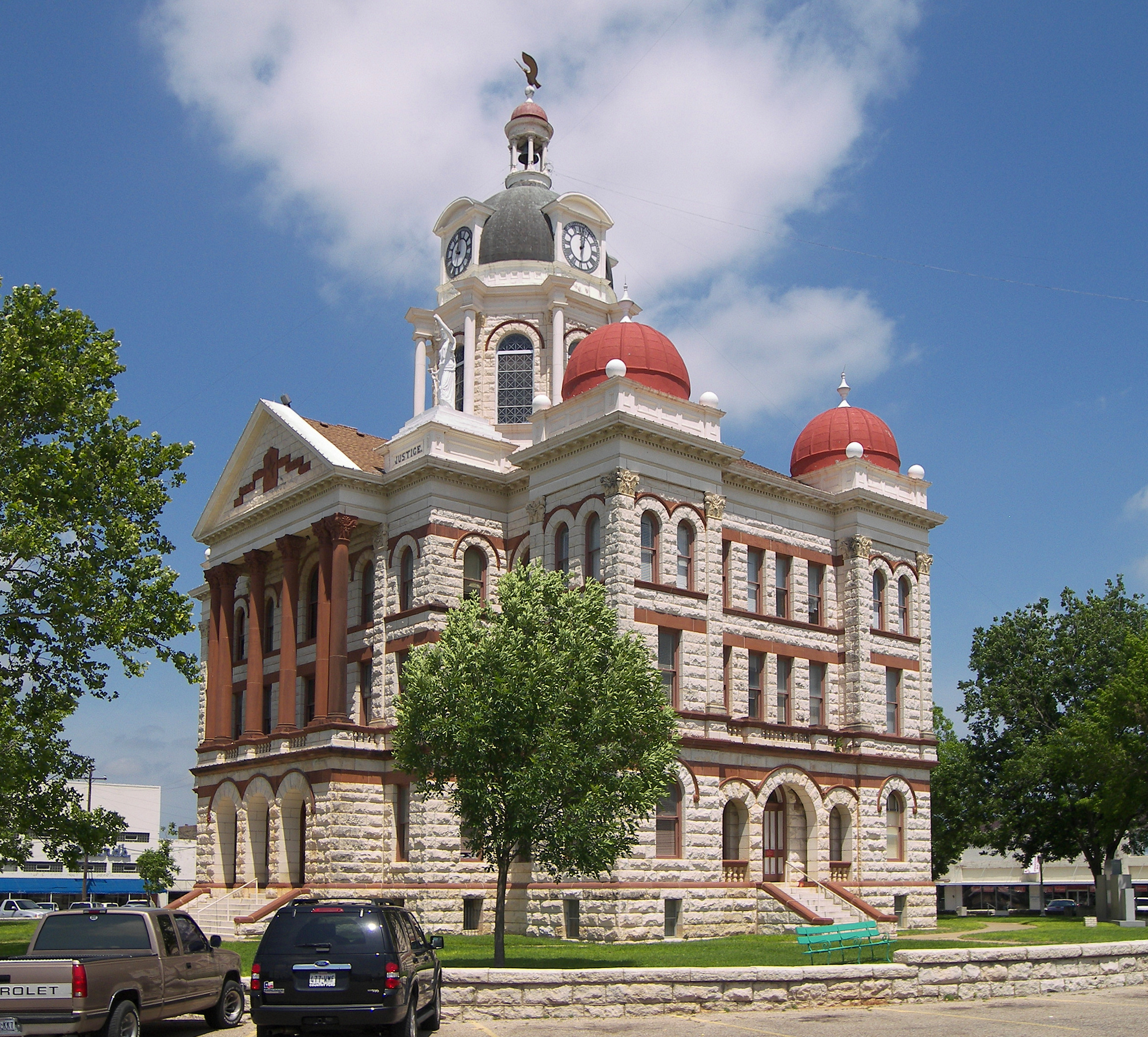
Coryell County, Texas  The Coryell County Courthouse in Gatesville, Texas. The courthouse was added to the National Register of Historic Places on August 18, 1977.
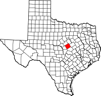
Location in the state of Texas
Texas's location in the U.S.Founded 1854 Seat Gatesville Area
- Total
- Land
- Water
1,057 sq mi (2,738 km²)
1,052 sq mi (2,725 km²)
5 sq mi (13 km²), 0.47%Population
- (2000)
- Density
74,978
73/sq mi (28/km²)Coryell County is a county located on the Edwards Plateau in the U.S. state of Texas. In 2000, its population was 74,978. The county seat is Gatesville. Coryell County forms part of the Killeen–Temple–Fort Hood Metropolitan Statistical Area. It is named for James Coryell, a frontiersman, and Texas Ranger who was killed by Native Americans while protecting settlers.
Contents
History
The habitation history of Coryell County dates to its indigenous peoples as far back as 4500 b.c. The Tonkawa, Lipan Apache, Kiowa and Comanche were among other tribes who migrated through the area.[1] When the General Colonization Law went into effect in 1824, and the 1825 State Colonization Law of Coahuila y Tejas, Robert Leftwich obtained a grant to settle 800 families in Texas.[2][3] This grant went through legal challenges, and later became known as the Robertson's Colony grant, named after Sterling C. Robertson. The grant encompassed all or part of thirty present-day Texas counties [4] Settlers began moving into the area only after Fort Gates was established at Gatesville. The state legislature established the county in 1854 and named it after exlorer James Coryell.[1][5]
Geography
According to the U.S. Census Bureau, the county has a total area of 1,057 square miles (2,738 km2), of which 1,052 square miles (2,725 km2) is land and 5 square miles (13 km2) (0.47%) is water.
Major highways
 U.S. Highway 84
 U.S. Highway 190
 State Highway 36
Adjacent counties
- Bosque County (north)
- McLennan County (northeast)
- Bell County (southeast)
- Lampasas County (southwest)
- Hamilton County (northwest)
Demographics
As of the census[6] of 2000, there were 74,978 people, 19,950 households, and 15,780 families residing in the county. The population density was 71 people per square mile (28/km²). There were 21,776 housing units at an average density of 21 per square mile (8/km²). The racial makeup of the county was 65.28% White, 21.80% Black or African American, 0.88% Native American, 1.75% Asian, 0.49% Pacific Islander, 6.26% from other races, and 3.54% from two or more races. 12.57% of the population were Hispanic or Latino of any race.
There were 19,950 households out of which 47.70% had children under the age of 18 living with them, 64.80% were married couples living together, 11.00% had a female householder with no husband present, and 20.90% were non-families. 16.90% of all households were made up of individuals and 5.50% had someone living alone who was 65 years of age or older. The average household size was 2.91 and the average family size was 3.27.
In the county, the population was spread out with 26.20% under the age of 18, 17.90% from 18 to 24, 36.30% from 25 to 44, 13.80% from 45 to 64, and 5.70% who were 65 years of age or older. The median age was 28 years. For every 100 females there were 105.30 males. For every 100 females age 18 and over, there were 106.20 males.
The median income for a household in the county was $35,999, and the median income for a family was $38,307. Males had a median income of $24,236 versus $21,186 for females. The per capita income for the county was $14,410. About 7.80% of families and 9.50% of the population were below the poverty line, including 12.30% of those under age 18 and 9.00% of those age 65 or over.
Cities and towns
- Copperas Cove
- Evant
- Flat (unincorporated)
- Fort Hood
- Gatesville
- Jonesboro (unincorporated)
- Mound (unincorporated)
- Oglesby
- Purmela (unincorporated)
- South Mountain
- The Grove (unincorporated)
- Turnersville (unincorporated)
Government and infrastructure
Of the eight Texas Department of Criminal Justice general correctional facilities for women, which include five prisons and three state jails,[7] Five of the units,[8] including four prisons and one state jail,[7] are in the City of Gatesville.[8][9]
The Christina Crain Unit prison (formerly Gatesville Unit),[10] the Hilltop Unit prison,[11] the Dr. Lane Murray Unit prison,[12] and the Linda Woodman Unit state jail are co-located amongst one another.[13] In addition the Mountain View Unit, a prison with the State of Texas female death row, is in Gatesville.[14] One male prison, the Alfred D. Hughes Unit, is in Gatesville.[15]
Mountain View opened in July 1975,[14] Crain opened in August 1980,[10] Hilltop opened in November 1981,[11] Hughes opened in January 1990.[15] Murray opened in November 1995,[12] and Woodman opened in June 1997.[13] In 1995, of the counties in Texas, Coryell had the third highest number of state prisons and jails, after Walker and Brazoria.[16]
See also
References
- ^ a b Smyrl, Vivian Elizabeth. "Coryell County". Handbook of Texas Online. Texas State Historical Association. http://www.tshaonline.org/handbook/online/articles/hcc23. Retrieved 15 October 2011.
- ^ Barker, Eugene C. "Mexican Colonization Laws". Handbook of Texas Online. Texas State Historical Association. http://www.tshaonline.org/handbook/online/articles/ugm01. Retrieved 15 October 2011.
- ^ Blackmar, Frank Wilson (1891). Spanish institutions of the Southwest. The John Hopking Press. pp. 312, 313.
- ^ McLean, Malcolm D. "Robertson's Colony". Handbook of Texas Online. Texas State Historical Association. http://www.tshaonline.org/handbook/online/articles/uer01. Retrieved 15 October 2011.
- ^ Hyman, Carolyn. "James Coryell". Handbook of Texas Online. Texas State Historical Association. http://www.tshaonline.org/handbook/online/articles/fco74. Retrieved 15 October 2011.
- ^ "American FactFinder". United States Census Bureau. http://factfinder.census.gov. Retrieved 2008-01-31.
- ^ a b "Unit Directory." Texas Department of Criminal Justice. Retrieved on May 10, 2010.
- ^ a b Gately, Paul "Former Downtown Waco Executive Director Moved to Gatesville." KWTX-TV. November 22, 2008. Retrieved on May 20, 2010.
- ^ "Gatesville city, Texas." U.S. Census Bureau. Retrieved on May 10, 2010.
- ^ a b "Crain Unit." Texas Department of Criminal Justice. Retrieved on May 10, 2010.
- ^ a b "Hilltop Unit." Texas Department of Criminal Justice. Retrieved on May 10, 2010.
- ^ a b "Murray Unit." Texas Department of Criminal Justice. Retrieved on May 10, 2010.
- ^ a b "Woodman Unit." Texas Department of Criminal Justice. Retrieved on May 10, 2010.
- ^ a b "Mountain View Unit." Texas Department of Criminal Justice. Retrieved on May 10, 2010.
- ^ a b "Hughes Unit." Texas Department of Criminal Justice. Retrieved on May 10, 2010.
- ^ Horswell, Cindy. "For hard-hit economy of Liberty County, crime officially pays." Houston Chronicle. Thursday June 29, 1995. A30. Retrieved on July 23, 2010.
External links
- Texas State Directory, County officials
- Coryell County at the Open Directory Project
- Coryell County in Handbook of Texas Online at the University of Texas
- Read James Coryell's entry in the Biographical Encyclopedia of Texas hosted by the Portal to Texas History.

Hamilton County Bosque County McLennan County 
 Coryell County, Texas

Lampasas County Bell County Municipalities and communities of Coryell County, Texas County seat: Gatesville Cities Copperas Cove‡ | Gatesville | McGregor‡ | Oglesby
Towns CDP Unincorporated
communitiesFootnotes ‡This populated place also has portions in an adjacent county or counties
Categories:- Texas counties
- Coryell County, Texas
- 1854 establishments in the United States
- Killeen – Temple – Fort Hood metropolitan area


Wikimedia Foundation. 2010.