- National Register of Historic Places listings in Love County, Oklahoma
-
 Location of Love County in Oklahoma
This is a list of the National Register of Historic Places listings in Love County, Oklahoma.
This is intended to be a complete list of the properties on the National Register of Historic Places in Love County, Oklahoma, United States. The locations of National Register properties for which the latitude and longitude coordinates are included below, may be seen in a Google map.[1]
There are 6 properties listed on the National Register in the county.
-
- This National Park Service list is complete through NPS recent listings posted November 10, 2011.[2]
Current listings
[3] Landmark name [4] Image Date listed Location City or town Summary 1 Archeological Site 34LV181 December 13, 2010 Address Restricted Rubottom vicinity 2 Archeological Site 34LV184 December 13, 2010 Address Restricted Leon vicinity 3 Love County Courthouse August 23, 1984 100 S. 4th St.
33°56′18″N 97°07′20″W / 33.938333°N 97.122222°WMarietta 4 Love County Jail and Sheriff's Residence September 6, 2007 408½ W. Chickasaw
33°56′12″N 97°07′19″W / 33.936667°N 97.121944°WMarietta 5 Santa Fe Depot September 6, 2007 101 SE Front
33°56′12″N 97°06′58″W / 33.936667°N 97.116111°WMarietta 6 Bill Washington Ranchhouse July 27, 1971 About 4 miles southwest of Marietta
33°55′10″N 97°09′13″W / 33.919444°N 97.153611°WMarietta See also
- List of National Historic Landmarks in Oklahoma
- National Register of Historic Places listings in Oklahoma
References
- ^ The latitude and longitude information provided in this table was derived originally from the National Register Information System, which has been found to be fairly accurate for about 99% of listings. For about 1% of NRIS original coordinates, experience has shown that one or both coordinates are typos or otherwise extremely far off; some corrections may have been made. A more subtle problem causes many locations to be off by up to 150 yards, depending on location in the country: most NRIS coordinates were derived from tracing out latitude and longitudes off of USGS topographical quadrant maps created under the North American Datum of 1927, which differs from the current, highly accurate WGS84 GPS system used by Google maps. Chicago is about right, but NRIS longitudes in Washington are higher by about 4.5 seconds, and are lower by about 2.0 seconds in Maine. Latitudes differ by about 1.0 second in Florida. Some locations in this table may have been corrected to current GPS standards.
- ^ "National Register of Historic Places: Weekly List Actions". National Park Service, United States Department of the Interior. Retrieved on November 10, 2011.
- ^ Numbers represent an ordering by significant words. Various colorings, defined here, differentiate National Historic Landmark sites and National Register of Historic Places Districts from other NRHP buildings, structures, sites or objects.
- ^ "National Register Information System". National Register of Historic Places. National Park Service. . http://nrhp.focus.nps.gov/natreg/docs/All_Data.html.
U.S. National Register of Historic Places Topics Lists by states Alabama • Alaska • Arizona • Arkansas • California • Colorado • Connecticut • Delaware • Florida • Georgia • Hawaii • Idaho • Illinois • Indiana • Iowa • Kansas • Kentucky • Louisiana • Maine • Maryland • Massachusetts • Michigan • Minnesota • Mississippi • Missouri • Montana • Nebraska • Nevada • New Hampshire • New Jersey • New Mexico • New York • North Carolina • North Dakota • Ohio • Oklahoma • Oregon • Pennsylvania • Rhode Island • South Carolina • South Dakota • Tennessee • Texas • Utah • Vermont • Virginia • Washington • West Virginia • Wisconsin • WyomingLists by territories Lists by associated states Other Municipalities and communities of Love County, Oklahoma City 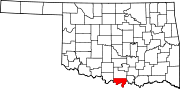
Towns Unincorporated
communitiesBurneyville | Courtney | Dunbar | Enville | Greenville | Jimtown | Orr | Oswalt | Overbrook | Rubottom | Turner
Categories:- Love County, Oklahoma
- National Register of Historic Places in Oklahoma by county
-

Wikimedia Foundation. 2010.