- Marietta, Oklahoma
-
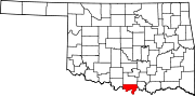
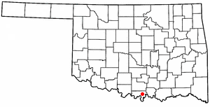
Marietta, Oklahoma — City — Location of Marietta, Oklahoma
Coordinates: 33°56′08″N 97°07′12″W / 33.93556°N 97.12°WCoordinates: 33°56′08″N 97°07′12″W / 33.93556°N 97.12°W Country United States State Oklahoma County Love Area – Total 2.4 sq mi (6.2 km2) – Land 2.4 sq mi (6.2 km2) – Water 0.0 sq mi (0.0 km2) Elevation 846 ft (258 m) Population (2000) – Total 2,445 – Density 1,029.2/sq mi (397.4/km2) Time zone Central (CST) (UTC-6) – Summer (DST) CDT (UTC-5) ZIP code 73448 Area code(s) 580 FIPS code 40-46500[1] GNIS feature ID 1095143[2] Marietta is a city in Love County, Oklahoma, United States. The population was 2,445 at the 2000 census. It is the county seat of Love County[3].
Marietta is part of the Ardmore, Oklahoma Micropolitan Statistical Area.
Contents
Geography
Marietta is located at 33°56′8″N 97°7′12″W / 33.93556°N 97.12°W (33.935551, -97.119867)[4].
According to the United States Census Bureau, the city has a total area of 2.4 square miles (6.2 km2), of which, 2.4 square miles (6.2 km2) of it is land and 0.42% is water.
Transportation
Highways
Marietta is located on State Highway 32 at the corner of junction US Route 77 and is just east of Interstate 35.
Airports
- McGehee Catfish Restaurant Airport, is located five nautical miles southwest of the central business district of Marietta
- Love County Airport (closed), was located two nautical miles northwest of the central business district of Marietta
Demographics
As of the census[1] of 2000, there were 2,445 people, 952 households, and 635 families residing in the city. The population density was 1,029.2 people per square mile (396.6/km²). There were 1,094 housing units at an average density of 460.5 per square mile (177.5/km²). The racial makeup of the city was 77.30% White, 6.34% African American, 5.15% Native American, 0.29% Asian, 0.04% Pacific Islander, 8.30% from other races, and 2.58% from two or more races. Hispanic or Latino of any race were 16.07% of the population.
There were 952 households out of which 32.9% had children under the age of 18 living with them, 47.3% were married couples living together, 16.1% had a female householder with no husband present, and 33.2% were non-families. 29.2% of all households were made up of individuals and 17.0% had someone living alone who was 65 years of age or older. The average household size was 2.48 and the average family size was 3.07.
In the city the population was spread out with 27.2% under the age of 18, 7.7% from 18 to 24, 26.2% from 25 to 44, 20.4% from 45 to 64, and 18.4% who were 65 years of age or older. The median age was 36 years. For every 100 females there were 85.2 males. For every 100 females age 18 and over, there were 78.1 males.
The median income for a household in the city was $26,454, and the median income for a family was $30,511. Males had a median income of $25,966 versus $19,760 for females. The per capita income for the city was $14,799. About 13.7% of families and 16.7% of the population were below the poverty line, including 22.0% of those under age 18 and 17.4% of those age 65 or over.
References
- ^ a b "American FactFinder". United States Census Bureau. http://factfinder.census.gov. Retrieved 2008-01-31.
- ^ "US Board on Geographic Names". United States Geological Survey. 2007-10-25. http://geonames.usgs.gov. Retrieved 2008-01-31.
- ^ "Find a County". National Association of Counties. http://www.naco.org/Counties/Pages/FindACounty.aspx. Retrieved 2011-06-07.
- ^ "US Gazetteer files: 2010, 2000, and 1990". United States Census Bureau. 2011-02-12. http://www.census.gov/geo/www/gazetteer/gazette.html. Retrieved 2011-04-23.
External links
- Marietta webpage
- Old and New Pictures of Marietta With LIVE Streaming audio of local Police, Fire and EMS scanner frequency with archive.
Municipalities and communities of Love County, Oklahoma City Marietta
Towns Unincorporated
communitiesBurneyville | Courtney | Dunbar | Enville | Greenville | Jimtown | Orr | Oswalt | Overbrook | Rubottom | Turner
County seats in Oklahoma Ada • Altus • Alva • Anadarko • Antlers • Arapaho • Ardmore • Arnett • Atoka • Bartlesville • Beaver • Boise City • Buffalo • Chandler • Chelsea • Cherokee • Cheyenne • Chickasha • Claremore • Coalgate • Duncan • Durant • El Reno • Enid • Eufaula • Fairview • Frederick • Guthrie • Guymon • Hobart • Holdenville • Hollis • Hugo • Idabel • Jay • Kingfisher • Lawton • Madill • Mangum • Marietta • McAlester • Medford • Miami • Muskogee • New Cordell • Newkirk • Nowata • Okemah • Oklahoma City • Okmulgee • Pauls Valley • Pawhuska • Pawnee • Perry • Poteau • Pryor • Purcell • Sallisaw • Sapulpa • Sayre • Shawnee • Stigler • Stillwater • Stilwell • Sulphur • Tahlequah • Taloga • Tishomingo • Tulsa • Vinita • Wagoner • Walters • Watonga • Waurika • Wewoka • Wilberton •
WoodwardCategories:- Cities in Oklahoma
- Populated places in Love County, Oklahoma
- County seats in Oklahoma
- Ardmore micropolitan area

Wikimedia Foundation. 2010.