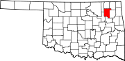
- Claremore, Oklahoma
-
Claremore, Oklahoma — City — Downtown Claremore Location in the state of Oklahoma
Coordinates: 36°18′55″N 95°36′46″W / 36.31528°N 95.61278°WCoordinates: 36°18′55″N 95°36′46″W / 36.31528°N 95.61278°W Country United States State Oklahoma County Rogers Incorporated 1883 Government - Mayor Flo Guthrie Area - City 12.3 sq mi (31.8 km2) - Land 12.0 sq mi (31.2 km2) - Water 0.2 sq mi (0.6 km2) Elevation 597 ft (182 m) Population (2009) - City 18,581 - Metro 905,755 Time zone CST (UTC-6) - Summer (DST) CDT (UTC-5) ZIP codes 74017, 74018, 74019 Area code(s) 539/918 FIPS code 40-14700[1] GNIS feature ID 1091382[2] Website www.claremorecity.com Claremore is a city and the county seat of Rogers County, Oklahoma, United States.[3] The population was 18,581 at the 2010 census, a 17.1 percent increase from 15,873 at the 2000 census.[4] It is part of the Tulsa Metropolitan Area and home to Rogers State University. It is best known as the home of entertainer Will Rogers.
Contents
History
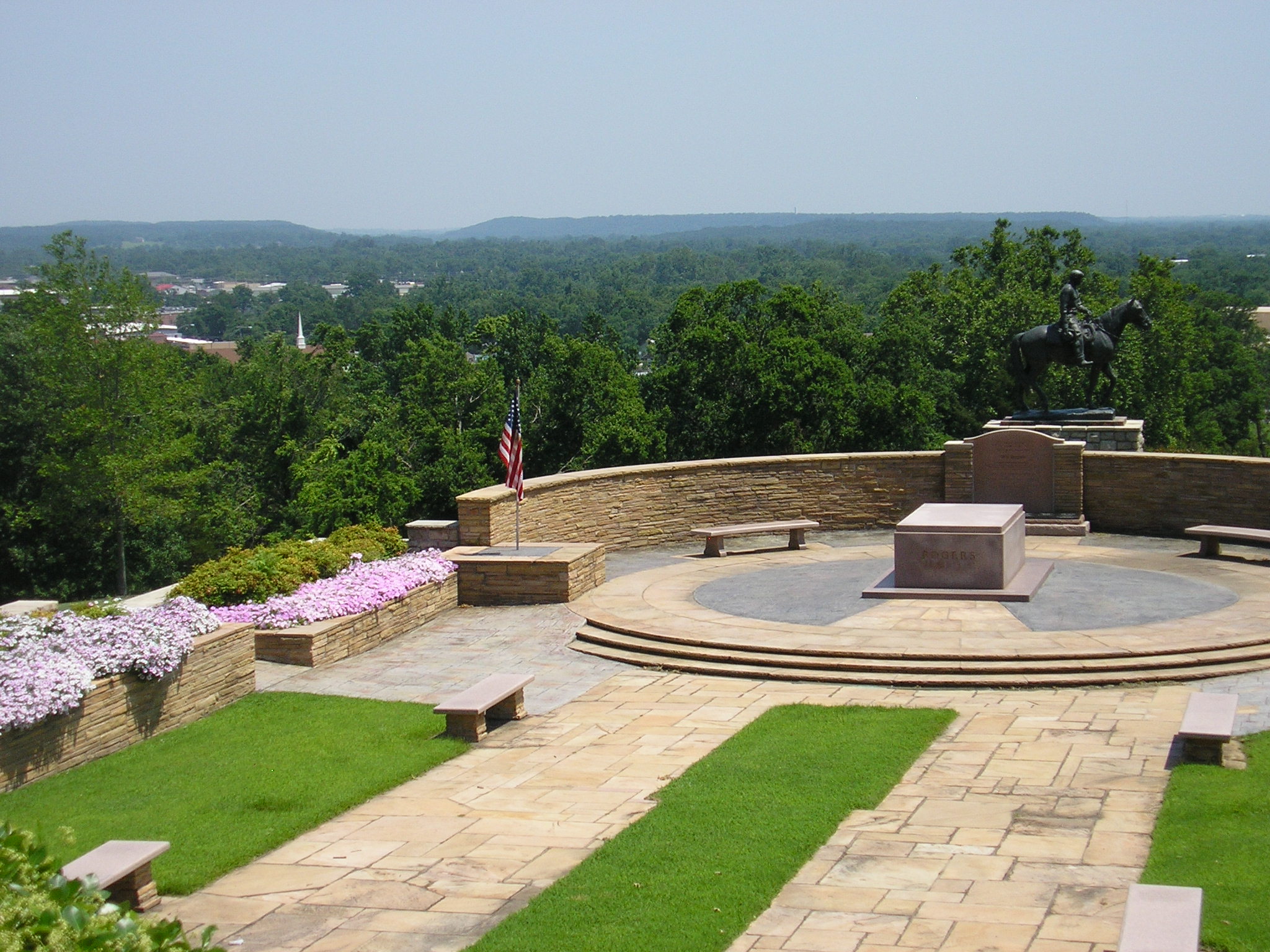
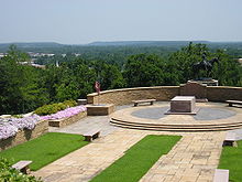 The Will Rogers Memorial overlooks Claremore's position in the foothills of the Ozark Mountains.
Around 1802, a band of Osage Indians settled in the area of present-day Claremore. The town's name came from an Osage chief called "Gra-moi." French traders in the area pronounced his name as "Clairmont," which means "mountain with a clear view." The area experienced some minor damage during the American Civil War, but quickly recovered after the end of the conflict.
After the Indian Removal Act of 1830 was passed by the United States, Claremore became part of Indian Territory and the Cherokee Nation. Claremore was a part of the Cooweescoowee District in the northwestern part of the Cherokee Nation. The Rogers family, for whom the county is named, was among the first settlers. Clem Rogers, father of the famous Will Rogers, who, along with his family, is buried at the Will Rogers Memorial, moved to the county in 1856. His ranch eventually was more than 60,000 acres (240 km2), and his home, which still stands outside Oologah, is an important historical site. Clem Rogers was a major advocate of Oklahoma statehood and was the oldest delegate to the state's Constitutional Convention in 1907 at age 69.
The coming of railways to Indian Territory was the driving factor in Claremore's early growth. Two early lines intersected in the center of town. The name of Claremore changed from Clermont to its present spelling on September 19, 1882. A clerk recording the town as having a post office spelled the name incorrectly, and it stuck. The city was incorporated in the Cherokee Nation in 1883.
Another major factor in the growth of Claremore was an area known as "Radium Town". In 1903, a man named George Eaton owned an oil company in Claremore. He was drilling just to the east of Claremore and struck an underground pool of water that smelled of sulfur. A local doctor, Dr. W.G. Williams, tested the water and marketed it as a cure. The water, known as "Radium Water," contained impurities that supposedly made it medically useful. Bath houses sprang up all over this area of Claremore, but only one is still standing today.[5]
Claremore's first hospital was established on Will Rogers Boulevard, or Highway 88, in the early 1900s. Today it can be seen with windows boarded up just off the road. Claremore's newspaper, the Claremore Daily Progress, was established in 1893 by cowboy Joe Klein and is still published daily. It is the oldest business in Rogers County.
There are many historic homes and other buildings in Claremore, including the old business district. In 2002, Claremore's historic core received a rebuilding grant from the state's Oklahoma Main Street program. Renovation work on the downtown was completed in 2007.
The Rodgers and Hammerstein musical Oklahoma! is set in Claremore and the surrounding area, in 1907 (the year Oklahoma became a State). The Quantum Leap (TV series) episode "8½ Months" is also set near Claremore. The movie Where the Heart Is starring Natalie Portman and Ashley Judd fictionally portrays Rogers County and the area surrounding Claremore.
Geography
Claremore is located at 36°18′55″N 95°36′46″W / 36.31528°N 95.61278°W (36.315181, -95.612784).[6] According to the United States Census Bureau, the city has a total area of 12.3 square miles (32 km2), of which, 12.0 square miles (31 km2) of it is land and 0.2 square miles (0.52 km2) of it (1.96%) is water.
The city is located in Green Country, a popular nickname for northeast Oklahoma that stems from the region's green vegetation and relatively high amount of hills and lakes compared to central and western areas of Oklahoma.[7] Claremore lies near the Verdigris River with undulating terrain producing hills and valleys. The city's primary water sources are Claremore and Oologah Lake, both within the drainage basin of the Verdigris River.
Climate
Climate data for Claremore, Oklahoma Month Jan Feb Mar Apr May Jun Jul Aug Sep Oct Nov Dec Year Average high °F (°C) 44.8
(7.1)50.3
(10.2)60.2
(15.7)71.2
(21.8)78.3
(25.7)86.3
(30.2)92.8
(33.8)92
(33)83.6
(28.7)73.6
(23.1)60.5
(15.8)48.8
(9.3)70.2 Average low °F (°C) 21.2
(−6.0)26.1
(−3.3)35.7
(2.1)46.8
(8.2)55.7
(13.2)64.9
(18.3)69.5
(20.8)67.3
(19.6)60.4
(15.8)47.2
(8.4)36.5
(2.5)26
(−3)46.4 Precipitation inches (mm) 1.6
(41)2
(51)3.6
(91)3.6
(91)4.6
(117)4.6
(117)3
(76)3.1
(79)4.5
(114)3.6
(91)3.2
(81)2.2
(56)39.4
(1,001)Source no. 1: weather.com Source no. 2: Weatherbase.com [8] Transportation
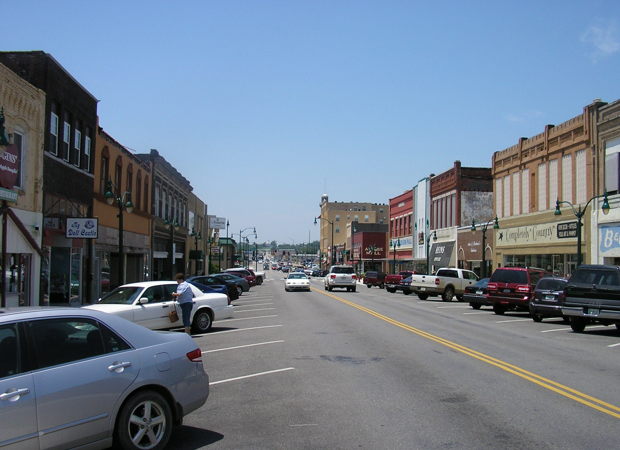
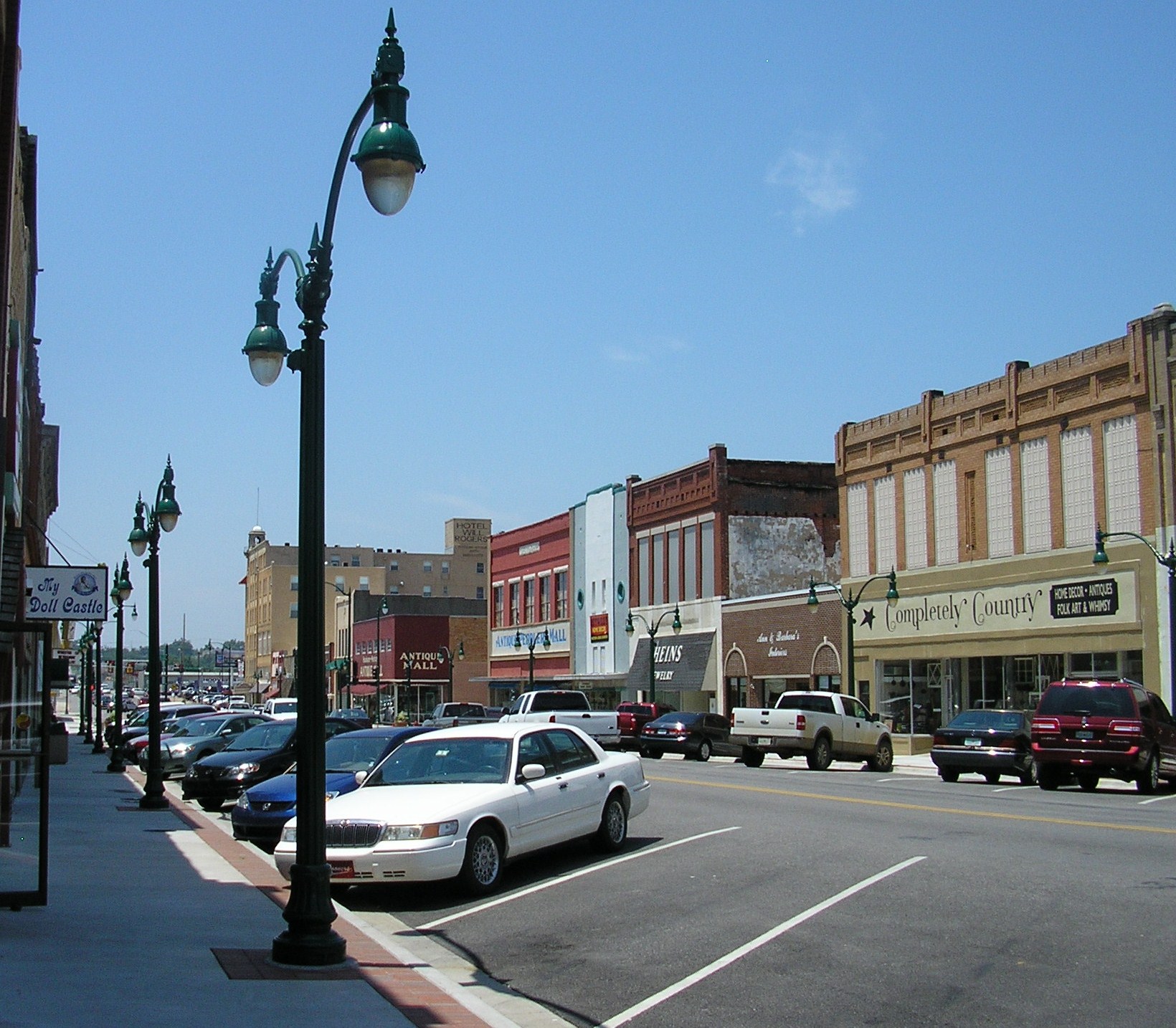
 Downtown Claremore
Claremore is a major intersection of heavily-traveled highways. Interstate 44 crosses the city to its southeast. State Highway 66 (historic US-66) forms one of the main roads of the town. The city is also intersected by State Highway 88 and State Highway 20.
Two railroads, the St. Louis, Iron Mountain, and Southern Railway (now controlled by Union Pacific) and the St. Louis-San Francisco Railway or "Frisco" (now controlled by BNSF), intersect in Claremore. The traffic problems spawned by the intersection of two major national rail lines has led to discussion among city officials about how best to improve traffic flow. As of 2007, the city plans to elevate the BNSF railroad throughout the entire town.
Demographics
As of the census[1] of 2000, there were 15,873 people, 6,283 households, and 4,165 families residing in the city. The population density was 1,319.4 people per square mile (509.4/km²). There were 6,784 housing units at an average density of 563.9 per square mile (217.7/km²). The racial makeup of the city was 75.69% White, 1.99% African American, 14.31% Native American, 0.44% Asian, 0.03% Pacific Islander, 1.12% from other races, and 6.42% from two or more races. Hispanic or Latino of any race were 3.02% of the population.
There were 6,283 households out of which 33.6% had children under the age of 18 living with them, 49.6% were married couples living together, 12.4% had a female householder with no husband present, and 33.7% were non-families. 29.7% of all households were made up of individuals and 13.8% had someone living alone who was 65 years of age or older. The average household size was 2.43 and the average family size was 3.02.
In the city the population was spread out with 26.7% under the age of 18, 9.0% from 18 to 24, 27.6% from 25 to 44, 19.8% from 45 to 64, and 16.9% who were 65 years of age or older. The median age was 36 years. For every 100 females there were 89.5 males. For every 100 females age 18 and over, there were 86.1 males.
The median income for a household in the city was $34,547, and the median income for a family was $45,810. Males had a median income of $36,227 versus $21,742 for females. The per capita income for the city was $17,853. About 8.9% of families and 11.9% of the population were below the poverty line, including 15.4% of those under the age of 18 and 15.0% of those 65 and older.
Education
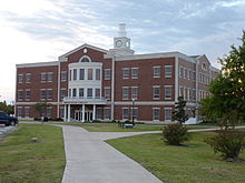 Stratton Taylor Library at Rogers State University.
Claremore is home to the main campus of Rogers State University, a bachelor's and associate's degree-granting state institution. The university serves over 4,000 students, and is the only public four-year university in the Tulsa Metropolitan Area.
Public school districts serving Claremore are the Claremore Independent School District and Sequoyah Public Schools. CISD currently consists of Claremore High School, Will Rogers Junior High, Central Upper Elementary, Westside Elementary, Claremont Elementary, Stuart Roosa Elementary, and the Alternative Learning Center. The district has plans to open a fourth elementary school once funds are secured for the project. Sequoyah Public Schools consists of Sequoyah High School, Sequoyah Junior High School, and Sequoyah Elementary School.
The first school in the Claremore area was opened to students in 1870. Claremore's first major high school was built in 1919 and was the most expensive public school building in the state of Oklahoma at the time. The building was used as a school for almost 80 years, until 1999, when the increasing costs of maintenance forced its closure.
Economy
Claremore's economy is diversified. Baker Hughes has a large presence in the town, along with several other large companies in Claremore Industrial Park, which is only a few miles away from the Tulsa Port of Catoosa on the McClellan–Kerr Arkansas River Navigation System (Verdigris River and Arkansas River). Coal mining is also an important industry; strip-style mines are currently operating on both the north and south sides of the town.
Attractions
 J.M. Davis Arms & Historical Museum
- J. M. Davis Arms and Historical Museum
- Will Rogers Memorial
- Will Rogers Downs
- Oklahoma Military Academy Museum
- Lynn Riggs Memorial Museum
- The Historic Belvidere Mansion
National Register of Historic Places
- The Belvidere Mansion - the 1907 Victorian-style built by the Bayless family (John M and Mary Bayless) who moved to Indian Territory from Cassville, Missouri in 1901. Much of the trim and woodwork used in the mansion were brought from the 1904 World's Fair in St. Louis.
- Claremore Auto Dealership - now called "Claremore Tire," an old auto dealer in the central business district
- Eastern University Preparatory School - administration building of Rogers State University
- Mendenhall's Bath House - a historic building in "Radium Town"
- Maurice Meyer Barracks - a building on the campus of Rogers State University, contains OMA Museum
- Will Rogers Hotel - a hotel in downtown Claremore, now renovated for usage as apartments for senior citizens
- Belvidere Mansion, a circa 1907 Victorian mansion
Notable people
- Brad Carson, former U.S. Congressman [9]
- Patti Page, singer and entertainer
- Lynn Riggs, playwright [10]
- Will Rogers, entertainer, comedian, and actor
- Stuart Roosa, astronaut [11]
- Helen Walton, philanthropist and wife of Wal-Mart founder Sam Walton [12]
Latif and Christina Whitsett - Married July 31, 2011
Town twinning
See also
References
- ^ a b "American FactFinder". United States Census Bureau. http://factfinder.census.gov. Retrieved 2008-01-31.
- ^ "US Board on Geographic Names". United States Geological Survey. 2007-10-25. http://geonames.usgs.gov. Retrieved 2008-01-31.
- ^ "Find a County". National Association of Counties. http://www.naco.org/Counties/Pages/FindACounty.aspx. Retrieved 2011-06-07.
- ^ MuniNet Guide:Claremore, Oklahoma.[1]
- ^ Larry Larkin, "Radium Town, the smell of success", Claremore Daily Progress, March 22, 2008.
- ^ "US Gazetteer files: 2010, 2000, and 1990". United States Census Bureau. 2011-02-12. http://www.census.gov/geo/www/gazetteer/gazette.html. Retrieved 2011-04-23.
- ^ Clapman, Leah (2004-09-24). "Key Races: Oklahoma Senate". PBS. http://www.pbs.org/newshour/vote2004/key-races/ok_profile.html. Retrieved 2007-04-30.
- ^ "Historical Weather for Claremore, Oklahoma, United States". http://www.weatherbase.com/weather/weatherall.php3?s=828143&refer=.
- ^ University of Tulsa Collins College of Business.[2]
- ^ Lynn Riggs: An Oklahoma Treasure, Friends of Libraries in Oklahoma
- ^ NASA Biographical Data.[3]
- ^ Porter, Eduardo (21 April 2007). "Helen Walton, Matriarch of Wal-Mart Family, Dies at 87". The New York Times. http://www.nytimes.com/2007/04/21/business/21walton.html. Retrieved 27 December 2010.
External links
- City of Claremore
- Claremore Chamber of Commerce
- Claremore Convention & Visitors Bureau
- Claremore information, photos and videos on TravelOK.com Official travel and tourism website for the State of Oklahoma
- Claremore, Oklahoma gallery at Wikimedia
- Encyclopedia of Oklahoma History and Culture - Claremore (City)
Municipalities and communities of Rogers County, Oklahoma County seat: ClaremoreCities Catoosa‡ | Claremore | Collinsville‡ | Owasso‡ | Tulsa‡
Towns CDPs Unincorporated
communitiesFootnotes ‡This populated place also has portions in an adjacent county or counties
County seats in Oklahoma Ada • Altus • Alva • Anadarko • Antlers • Arapaho • Ardmore • Arnett • Atoka • Bartlesville • Beaver • Boise City • Buffalo • Chandler • Chelsea • Cherokee • Cheyenne • Chickasha • Claremore • Coalgate • Duncan • Durant • El Reno • Enid • Eufaula • Fairview • Frederick • Guthrie • Guymon • Hobart • Holdenville • Hollis • Hugo • Idabel • Jay • Kingfisher • Lawton • Madill • Mangum • Marietta • McAlester • Medford • Miami • Muskogee • New Cordell • Newkirk • Nowata • Okemah • Oklahoma City • Okmulgee • Pauls Valley • Pawhuska • Pawnee • Perry • Poteau • Pryor • Purcell • Sallisaw • Sapulpa • Sayre • Shawnee • Stigler • Stillwater • Stilwell • Sulphur • Tahlequah • Taloga • Tishomingo • Tulsa • Vinita • Wagoner • Walters • Watonga • Waurika • Wewoka • Wilberton •
WoodwardCategories:- Populated places in Rogers County, Oklahoma
- Cities in Oklahoma
- Communities on U.S. Route 66
- County seats in Oklahoma
- Tulsa Metropolitan Area


Wikimedia Foundation. 2010.