- Creek County, Oklahoma
-
Creek County, Oklahoma 
Location in the state of Oklahoma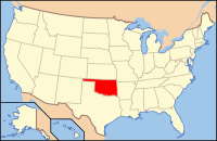
Oklahoma's location in the U.S.Founded 1907 Seat Sapulpa Area
- Total
- Land
- Water
970 sq mi (2,512 km²)
956 sq mi (2,475 km²)
14 sq mi (37 km²), 1.47%Population
- (2010)
- Density
69,967
70/sq mi (27.85/km²)Congressional district 3rd Time zone Central: UTC-6/-5 Website www.creekcountyonline.com Creek County is a county located in the U.S. state of Oklahoma. As of 2010, the population was 69,967. Its county seat is Sapulpa[1].
Contents
Geography
According to the U.S. Census Bureau, the county has a total area of 970 square miles (2,512.3 km2), of which 956 square miles (2,476.0 km2) is land and 14 square miles (36.3 km2) (1.47%) is water.
Major highways
 Interstate 44
 Alternate U.S. Highway 75
- State Highway 66
 State Highway 16
 State Highway 33
- State Highway 48
 State Highway 51
 State Highway 99
- State Highway 117
Adjacent counties
- Pawnee County (north)
- Tulsa County (east)
- Okmulgee County (southeast)
- Okfuskee County (south)
- Lincoln County (west)
- Payne County (northwest)
Demographics
 Age pyramid for Creek County, Oklahoma, based on census 2000 data.
As of the census[2] of 2000, there were 67,367 people, 25,289 households, and 19,017 families residing in the county. The population density was 70 people per square mile (27/km²). There were 27,986 housing units at an average density of 29 per square mile (11/km²). The racial makeup of the county was 82.27% White, 2.56% Black or African American, 9.08% Native American, 0.27% Asian, 0.03% Pacific Islander, 0.63% from other races, and 5.16% from two or more races. 1.90% of the population were Hispanic or Latino of any race.
There were 25,289 households out of which 34.80% had children under the age of 18 living with them, 60.10% were married couples living together, 10.90% had a female householder with no husband present, and 24.80% were non-families. 21.60% of all households were made up of individuals and 9.40% had someone living alone who was 65 years of age or older. The average household size was 2.64 and the average family size was 3.06.
In the county, the population was spread out with 27.40% under the age of 18, 8.00% from 18 to 24, 27.30% from 25 to 44, 24.50% from 45 to 64, and 12.80% who were 65 years of age or older. The median age was 37 years. For every 100 females there were 96.00 males. For every 100 females age 18 and over, there were 92.90 males.
The median income for a household in the county was $33,168, and the median income for a family was $38,470. Males had a median income of $31,190 versus $21,690 for females. The per capita income for the county was $16,191. About 8% of families and 13.50% of the population were below the poverty line, including 17.20% of those under age 18 and 14.10% of those age 65 or over.
Cities and towns
Unincorporated communities
- Bowden
- Gypsy
- Silver City
NRHP Sites
The following sites in Creek County are listed on the National Register of Historic Places:
- Beard Motor Company, Bristow
- Berryhill Building, Sapulpa
- Bridge No. 18 at Rock Creek, Sapulpa
- Bristow Motor Company Building, Bristow
- Bristow Presbyterian Church, Bristow
- Bristow Tire Shop, Bristow
- Creek County Courthouse, Sapulpa
- Drumright Gasoline Plant No. 2, Drumright
- Aaron Drumright House, Drumright
- First United Methodist Church of Drumright, Drumright
- John Frank House, Sapulpa
- J. W. Fulkerson House, Drumright
- Barnett Jackson No. 11 Oil Well, Drumright
- Little Deep Fork Creek Bridge, Bristow
- Markham School and Teacherage, Oilton
- McClung House, Sapulpa
- Meacham Building, Oilton
- Santa Fe Depot (Drumright), Drumright
- Sapulpa Downtown Historic District, Sapulpa
- Texaco Service Station, Bristow
- Tidal School, Drumright
- Washington School, Drumright
- West Sapulpa Route 66 Roadbed, Sapulpa
- Wheeler No. 1 Oil Well, Drumright
References
- ^ "Find a County". National Association of Counties. http://www.naco.org/Counties/Pages/FindACounty.aspx. Retrieved 2011-06-07.
- ^ "American FactFinder". United States Census Bureau. http://factfinder.census.gov. Retrieved 2008-01-31.
External links
- www.creekcountyonline.com The official county government website
- Encyclopedia of Oklahoma History and Culture - Creek County
Municipalities and communities of Creek County, Oklahoma County seat: Sapulpa Cities 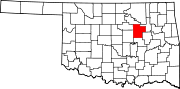
Towns Depew | Kellyville | Kiefer | Lawrence Creek | Mannford‡ | Mounds | Shamrock | Slick
CDP Unincorporated
communitiesGhost towns Pameta | Phillipsburg | Pumpkin Center | Robertsburg | Thompsonville | Twin Mounds
Footnotes ‡This populated place also has portions in an adjacent county or counties
Categories:- Oklahoma counties
- Creek County, Oklahoma
- Tulsa Metropolitan Area


Wikimedia Foundation. 2010.