- Coal County, Oklahoma
-
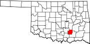
Coal County, Oklahoma 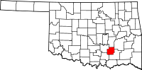
Location in the state of Oklahoma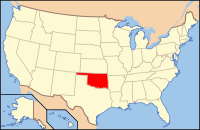
Oklahoma's location in the U.S.Founded information needed Seat Coalgate Area
- Total
- Land
- Water
521 sq mi (1,350 km²)
518 sq mi (1,342 km²)
3 sq mi (8 km²), 0.59%Population
- (2000)
- Density
6,031
5/sq mi (2/km²)Time zone Central: UTC-6/-5 Coal County is a county located in the U.S. state of Oklahoma. As of 2000, the population is 6,031. Its county seat is Coalgate[1].
Contents
Geography
According to the U.S. Census Bureau, the county has a total area of 521 square miles (1,349.4 km2), of which 518 square miles (1,341.6 km2) is land and 3 square miles (7.8 km2) (0.59%) is water.
Major highways
 U.S. Highway 75
 State Highway 3
 State Highway 31
- State Highway 43
- State Highway 48
Adjacent counties
- Hughes County (north)
- Pittsburg County (northeast)
- Atoka County (east & south)
- Johnston County (southwest)
- Pontotoc County (west)
Demographics
 Age pyramid for Coal County, Oklahoma, based on census 2000 data.
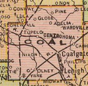
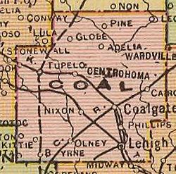 Map of Coal County, 1909
As of the census[2] of 2000, there were 6,031 people, 2,373 households, and 1,653 families residing in the county. The population density was 12 people per square mile (4/km²). There were 2,744 housing units at an average density of 5 per square mile (2/km²). The racial makeup of the county was 75.18% White, 0.36% Black or African American, 17.31% Native American, 0.32% Asian, 0.75% from other races, and 6.09% from two or more races. 2.14% of the population were Hispanic or Latino of any race. 94.6% spoke English, 3.0% Spanish, 1.1% German and 1.1% Choctaw as their first language.
There were 2,373 households out of which 30.70% had children under the age of 18 living with them, 55.20% were married couples living together, 10.60% had a female householder with no husband present, and 30.30% were non-families. 27.30% of all households were made up of individuals and 14.30% had someone living alone who was 65 years of age or older. The average household size was 2.51 and the average family size was 3.05.
In the county, the population was spread out with 26.60% under the age of 18, 7.70% from 18 to 24, 25.30% from 25 to 44, 22.50% from 45 to 64, and 17.90% who were 65 years of age or older. The median age was 38 years. For every 100 females there were 96.30 males. For every 100 females age 18 and over, there were 92.90 males.
The median income for a household in the county was $23,705, and the median income for a family was $28,333. Males had a median income of $22,721 versus $18,419 for females. The per capita income for the county was $12,013. About 18.50% of families and 23.10% of the population were below the poverty line, including 27.90% of those under age 18 and 20.90% of those age 65 or over.
Cities and towns
NRHP sites
The following sites in Coal County are listed on the National Register of Historic Places:
- Coalgate School Gymnasium-Auditorium, Coalgate
- Benjamin Franklin Smallwood House, Lehigh
References
- ^ "Find a County". National Association of Counties. http://www.naco.org/Counties/Pages/FindACounty.aspx. Retrieved 2011-06-07.
- ^ "American FactFinder". United States Census Bureau. http://factfinder.census.gov. Retrieved 2008-01-31.
External links
Municipalities and communities of Coal County, Oklahoma Cities Centrahoma | Coalgate | Lehigh
Towns Unincorporated
communitiesCairo | Clarita | Cottonwood | East Jessie | Olney | Parker
Footnotes ‡This populated place also has portions in an adjacent county or counties
Categories:- Oklahoma counties
- Coal County, Oklahoma
- 1909 establishments in the United States
- Populated places established in 1909


Wikimedia Foundation. 2010.