- McIntosh County, Oklahoma
-
McIntosh County, Oklahoma 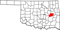
Location in the state of Oklahoma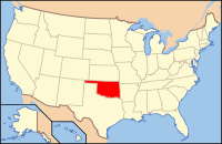
Oklahoma's location in the U.S.Founded 1907 Seat Eufaula Area
- Total
- Land
- Water
712 sq mi (1,844 km²)
620 sq mi (1,606 km²)
92 sq mi (238 km²), 12.98%Population
- (2000)
- Density
19,456
31/sq mi (12/km²)McIntosh County is a county located in the U.S. state of Oklahoma. As of 2000, the population was 19,456. Its county seat is Eufaula[1].
Contents
Geography
According to the U.S. Census Bureau, the county has a total area of 1,845 km² (712 mi²). 1,606 km² (620 mi²) of it is land and 240 km² (92 mi²) of it (12.98%) is water.
Major highways
 Interstate 40
 U.S. Highway 69
 U.S. Highway 266
 State Highway 9
 State Highway 72
- Indian Nation Turnpike
Adjacent counties
- Muskogee County (north & east)
- Haskell County (southeast)
- Pittsburg County (south)
- Hughes County (southwest)
- Okfuskee County (west)
- Okmulgee County (northwest)
Demographics
As of the census[2] of 2000, there were 19,456 people, 8,085 households, and 5,683 families residing in the county. The population density was 12/km² (31/mi²). There were 12,640 housing units at an average density of 8/km² (20/mi²). The racial makeup of the county was 72.59% White, 4.06% Black or African American, 16.20% Native American, 0.14% Asian, 0.03% Pacific Islander, 0.35% from other races, and 6.63% from two or more races. 1.27% of the population were Hispanic or Latino of any race. 96.4% spoke English, 1.5% Muskogee and 1.5% Spanish as their first language.
There were 8,085 households out of which 25.60% had children under the age of 18 living with them, 56.60% were married couples living together, 10.40% had a female householder with no husband present, and 29.70% were non-families. 26.70% of all households were made up of individuals and 14.50% had someone living alone who was 65 years of age or older. The average household size was 2.37 and the average family size was 2.84.
In the county, the population was spread out with 22.60% under the age of 18, 6.40% from 18 to 24, 22.30% from 25 to 44, 26.90% from 45 to 64, and 21.80% who were 65 years of age or older. The median age was 44 years. For every 100 females there were 91.70 males. For every 100 females age 18 and over, there were 89.30 males.
The median income for a household in the county was $25,964, and the median income for a family was $31,990. Males had a median income of $27,998 versus $19,030 for females. The per capita income for the county was $16,410. About 13.50% of families and 18.20% of the population were below the poverty line, including 24.80% of those under age 18 and 13.30% of those age 65 or over.
Communities
Cities
Towns
Census-designated places
NRHP sites
The following sites in McIntosh County are listed on the National Register of Historic Places:
- Checotah Business District, Checotah
- Checotah City Hall, Checotah
- Checotah MKT Depot, Checotah
- C. L. Cooper Building, Eufaula
- Eufaula Armory, Eufaula
- Eufaula Business District, Eufaula
- First Soil Conservation District Dedication Site, Eufaula
- Honey Springs Battlefield, Rentiesville
- Johnson Lake Shelters, Warner
- McIntosh County Courthouse, Eufaula
- Methodist Episcopal Church, South, Checotah
- Oklahoma Odd Fellows Home at Checotah, Checotah
- Rock Front, Vernon
- Slippery Moss Shelter, Texanna
- Tabor House, Checotah
References
- ^ "Find a County". National Association of Counties. http://www.naco.org/Counties/Pages/FindACounty.aspx. Retrieved 2011-06-07.
- ^ "American FactFinder". United States Census Bureau. http://factfinder.census.gov. Retrieved 2008-01-31.
Municipalities and communities of McIntosh County, Oklahoma Cities 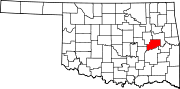
Towns Hanna | Hitchita | Rentiesville | Stidham
CDPs Unincorporated
communitiesBond | Brush Hill | Fame | Lenna | Mellette | Onapa | Pierce | Shady Grove | Texanna | Vernon | Vivian
Categories:- Oklahoma counties
- McIntosh County, Oklahoma
- 1907 establishments in the United States
- Populated places established in 1907


Wikimedia Foundation. 2010.