- Mayes County, Oklahoma
-
Mayes County, Oklahoma 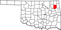
Location in the state of Oklahoma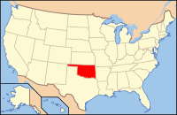
Oklahoma's location in the U.S.Founded November 16, 1907 (date of Oklahoma's statehood) Named for Samuel Houston Mayes, Principal Chief of the Cherokee Nation (1895-1899) Seat Pryor Creek Largest city Pryor Creek Area
- Total
- Land
- Water
684 sq mi (1,770 km²)
656 sq mi (1,699 km²)
27 sq mi (71 km²), 4.00%Population
- (2010)
- Density
41,259
58/sq mi (23/km²)Time zone Central: UTC-6/-5 Mayes County is a county located in the U.S. state of Oklahoma. It was named for Samuel Houston Mayes, Principal Chief of the Cherokee Nation from 1895 to 1899. According to the 2010 census the population was 41,259,[1] a 7.5 percent increase from 2000, when the population was 38,369. Its county seat is Pryor Creek, Oklahoma[2].
Contents
History
According to the Encyclopedia of Oklahoma History and Culture, the area covered by what is now Mayes County has many prehistoric sites. There is evidence of human habitation dated before 6,000 B. C., plus 35 Archaic sites ( 6,000 B. C to 1 A. D.), 25 Woodland sites (1 A. D. to 1000 A. D.) and 31 Plains Village sites (1000 A. D. to 1500 A. D.[3]
French voyageurs roamed the area in the early 18th Century, giving French names to many of the waterways and other local sites. Jean Pierre Chouteau established a trading post at the location of the present town of Salina, where he chiefly traded with the Osage tribe that had settled in the vicinity. Union Mission, near the present day town of Chouteau, Oklahoma was established in 1820. Rev. Samuel Worcestor set up the first printing press in this part of the United States at Union Mission in 1835.[3]
In 1828, members of the Western Cherokee Nation began arriving in the area from their former lands in Arkansas. The Eastern Cherokee, who were forced from their homes in Tennessee, Georgia and North Carolina, followed during the 1830s. In 1841, the present Mayes County area became part of the Saline District of the Cherokee Nation.[3]
Geography
According to the U.S. Census Bureau, the county has a total area of 684 square miles (1,770 km2), of which 656 square miles (1,700 km2) is land and 27 square miles (70 km2) (4.00%) is water.
The county is bisected by the Grand River. The eastern half of the county is on the Ozark Plateau, with flat areas divided by deep stream valleys. The western half is in the Prairie Plains.[3]
The county contains several man-made major reservoirs, including:
- Lake Fort Gibson;
- Lake Spavinaw;
- Grand Lake o' the Cherokees;
- Lake Hudson;
- Salina Pumped Storage Project.
Lake Spavinaw is owned by the city of Tulsa and is the principal source of water for the city. The other three reservoirs were built by the Federal Government primarily for flood control and hydroelectric power generation. They are managed by the Grand River Dam Authority (GRDA). GRDA also manages the GRDA Coal-fired power generation station.[3]
Economy
Agriculture has long been the primary economic activity in the county. Important crops include:corn, soybeans, sorghum and hay. Cattle raising and dairy farming occur in the more rugged parts of the Ozark Plateau.[3]
In 1960, the former munitions plant near Pryor was converted into the Mid-America Industrial Park, which included plants manufacturing paper, cement and fertilizer.[3]
Major highways
 Interstate 44
 U.S. Highway 69
 U.S. Highway 412
 State Highway 20
 State Highway 28
 State Highway 82
Demographics
As of 2010 Mayes County had a population of 41.259. The racial and ethnic makeup of the population was 68.0% white, 0.4% black, 21.4% Native American, 0.4% Asian, 0.8% reporting some other race and 9.0% of the population reporting two or more races. 2.7% of the population reported being Hispanic or Latino of any race.[4]
As of the census[5] of 2000, there were 38,369 people, 14,823 households, and 10,820 families residing in the county. The population density was 58 people per square mile (23/km²). There were 17,423 housing units at an average density of 27 per square mile (10/km²). The racial makeup of the county was 72.14% White, 0.30% Black or African American, 19.10% Native American, 0.28% Asian, 0.01% Pacific Islander, 0.62% from other races, and 7.55% from two or more races. 1.87% of the population were Hispanic or Latino of any race. 94.8% spoke English, 2.1% Cherokee, 1.4% Spanish and 1.2% German as their first language.
There were 14,823 households out of which 32.60% had children under the age of 18 living with them, 60.20% were married couples living together, 9.00% had a female householder with no husband present, and 27.00% were non-families. 23.80% of all households were made up of individuals and 11.10% had someone living alone who was 65 years of age or older. The average household size was 2.55 and the average family size was 3.02.
In the county, the population was spread out with 26.60% under the age of 18, 8.60% from 18 to 24, 26.20% from 25 to 44, 23.80% from 45 to 64, and 14.90% who were 65 years of age or older. The median age was 37 years. For every 100 females there were 98.40 males. For every 100 females age 18 and over, there were 95.40 males.
The median income for a household in the county was $31,125, and the median income for a family was $37,542. Males had a median income of $31,668 versus $20,573 for females. The per capita income for the county was $15,350. About 11.20% of families and 14.30% of the population were below the poverty line, including 18.90% of those under age 18 and 10.90% of those age 65 or over.
Cities and towns
Unincorporated communities
Census Designated Places (CDPs)
NRHP sites
The following sites in Mayes County are listed on the National Register of Historic Places:
- Cabin Creek Battlefield, Pensacola
- Farmers and Merchants Bank, Chouteau
- Lewis Ross/Cherokee Orphan Asylum Springhouse, Salina
- Pensacola Dam, Langley
- Territorial Commercial District, Chouteau
- Union Mission Site, Mazie
Adjacent counties
- Craig County (north)
- Delaware County (east)
- Cherokee County (southeast)
- Wagoner County (south)
- Rogers County (west)
References
- ^ Pryor Daily Times. "Mayes County grows by 3,000. April 4, 2011. Retrieved September 14, 2011.[1]
- ^ "Find a County". National Association of Counties. http://www.naco.org/Counties/Pages/FindACounty.aspx. Retrieved 2011-06-07.
- ^ a b c d e f g Carney, Amanda. Encyclopedia of Oklahoma History and Culture. "Mayes County." Retrieved September 14, 2011.[2]
- ^ 2010 general profile of population and housing characteristics of Mayes County from the US Census
- ^ "American FactFinder". United States Census Bureau. http://factfinder.census.gov. Retrieved 2008-01-31.
Municipalities and communities of Mayes County, Oklahoma City 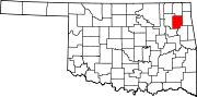
Towns Adair | Chouteau | Disney | Grand Lake Towne | Hoot Owl | Langley | Locust Grove | Pensacola | Salina | Spavinaw | Sportsmen Acres | Strang
CDPs Ballou | Cedar Crest | Iron Post | Mazie | Murphy | Pin Oak Acres | Pump Back | Sams Corner | Snake Creek | Sportsmen Acres Community | Wickliffe
Unincorporated
communitiesBoatman | Cedar Crest | Mazie | Murphy | Paradise View | Patton | Pin Oaks Acres | Rose | Tiajuana
Categories:- Oklahoma counties
- Mayes County, Oklahoma
- 1907 establishments in the United States
- Populated places established in 1907


Wikimedia Foundation. 2010.