- National Register of Historic Places listings in McIntosh County, Oklahoma
-
 Location of McIntosh County in Oklahoma
This is a list of the National Register of Historic Places listings in McIntosh County, Oklahoma.
This is intended to be a complete list of the properties and districts on the National Register of Historic Places in McIntosh County, Oklahoma, United States. The locations of National Register properties and districts for which the latitude and longitude coordinates are included below, may be seen in a Google map.[1]
There are 15 properties and districts listed on the National Register in the county.
-
- This National Park Service list is complete through NPS recent listings posted November 10, 2011.[2]
Current listings
[3] Landmark name [4] Image Date listed Location City or town Summary 1 Checotah Business District September 13, 1982 Gentry Ave. between W. 1st and W. Main Sts. and Broadway Ave. between Lafayette and Spaulding Aves.
35°28′12″N 95°31′22″W / 35.47°N 95.522778°WChecotah 2 Checotah City Hall June 26, 1998 201 N. Broadway
35°28′15″N 95°31′20″W / 35.470833°N 95.522222°WChecotah 3 Checotah MKT Depot September 5, 1991 Paul Carr Dr.
35°28′16″N 95°32′12″W / 35.471111°N 95.536667°WChecotah 4 C.L. Cooper Building March 22, 1985 5B and Harrison
35°17′03″N 95°34′47″W / 35.284167°N 95.579722°WEufaula 5 Eufaula Armory May 20, 1994 48 Memorial Dr.
35°17′21″N 95°34′54″W / 35.289167°N 95.581667°WEufaula 6 Eufaula Business District April 14, 1988 Main St. between Pine and Grand Sts.
35°17′12″N 95°34′56″W / 35.286667°N 95.582222°WEufaula 7 First Soil Conservation District Dedication Site September 20, 1982 North of Eufaula
35°18′28″N 95°37′00″W / 35.307778°N 95.616667°WEufaula 8 Honey Springs Battlefield September 29, 1970 North of Rentiesville
35°32′41″N 95°28′41″W / 35.544722°N 95.478056°WRentiesville 9 Johnson Lake Shelters December 15, 1978 Address Restricted Warner 10 McIntosh County Courthouse March 22, 1985 110 N. 1st St.
35°17′13″N 95°35′03″W / 35.286944°N 95.584167°WEufaula 11 Methodist Episcopal Church, South November 13, 1984 419 W. Gentry St.
35°28′14″N 95°31′28″W / 35.470556°N 95.524444°WChecotah 12 Oklahoma Odd Fellows Home at Checotah June 14, 2001 211 W. North St.
35°28′46″N 101°31′15″W / 35.479444°N 101.520833°WChecotah 13 Rock Front June 22, 1984 Broadway
35°12′50″N 95°55′34″W / 35.213889°N 95.926111°WVernon 14 Slippery Moss Shelter December 15, 1978 Address Restricted Texanna 15 Tabor House September 23, 1996 631 W. Lafayette
35°28′13″N 95°31′40″W / 35.470278°N 95.527778°WChecotah See also
- List of National Historic Landmarks in Oklahoma
- National Register of Historic Places listings in Oklahoma
References
- ^ The latitude and longitude information provided in this table was derived originally from the National Register Information System, which has been found to be fairly accurate for about 99% of listings. For about 1% of NRIS original coordinates, experience has shown that one or both coordinates are typos or otherwise extremely far off; some corrections may have been made. A more subtle problem causes many locations to be off by up to 150 yards, depending on location in the country: most NRIS coordinates were derived from tracing out latitude and longitudes off of USGS topographical quadrant maps created under the North American Datum of 1927, which differs from the current, highly accurate WGS84 GPS system used by Google maps. Chicago is about right, but NRIS longitudes in Washington are higher by about 4.5 seconds, and are lower by about 2.0 seconds in Maine. Latitudes differ by about 1.0 second in Florida. Some locations in this table may have been corrected to current GPS standards.
- ^ "National Register of Historic Places: Weekly List Actions". National Park Service, United States Department of the Interior. Retrieved on November 10, 2011.
- ^ Numbers represent an ordering by significant words. Various colorings, defined here, differentiate National Historic Landmark sites and National Register of Historic Places Districts from other NRHP buildings, structures, sites or objects.
- ^ "National Register Information System". National Register of Historic Places. National Park Service. . http://nrhp.focus.nps.gov/natreg/docs/All_Data.html.
U.S. National Register of Historic Places Topics Lists by states Alabama • Alaska • Arizona • Arkansas • California • Colorado • Connecticut • Delaware • Florida • Georgia • Hawaii • Idaho • Illinois • Indiana • Iowa • Kansas • Kentucky • Louisiana • Maine • Maryland • Massachusetts • Michigan • Minnesota • Mississippi • Missouri • Montana • Nebraska • Nevada • New Hampshire • New Jersey • New Mexico • New York • North Carolina • North Dakota • Ohio • Oklahoma • Oregon • Pennsylvania • Rhode Island • South Carolina • South Dakota • Tennessee • Texas • Utah • Vermont • Virginia • Washington • West Virginia • Wisconsin • WyomingLists by territories Lists by associated states Other Municipalities and communities of McIntosh County, Oklahoma Cities 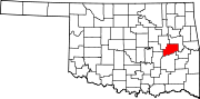
Towns Hanna | Hitchita | Rentiesville | Stidham
CDPs Unincorporated
communitiesBond | Brush Hill | Fame | Lenna | Mellette | Onapa | Pierce | Shady Grove | Texanna | Vernon | Vivian
Categories:- McIntosh County, Oklahoma
- National Register of Historic Places in Oklahoma by county
-

Wikimedia Foundation. 2010.