- National Register of Historic Places listings in Traill County, North Dakota
-
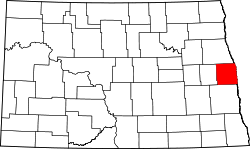 Location of Traill County in North Dakota
This is a list of the National Register of Historic Places listings in Traill County, North Dakota.
This is intended to be a complete list of the properties and districts on the National Register of Historic Places in Traill County, North Dakota, United States. The locations of National Register properties and districts for which the latitude and longitude coordinates are included below, may be seen in a Google map.[1]
There are 22 properties and districts listed on the National Register in the county.
Contents: Counties in North Dakota Adams | Barnes | Benson | Billings | Bottineau | Bowman | Burke | Burleigh | Cass | Cavalier | Dickey | Divide | Dunn | Eddy | Emmons | Foster | Golden Valley | Grand Forks | Grant | Griggs | Hettinger | Kidder | La Moure | Logan | McHenry | McIntosh | McKenzie | McLean | Mercer | Morton | Mountrail | Nelson | Oliver | Pembina | Pierce | Ramsey | Ransom | Renville | Richland | Rolette | Sargent | Sheridan | Sioux | Slope | Stark | Steele | Stutsman | Towner | Traill | Walsh | Ward | Wells | Williams -
- This National Park Service list is complete through NPS recent listings posted November 10, 2011.[2]
Listings county-wide
[3] Landmark name Image Date listed Location City or town Summary 1 Caledonia Bridge February 27, 1997 Unnamed county road across the Goose River, approximately 1 mile west of the Minnesota state line
47°27′26″N 96°53′03″W / 47.457222°N 96.884167°WCaledonia 2 Delchar Theater November 14, 1985 20 W. Main St.
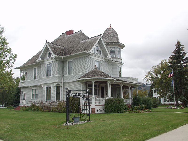
47°30′01″N 97°19′36″W / 47.500278°N 97.326667°WMayville 3 Carl Ben Eielson House 
April 11, 1977 405 8th St.
47°38′16″N 97°27′20″W / 47.637778°N 97.455556°WHatton 4 Ellingson Farm District September 12, 1985 1 mile north and 2.5 miles west of Hillsboro
47°27′39″N 97°07′31″W / 47.460833°N 97.125278°WHillsboro 5 First National Bank November 20, 1985 22 W. Main St.
47°30′01″N 97°19′35″W / 47.500278°N 97.326389°WMayville 6 First State Bank of Buxton February 14, 1978 423 Broadway St.
47°36′10″N 97°05′51″W / 47.602778°N 97.0975°WBuxton 7 Goose River Bank November 14, 1985 45 Main St., E.
47°30′00″N 97°19′29″W / 47.5°N 97.324722°WMayville 8 Grandins' Mayville Farm District November 19, 1985 2 Brunsdale, W.
47°30′12″N 97°20′02″W / 47.503333°N 97.333889°WMayville 9 Great Northern Railway Depot October 5, 1977 Front St.
47°30′00″N 97°19′26″W / 47.5°N 97.323889°WMayville 10 Grinager Mercantile Building November 20, 1985 37 Main St., E.
47°30′01″N 97°19′31″W / 47.500278°N 97.325278°WMayville 11 Lucken Farm May 14, 1986 North of Portland
47°31′33″N 97°22′09″W / 47.525833°N 97.369167°WPortland 12 Lura Building November 14, 1985 29 W. Main St.
47°30′00″N 97°19′34″W / 47.5°N 97.326111°WMayville 13 Mayville Historic District November 19, 1985 Roughly bounded by 3rd St., NE., 5th Ave., NE., Main St., E., and 3rd Ave., NE. and 2nd Ave., NE.
47°30′13″N 97°19′19″W / 47.503611°N 97.321944°WMayville 14 Mayville Public Library April 11, 1977 Center Ave., N.
47°30′04″N 97°19′33″W / 47.501111°N 97.325833°WMayville 15 Andres O. Ness House July 15, 1977 Oak Ave. and 6th St.
47°38′14″N 97°27′44″W / 47.637222°N 97.462222°WHatton 16 Norway Bridge February 27, 1997 Unnamed county road across the Goose River, approximately 6 miles east and 3 miles south of Mayville
47°27′26″N 97°11′55″W / 47.457222°N 97.198611°WMayville 17 Amos and Lillie Plummer House January 4, 1996 306 W. Caledonia Ave.
47°24′11″N 97°03′58″W / 47.403056°N 97.066111°WHillsboro 18 Col. William H. Robinson House April 11, 1977 127 4th Ave., NE.
47°30′11″N 97°19′20″W / 47.503056°N 97.322222°WMayville 19 Stomner House October 11, 1979 32 3rd St., NE.
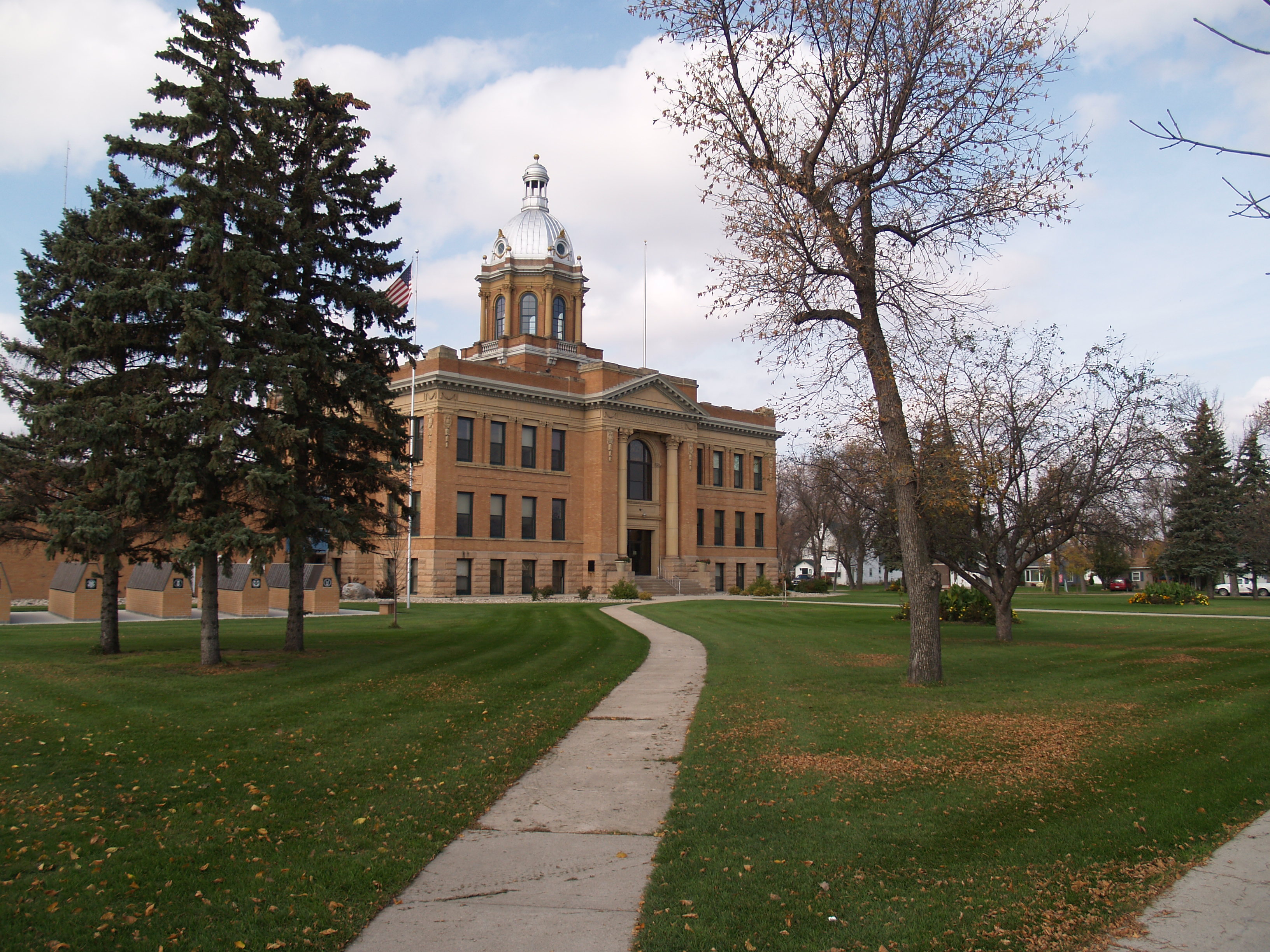
47°30′07″N 97°19′22″W / 47.501944°N 97.322778°WMayville 20 Traill County Courthouse 
November 25, 1980 Off U.S. Route 81
47°24′13″N 97°03′48″W / 47.403611°N 97.063333°WHillsboro 21 Union Block November 20, 1985 21-25 Main St., W.
47°29′59″N 97°19′36″W / 47.499722°N 97.326667°WMayville 22 Viking Bridge February 27, 1997 Unnamed county road across the Goose River, approximately 1 mile northwest of Portland
47°31′02″N 97°23′21″W / 47.517222°N 97.389167°WPortland Former listings
[3] Landmark name Image Date listed Location City or town Summary 1 Blanchard Bridge March 25, 2009 Unnamed county road across the Elm River, approximately 0.5 miles (0.8 km) south of Blanchard, east of ND 18
47°20′23″N 97°12′59″W / 47.33972°N 97.21639°WBlanchard Listed February 27, 1997. Was moved from location in August 2007.[4] 2 Goose River Bridge March 25, 2009 Unnamed county road across the Goose River, approximately 6 miles (9.7 km) east and 1 mile (1.6 km) north of Hillsboro
47°26′41″N 96°55′15″W / 47.44472°N 96.92083°WHillsboro Listed February 27, 1997 3 Porter Elliott Bridge March 25, 2009 Unnamed county road across the Sheyenne River, approximately 5 miles (8.0 km) east and 1 mile (1.6 km) north of Hillsboro
47°26′10″N 96°56′32″W / 47.43611°N 96.94222°WHillsboro Listed on February 27, 1997 4 O.C. Sarles House March 25, 2009 2nd Avenue and 3rd Street, northeast corner
47°24′24″N 97°3′25″W / 47.40667°N 97.05694°WHillsboro Listed on March 12, 1985 See also
- List of National Historic Landmarks in North Dakota
- National Register of Historic Places listings in North Dakota
References
- ^ The latitude and longitude information provided in this table was derived originally from the National Register Information System, which has been found to be fairly accurate for about 99% of listings. For about 1% of NRIS original coordinates, experience has shown that one or both coordinates are typos or otherwise extremely far off; some corrections may have been made. A more subtle problem causes many locations to be off by up to 150 yards, depending on location in the country: most NRIS coordinates were derived from tracing out latitude and longitudes off of USGS topographical quadrant maps created under the North American Datum of 1927, which differs from the current, highly accurate WGS84 GPS system used by Google maps. Chicago is about right, but NRIS longitudes in Washington are higher by about 4.5 seconds, and are lower by about 2.0 seconds in Maine. Latitudes differ by about 1.0 second in Florida. Some locations in this table may have been corrected to current GPS standards.
- ^ "National Register of Historic Places: Weekly List Actions". National Park Service, United States Department of the Interior. Retrieved on November 10, 2011.
- ^ Numbers represent an ordering by significant words. Various colorings, defined here, differentiate National Historic Landmark sites and National Register of Historic Places Districts from other NRHP buildings, structures, sites or objects.
- ^ "Sunsets numbered for historic 107-year-old bridge at Blanchard". Hillsboro Banner. August 10, 2007. http://hbanner.wordpress.com/2007/08/10/sunsets-numbered-for-historic-107-year-old-bridge-at-blanchard. Retrieved April 3, 2009.
U.S. National Register of Historic Places Topics Lists by states Alabama • Alaska • Arizona • Arkansas • California • Colorado • Connecticut • Delaware • Florida • Georgia • Hawaii • Idaho • Illinois • Indiana • Iowa • Kansas • Kentucky • Louisiana • Maine • Maryland • Massachusetts • Michigan • Minnesota • Mississippi • Missouri • Montana • Nebraska • Nevada • New Hampshire • New Jersey • New Mexico • New York • North Carolina • North Dakota • Ohio • Oklahoma • Oregon • Pennsylvania • Rhode Island • South Carolina • South Dakota • Tennessee • Texas • Utah • Vermont • Virginia • Washington • West Virginia • Wisconsin • WyomingLists by territories Lists by associated states Other Municipalities and communities of Traill County, North Dakota Cities 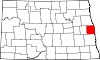
Townships Belmont | Bingham | Blanchard | Bloomfield | Bohnsack | Buxton | Caledonia | Eldorado | Elm River | Ervin | Galesburg | Garfield | Greenfield | Herberg | Hillsboro | Kelso | Lindaas | Mayville | Morgan | Norman | Norway | Roseville | Stavanger | Viking | Wold
CDPs Unincorporated
communitiesAlton | Cummings | Greenfield | Kelso | Murray | Portland Junction | Preston | Roseville | Taft
Footnotes ‡This populated place also has portions in an adjacent county or counties
Categories:- National Register of Historic Places in North Dakota by county
- Traill County, North Dakota
-

Wikimedia Foundation. 2010.