- McKenzie County, North Dakota
-
McKenzie County, North Dakota 
Location in the state of North Dakota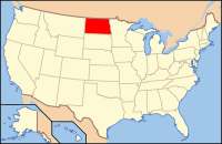
North Dakota's location in the U.S.Founded 1905 Seat Watford City Largest city Watford City Area
- Total
- Land
- Water
2,861 sq mi (7,410 km²)
2,742 sq mi (7,102 km²)
119 sq mi (308 km²), 4.16%Population
- (2010)
- Density
6,360
210/sq mi (081/km²)McKenzie County is a county located in the U.S. state of North Dakota. As of the 2010 census, the population was 6,360.[1] Its county seat is Watford City.[2]
McKenzie County was first created by the 1883 Dakota Territory legislature but eliminated in 1891 due to a lack of settlement. The county was then recreated by the 1905 state legislature, with the county government first organizing on April 20, 1905. The name comes from early North Dakota politician Alexander McKenzie. Before becoming Watford City, the county seat was Alexander from 1905 to 1907 and Schafer from 1907 to 1941.[3]
Contents
Geography
According to the U.S. Census Bureau, the county has a total area of 2,861 square miles (7,410 km²), the largest county in North Dakota, of which, 2,742 square miles (7,102 km²) of it is land and 119 square miles (308 km²) of it (4.16%) is water.
The McKenzie County landscape features a wide diversity of physical features, ranging from sugarbeet fields bordering the Missouri River at the northwest corner of the county to rugged badlands near the Little Missouri River in the south, where Theodore Roosevelt National Park and the Little Missouri National Grassland are located. Between the two rivers is a large area of prairie, ranging from gentle rolling terrain to rocky, rugged pastures. The southeast corner of the county, bordering on the Little Missouri badlands of neighboring Dunn County, is abundant in wildlife, quaking aspen groves, and bur oak groves, interspersed in places with western red cedar on the north-facing slopes of the badlands.
Townships
- Alex
- Antelope Creek
- Arnegard
- Blue Butte
- Charbon
- Elm Tree
- Grail
- Grassy Butte
- Hawkeye
- Keene
- Randolph
- Riverview
- Sioux
- Tri
- Twin Valley
- Yellowstone
Defunct Townships
Elk, Poe, and Wilbur townships merged January 1, 2002 to form Tri Township.[4]
Adjacent counties
- Williams County (north)
- Mountrail County (northeast)
- Dunn County (southeast)
- Billings County (south)
- Golden Valley County and Wibaux County, Montana (southwest)
- Richland County, Montana (west)

Williams County Mountrail County Richland County, Montana 
 McKenzie County, North Dakota

Wibaux County, Montana and Golden Valley County Billings County Dunn County Major highways
 U.S. Highway 85
 North Dakota Highway 22
 North Dakota Highway 23
 North Dakota Highway 58
 North Dakota Highway 68
 North Dakota Highway 73
 North Dakota Highway 200
 North Dakota Highway 1806
National protected areas
Demographics
Historical populations Census Pop. %± 1910 5,720 — 1920 9,544 66.9% 1930 9,709 1.7% 1940 8,426 −13.2% 1950 6,849 −18.7% 1960 7,296 6.5% 1970 6,127 −16.0% 1980 7,132 16.4% 1990 6,383 −10.5% 2000 5,737 −10.1% 2010 6,360 10.9% U.S. Decennial Census As of the census[5] of 2000, there were 5,737 people, 2,151 households, and 1,548 families residing in the county. The population density was 2 people per square mile (1/km²). There were 2,719 housing units at an average density of 1 per square mile (0/km²). The racial makeup of the county was 77.36% White, 0.07% Black or African American, 21.18% Native American, 0.05% Asian, 0.02% Pacific Islander, 0.14% from other races, and 1.19% from two or more races. 1.01% of the population were Hispanic or Latino of any race. 33.4% were of Norwegian and 20.9% German ancestry according to Census 2000.
There were 2,151 households out of which 34.50% had children under the age of 18 living with them, 57.90% were married couples living together, 9.30% had a female householder with no husband present, and 28.00% were non-families. 25.80% of all households were made up of individuals and 13.10% had someone living alone who was 65 years of age or older. The average household size was 2.64 and the average family size was 3.17.
In the county the population was spread out with 30.60% under the age of 18, 5.50% from 18 to 24, 23.30% from 25 to 44, 24.90% from 45 to 64, and 15.70% who were 65 years of age or older. The median age was 40 years. For every 100 females there were 100.70 males. For every 100 females age 18 and over, there were 98.90 males.
The median income for a household in the county was $29,342, and the median income for a family was $34,091. Males had a median income of $26,351 versus $20,147 for females. The per capita income for the county was $14,732. About 13.70% of families and 17.20% of the population were below the poverty line, including 22.10% of those under age 18 and 12.70% of those age 65 or over.
Places
Cities
Note: all incorporated communities in North Dakota are called "cities" regardless of their size.
Census-designated places
Unincorporated communities
Sites of interest
See also
Municipalities and communities of McKenzie County, North Dakota Cities 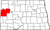
Townships Alex | Antelope Creek | Arnegard | Blue Butte | Charbon | Elm Tree | Grail | Hawkeye | Keene | Randolph | Riverview | Sioux | Tri | Twin Valley | Yellowstone
CDPs East Fairview | Four Bears Village | Mandaree
Unorganized
territoriesCentral McKenzie | East McKenzie | Fort Berthold | North McKenzie | Southeast McKenzie | Southwest McKenzie
Unincorporated
communitiesBanks | Charlson | Cartwright | Charbonneau | Croff | Dore | Grassy Butte | Harding | Johnsons Corner | Keene | Rawson | Schafer | Skaar | Spotted Horn
Coordinates: 47°44′N 103°23′W / 47.73°N 103.39°W
References
- ^ "2010 Census Redistricting Data (Public Law 94-171) Summary File". American FactFinder. United States Census Bureau. http://factfinder2.census.gov/faces/tableservices/jsf/pages/productview.xhtml?pid=DEC_10_PL_GCTPL2.ST05&prodType=table. Retrieved 3 May 2011.
- ^ "Find a County". National Association of Counties. http://www.naco.org/Counties/Pages/FindACounty.aspx. Retrieved 2011-06-07.
- ^ "County History". Official Portal for North Dakota State Government. http://www.nd.gov/content.htm?parentCatID=83&id=County%20History. Retrieved 4 May 2011.
- ^ U.S. Census Bureau: Boundary Changes
- ^ "American FactFinder". United States Census Bureau. http://factfinder.census.gov. Retrieved 2008-01-31.
Categories:- North Dakota counties
- McKenzie County, North Dakota
- North Dakota counties on the Missouri River


Wikimedia Foundation. 2010.