- Morton County, North Dakota
-
Morton County, North Dakota 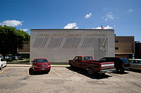 Morton County Courthouse in Mandan, North Dakota
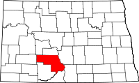
Location in the state of North Dakota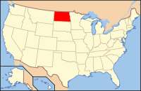
North Dakota's location in the U.S.Founded 1873 Seat Mandan Largest city Mandan Area
- Total
- Land
- Water
1,945 sq mi (5,038 km²)
1,926 sq mi (4,988 km²)
19 sq mi (49 km²), 0.98%Population
- (2010)
- Density
27,471
13/sq mi (5/km²)Website www.co.morton.nd.us Morton County is a county located in the U.S. state of North Dakota. In 2010, the population was 27,471.[1] Its county seat is Mandan.[2] Morton County and Burleigh County, North Dakota make up the "Bismarck, ND, Metropolitan Statistical Area" or "Bismarck-Mandan".
The county was created by the 1872-1873 territorial legislature and named for Oliver Hazard Perry Throck Morton (1823-1877), governor of Indiana during the American Civil War and later a United States Senator. It was organized on March 23, 1878, but the action of the 1878 legislature in attaching the eastern portion to Burleigh County effectively nullified this action. The county was reorganized on February 18, 1881, after the detached portion had been returned to Morton County by the 1881 legislature. Mandan has always been county seat, though during a period from 1878 to 1879, Mandan, and thus also the county seat, was known as Lincoln.[3][4]
Contents
Geography
According to the U.S. Census Bureau, the county has a total area of 1,945 square miles (5,040 km2), of which, 1,926 square miles (4,990 km2) of it is land and 19 square miles (49 km2) of it (0.98%) is water.
Townships
- Breien
- Captain's Landing
- Fort Rice
- Huff
Major highways
 North Dakota Highway 6
 North Dakota Highway 21
 North Dakota Highway 25
 North Dakota Highway 31
 North Dakota Highway 49
 North Dakota Highway 1806
Adjacent counties
- Oliver County (north)
- Burleigh County (northeast)
- Emmons County (east)
- Sioux County (southeast)
- Grant County (south)
- Stark County (west)
- Mercer County (northwest)

Mercer County Oliver County Burleigh County Stark County 
Emmons County  Morton County, North Dakota

Grant County Sioux County National protected area
Demographics
Historical populations Year Pop. ±% 1880 200 — 1890 4,728 +2264.0% 1900 8,069 +70.7% 1910 25,289 +213.4% 1920 18,714 −26.0% 1930 19,647 +5.0% 1940 20,184 +2.7% 1950 19,295 −4.4% 1960 20,992 +8.8% 1970 20,310 −3.2% 1980 25,177 +24.0% 1990 23,700 −5.9% 2000 25,303 +6.8% 2010 27,471 +8.6% 2010 Est 27,600 +0.5% U.S. Decennial Census
July 1, 2010 Population EstimateAs of the census[5] of 2000, there were 25,303 people, 9,889 households, and 6,932 families residing in the county. The population density was 13 people per square mile (5/km²). There were 10,587 housing units at an average density of 6 per square mile (2/km²). The racial makeup of the county was 95.82% White, 0.16% Black or African American, 2.39% Native American, 0.30% Asian, 0.01% Pacific Islander, 0.16% from other races, and 1.16% from two or more races. 0.65% of the population were Hispanic or Latino of any race. 64.5% were of German and 10.6% Norwegian ancestry according to Census 2000.
There were 9,889 households out of which 34.90% had children under the age of 18 living with them, 58.20% were married couples living together, 8.50% had a female householder with no husband present, and 29.90% were non-families. 25.70% of all households were made up of individuals and 10.90% had someone living alone who was 65 years of age or older. The average household size was 2.51 and the average family size was 3.03.
In the county the population was spread out with 27.00% under the age of 18, 7.80% from 18 to 24, 28.20% from 25 to 44, 22.40% from 45 to 64, and 14.60% who were 65 years of age or older. The median age was 37 years. For every 100 females there were 99.30 males. For every 100 females age 18 and over, there were 96.30 males.
The median income for a household in the county was $37,028, and the median income for a family was $44,592. Males had a median income of $30,698 versus $21,301 for females. The per capita income for the county was $17,202. About 6.80% of families and 9.60% of the population were below the poverty line, including 11.00% of those under age 18 and 14.30% of those age 65 or over.
Places
Cities
Note: all incorporated communities in North Dakota are called "cities" regardless of their size.
Unincorporated communities
See also
References
- ^ "2010 Census Redistricting Data (Public Law 94-171) Summary File". American FactFinder. United States Census Bureau. http://factfinder2.census.gov/faces/tableservices/jsf/pages/productview.xhtml?pid=DEC_10_PL_GCTPL2.ST05&prodType=table. Retrieved 3 May 2011.
- ^ "Find a County". National Association of Counties. http://www.naco.org/Counties/Pages/FindACounty.aspx. Retrieved 2011-06-07.
- ^ "County History". Official Portal for North Dakota State Government. http://www.nd.gov/content.htm?parentCatID=83&id=County%20History. Retrieved 4 May 2011.
- ^ Wick, Douglas A.. "Mandan (Morton County)". North Dakota Place Names. http://www.webfamilytree.com/North_Dakota_Place_Names/M/mandan_%28morton_county%29.htm. Retrieved 6 May 2011.
- ^ "American FactFinder". United States Census Bureau. http://factfinder.census.gov. Retrieved 2008-01-31.
External links
Coordinates: 46°43′N 101°17′W / 46.72°N 101.28°W
Municipalities and communities of Morton County, North Dakota Cities 
Township Captain's Landing
CDP Harmon
Unorganized
territoriesEast Morton | Mandan | West Morton
Unincorporated
communities Bismarck-Mandan Metropolitan Area (ND)
Counties Burleigh | MortonCore city Surrounding areas Categories:- North Dakota counties
- Morton County, North Dakota
- Bismarck–Mandan
- North Dakota counties on the Missouri River


Wikimedia Foundation. 2010.