- McIntosh County, North Dakota
-
McIntosh County, North Dakota 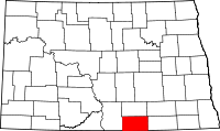
Location in the state of North Dakota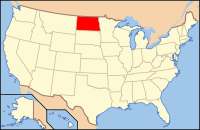
North Dakota's location in the U.S.Founded 1883 Seat Ashley Largest city Wishek Area
- Total
- Land
- Water
995 sq mi (2,577 km²)
975 sq mi (2,525 km²)
20 sq mi (52 km²), 1.99%Population
- (2010)
- Density
2,809
3/sq mi (1/km²)McIntosh County is a county located in the U.S. state of North Dakota. As of 2010, the population was 2,809.[1] Its county seat is Ashley.[2]
McIntosh County was created by the 1883 territorial legislature after the southern half of Logan County was divided. The name refers to Edward H. McIntosh, a member of the legislature at the time.[3] The county seat was originally Hoskins, but changed in 1888 after everything in Hoskins but the school was moved three miles east to the new Soo Line Railroad townsite of Ashley.[4]
Contents
Geography
According to the U.S. Census Bureau, the county has a total area of 995 square miles (2,580 km2), of which, 975 square miles (2,530 km2) of it is land and 20 square miles (52 km2) of it (1.99%) is water.
Township
Adjacent counties
- Logan County (north)
- LaMoure County (northeast)
- Dickey County (east)
- McPherson County, South Dakota (south)
- Campbell County, South Dakota (southwest)
- Emmons County (west)

Logan County LaMoure County Emmons County 
Dickey County  McIntosh County, North Dakota

Campbell County, South Dakota McPherson County, South Dakota Major highways
 North Dakota Highway 3
 North Dakota Highway 11
 North Dakota Highway 13
Demographics
Historical populations Census Pop. %± 1890 3,248 — 1900 4,818 48.3% 1910 7,251 50.5% 1920 9,010 24.3% 1930 9,621 6.8% 1940 8,984 −6.6% 1950 7,590 −15.5% 1960 6,702 −11.7% 1970 5,545 −17.3% 1980 4,800 −13.4% 1990 4,021 −16.2% 2000 3,390 −15.7% 2010 2,809 −17.1% U.S. Decennial Census As of the census[5] of 2000, there were 3,390 people, 1,467 households, and 975 families residing in the county. The population density was 4 people per square mile (1/km²). There were 1,853 housing units at an average density of 2 per square mile (1/km²). The racial makeup of the county was 98.88% White, 0.15% Native American, 0.29% Asian, 0.03% Pacific Islander, 0.09% from other races, and 0.56% from two or more races. 0.83% of the population were Hispanic or Latino of any race. 82.2% were of German and 5.0% American ancestry according to Census 2000.
There were 1,467 households out of which 22.30% had children under the age of 18 living with them, 60.30% were married couples living together, 3.50% had a female householder with no husband present, and 33.50% were non-families. 32.00% of all households were made up of individuals and 19.90% had someone living alone who was 65 years of age or older. The average household size was 2.19 and the average family size was 2.75.
In the county the population was spread out with 19.40% under the age of 18, 4.60% from 18 to 24, 19.40% from 25 to 44, 22.40% from 45 to 64, and 34.20% who were 65 years of age or older. The median age was 51 years. For every 100 females there were 91.50 males. For every 100 females age 18 and over, there were 91.70 males.
The median income for a household in the county was $26,389, and the median income for a family was $31,771. Males had a median income of $22,153 versus $16,743 for females. The per capita income for the county was $15,018. About 10.60% of families and 15.40% of the population were below the poverty line, including 14.50% of those under age 18 and 18.90% of those age 65 or over.
Politics
Presidential election results Year GOP DEM Others 2008 59.8% 916 37.8% 579 2.4% 37 2004 72.8% 1,254 25.3% 436 1.9% 32 2000 72.0% 1,178 21.4% 350 6.7% 109 1996 56.4% 1,005 26.4% 470 17.2% 306 1992 55.2% 1,134 21.9% 450 22.9% 470 1988 73.5% 1,726 25.5% 598 1.0% 23 1984 81.5% 2,047 17.0% 427 1.6% 39 1980 86.0% 2,471 10.7% 308 3.3% 94 1976 64.3% 1,785 32.9% 912 2.8% 79 1972 81.6% 2,440 17.4% 521 1.0% 29 1968 59.6% 1,625 34.3% 935 6.0% 165 1964 66.6% 1,891 33.4% 950 0.0% 0 1960 81.1% 2,694 18.9% 628 0.0% 0 McIntosh County is a historically Republican county. The last Democrat to carry McIntosh County was Franklin D. Roosevelt in 1936.[6] In 1920,[7] 1940,[8] 1944.[9] and 1952[10] elections the Republican Presidential candidate reportedly received over 90% of the county's vote. Although shifting somewhat Democratic in more recent Presidential elections John McCain received roughly 59% of the county's vote in the 2008 U.S. presidential election.[11]
In the United States House of Representatives it is represented by Republican Rick Berg. As part of District 28 it is represented in the North Dakota Senate by Robert S. Erbele (R) and in the North Dakota House of Representatives by Mike Brandenburg (R) and William E. Kretschmar (R).[12]
Cities
Note: all incorporated communities in North Dakota are called "cities" regardless of their size.
See also
References
- ^ "2010 Census Redistricting Data (Public Law 94-171) Summary File". American FactFinder. United States Census Bureau. http://factfinder2.census.gov/faces/tableservices/jsf/pages/productview.xhtml?pid=DEC_10_PL_GCTPL2.ST05&prodType=table. Retrieved 3 May 2011.
- ^ "Find a County". National Association of Counties. http://www.naco.org/Counties/Pages/FindACounty.aspx. Retrieved 2011-06-07.
- ^ "County History". Official Portal for North Dakota State Government. http://www.nd.gov/content.htm?parentCatID=83&id=County%20History. Retrieved 4 May 2011.
- ^ Wick, Douglas A.. "Hoskins (McIntosh County)". North Dakota Place Names. http://www.webfamilytree.com/North_Dakota_Place_Names/H/hoskins_%28mcintosh_county%29.htm. Retrieved 4 May 2011.
- ^ "American FactFinder". United States Census Bureau. http://factfinder.census.gov. Retrieved 2008-01-31.
- ^ Presidential election of 1936 - Map by counties
- ^ David Leip's Election Atlas statistics for 1920
- ^ David Leip's Election Atlas statistics for 1940
- ^ David Leip's Election Atlas statistics for 1944
- ^ David Leip's Election Atlas statistics for 1952
- ^ The New York Times electoral map (Zoom in on North Dakota)
- ^ North Dakota Legislature site
Municipalities and communities of McIntosh County, North Dakota Cities 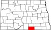
Township Unorganized
territoryEast McIntosh | Northwest McIntosh | Southwest McIntosh
Unincorporated
communitiesDanzig | Lowell
Footnotes ‡This populated place also has portions in an adjacent county or counties
Categories:- North Dakota counties
- McIntosh County, North Dakota


Wikimedia Foundation. 2010.