- Crosby, North Dakota
-
Crosby, North Dakota — City — Location of Crosby, North Dakota
Coordinates: 48°54′45″N 103°17′41″W / 48.9125°N 103.29472°WCoordinates: 48°54′45″N 103°17′41″W / 48.9125°N 103.29472°W Country United States State North Dakota County Divide Area – Total 1.3 sq mi (3.5 km2) – Land 1.3 sq mi (3.5 km2) – Water 0.0 sq mi (0.0 km2) Elevation 1,962 ft (598 m) Population (2010)[1] – Total 1,070 – Density 807.6/sq mi (311.8/km2) Time zone Central (CST) (UTC-6) – Summer (DST) CDT (UTC-5) ZIP code 58730 Area code(s) 701 FIPS code 38-16940[2] GNIS feature ID 1028544[3] Highways ND 5 Crosby is a city in Divide County, North Dakota in the United States. It is the county seat of Divide County.[4] The population was 1,070 at the 2010 census.[1]
Crosby was founded in 1904 at the end of a Great Northern Railway branch line that began in Berthold. The name comes from S.A. Crosby, a businessman from Portal involved in establishing the city.[5]
Contents
Geography
Crosby is located at 48°54′45″N 103°17′41″W / 48.9125°N 103.29472°W (48.912488, -103.294707)[6].
According to the United States Census Bureau, the city has a total area of 1.4 square miles (3.6 km2), all of it land.
Demographics
Historical populations Census Pop. %± 1910 206 — 1920 1,147 456.8% 1930 1,271 10.8% 1940 1,404 10.5% 1950 1,689 20.3% 1960 1,759 4.1% 1970 1,545 −12.2% 1980 1,469 −4.9% 1990 1,312 −10.7% 2000 1,089 −17.0% 2010 1,070 −1.7% U.S. Decennial Census As of the census[2] of 2000, there were 1,089 people, 489 households, and 290 families residing in the city. The population density was 807.6 people per square mile (311.5/km²). There were 637 housing units at an average density of 472.4 per square mile (182.2/km²). The racial makeup of the city was 98.26% White, 0.28% Native American, 1.01% Asian, 0.18% from other races, and 0.28% from two or more races. Hispanic or Latino of any race were 0.83% of the population.
There were 489 households out of which 22.1% had children under the age of 18 living with them, 50.1% were married couples living together, 5.9% had a female householder with no husband present, and 40.5% were non-families. 38.0% of all households were made up of individuals and 24.5% had someone living alone who was 65 years of age or older. The average household size was 2.09 and the average family size was 2.77.
In the city the population was spread out with 19.5% under the age of 18, 4.6% from 18 to 24, 18.7% from 25 to 44, 23.3% from 45 to 64, and 33.9% who were 65 years of age or older. The median age was 50 years. For every 100 females there were 88.1 males. For every 100 females age 18 and over, there were 79.3 males.
The median income for a household in the city was $26,382, and the median income for a family was $39,643. Males had a median income of $27,500 versus $15,882 for females. The per capita income for the city was $15,922. About 8.5% of families and 13.6% of the population were below the poverty line, including 18.4% of those under age 18 and 15.4% of those age 65 or over.
Notable people
- Martin Sabo, congressman from Minnesota.
Climate
Crosby experiences a semi-arid climate (Köppen BSk) with cold, dry winters and hot, wetter summers.
Climate data for Crosby, ND Month Jan Feb Mar Apr May Jun Jul Aug Sep Oct Nov Dec Year Record high °F (°C) 51
(11)66
(19)81
(27)92
(33)103
(39)105
(41)111
(44)107
(42)103
(39)91
(33)71
(22)61
(16)111
(44)Average high °F (°C) 17.8
(−7.9)25.7
(−3.5)38.2
(3.4)56.1
(13.4)69.7
(20.9)77.9
(25.5)83.0
(28.3)82.3
(27.9)69.9
(21.1)56.2
(13.4)34.9
(1.6)22.2
(−5.4)52.83
(11.57)Daily mean °F (°C) 8.1
(−13.3)16.2
(−8.8)28.1
(−2.2)43.3
(6.3)56.1
(13.4)64.6
(18.1)69.2
(20.7)67.8
(19.9)56.5
(13.6)44.2
(6.8)25.8
(−3.4)12.9
(−10.6)41.07
(5.04)Average low °F (°C) −1.7
(−18.7)6.6
(−14.1)18.0
(−7.8)30.5
(−0.8)42.4
(5.8)51.3
(10.7)55.3
(12.9)53.2
(11.8)43.1
(6.2)32.1
(0.1)16.7
(−8.5)3.5
(−15.8)29.25
(−1.53)Record low °F (°C) −45
(−43)−47
(−44)−34
(−37)−13
(−25)11
(−12)24
(−4)33
(1)25
(−4)9
(−13)−7
(−22)−25
(−32)−40
(−40)−47
(−44)Precipitation inches (mm) 0.48
(12.2)0.33
(8.4)0.59
(15)1.02
(25.9)2.01
(51.1)2.69
(68.3)2.75
(69.9)1.54
(39.1)1.62
(41.1)0.93
(23.6)0.53
(13.5)0.45
(11.4)14.94
(379.5)Source no. 1: NOAA (normals, 1971-2000) [7] Source no. 2: The Weather Channel (Records) [8] References
- ^ a b "2010 Census Redistricting Data (Public Law 94-171) Summary File". American FactFinder. United States Census Bureau. http://factfinder2.census.gov/faces/tableservices/jsf/pages/productview.xhtml?pid=DEC_10_PL_GCTPL2.ST13&prodType=table. Retrieved 2 May 2011.
- ^ a b "American FactFinder". United States Census Bureau. http://factfinder.census.gov. Retrieved 2008-01-31.
- ^ "US Board on Geographic Names". United States Geological Survey. 2007-10-25. http://geonames.usgs.gov. Retrieved 2008-01-31.
- ^ "Find a County". National Association of Counties. http://www.naco.org/Counties/Pages/FindACounty.aspx. Retrieved 2011-06-07.
- ^ Wick, Douglas A.. "Crosby (Divide County)". North Dakota Place Names. http://www.webfamilytree.com/North_Dakota_Place_Names/C/crosby_%28divide_county%29.htm. Retrieved 9 May 2011.
- ^ "US Gazetteer files: 2010, 2000, and 1990". United States Census Bureau. 2011-02-12. http://www.census.gov/geo/www/gazetteer/gazette.html. Retrieved 2011-04-23.
- ^ "Climatography of the United States NO.81". National Oceanic and Atmospheric Administration. http://cdo.ncdc.noaa.gov/climatenormals/clim81/NDnorm.pdf. Retrieved January 16, 2011.
- ^ "Monthly Averages for Crosby, ND". The Weather Channel. http://www.weather.com/outlook/travel/businesstraveler/wxclimatology/monthly/USND0078. Retrieved January 16, 2011.
External links
- City of Crosby official website
- The Journal newspaper website
- "Not Far From Forsaken" Article by Richard Rubin, The New York Times magazine, April 9, 2006.
Municipalities and communities of Divide County, North Dakota County seat: CrosbyCities 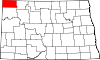
Townships Alexandria | Ambrose | Blooming Prairie | Blooming Valley | Border | Burg | Clinton | Coalfield | Daneville | De Witt | Elkhorn | Fertile Valley | Fillmore | Frazier | Frederick | Garnet | Gooseneck | Hawkeye | Hayland | Lincoln Valley | Long Creek | Mentor | Palmer | Plumer | Sioux Trail | Smoky Butte | Stoneview | Troy | Twin Butte | Upland | Westby | Writing Rock
Unincorporated
communitiesAlkabo | Bounty | Colgan | Juno | Kermit | Paulson | Stady
Categories:- Cities in North Dakota
- Populated places in Divide County, North Dakota
- County seats in North Dakota
- Populated places established in 1904


Wikimedia Foundation. 2010.