- Dickey County, North Dakota
-
Dickey County, North Dakota 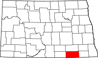
Location in the state of North Dakota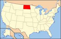
North Dakota's location in the U.S.Founded 1881 Seat Ellendale Largest city Oakes Area
- Total
- Land
- Water
1,142 sq mi (2,958 km²)
1,131 sq mi (2,929 km²)
11 sq mi (28 km²), 0.93%Population
- (2010)
- Density
5,289
5/sq mi (2/km²)Website www.ellendalend.com/ Dickey County is a county located in the U.S. state of North Dakota. As of 2010, the population was 5,289.[1] Its county seat is Ellendale.[2]
The legislature for the Dakota Territory authorized the formation of Dickey County in 1881, naming it for one of their members, George H. Dickey. An organizing meeting was held on August 28, 1882, at Ellendale.
Contents
Geography
According to the U.S. Census Bureau, the county has a total area of 1,142 square miles (2,957.8 km2), of which 1,131 square miles (2,929.3 km2) is land and 11 square miles (28.5 km2) (0.93%) is water.
Townships
- Ada
- Albertha
- Albion
- Bear Creek
- Clement
- Divide
- Elden
- Ellendale
- Elm
- German
- Grand Valley
- Hamburg
- Hudson
- James River Valley
- Kent
- Kentner
- Keystone
- Lorraine
- Lovell
- Maple
- Merricourt
- Northwest
- Port Emma
- Porter
- Potsdam
- Riverdale
- Spring Valley
- Valley
- Van Meter
- Whitestone
- Wright
- Yorktown
- Young
Adjacent counties
- LaMoure County (north)
- Ransom County (northeast)
- Sargent County (east)
- Brown County, South Dakota (south)
- McPherson County, South Dakota (southwest)
- McIntosh County (west)

LaMoure County Ransom County McIntosh County 
Sargent County  Dickey County, North Dakota

McPherson County, South Dakota Brown County, South Dakota Major highways
 U.S. Highway 281
 North Dakota Highway 1
 North Dakota Highway 11
 North Dakota Highway 56
National protected areas
Demographics
Historical populations Census Pop. %± 1890 5,573 — 1900 6,061 8.8% 1910 9,839 62.3% 1920 10,499 6.7% 1930 10,877 3.6% 1940 9,696 −10.9% 1950 9,121 −5.9% 1960 8,147 −10.7% 1970 6,976 −14.4% 1980 7,207 3.3% 1990 6,107 −15.3% 2000 5,757 −5.7% 2010 5,289 −8.1% U.S. Decennial Census As of the census[3] of 2000, there were 5,757 people, 2,283 households, and 1,499 families residing in the county. The population density was 5 people per square mile (2/km²). There were 2,656 housing units at an average density of 2 per square mile (1/km²). The racial makeup of the county was 97.78% White, 0.10% Black or African American, 0.35% Native American, 0.50% Asian, 0.56% from other races, and 0.71% from two or more races. 1.35% of the population were Hispanic or Latino of any race. 48.9% were of German, 14.7% Norwegian, 6.7% American and 6.0% Irish ancestry according to Census 2000. 92.3% spoke English, 5.7% German and 1.5% Spanish as their first language.
There were 2,283 households out of which 27.90% had children under the age of 18 living with them, 58.00% were married couples living together, 4.90% had a female householder with no husband present, and 34.30% were non-families. 32.00% of all households were made up of individuals and 17.60% had someone living alone who was 65 years of age or older. The average household size was 2.36 and the average family size was 2.99.
In the county the population was spread out with 23.80% under the age of 18, 10.20% from 18 to 24, 22.50% from 25 to 44, 22.20% from 45 to 64, and 21.30% who were 65 years of age or older. The median age was 41 years. For every 100 females there were 97.20 males. For every 100 females age 18 and over, there were 92.50 males.
The median income for a household in the county was $29,231, and the median income for a family was $36,682. Males had a median income of $26,914 versus $15,668 for females. The per capita income for the county was $15,846. About 11.60% of families and 14.80% of the population were below the poverty line, including 20.40% of those under age 18 and 10.80% of those age 65 or over.
Places
Cities
Note: all incorporated communities in North Dakota are called "cities" regardless of their size.
Unincorporated Communities
- Glover
- Guelph
- Merricourt
See also
References
- ^ "2010 Census Redistricting Data (Public Law 94-171) Summary File". American FactFinder. United States Census Bureau. http://factfinder2.census.gov/faces/tableservices/jsf/pages/productview.xhtml?pid=DEC_10_PL_GCTPL2.ST05&prodType=table. Retrieved 3 May 2011.
- ^ "Find a County". National Association of Counties. http://www.naco.org/Counties/Pages/FindACounty.aspx. Retrieved 2011-06-07.
- ^ "American FactFinder". United States Census Bureau. http://factfinder.census.gov. Retrieved 2008-01-31.
Municipalities and communities of Dickey County, North Dakota Cities 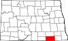
Townships Ada | Albertha | Albion | Bear Creek | Clement | Divide | Elden | Ellendale | Elm | German | Grand Valley | Hamburg | Hudson | James River Valley | Kent | Kentner | Keystone | Lorraine | Lovell | Maple | Merricourt | Northwest | Port Emma | Porter | Potsdam | Riverdale | Spring Valley | Valley | Van Meter | Whitestone | Wright | Yorktown | Young
Unincorporated
communitiesClement | Duane | Guelph | Merricourt | Norway | Wirch
Categories:- North Dakota counties
- Dickey County, North Dakota


Wikimedia Foundation. 2010.