- Cooperstown, North Dakota
-
Cooperstown, North Dakota — City — Location of Cooperstown, North Dakota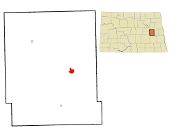
Coordinates: 47°26′43″N 98°7′22″W / 47.44528°N 98.12278°WCoordinates: 47°26′43″N 98°7′22″W / 47.44528°N 98.12278°W Country United States State North Dakota County Griggs Area – Total 0.9 sq mi (2.4 km2) – Land 0.9 sq mi (2.4 km2) – Water 0.0 sq mi (0.0 km2) Elevation 1,434 ft (437 m) Population (2010)[1] – Total 984 – Density 1,128.2/sq mi (435.6/km2) Time zone Central (CST) (UTC-6) – Summer (DST) CDT (UTC-5) ZIP code 58425 Area code(s) 701 FIPS code 38-15900[2] GNIS feature ID 1028450[3] Highways ND 45, ND 200 Website www.cooperstownnd.com Cooperstown is a city in Griggs County, North Dakota in the United States. It is the county seat of Griggs County[4]. The population was 984 at the 2010 census.[1] Cooperstown was founded in 1882. It is the closest town to the Sibley Lake National Wildlife Refuge.
Contents
Geography
Cooperstown is located at 47°26′43″N 98°7′22″W / 47.44528°N 98.12278°W (47.445175, -98.122878)[5].
According to the United States Census Bureau, the city has a total area of 0.9 square miles (2.3 km2), all of it land.
Demographics
Historical populations Census Pop. %± 1890 368 — 1900 648 76.1% 1910 1,019 57.3% 1920 1,112 9.1% 1930 1,053 −5.3% 1940 1,077 2.3% 1950 1,189 10.4% 1960 1,424 19.8% 1970 1,485 4.3% 1980 1,308 −11.9% 1990 1,247 −4.7% 2000 1,053 −15.6% 2010 984 −6.6% U.S. Decennial Census As of the census[2] of 2000, there were 1,053 people, 489 households, and 270 families residing in the city. The population density was 1,128.2 people per square mile (437.2/km²). There were 563 housing units at an average density of 603.2 per square mile (233.7/km²). The racial makeup of the city was 98.86% White, 0.19% Native American, 0.28% Asian, 0.38% from other races, and 0.28% from two or more races. Hispanic or Latino of any race were 0.95% of the population.
There were 489 households out of which 22.9% had children under the age of 18 living with them, 48.3% were married couples living together, 5.7% had a female householder with no husband present, and 44.6% were non-families. 42.3% of all households were made up of individuals and 26.0% had someone living alone who was 65 years of age or older. The average household size was 2.04 and the average family size was 2.79.
In the city the population was spread out with 20.0% under the age of 18, 4.7% from 18 to 24, 20.3% from 25 to 44, 22.9% from 45 to 64, and 32.1% who were 65 years of age or older. The median age was 48 years. For every 100 females there were 84.7 males. For every 100 females age 18 and over, there were 83.8 males.
The median income for a household in the city was $28,705, and the median income for a family was $41,307. Males had a median income of $26,688 versus $17,083 for females. The per capita income for the city was $17,334. About 5.5% of families and 10.5% of the population were below the poverty line, including 11.7% of those under age 18 and 11.2% of those age 65 or over.
Notable people
- Dick Johnson, chief test pilot for Convair.
References
- ^ a b "2010 Census Redistricting Data (Public Law 94-171) Summary File". American FactFinder. United States Census Bureau. http://factfinder2.census.gov/faces/tableservices/jsf/pages/productview.xhtml?pid=DEC_10_PL_GCTPL2.ST13&prodType=table. Retrieved 2 May 2011.
- ^ a b "American FactFinder". United States Census Bureau. http://factfinder.census.gov. Retrieved 2008-01-31.
- ^ "US Board on Geographic Names". United States Geological Survey. 2007-10-25. http://geonames.usgs.gov. Retrieved 2008-01-31.
- ^ "Find a County". National Association of Counties. http://www.naco.org/Counties/Pages/FindACounty.aspx. Retrieved 2011-06-07.
- ^ "US Gazetteer files: 2010, 2000, and 1990". United States Census Bureau. 2011-02-12. http://www.census.gov/geo/www/gazetteer/gazette.html. Retrieved 2011-04-23.
Municipalities and communities of Griggs County, North Dakota County seat: CooperstownCities 
Townships Addie | Ball Hill | Bartley | Broadview | Bryan | Clearfield | Cooperstown | Dover | Greenfield | Helena | Jessie | Kingsley | Lenora | Mabel | Pilot Mound | Romness | Rosendal | Sverdrup | Tyrol | Walum | Washburn | Willow
CDPs Unincorporated
communitiesKarnak | Mose | Revere | Shepard | Walum
Categories:- Cities in North Dakota
- Populated places in Griggs County, North Dakota
- County seats in North Dakota
- Populated places established in 1882


Wikimedia Foundation. 2010.