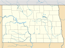
- Clearfield Township, Griggs County, North Dakota
-
Clearfield Township, North Dakota — Township — Location within the state of North Dakota Coordinates: 47°27′51″N 98°17′50″W / 47.46417°N 98.29722°WCoordinates: 47°27′51″N 98°17′50″W / 47.46417°N 98.29722°W Country United States State North Dakota County Griggs Area - Total 36.0 sq mi (93.2 km2) - Land 35.4 sq mi (91.6 km2) - Water 0.6 sq mi (1.6 km2) Elevation 1,457 ft (444 m) Population (2000) - Total 49 - Density 1.4/sq mi (0.5/km2) Time zone Central (CST) (UTC-6) - Summer (DST) CDT (UTC-5) Area code(s) 701 FIPS code 38-14340[1] GNIS feature ID 1036644[2] Clearfield Township is a township in Griggs County, North Dakota, United States. At the 2000 census, its population was 49, 44 of whom were over 18.
References
- ^ "American FactFinder". United States Census Bureau. http://factfinder.census.gov. Retrieved 2008-01-31.
- ^ "US Board on Geographic Names". United States Geological Survey. 2007-10-25. http://geonames.usgs.gov. Retrieved 2008-01-31.
Municipalities and communities of Griggs County, North Dakota County seat: Cooperstown Cities Townships Addie | Ball Hill | Bartley | Broadview | Bryan | Clearfield | Cooperstown | Dover | Greenfield | Helena | Jessie | Kingsley | Lenora | Mabel | Pilot Mound | Romness | Rosendal | Sverdrup | Tyrol | Walum | Washburn | Willow
CDPs Unincorporated
communitiesKarnak | Mose | Revere | Shepard | Walum
Categories:- North Dakota geography stubs
- Townships in Griggs County, North Dakota
Wikimedia Foundation. 2010.


