- North Dakota Highway 200
-
North Dakota Highway 200
Route information Maintained by NDDOT Length: 420 mi[1] (675.92 km) Major junctions West end:  MT 200 near Fairview, Montana
 US 52 near Bowdon
 US 52 / US 281 at Carrington
 I-29 near Kelso
East end:  MN 200 near Halstad, Minnesota
Location Counties: Foster, Mercer, Wells, Griggs, Sherdian, McLean, Dunn, McKenzie, Steele, Traill Highway system ←  I-194
I-194ND 210  →
→North Dakota Highway 200 is a major east–west highway in North Dakota. It runs from Minnesota State Highway 200 at the Minnesota border near Halstad, Minnesota to Montana Highway 200 near Fairview, Montana.[1]
This state highway is part of a nationwide chain of similarly-numbered state highways that stretch from Minnesota to Washington state.
Contents
Major intersections
County Location Mile[2] Destinations Notes McKenzie  ND 58
ND 58 ND 68
ND 68 US 85
US 85West end of US 85 overlap Watford City  ND 23 east US 85
East end of US 85 overlap Dunn  ND 22
ND 224th Street Southwest - Dunn Center  ND 8
ND 8Mercer  CR 5 north – Golden Valley
 CR 13 north
 ND 49 south / CR 21 north
Hazen  CR 27 north


 ND 200A east
 CR 37 north
 ND 1806 west
Mclean  ND 48 north
 US 83
US 83West end of US 83 overlap US 83East end of US 83 overlap
ND 200A east ND 41 north
West end of ND 41 overlap Mercer ND 41 southEast end of ND 41 overlap Mercer  CR 33 north
Sheridan McClusky 4th Street east, 5th Aveune Northeast Denhoff  ND 14
ND 14Wells  ND 3 south
West end of ND 3 overlap Hurdsfield ND 3 northEast end of ND 3 overlap  CR 4 north – Chaseley
268  US 52 west (43rd Avenue Northeast) / CR 71 south – Fessenden, Harvey, Minot
West end of US 52 overlap  CR 8 north (47th Avenue Northeast) – Heaton
207  ND 30 north (53rd Avenue Northeast) – Cathay
209  CR 69 south (54th Avenue Northeast)
Misprinted as ND 30 on some maps. Foster Carrington 221  CR 1605 north (66th Avenue Northeast) – New Rockford, Barlow
222 US 52 east / US 281 (4th Avenue North) – New Rockford, Jamestown, Devils LakeEast end of US 52 overlap  CR 1613 (74th Avenue Northeast) – Bordulac
 CR 1621 north (81st Avenue Northeast) – Grace City CR 1621 south (85th Avenue Northeast) – Kensal
87th Avenue Northeast - Juanita Glenfield  ND 20 – Jamestown, Devils Lake
Griggs 99th Avenue Northeast - Sutton  ND 1 north ND 1 south
Cooperstown  ND 45 north
 CR 19
CR 19Steele  CR 25 – Luverne
 ND 32 east / CR 11
West end of ND 32 overlap  ND 32 west / CR 18
East end of ND 32 overlap. 4 Way Stop.  CR 8
CR 8Traill  ND 18 north
West end of ND 32 overlap  CR 16 south – Clifford, Galesburg
Portland CR 16 northMayville ND 18 southEast end of ND 32 overlap  CR 14 north I-29
 CR 81 north
Hillsboro  CR 11 (Caledonia Avenue)
ND 200A westConcurrencies
- US 85 from 3 miles (4.8 km) north of Alexander to 5 miles (8.0 km) southeast of Grassy Butte
- ND-8 for 2 miles (3.2 km) south from Halliday
- US 83 from Gateway to Underwood
- ND-41 from 2 miles (3.2 km) south of Turtle Lake to Mercer
- ND-3 for 2 miles (3.2 km) west from Hurdsford
- US 52 from 5 miles (8.0 km) east of Bowdon to Carrington
- ND-1 from 6 miles (9.7 km) west of Cooperstown to 2 miles (3.2 km) west of Cooperstown
- ND-32 for 5 miles (8.0 km) south from Finley
- ND-18 from 7 miles (11 km) northwest of Portland to Mayville
Notes
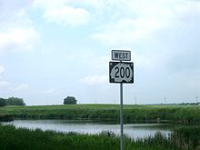 Highway 200 reassurance shield in Sheridan County
- ^ a b Mileage retrieved from North Dakota Highways 101+ unless otherwise noted.
- ^ "Appendix III-09 C: Interchange Numbering on I-29". North Dakota Department of Transportation. http://www.dot.nd.gov/manuals/design/designmanual/chapter3/DM-3-09-c_tag.pdf. Retrieved 2008-06-22.
External links
- The North Dakota Highways Page by Chris Geelhart
Bridges of the Missouri River Upstream
Four Bears Bridge

ND 200 Bridge

Downstream
ND 200A BridgeBridges of the James River Upstream
Foster County CR 1604 Raised RoadND 200 Bridge
Downstream
ND 9 Bridge
 Categories:
- State highways in North Dakota
- Theodore Roosevelt Expressway


Wikimedia Foundation. 2010.